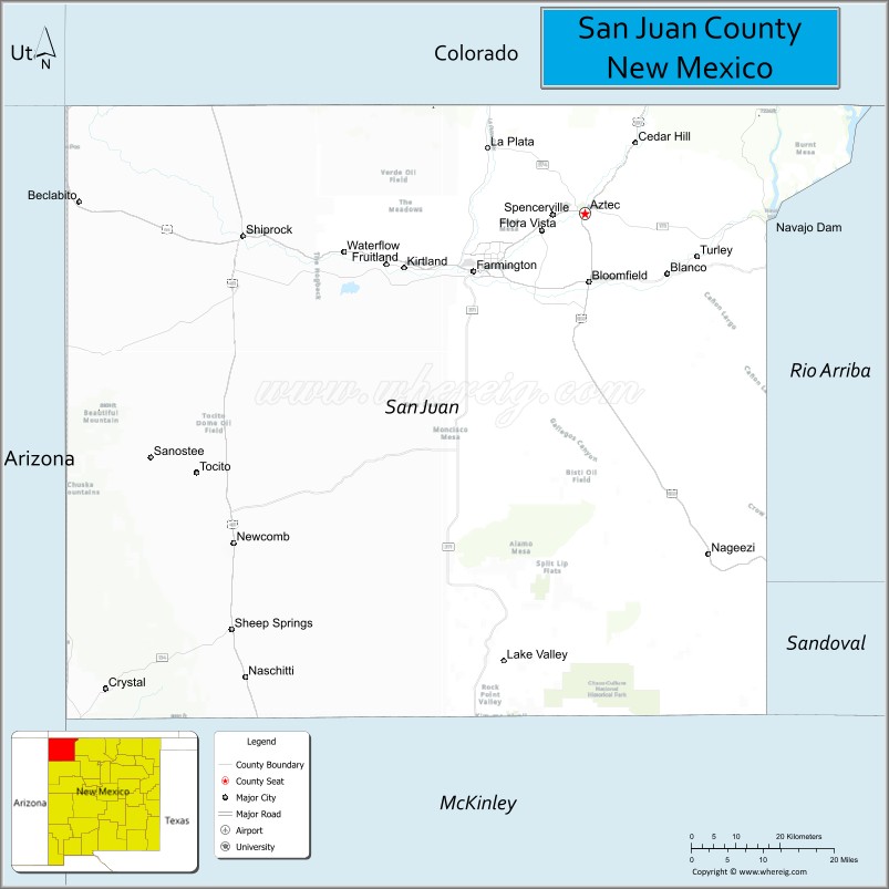
| Name: | San Juan County |
|---|---|
| FIPS code: | 35-045 |
| State: | New Mexico |
| Founded: | February 24, 1887 |
| Named for: | San Juan River |
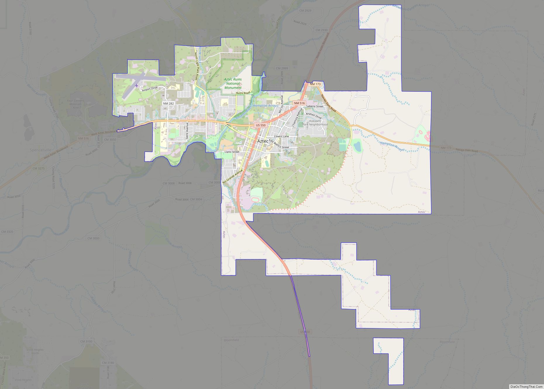
| Seat: | Aztec |
| Largest city: | Farmington |
| Total Area: | 5,538 sq mi (14,340 km²) |
| Land Area: | 5,513 sq mi (14,280 km²) |
| Total Population: | 121,661 |
| Population Density: | 24/sq mi (9/km²) |
| Time zone: | UTC−7 (Mountain) |
| Summer Time Zone (DST): | UTC−6 (MDT) |
| Website: | www.sjcounty.net |
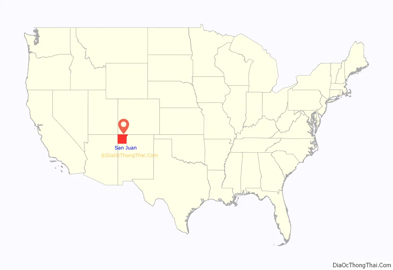
San Juan County location map. Where is San Juan County?
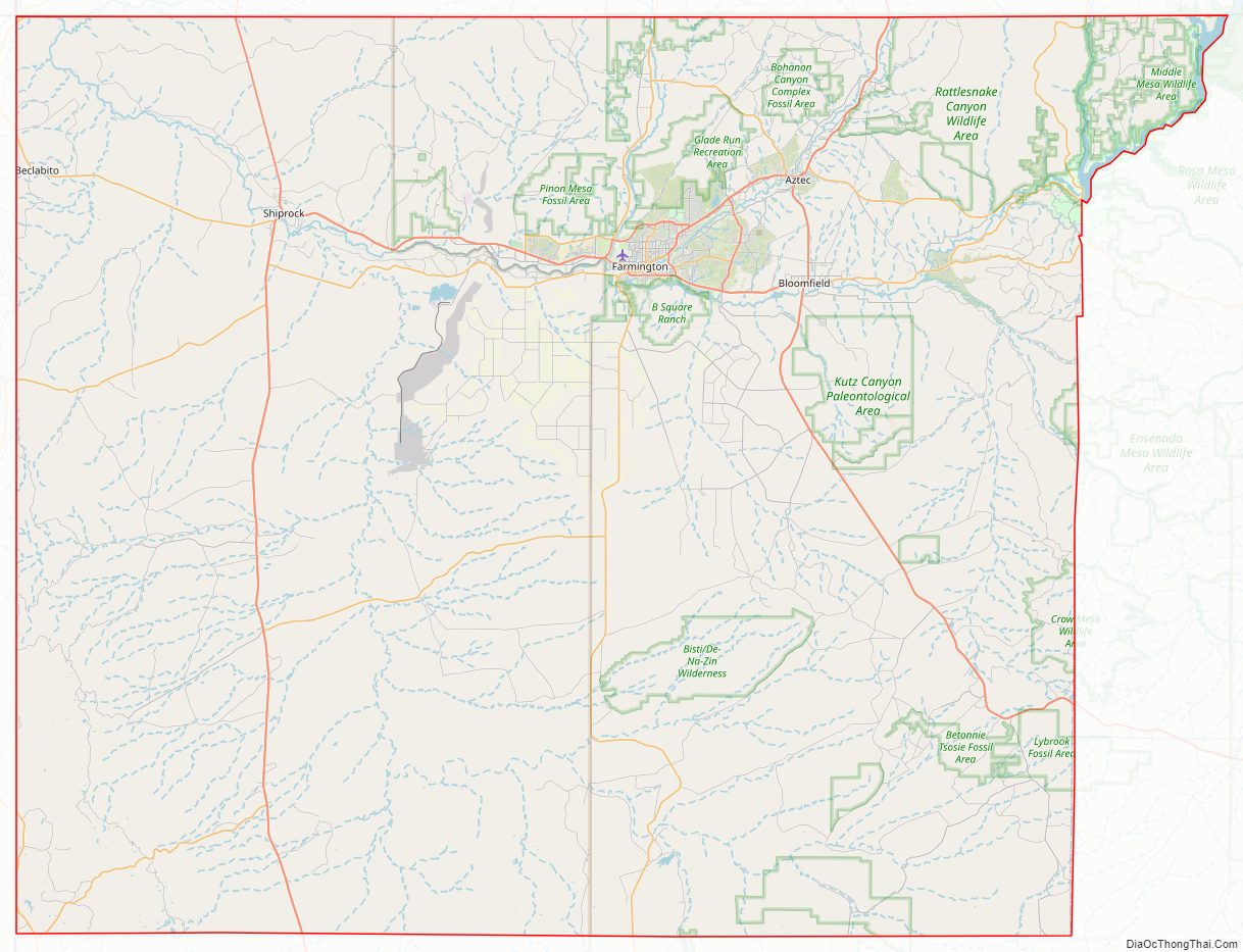
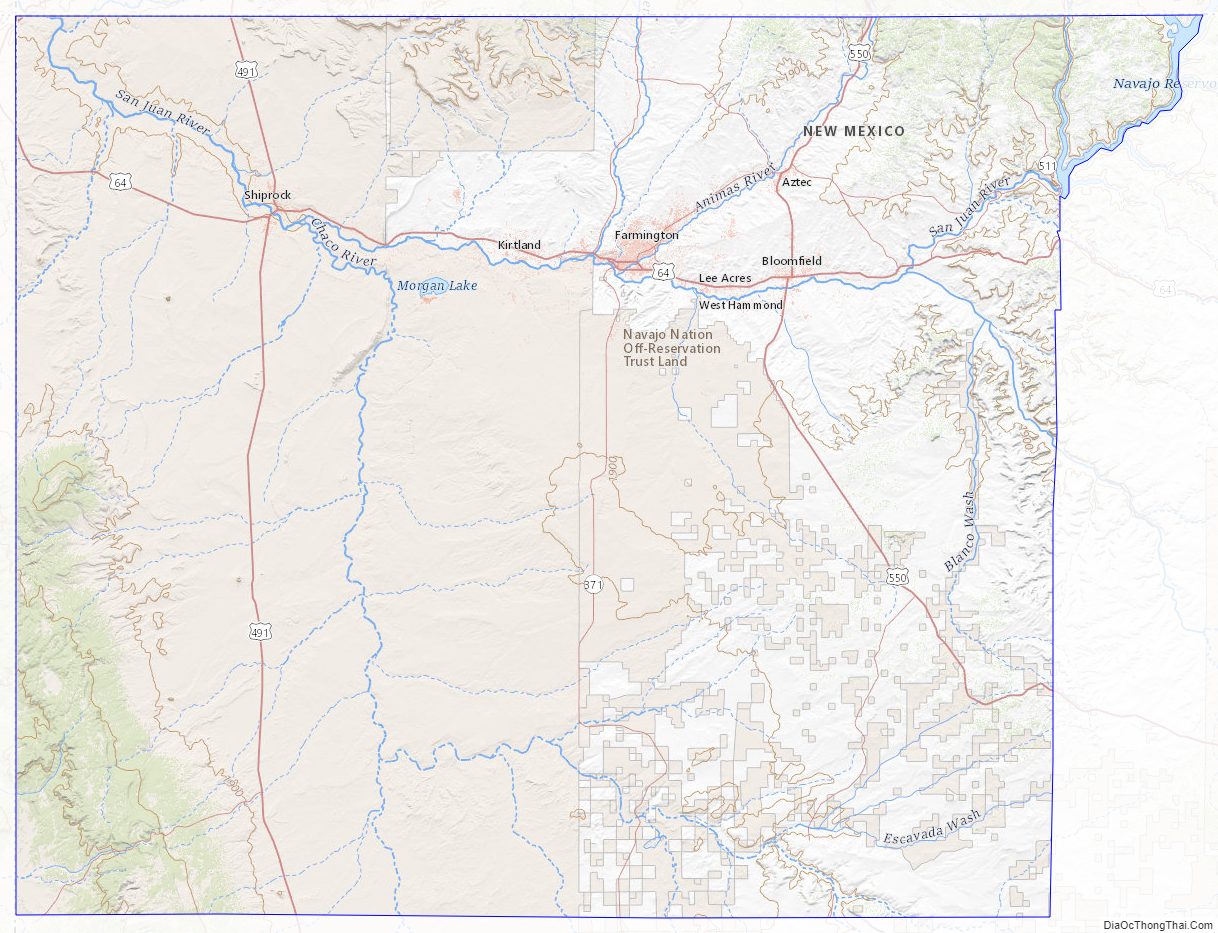
San Juan County Road Map
Geography
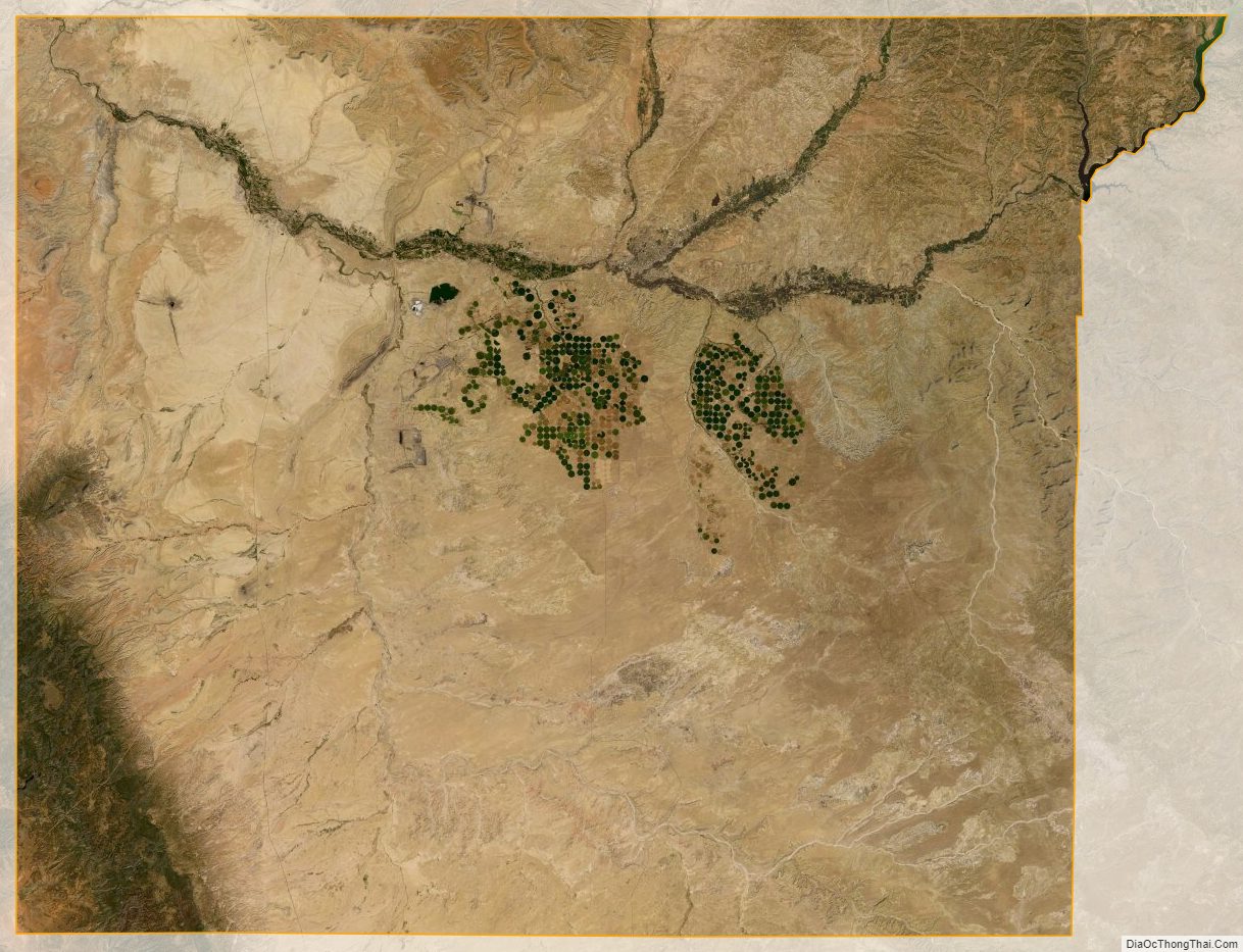
According to the U.S. Census Bureau, the county has a total area of 5,538 square miles (14,340 km), of which 5,513 square miles (14,280 km) is land and 25 square miles (65 km) (0.5%) is water. Indian reservations (and off-reservation trust lands) comprise 63.4 percent of the county’s land area: The Navajo Nation takes up 60.45% and the Ute Mountain Ute Tribe Reservation another 2.93%.
The physical features include three rivers: the San Juan, Animas, and La Plata rivers; also, the Chuska Mountains and Shiprock Pinnacle to the west, volcanic structures, buttes, mesas, badlands, and fertile river valleys.
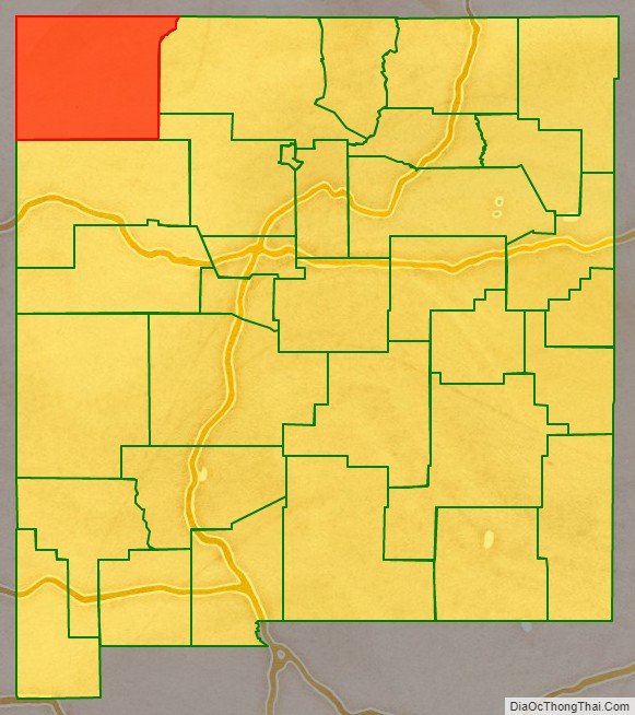
Adjacent counties
- Rio Arriba County – east
- Sandoval County – southeast
- McKinley County – south
- Apache County, Arizona – west
- San Juan County, Utah – northwest
- Montezuma County, Colorado – north
- La Plata County, Colorado – north
- Archuleta County, Colorado – northeast
National protected areas
- Aztec Ruins National Monument
- Chaco Culture National Historical Park (part)
Major highways
- U.S. Route 64
- U.S. Route 491 (formerly U.S. Route 666)
- U.S. Route 550
- New Mexico State Road 170
- New Mexico State Road 371
- New Mexico State Road 511
- New Mexico State Road 597(connector to Four Corners Monument)
San Juan County Topographic Map
San Juan County Satellite Map
San Juan County Outline Map