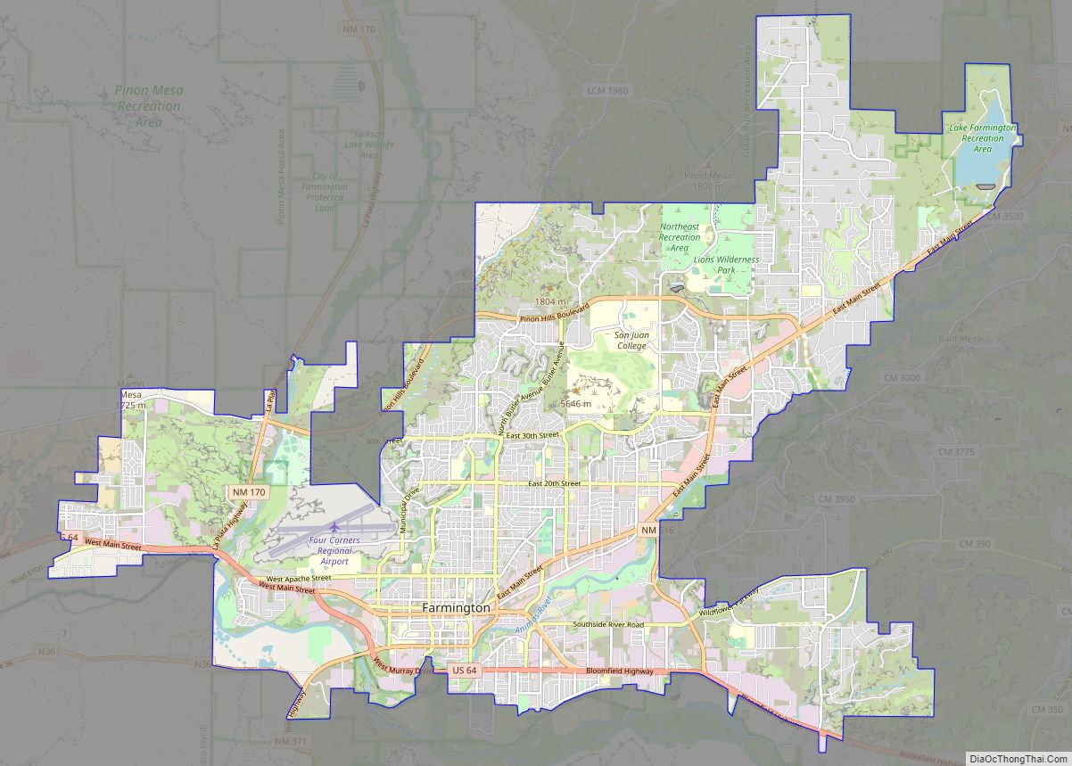
Farmington is a city in San Juan County in the U.S. state of New Mexico. As of the 2020 census the city had a population of 46,624 people. Farmington (and surrounding San Juan County) makes up one of the four metropolitan statistical areas (MSAs) in New Mexico.
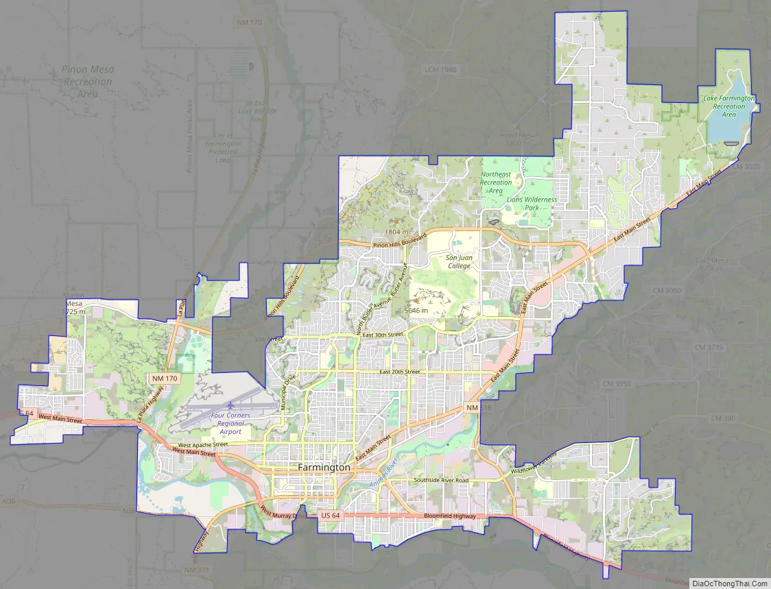
Farmington is located at the junction of the San Juan River, the Animas River, and the La Plata River, and is located on the Colorado Plateau. Farmington is the largest city of San Juan County, one of the geographically largest counties in the United States covering 5,538 square miles (14,340 km). Farmington serves as the commercial hub for most of northwestern New Mexico and the Four Corners region of four states. Farmington lies at or near the junction of several highways: U.S. Highway 64, New Mexico Highway 170, New Mexico Highway 371, and New Mexico Highway 516.
It is on the Trails of the Ancients Byway, one of the designated New Mexico Scenic Byways.
The primary non-government industries of Farmington are the production of petroleum, natural gas, and coal and its function as a major retail hub. Outside of Farmington, the Navajo Mine (coal), operated by the Navajo Transitional Energy Company (NTEC), is used entirely for fuel for the nearby Four Corners Generating Station to produce electric power.
| Name: | Farmington city |
|---|---|
| LSAD Code: | 25 |
| LSAD Description: | city (suffix) |
| State: | New Mexico |
| County: | San Juan County |
| Founded: | 1901 |
| Elevation: | 5,395 ft (1,644 m) |
| Total Area: | 34.95 sq mi (90.51 km²) |
| Land Area: | 34.46 sq mi (89.25 km²) |
| Water Area: | 0.49 sq mi (1.26 km²) |
| Total Population: | 46,624 |
| Population Density: | 1,352.95/sq mi (522.38/km²) |
| ZIP code: | 87401, 87402, 87499 |
| Area code: | 505 |
| FIPS code: | 3525800 |
| GNISfeature ID: | 0902246 |
| Website: | www.fmtn.org |
Online Interactive Map
Click on ![]() to view map in "full screen" mode.
to view map in "full screen" mode.
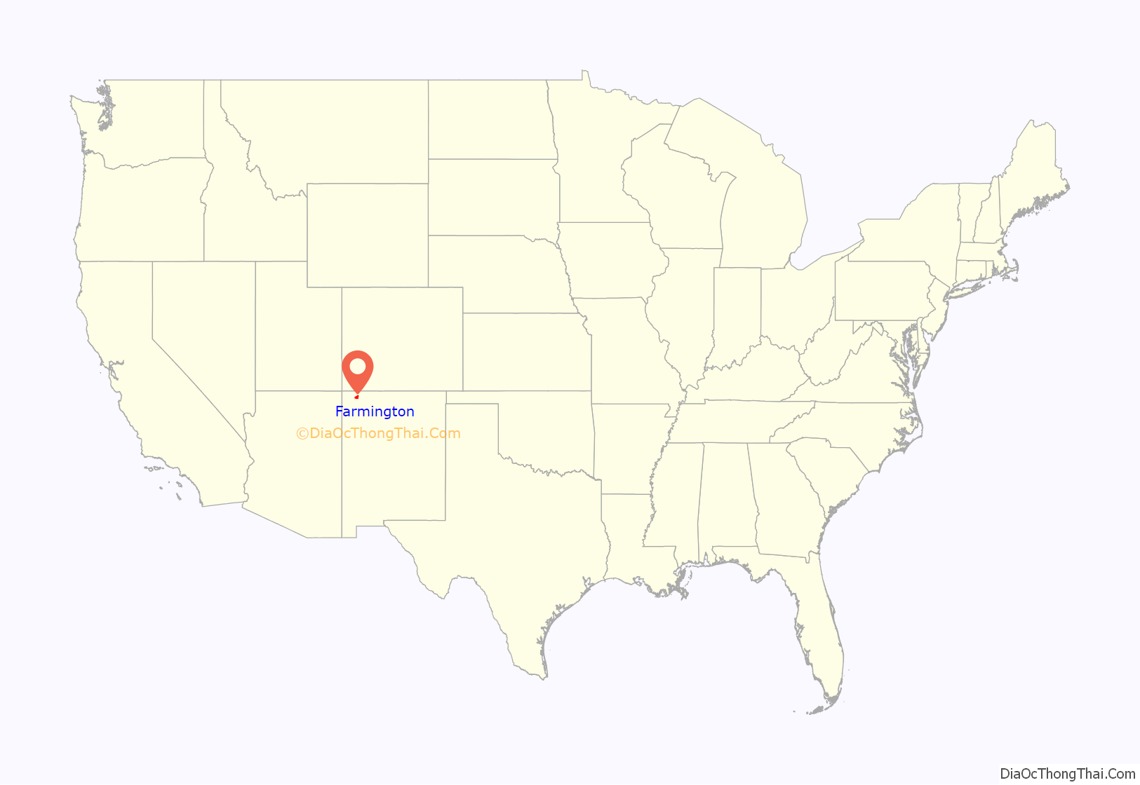
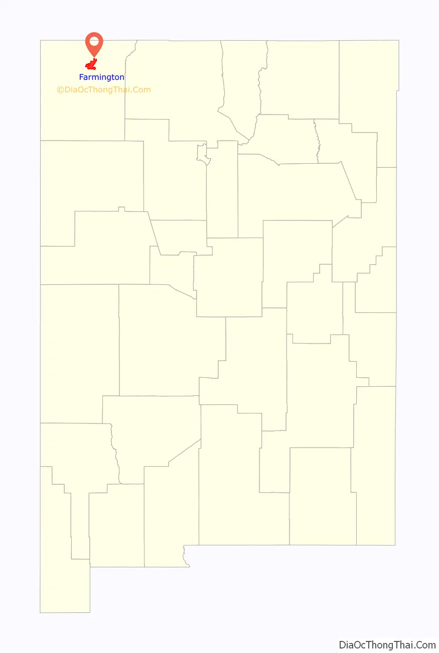
Farmington location map. Where is Farmington city?
History
The area that is now Farmington was settled by Ancestral Pueblo people in the 7th Century. Ruins can be visited at nearby Salmon Ruins and at the Aztec Ruins. When the Ancestral Puebloans left the area, the Navajos, Jicarilla Apaches, and Utes moved into the area. A key part of the region was known in Navajo as Tóta’ which means “where three rivers meet”.
Although Spanish and American mineral prospecting happened in the area, there were few permanent settlements. In 1868, the Navajo Nation was created, taking up the western half of San Juan County. Six years later, the U.S. government offered territory in the rest of San Juan County to the Jicarilla Apache but they refused. As a result, the area was opened for settlement and a number of settlers moved into the region from Southern Colorado. The area was originally known as “Junction City” because of the access to the three rivers.
In 1901 the town was incorporated and named Farmington with a population of 548. By September 19, 1905, the railroad was finished connecting Farmington to Durango, Colorado, expanding economic and settlement opportunities. It was unusual in that it was a standard-gauge railway that connected to the Denver & Rio Grande Western Railroad narrow-gauge lines of southwestern Colorado. The railroad converted the line to narrow gauge in 1923. The line was abandoned in 1968 and dismantled to Durango in 1969. In addition, in the 1920s there was significant investment in natural gas and oil in the area, although actual production remained low until the 1950s. With construction of a developed road connecting Farmington to U.S. Route 66 and Albuquerque in the 1940s and the construction of the San Juan Basin Natural Gas Pipeline in 1953 – a venture led by Tom Bolack – the population expanded significantly. However, the significant connection to the energy industry made the economics of the town largely vulnerable to international market fluctuations during the 1970s energy crisis and resulted in some economic diversification.
In 1967, as part of a joint U.S. Government-El Paso Electric operation, an underground nuclear detonation occurred 50 miles (80 km) east of Farmington and about 25 miles (40 km) south of Dulce, New Mexico in present-day Carson National Forest. This pilot project of Operation Plowshare, code-named Project Gasbuggy, was an attempt to fracture a large volume of underground bedrock to make more natural gas available for extraction by gas wells.
The people of Farmington have been the subject of several civil rights investigations, including the 2005 report, The Farmington Report: Civil Rights for Native Americans 30 Years Later.
On March 18, 1950, Farmington was the site of a mass UFO sighting in which over half the town’s population was reported to have seen large saucers in the sky flying at rapid speeds.
Farmington Road Map
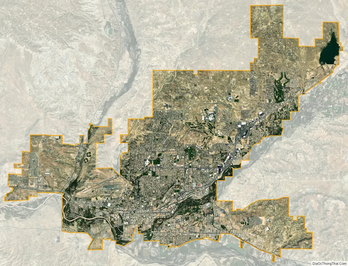
Farmington city Satellite Map
Geography
According to the U.S. Census Bureau, Farmington has a total area of 32.0 square miles (83 km), of which 31.5 square miles (82 km) is land and 0.5 square miles (1.3 km) is water.
Climate
Farmington has a semi-arid climate. The city can experience hot summers and cold winters with low precipitation throughout the year. The average annual snowfall is 12.3 inches (0.31 m).
See also
Map of New Mexico State and its subdivision: Map of other states:- Alabama
- Alaska
- Arizona
- Arkansas
- California
- Colorado
- Connecticut
- Delaware
- District of Columbia
- Florida
- Georgia
- Hawaii
- Idaho
- Illinois
- Indiana
- Iowa
- Kansas
- Kentucky
- Louisiana
- Maine
- Maryland
- Massachusetts
- Michigan
- Minnesota
- Mississippi
- Missouri
- Montana
- Nebraska
- Nevada
- New Hampshire
- New Jersey
- New Mexico
- New York
- North Carolina
- North Dakota
- Ohio
- Oklahoma
- Oregon
- Pennsylvania
- Rhode Island
- South Carolina
- South Dakota
- Tennessee
- Texas
- Utah
- Vermont
- Virginia
- Washington
- West Virginia
- Wisconsin
- Wyoming