| Name: | San Luis Obispo County |
|---|---|
| FIPS code: | 06-079 |
| State: | California |
| Founded: | 1850 |
| Named for: | Saint Louis, Bishop of Toulouse |
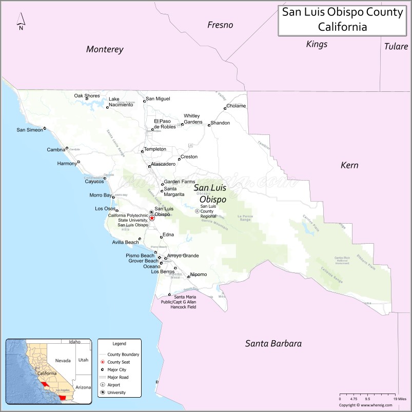
| Seat: | San Luis Obispo |
| Largest city: | Atascadero |
| Total Area: | 3,616 sq mi (9,370 km²) |
| Land Area: | 3,299 sq mi (8,540 km²) |
| Total Population: | 282,424 |
| Population Density: | 86/sq mi (33/km²) |
| Website: | www.co.slo.ca.us |
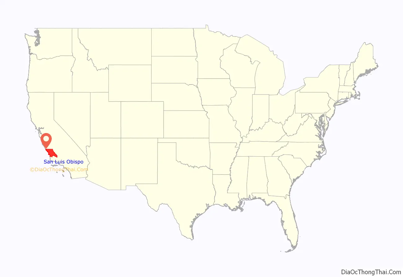
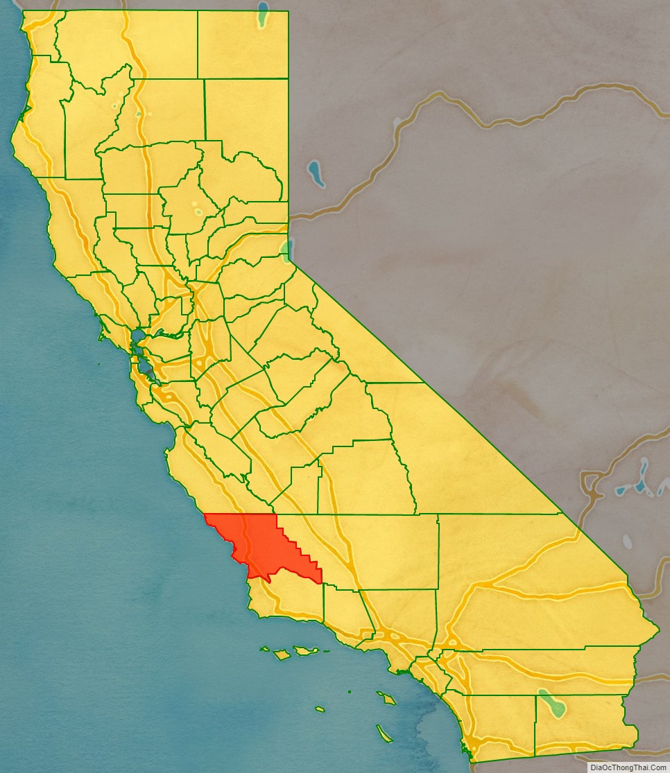
San Luis Obispo County location map. Where is San Luis Obispo County?
History
The prehistory of San Luis Obispo County is strongly influenced by the Chumash people. There has been significant settlement here at least as early as the Millingstone Horizon thousands of years ago. Important settlements existed in coastal areas such as Morro Bay and Los Osos.
Mission San Luis Obispo de Tolosa was founded on September 1, 1772 in the area that is now the city of San Luis Obispo. The namesake of the mission, city and county is Saint Louis of Toulouse, the young bishop of Toulouse (Obispo and Tolosa in Spanish) in 1297.
San Luis Obispo County was one of the original counties of California, created in 1850 at the time of statehood.
The Salinas River Valley, a region that figures strongly in several John Steinbeck novels, stretches north from San Luis Obispo County.
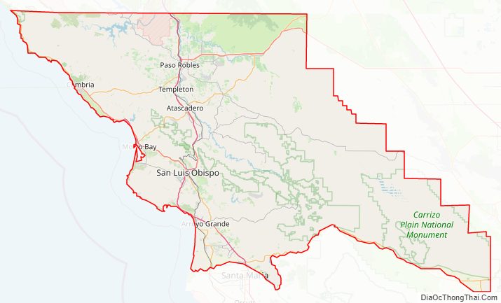
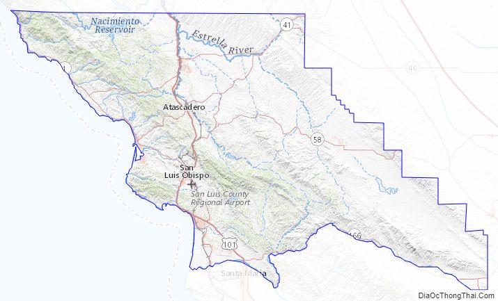
San Luis Obispo County Road Map
Geography
According to the U.S. Census Bureau, the county has a total area of 3,616 square miles (9,370 km), of which 3,299 square miles (8,540 km) is land and 317 square miles (820 km) (comprising 8.8%) is water.
Climate
San Luis Obispo County has three main climate types. BSk climate can mainly be found in the eastern portions of the county, along with certain smaller areas in the north. Csa climate can mainly be found in the central portions of the counties, in communities such as Paso Robles. The rest of the county is made up of the Csb climate type.
Adjacent counties
National protected areas
- Carrizo Plain National Monument (part)
- Guadalupe-Nipomo Dunes National Wildlife Refuge (part)
- Los Padres National Forest (part)
Marine Protected Areas
- Piedras Blancas State Marine Reserve and Marine Conservation Area
- Cambria State Marine Conservation Area
- White Rock (Cambria) State Marine Conservation Area
- Morro Bay State Marine Recreational Management Area and Morro Bay State Marine Reserve
- Point Buchon State Marine Reserve and Marine Conservation Area
San Luis Obispo County Topographic Map
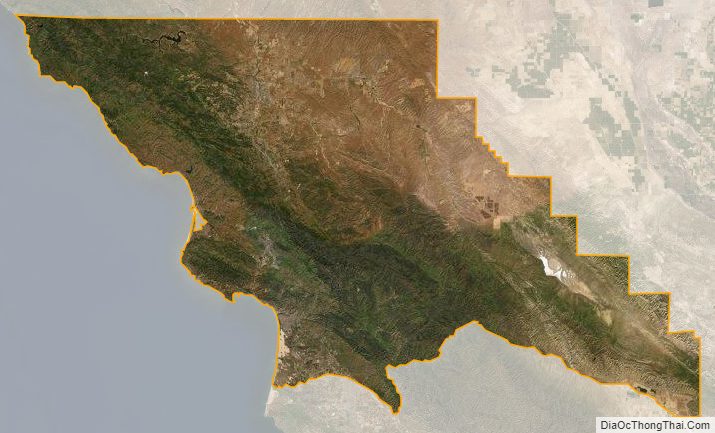
San Luis Obispo County Satellite Map
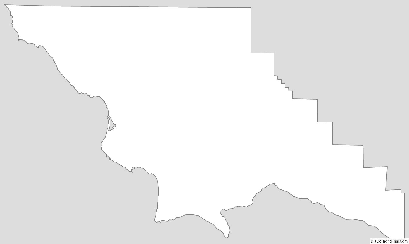
San Luis Obispo County Outline Map