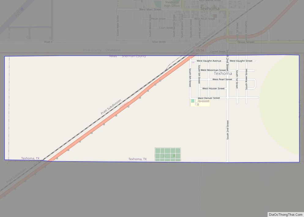
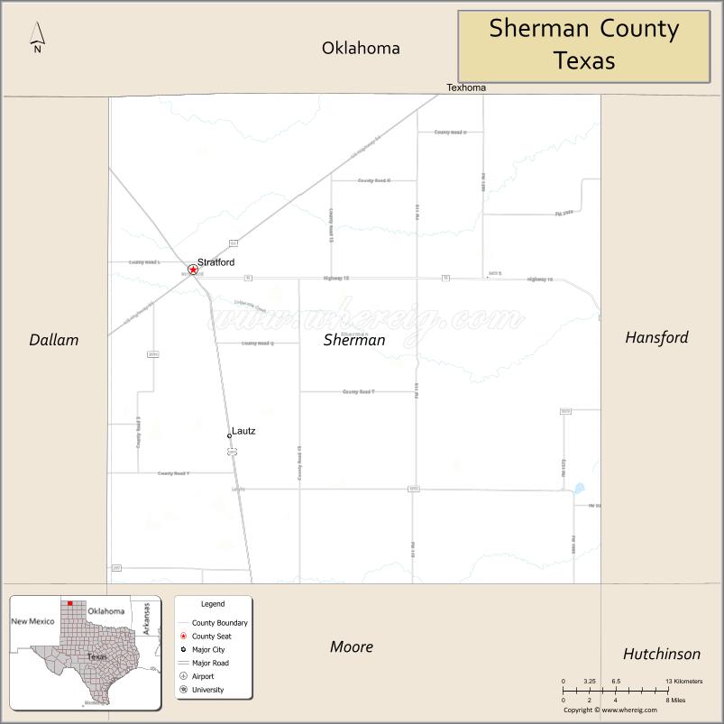
Sherman County is a county located in the U.S. state of Texas. As of the 2020 census, its population was 2,782. Its county seat is Stratford. The county was created in 1876 and organized in 1889. It is named for Sidney Sherman, who fought in the Texas Revolution.
Though both Sherman County and Sherman, Texas, are named for the same person, the city of Sherman is located in Grayson County, about 430 miles to the southeast.
| Name: | Sherman County |
|---|---|
| FIPS code: | 48-421 |
| State: | Texas |
| Founded: | 1889 |
| Named for: | Sidney Sherman |
| Seat: | Stratford |
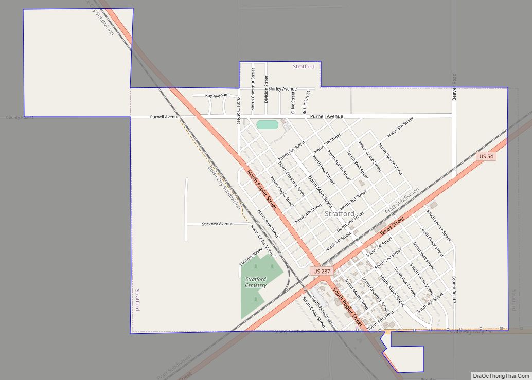
| Largest city: | Stratford |
| Total Area: | 923 sq mi (2,390 km²) |
| Land Area: | 923 sq mi (2,390 km²) |
| Total Population: | 2,782 |
| Population Density: | 3.0/sq mi (1.2/km²) |
| Time zone: | UTC−6 (Central) |
| Summer Time Zone (DST): | UTC−5 (CDT) |
| Website: | www.co.sherman.tx.us |
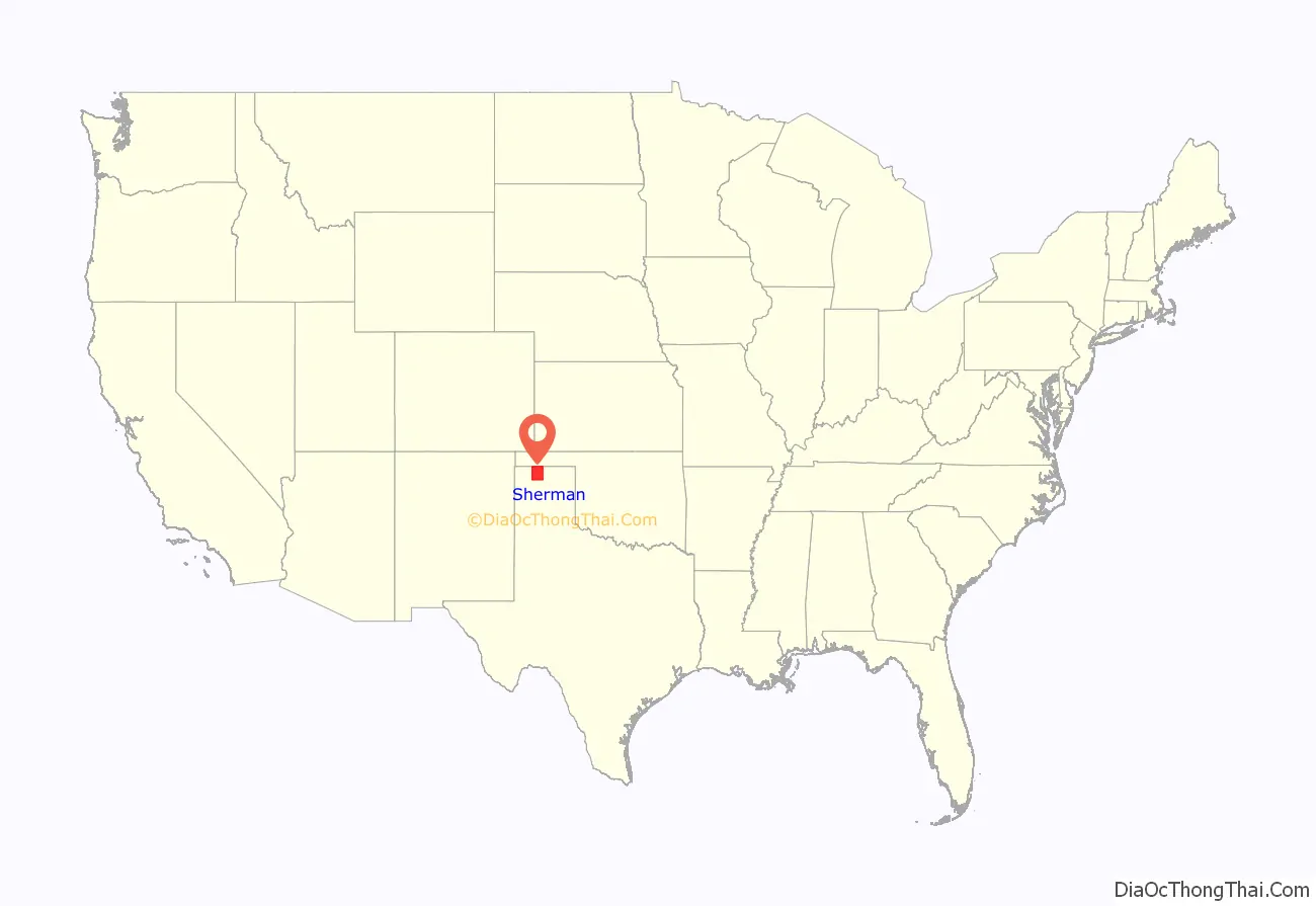
Sherman County location map. Where is Sherman County?
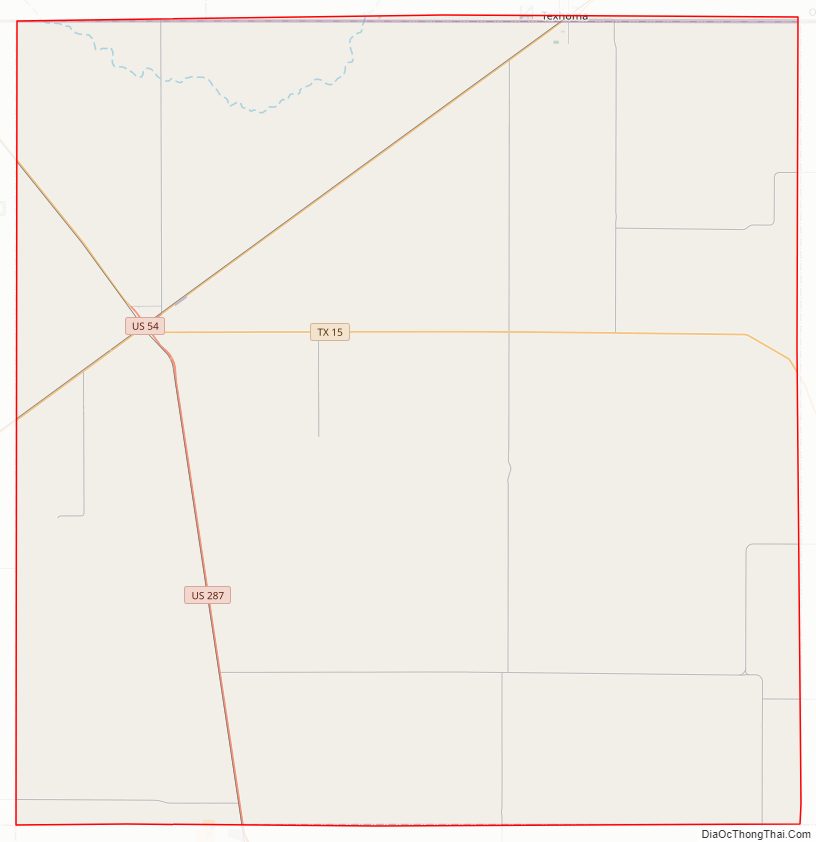
Sherman County Road Map
Geography
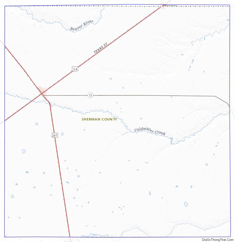
According to the U.S. Census Bureau, the county has a total area of 923 square miles (2,390 km), of which 923 square miles (2,390 km) are land and 0.2 square miles (0.52 km) (0.02%) is covered by water.
Major highways
- U.S. Highway 54
- U.S. Highway 287
- State Highway 15
Adjacent counties
- Texas County, Oklahoma (north)
- Hansford County (east)
- Moore County (south)
- Dallam County (west)
- Cimarron County, Oklahoma (northwest)
- Hartley County (southwest)
- Hutchinson County (southeast)
Sherman County Topographic Map
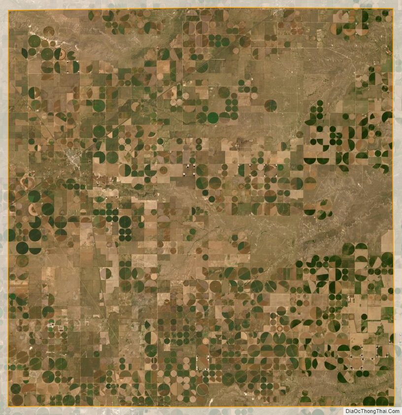
Sherman County Satellite Map
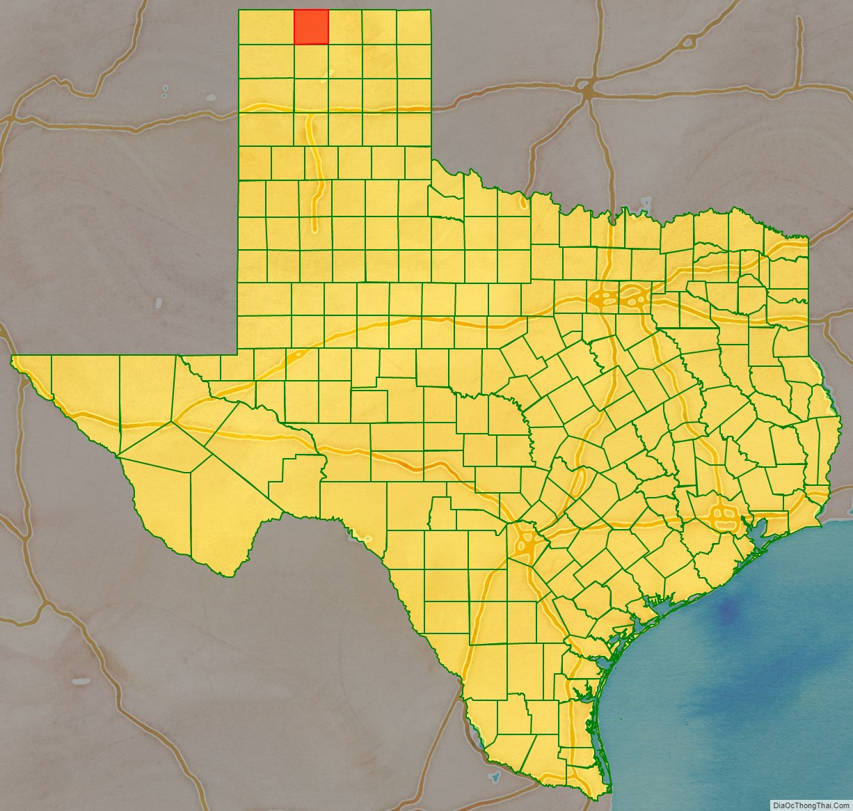
Sherman County Outline Map