| Name: | Hansford County |
|---|---|
| FIPS code: | 48-195 |
| State: | Texas |
| Founded: | 1889 |
| Named for: | John M. Hansford |
| Seat: | Spearman |
| Largest city: | Spearman |
| Total Area: | 920 sq mi (2,400 km²) |
| Land Area: | 920 sq mi (2,400 km²) |
| Total Population: | 5,285 |
| Population Density: | 5.7/sq mi (2.2/km²) |
| Time zone: | UTC−6 (Central) |
| Summer Time Zone (DST): | UTC−5 (CDT) |
| Website: | www.co.hansford.tx.us |
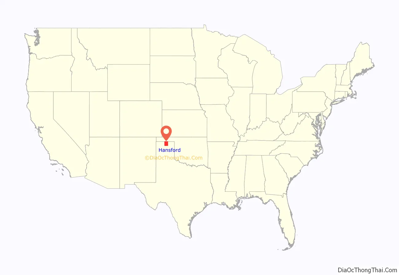
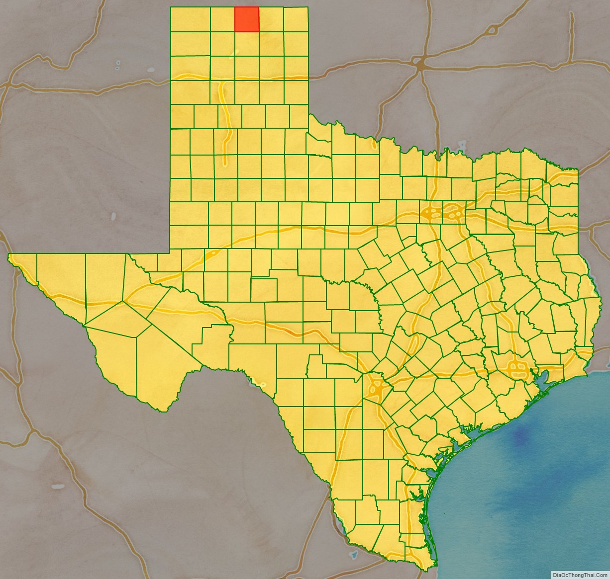
Hansford County location map. Where is Hansford County?
History
Native Americans
In 1873, English brothers James Hamilton Cator and Arthur J. L. (Bob) Cator were sent by their father, British naval officer Captain John Bertie Cator, to Kansas in search of financial opportunity. The brothers soon found their true calling as buffalo hunters and established an outpost along the North Palo Duro Creek. They named this camp Zulu, and it soon became known as Zulu Stockade.
The depletion of the buffalo herds led in part to the ongoing conflict between Indians and settlers. The Second Battle of Adobe Walls took place in neighboring Hutchinson County in 1874 and led to the Red River War of 1874–1875. A group of buffalo hunters attempted a revitalization of Fort Adobe. The Comanches, Cheyenne, Arapaho, and Kiowa saw the fort and the decimation of the buffalo herd as threats to their existence. Comanche medicine man Isa-tai prophesied a victory and immunity to the white man’s bullets in battle. Quanah Parker lead several hundred in a raid on the fort. The buffalo hunters were able to force the Indians into retreat. The Red River War of 1874-1875 was a United States Army campaign to force the removal of Indians in Texas and their relocation to reservations, to open the region to white settlers.
Establishment and growth
The Texas Legislature formed Hansford County in 1876 from Young and Bexar Counties. The county was organized in 1889. The town of Hansford became the first county seat.
Early large ranches in Hansford County were spread in neighboring counties, as well. By 1890, only 23 ranches were in operation in the county. In November 1876, Kansan Thomas Sherman Bugbee established the Quarter Circle T Ranch. The Scissors Ranch was begun in 1878 by William E. Anderson at the Adobe Walls site. The ranch was named after the brand, which looked like a pair of scissors. Coloradan Richard E. McNalty moved to Texas and began the Turkey Track Ranch, which he sold to Charles Wood and Jack Snider in 1881. Scotland- born James M. Coburn formed the Hansford Land and Cattle Company. The Quarter Circle T Ranch and Scissors Ranch were sold to Coburn in 1882. Coburn acquired the Turkey Track Ranch in 1883.
In 1887, Hansford became a stage stop on the old Tascosa-Dodge City Trail.
In 1909, Anders L. Mordt began to bring in Norwegian farmers to settle the northern part of the county, centering on a rural community they named Oslo.
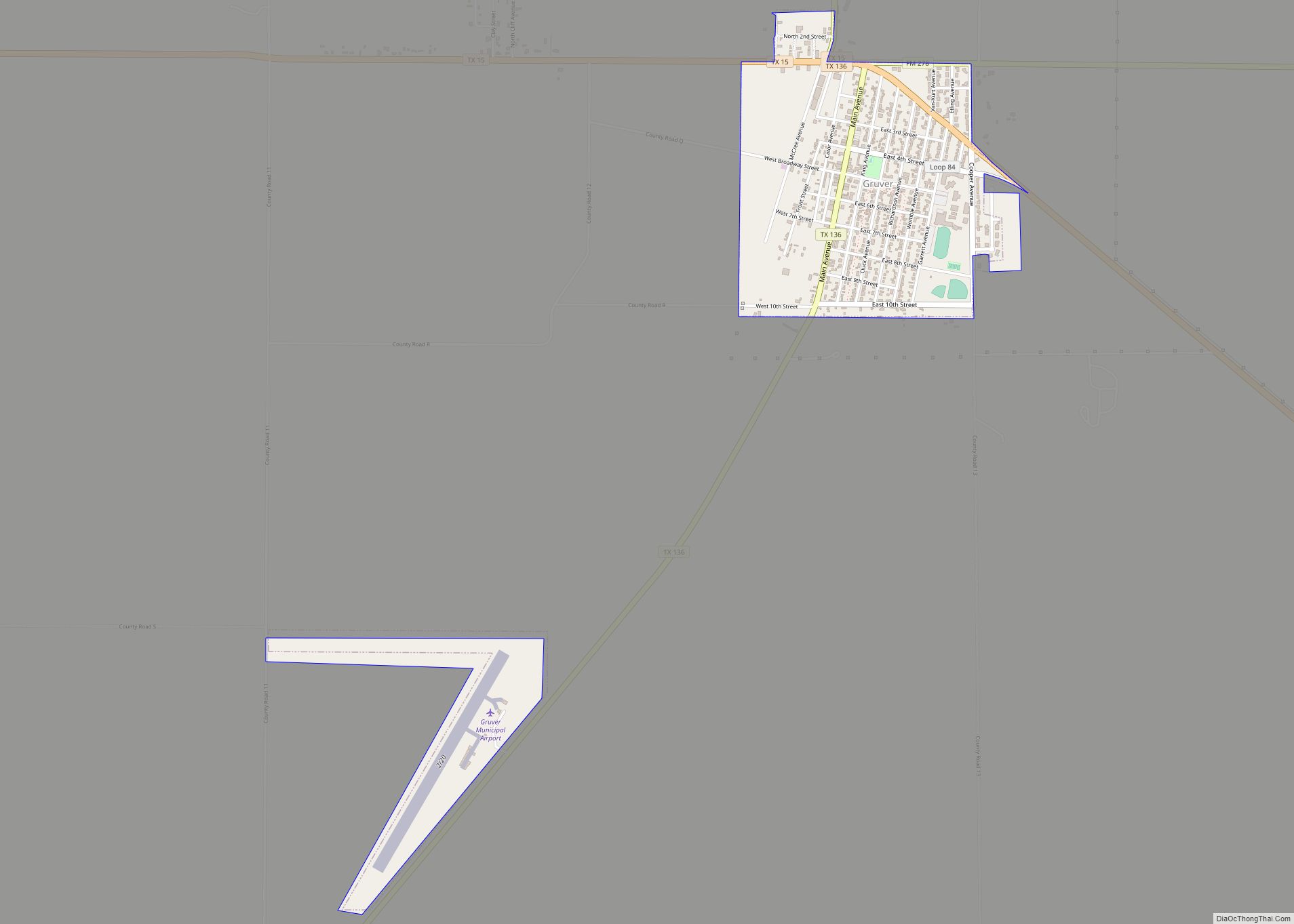
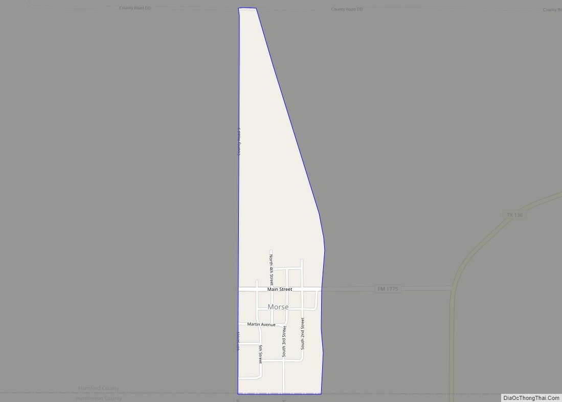
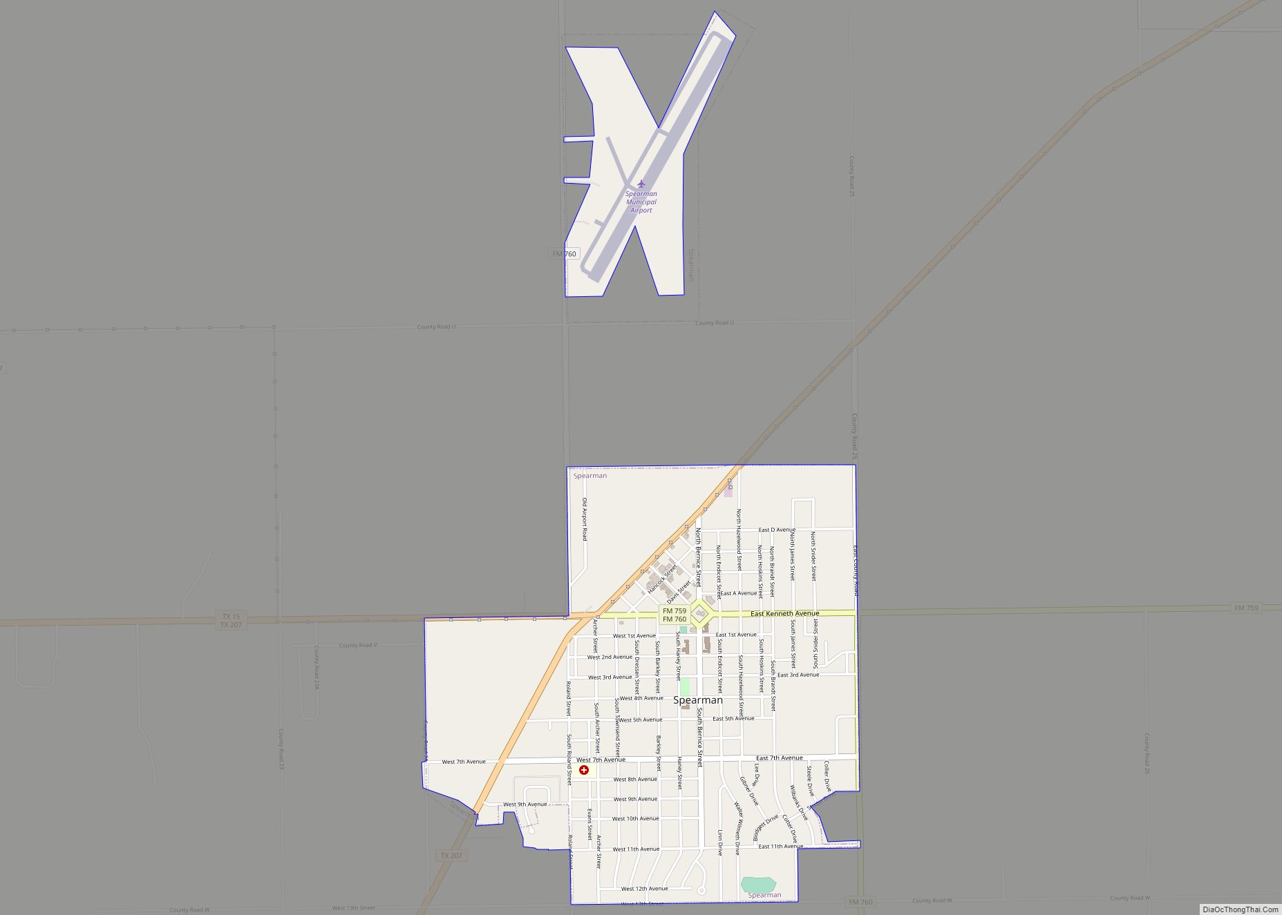
By 1920, 221 farms and ranches had been established in the county. The same year, the North Texas and Santa Fe Railway built into Spearman. By 1929, Spearman became the county seat. Chicago, Rock Island and Gulf Railway built southward in the 1920s leading to Gruver, becoming the second-largest town in the county. In 1931, the Santa Fe Railroad connected with the Rock Island, joining Morse.
The county began to be connected by highways and farm roads, from the 1920s through the 1940s. Oil was discovered in Hansford County in 1937. By the end of 1974, 38,279,469 barrels (6,085,949.2 m) had been extracted from county lands since 1937. By the 1980s, Hansford County had a diversified economy based on agriculture, oil, and transportation.
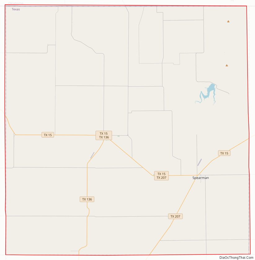
Hansford County Road Map

Geography
According to the U.S. Census Bureau, the county has a total area of 920 square miles (2,400 km), of which 920 square miles (2,400 km) are land and 0.6 square miles (1.6 km) (0.06%) is covered by water.
Major highways
- State Highway 15
- State Highway 51
- State Highway 136
- State Highway 207
Adjacent counties
- Texas County, Oklahoma (north)
- Ochiltree County (east)
- Roberts County (southeast)
- Hutchinson County (south)
- Sherman County (west)
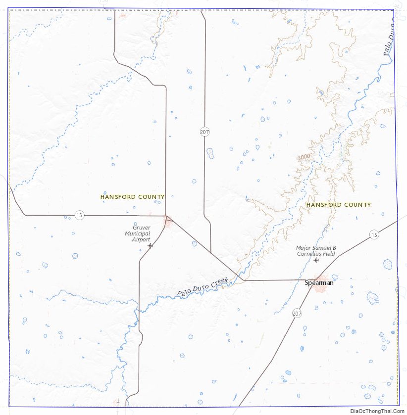
Hansford County Topographic Map
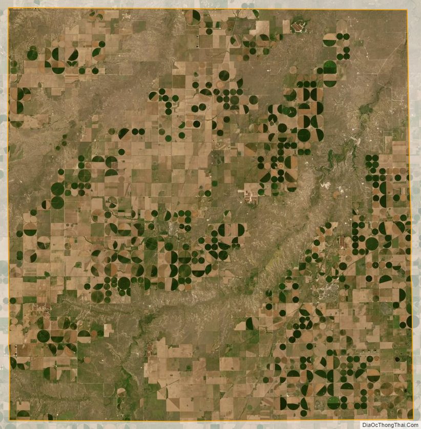
Hansford County Satellite Map
Hansford County Outline Map