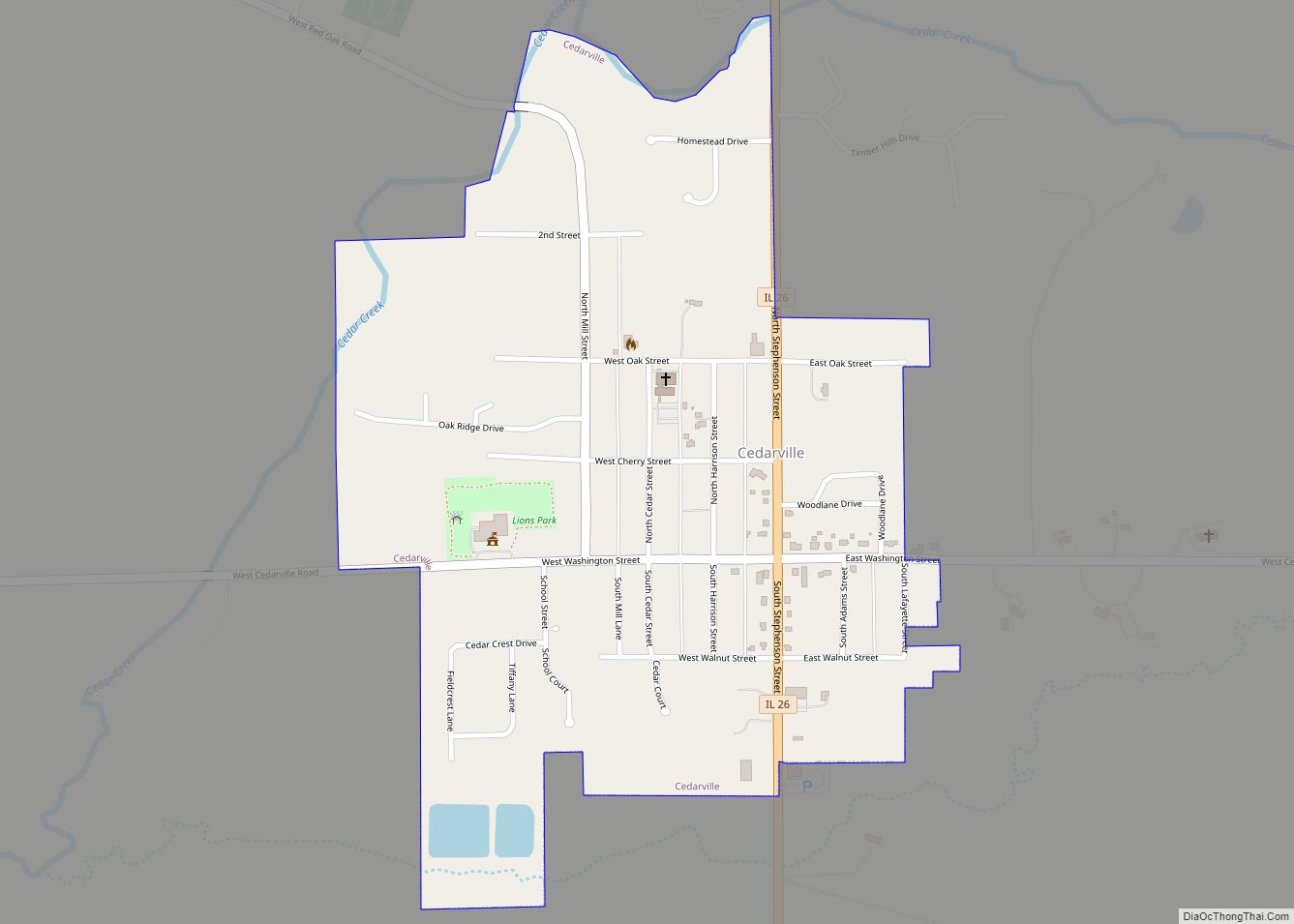
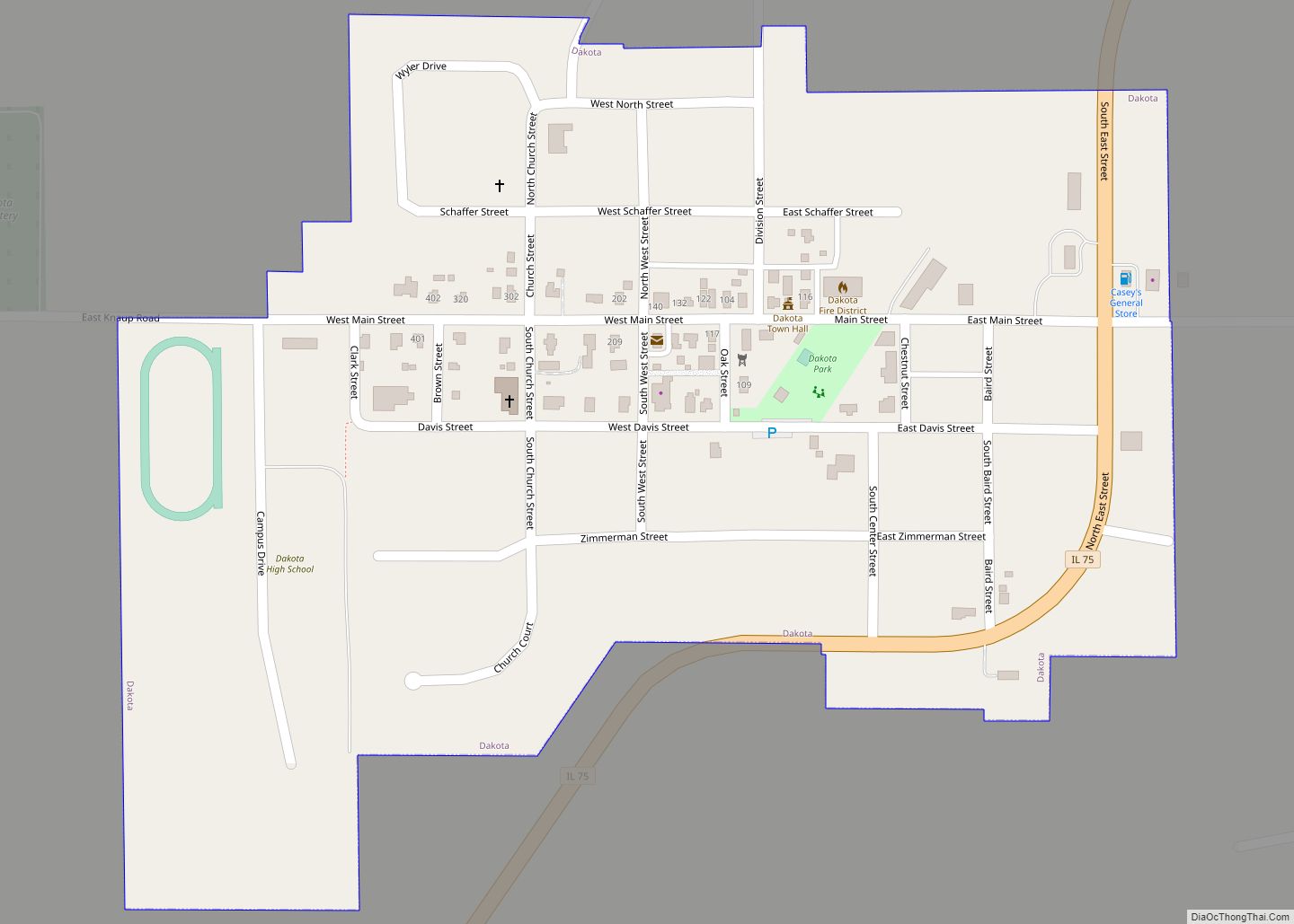
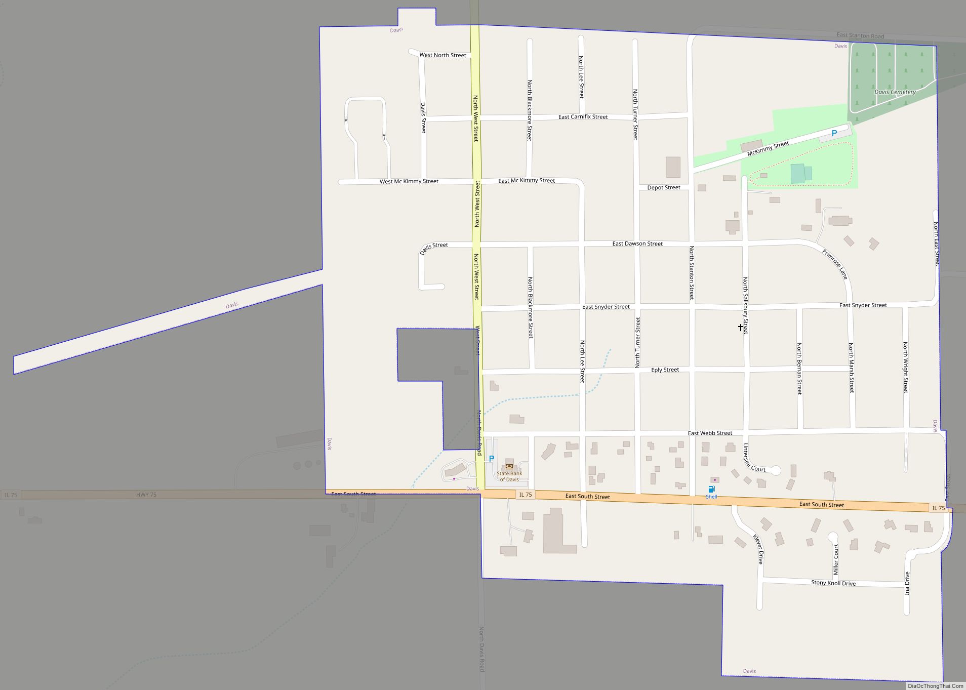
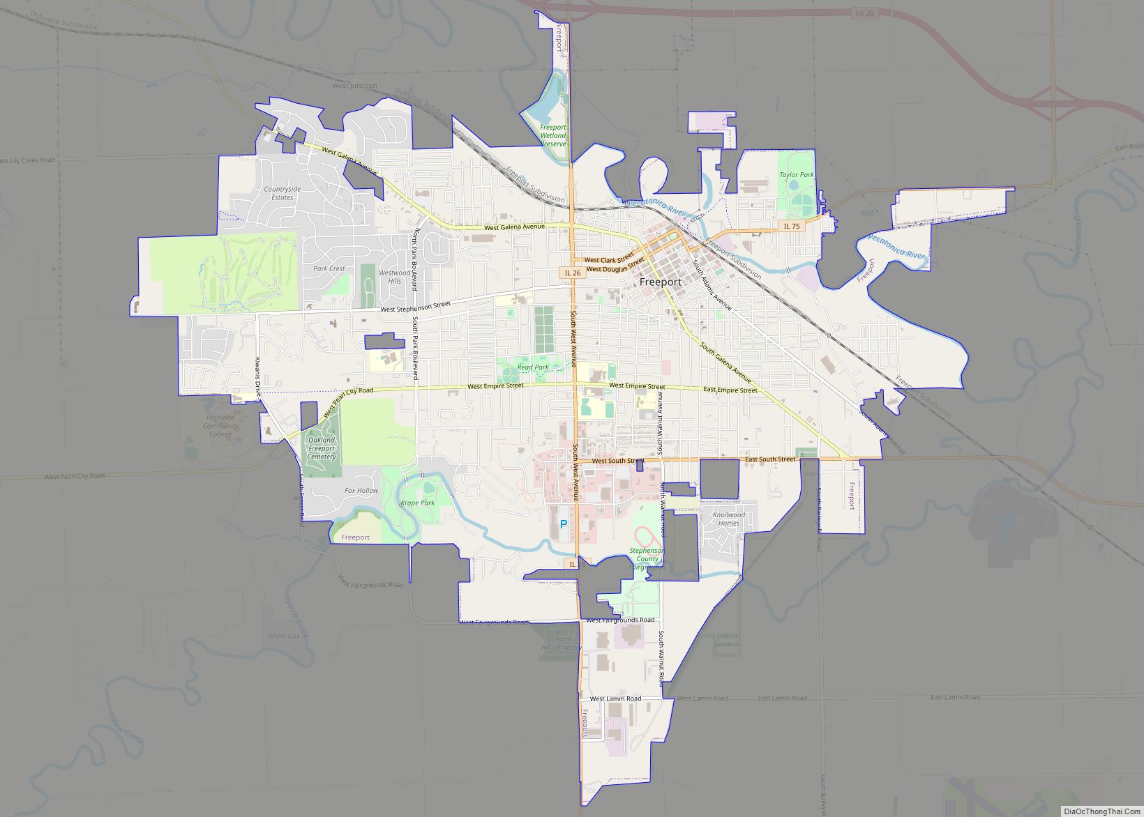
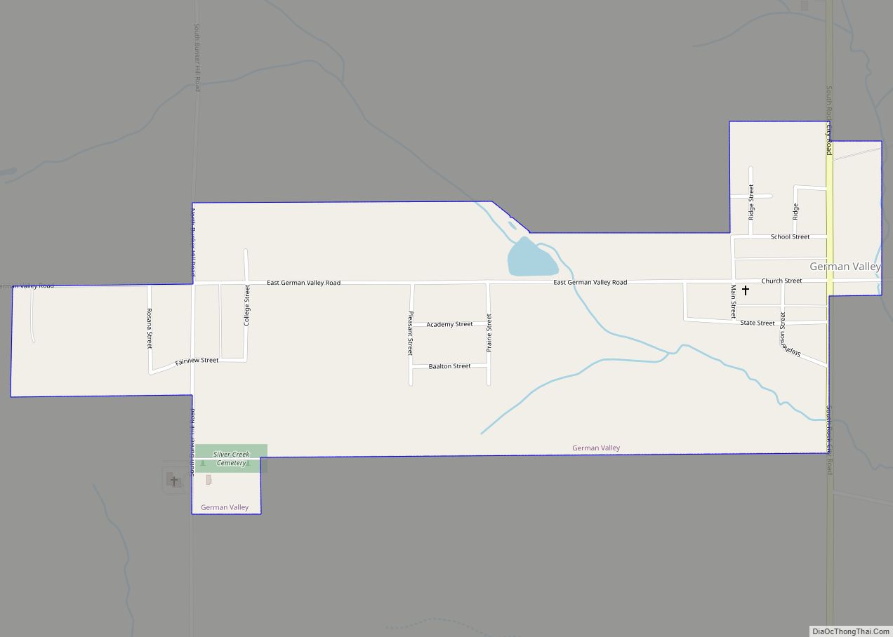
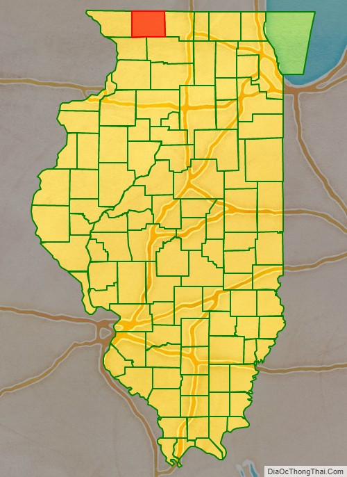
Stephenson County is a county located in the U.S. state of Illinois. According to the 2020 United States Census, it had a population of 44,630. Its county seat is Freeport.
Stephenson County is included in the Freeport, IL Micropolitan Statistical Area, which is also included in the Rockford-Freeport-Rochelle, IL Combined Statistical Area.
| Name: | Stephenson County |
|---|---|
| FIPS code: | 17-177 |
| State: | Illinois |
| Founded: | 1837 |
| Named for: | Benjamin Stephenson |
| Seat: | Freeport |
| Largest city: | Freeport |
| Total Area: | 565 sq mi (1,460 km²) |
| Land Area: | 565 sq mi (1,460 km²) |
| Total Population: | 44,630 |
| Population Density: | 79/sq mi (30/km²) |
| Time zone: | UTC−6 (Central) |
| Summer Time Zone (DST): | UTC−5 (CDT) |
| Website: | www.co.stephenson.il.us |
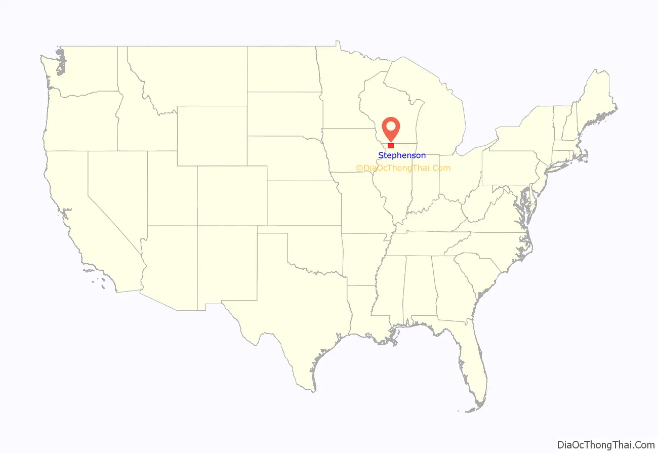
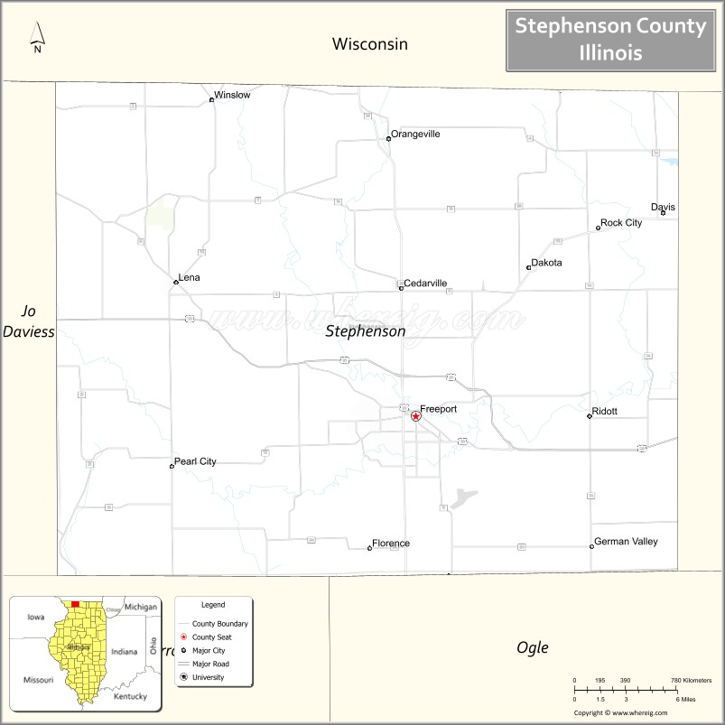
Stephenson County location map. Where is Stephenson County?
History
The land that became Stephenson County was first settled by William Waddams in 1832, who founded Waddams Grove. By 1837, population was sufficient to form Stephenson County, taking land from Jo Daviess and Winnebago counties. The county was named for Colonel Benjamin Stephenson, an official of the Illinois Territory.
Marker marking Waddams’ first settlement in Stephenson County
Stephenson County at the time of its creation in 1837. Its boundaries have remained unchanged since then.
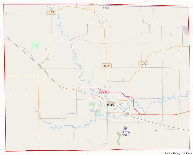
Stephenson County Road Map
Geography
According to the US Census Bureau, the county has a total area of 565 square miles (1,460 km), of which 565 square miles (1,460 km) is land and 0.5 square miles (1.3 km) (0.09%) is water.
Climate and weather
In recent years the average temperatures in the county seat of Freeport, have ranged from a low of 9 °F (−13 °C) in January to a high of 82 °F (28 °C) in July, although a record low of −29 °F (−34 °C) was recorded in January 2009 and a record high of 101 °F (38 °C) was recorded in July 1988. Average monthly precipitation ranged from 1.33 inches (34 mm) in January to 4.46 inches (113 mm) in June.
Adjacent counties
- Green County, Wisconsin (north)
- Winnebago County (east)
- Ogle County (southeast)
- Carroll County (southwest)
- Jo Daviess County (west)
- Lafayette County, Wisconsin (northwest)
Major highways
- US Highway 20
- Illinois Route 26
- Illinois Route 73
- Illinois Route 75
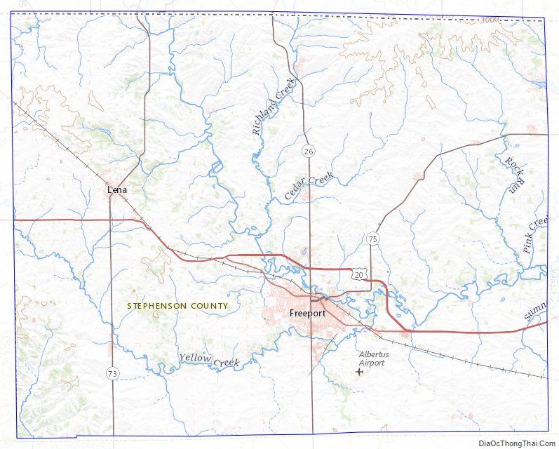
Stephenson County Topographic Map
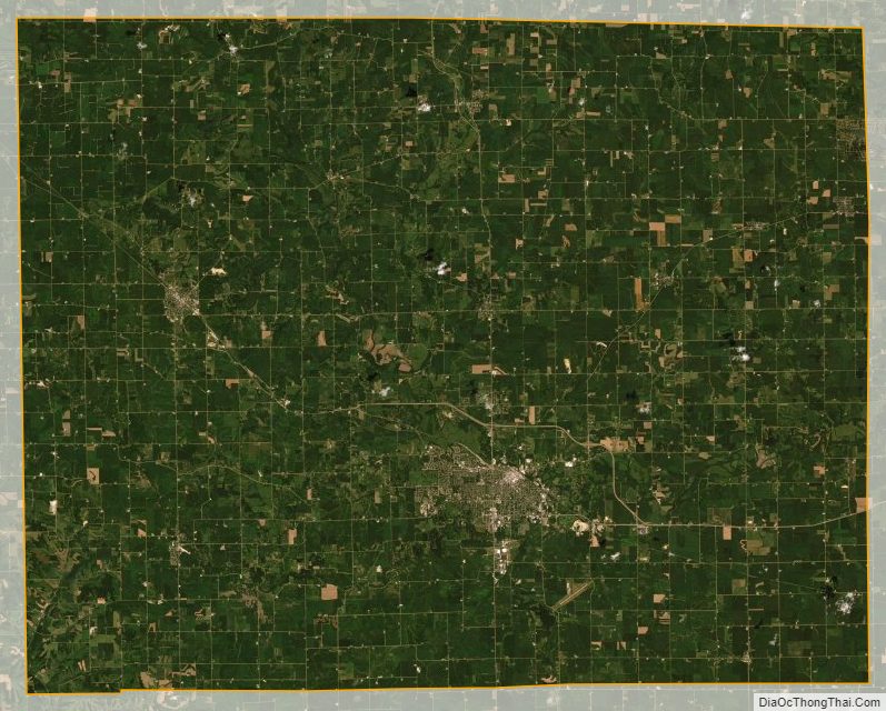
Stephenson County Satellite Map
Stephenson County Outline Map