Rochelle is a city in Ogle County, Illinois. The population was 9,446 at the 2020 census. Rochelle is approximately 80 miles (130 km) west of Chicago and 25 miles (40 km) south of Rockford.
| Name: | Rochelle city |
|---|---|
| LSAD Code: | 25 |
| LSAD Description: | city (suffix) |
| State: | Illinois |
| County: | Lee County, Ogle County |
| Elevation: | 823 ft (251 m) |
| Total Area: | 13.42 sq mi (34.76 km²) |
| Land Area: | 13.40 sq mi (34.71 km²) |
| Water Area: | 0.02 sq mi (0.05 km²) |
| Total Population: | 9,446 |
| Population Density: | 704.87/sq mi (272.16/km²) |
| ZIP code: | 61068 |
| Area code: | 815 |
| FIPS code: | 1764746 |
| Website: | www.cityofrochelle.net |
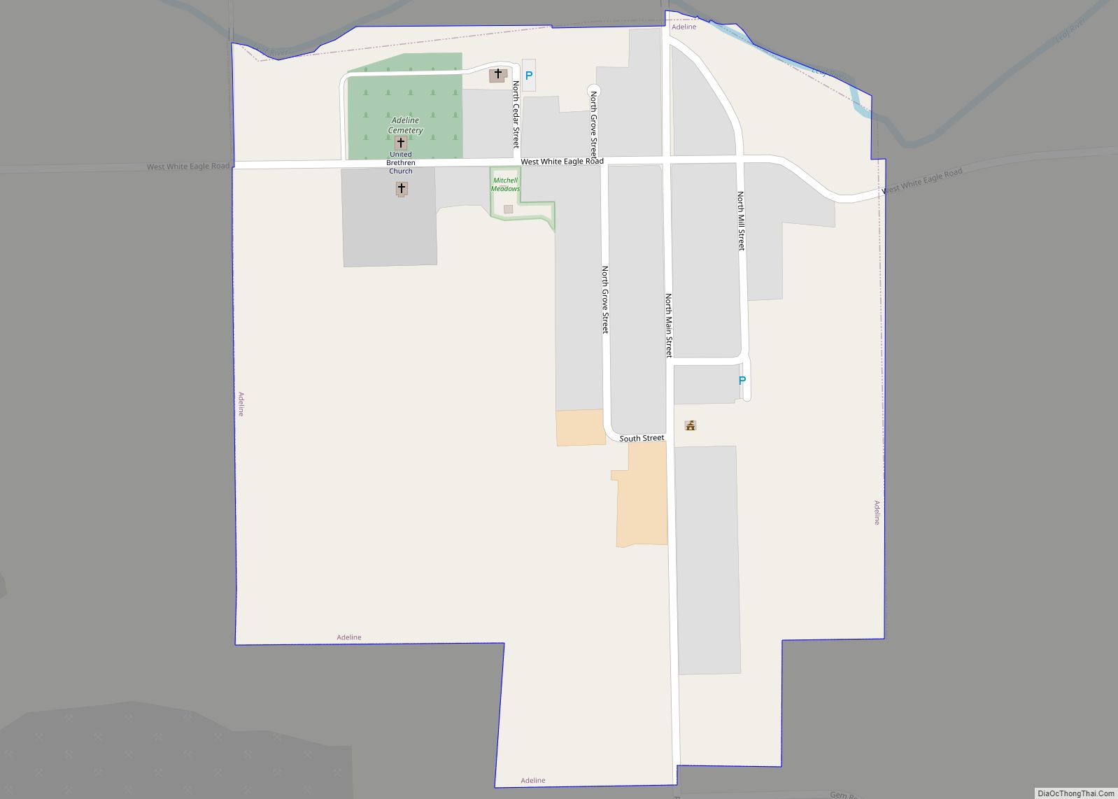
Online Interactive Map
Click on ![]() to view map in "full screen" mode.
to view map in "full screen" mode.
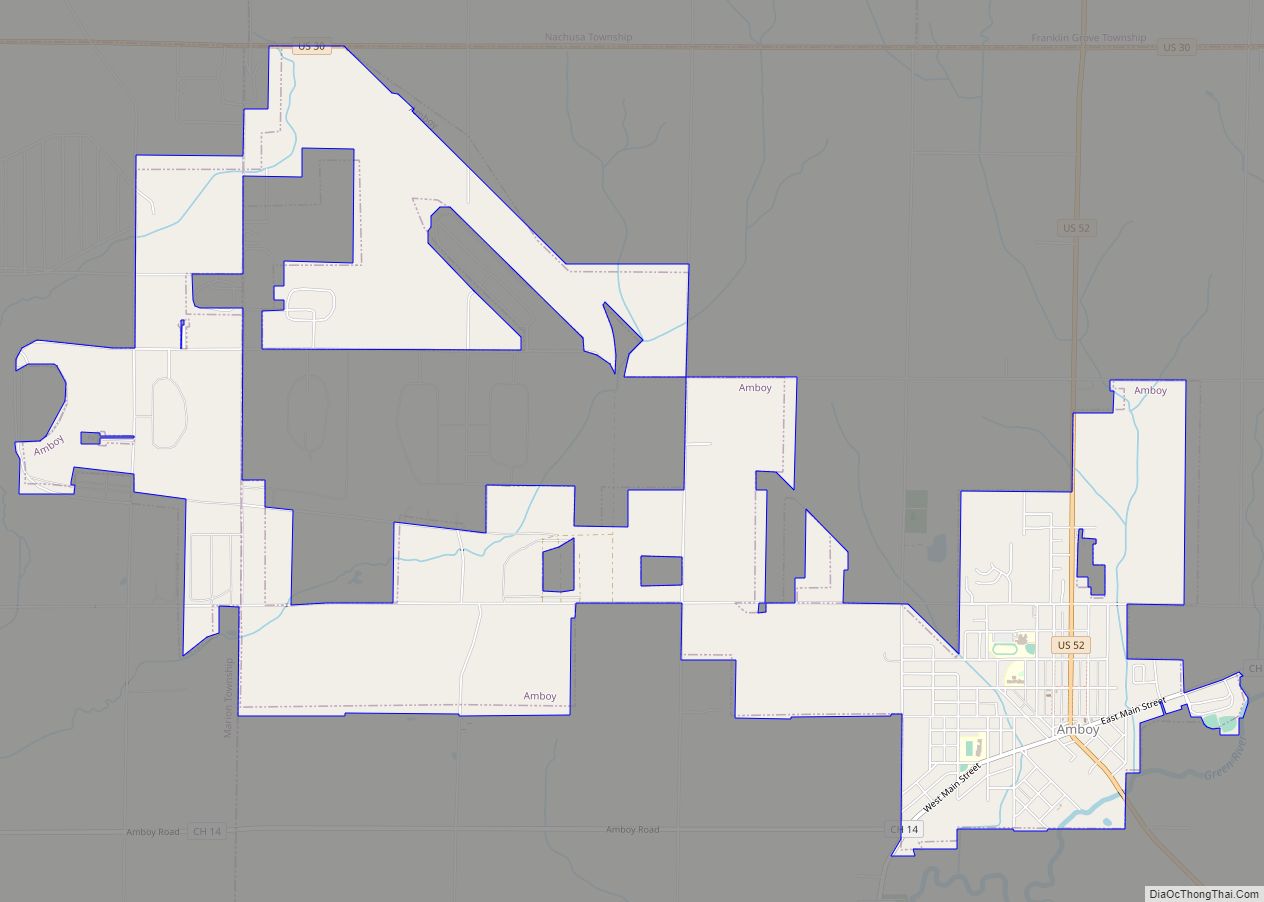
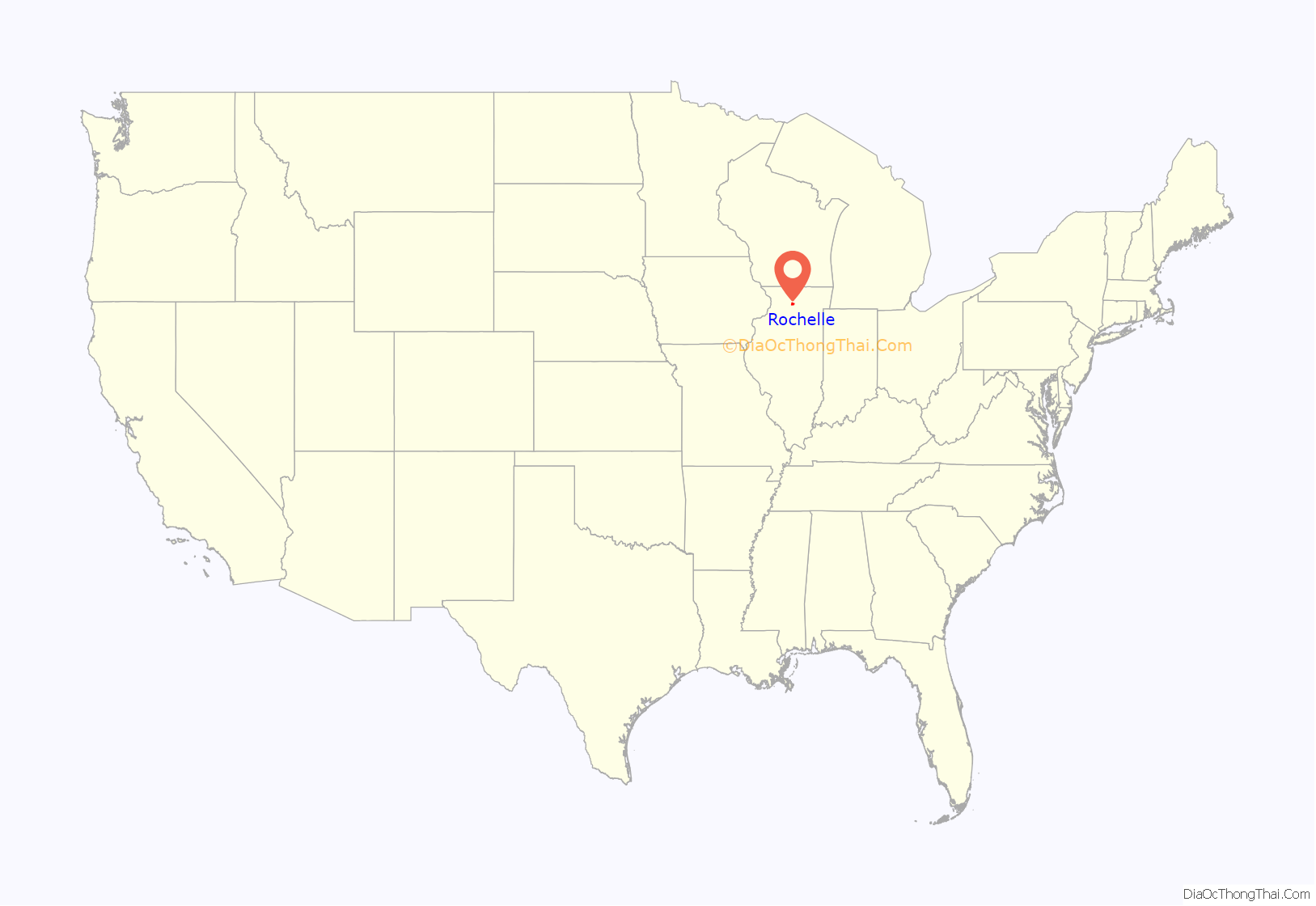
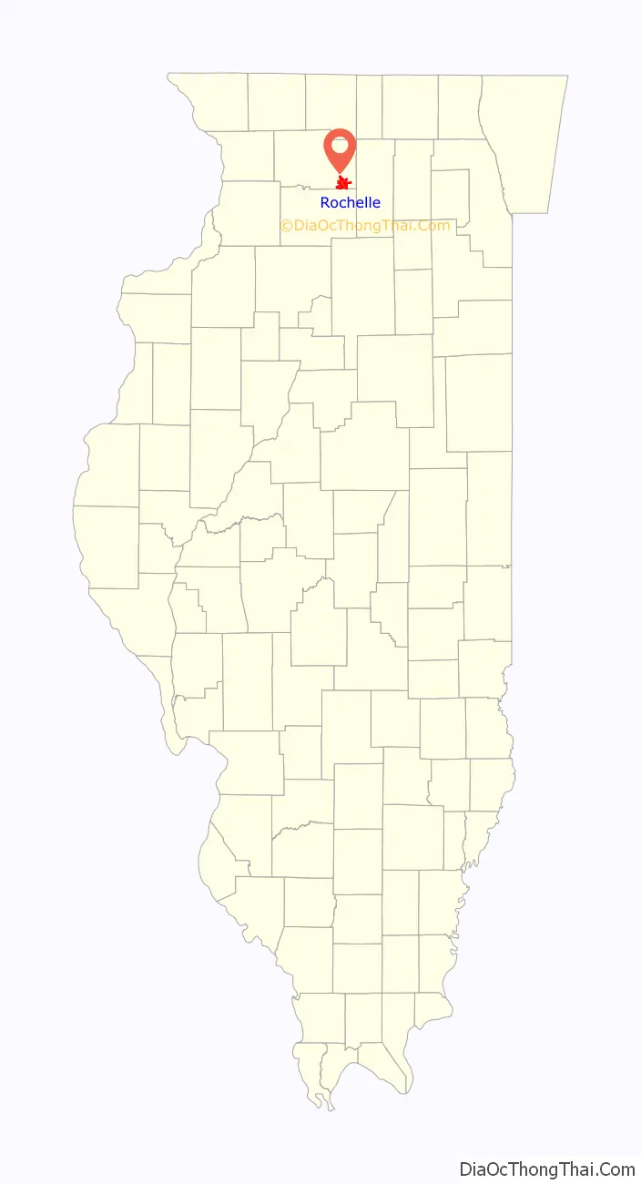
Rochelle location map. Where is Rochelle city?
History
Originally named Hickory Grove, the town sits at the intersection of two rail lines, the Burlington Northern Santa Fe and the Union Pacific. Having a number of granaries holding corn, wheat and other crops for shipping eastward, the town was an important rail link for farmers.
After World War II, Rochelle grew, becoming a center for Swift Meat Packing and Del Monte canned vegetables such as asparagus, corn, green beans, and peas.
The community is home to the popular Rochelle Railroad Park where visitors from across the country come to watch passing trains at the intersection of the BNSF and Union Pacific Railroads; the Chicagoland Skydiving Center and Flight Deck Restaurant where diners watch jumpers jump from a perfectly good airplane; and the Kennay Farms Distillery just west of Rochelle.
On April 9, 2015, parts of the city suffered damage when an EF4 tornado struck near the outskirts of the town.
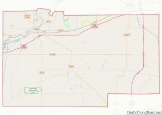
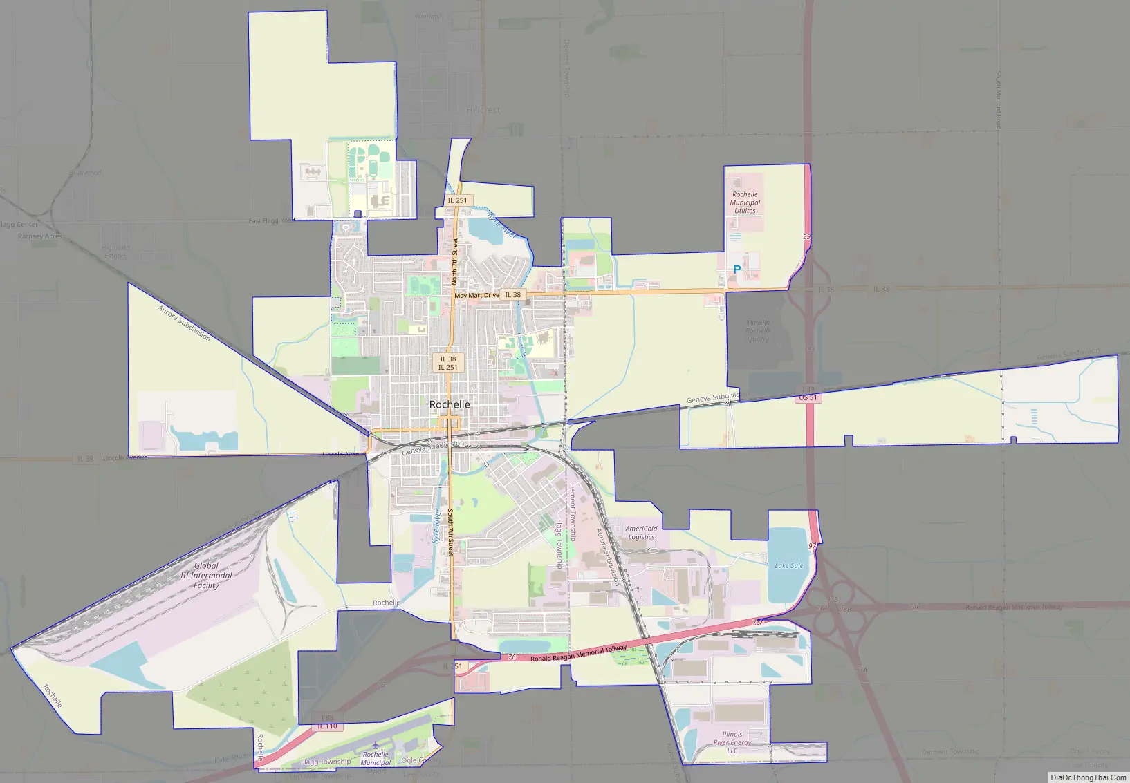
Rochelle Road Map
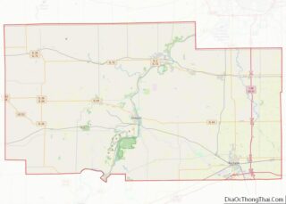
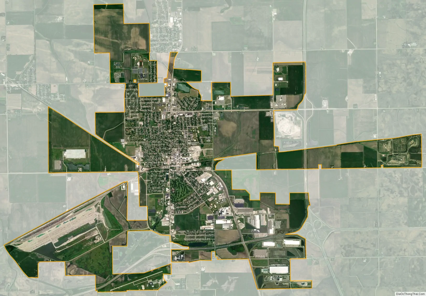
Rochelle city Satellite Map
Geography
Rochelle is located along the Kyte River (commonly, if inaccurately, known to most locals as “Kyte Creek”). It is also located near the junction of Interstates 39 and 88.
According to the 2010 census, Rochelle has a total area of 12.919 square miles (33.46 km), of which 12.9 square miles (33.41 km) (or 99.85%) is land and 0.019 square miles (0.05 km) (or 0.15%) is water.
See also
Map of Illinois State and its subdivision:- Adams
- Alexander
- Bond
- Boone
- Brown
- Bureau
- Calhoun
- Carroll
- Cass
- Champaign
- Christian
- Clark
- Clay
- Clinton
- Coles
- Cook
- Crawford
- Cumberland
- De Kalb
- De Witt
- Douglas
- Dupage
- Edgar
- Edwards
- Effingham
- Fayette
- Ford
- Franklin
- Fulton
- Gallatin
- Greene
- Grundy
- Hamilton
- Hancock
- Hardin
- Henderson
- Henry
- Iroquois
- Jackson
- Jasper
- Jefferson
- Jersey
- Jo Daviess
- Johnson
- Kane
- Kankakee
- Kendall
- Knox
- La Salle
- Lake
- Lake Michigan
- Lawrence
- Lee
- Livingston
- Logan
- Macon
- Macoupin
- Madison
- Marion
- Marshall
- Mason
- Massac
- McDonough
- McHenry
- McLean
- Menard
- Mercer
- Monroe
- Montgomery
- Morgan
- Moultrie
- Ogle
- Peoria
- Perry
- Piatt
- Pike
- Pope
- Pulaski
- Putnam
- Randolph
- Richland
- Rock Island
- Saint Clair
- Saline
- Sangamon
- Schuyler
- Scott
- Shelby
- Stark
- Stephenson
- Tazewell
- Union
- Vermilion
- Wabash
- Warren
- Washington
- Wayne
- White
- Whiteside
- Will
- Williamson
- Winnebago
- Woodford
- Alabama
- Alaska
- Arizona
- Arkansas
- California
- Colorado
- Connecticut
- Delaware
- District of Columbia
- Florida
- Georgia
- Hawaii
- Idaho
- Illinois
- Indiana
- Iowa
- Kansas
- Kentucky
- Louisiana
- Maine
- Maryland
- Massachusetts
- Michigan
- Minnesota
- Mississippi
- Missouri
- Montana
- Nebraska
- Nevada
- New Hampshire
- New Jersey
- New Mexico
- New York
- North Carolina
- North Dakota
- Ohio
- Oklahoma
- Oregon
- Pennsylvania
- Rhode Island
- South Carolina
- South Dakota
- Tennessee
- Texas
- Utah
- Vermont
- Virginia
- Washington
- West Virginia
- Wisconsin
- Wyoming