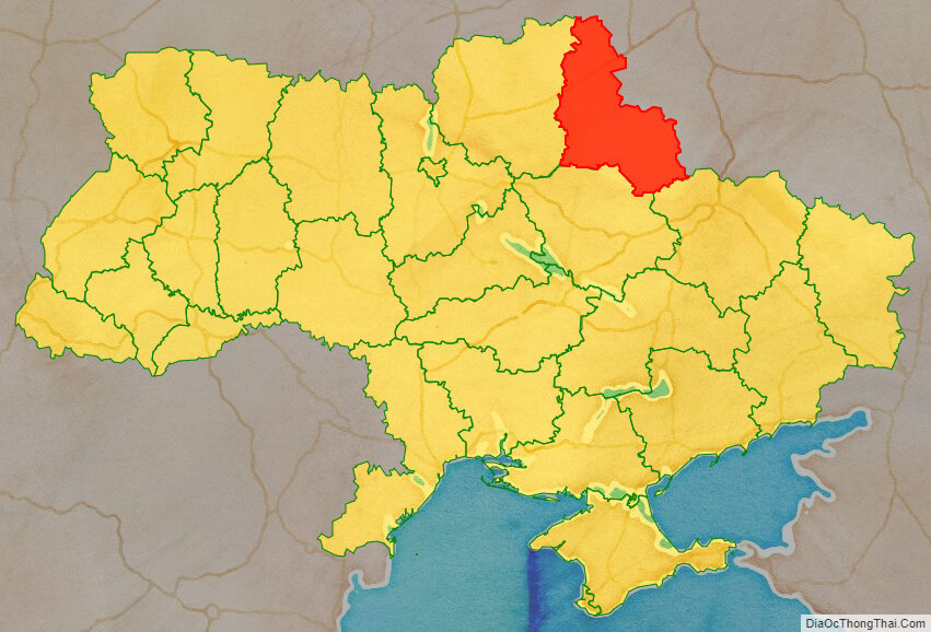
Sumy Oblast (Ukrainian: Сумська́ о́бласть, romanized: Sumska oblast), also known as Sumshchyna (Ukrainian: Су́мщина), is an oblast (province) in northeast Ukraine. The oblast was created in its most recent form, from the merging of raions from Kharkiv Oblast, Chernihiv Oblast, and Poltava Oblast in 1939 by the Presidium of the Supreme Soviet of the Soviet Union.
The estimated population is 1,035,772 (2022 est.).
The administrative center of the oblast is the city of Sumy. Other important cities within the oblast include Konotop, Okhtyrka, Romny, and Shostka. The oblast has a heavy mix of agriculture and industry, with over 600 industrial locations. Importantly, seven rivers pass through the oblast.
| Unit Name | Sumy Oblast |
|---|---|
| Administrative center | Sumy |
| Total area | 23.834 km² (9.202 sq mi) |
| Area Rank | Rank 16th |
| Population (2021) | 1.053.402 |
| Time zone | UTC+2 (EET) |
| Summer (DST) | UTC+3 (EEST) |
| Postal code | 40000-41999 |
| Area code | +380-54 |
| ISO 3166 code | UA-59 |
| Website | sorada.gov.ua |
| Flag |  |
| Coat of arms |  |
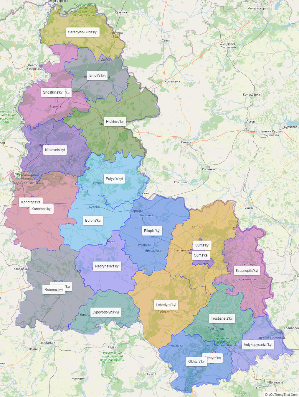
Online subdivision map of Sumy oblast
Sumy Oblast is a beautiful region located in northeastern Ukraine, known for its stunning landscapes, rich culture, and fascinating history. Whether you’re a local resident or a curious traveler, exploring the region’s sub-administrative units can provide you with a wealth of information and insights. Using an online base map such as OpenStreetMap, you can easily view the region’s various sub-administrative units in detail. The map includes a cover layer with different colors to show the borders and boundaries of each area, making it easy to distinguish between them. You can zoom in and out of the map to explore the different cities, towns, and villages within Sumy Oblast. This allows you to discover the unique architecture, landmarks, and natural beauty of the region, such as the beautiful landscapes of the Sumy Polesia, the Kremenchuk Reservoir, and the stunning landscapes of the Desna River valley. Whether you’re planning a day trip or simply curious about the region, an online subdivision map of Sumy Oblast can provide you with a great deal of information and inspiration. So why not take some time to explore the region and discover its hidden gems?
Click on ![]() to view map in "full screen" mode.
to view map in "full screen" mode.
List administrative sub-division of Sumy oblast
| # | Name | Type |
|---|---|---|
| 1 | Konotops’ka | Mis’ka Rada |
| 2 | Okhtyrs’ka | Mis’ka Rada |
| 3 | Romens’ka | Mis’ka Rada |
| 4 | Sums’ka | Mis’ka Rada |
| 5 | Shostkins’ka | Misto |
| 6 | Bilopils’kyi | Raion |
| 7 | Buryns’kyi | Raion |
| 8 | Hlukhivs’kyi | Raion |
| 9 | Iampil’s’kyi | Raion |
| 10 | Konotops’kyi | Raion |
| 11 | Krasnopil’s’kyi | Raion |
| 12 | Krolevets’kyi | Raion |
| 13 | Lebedyns’kyi | Raion |
| 14 | Lypovodolyns’kyi | Raion |
| 15 | Nedryhailivs’kyi | Raion |
| 16 | Okhtyrs’kyi | Raion |
| 17 | Putyvl’s’kyi | Raion |
| 18 | Romens’kyi | Raion |
| 19 | Seredyno-Buds’kyi | Raion |
| 20 | Shostkins’kyi | Raion |
| 21 | Sums’kyi | Raion |
| 22 | Trostianets’kyi | Raion |
| 23 | Velykopysarivs’kyi | Raion |
Explaination:
- Mis’ka Rada: City municipalities (governed by a mayor and a city council)
- Misto: city at least 10,000 people (not a town).
- Raion: often translated as “district”.
Location map of Sumy oblast, Ukraine

Political map of Sumy oblast

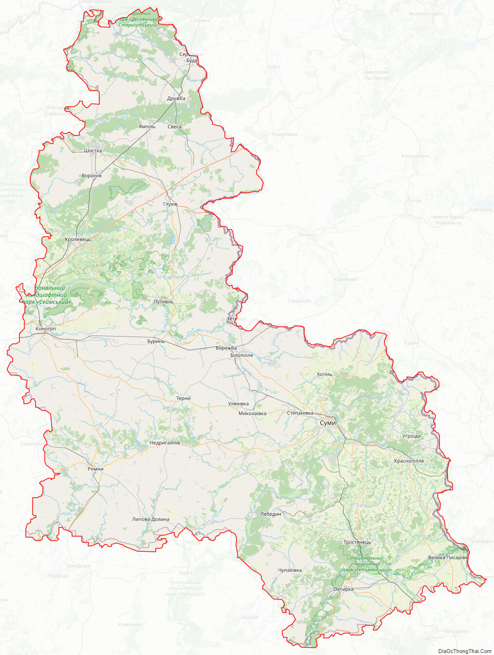
Sumy oblast streeet map
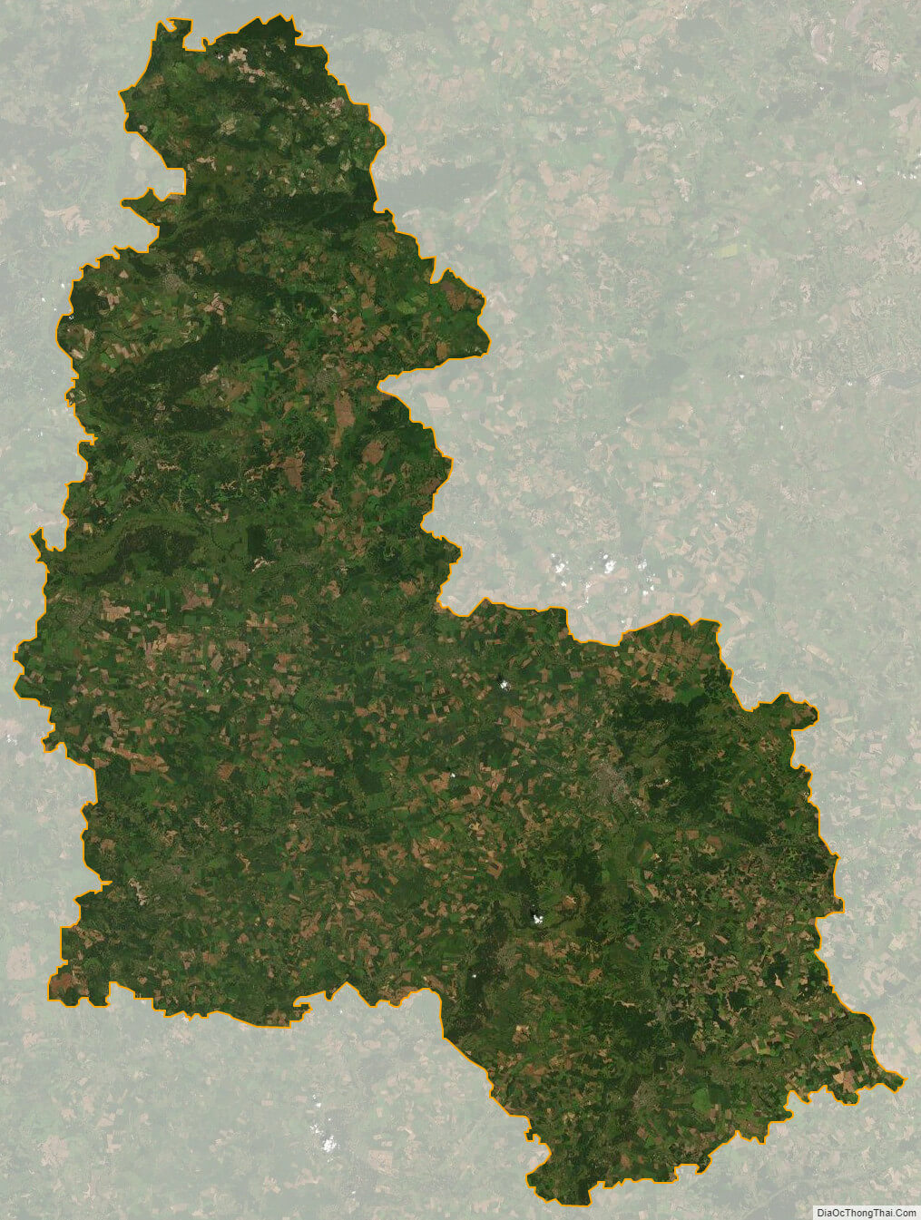
Sumy oblast satellite map