Kharkiv Oblast (Ukrainian: Харківська́ о́бласть, romanized: Kharkivska oblast), also referred to as Kharkivshchyna (Ukrainian: Ха́рківщина), is an oblast (province) of eastern Ukraine. The oblast borders Russia to the north, Luhansk Oblast to the east, Donetsk Oblast to the south-east, Dnipropetrovsk Oblast to the south-west, Poltava Oblast to the west and Sumy Oblast to the north-west. The area of the oblast is 31,400 km², corresponding to 5.2% of the total territory of Ukraine.
The oblast is the third most populous province of Ukraine, with a population of 2,598,961 in 2021, more than half (1.42 million) of whom live in the city of Kharkiv, the oblast’s administrative center. While the Russian language is primarily spoken in the cities of Kharkiv oblast, elsewhere in the oblast most inhabitants speak Ukrainian.
| Unit Name | Kharkiv Oblast |
|---|---|
| Administrative center | Kharkiv |
| Total area | 31.415 km² (12.129 sq mi) |
| Area Rank | Rank 4th |
| Population (2021) | 2.633.834 |
| Time zone | UTC+2 (EET) |
| Summer (DST) | UTC+3 (EEST) |
| Postal code | 61-64 |
| Area code | +380-57 |
| ISO 3166 code | UA-63 |
| Website | www.kharkivoda.gov.ua |
| Flag |  |
| Coat of arms |  |
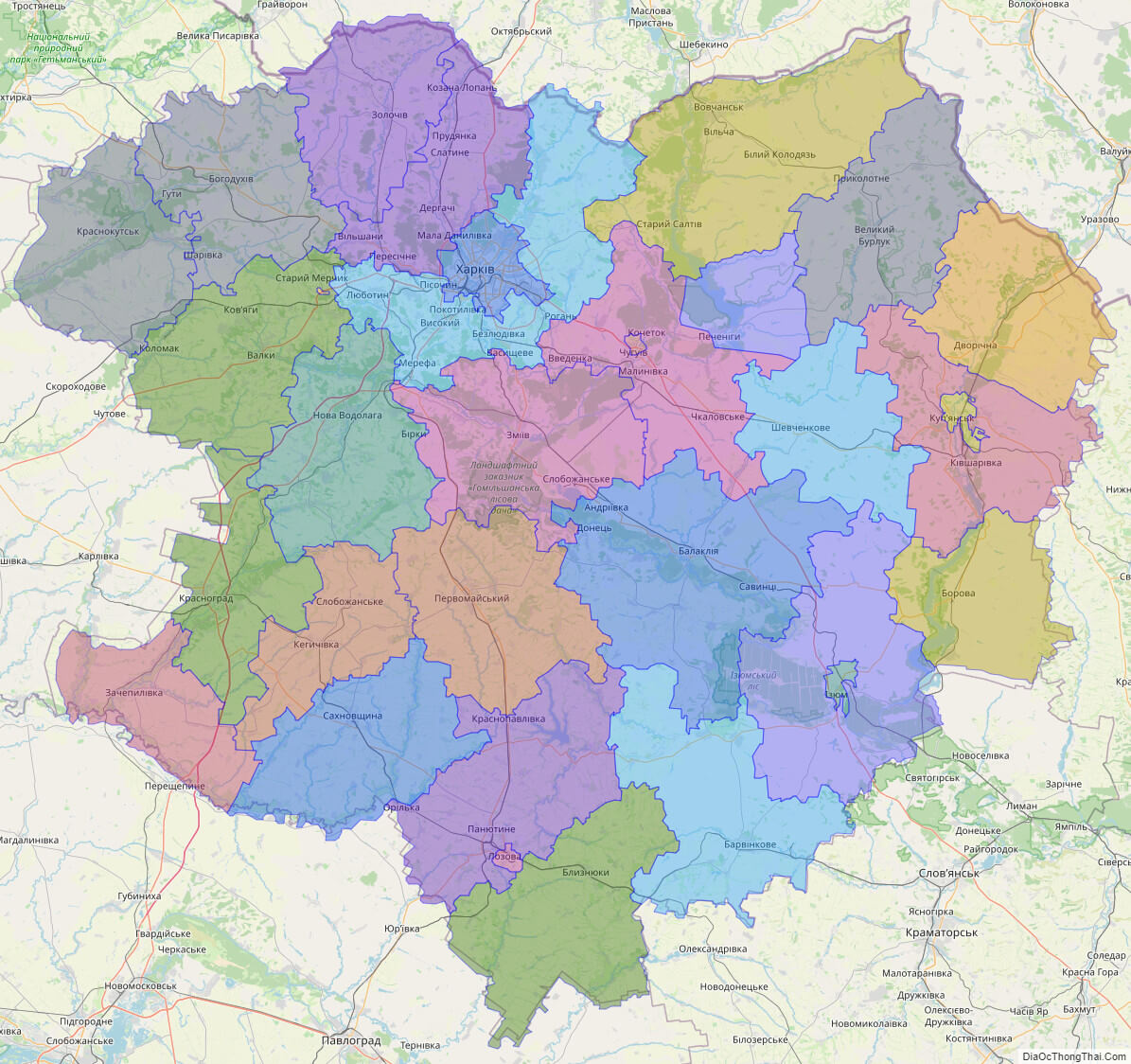
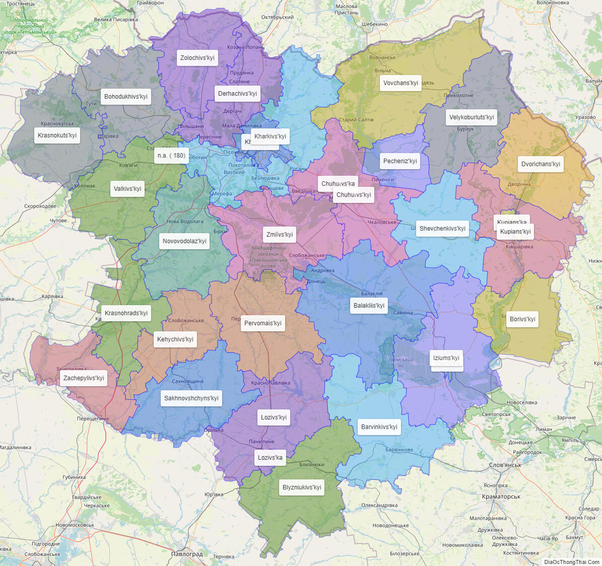
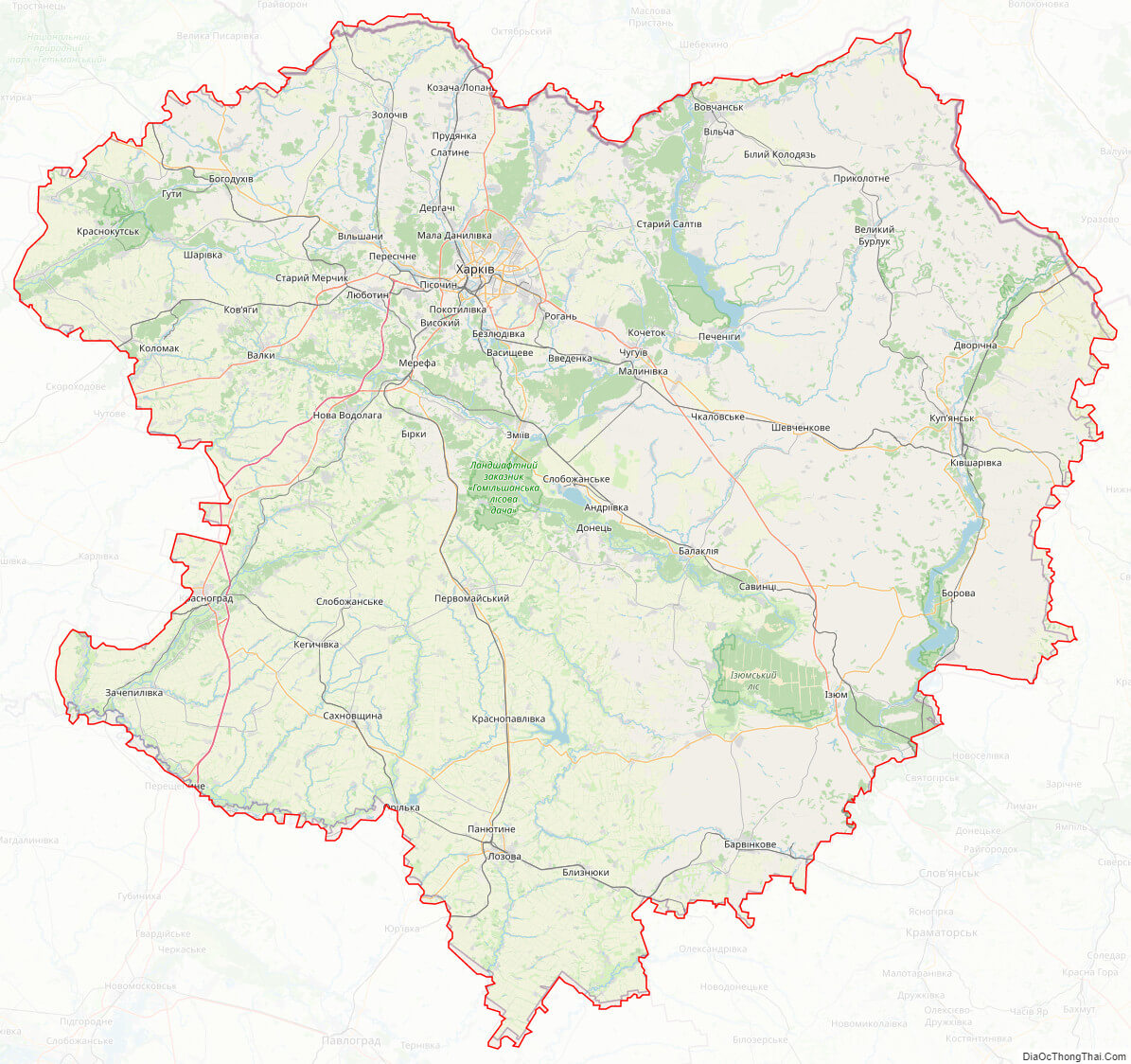
Online subdivision map of Kharkiv oblast
Kharkiv Oblast, located in the northeast region of Ukraine, is a diverse and expansive area with many different sub-administrative units. If you’re looking for a detailed and easy-to-use map to help you navigate the region, look no further than the online subdivision map of Kharkiv Oblast.
This map provides a wealth of information, including an overview of the entire region, as well as more detailed views of individual cities, towns, and villages. You can choose from several different base maps, including OpenStreetMap and satellite views, to get a better understanding of the terrain and surrounding areas.
In addition, the map is color-coded to show the boundaries of each sub-administrative unit, making it easy to distinguish between different cities and towns. You can zoom in and out to get a closer look at individual streets, buildings, and landmarks, and the map also includes a search function that allows you to quickly find specific addresses or locations.
Whether you’re a resident of Kharkiv Oblast or a visitor to the region, the online subdivision map is an invaluable tool for anyone looking to explore and navigate this beautiful part of Ukraine. So why wait? Check it out today and start planning your next adventure!
Click on ![]() to view map in "full screen" mode.
to view map in "full screen" mode.
List administrative sub-division of Kharkiv oblast
| # | Name | Type |
|---|---|---|
| 1 | Chuhu‹vs’ka | Mis’ka Rada |
| 2 | Kharkivs’ka | Mis’ka Rada |
| 3 | Kupians’ka | Mis’ka Rada |
| 4 | Lozivs’ka | Mis’ka Rada |
| 5 | Iziums’ka | Misto |
| 6 | Balakliis’kyi | Raion |
| 7 | Barvinkivs’kyi | Raion |
| 8 | Blyzniukivs’kyi | Raion |
| 9 | Bohodukhivs’kyi | Raion |
| 10 | Borivs’kyi | Raion |
| 11 | Chuhu‹vs’kyi | Raion |
| 12 | Derhachivs’kyi | Raion |
| 13 | Dvorichans’kyi | Raion |
| 14 | Iziums’kyi | Raion |
| 15 | Kehychivs’kyi | Raion |
| 16 | Kharkivs’kyi | Raion |
| 17 | Krasnohrads’kyi | Raion |
| 18 | Krasnokuts’kyi | Raion |
| 19 | Kupians’kyi | Raion |
| 20 | Lozivs’kyi | Raion |
| 21 | Novovodolaz’kyi | Raion |
| 22 | Pecheniz’kyi | Raion |
| 23 | Pervomais’kyi | Raion |
| 24 | Sakhnovshchyns’kyi | Raion |
| 25 | Shevchenkivs’kyi | Raion |
| 26 | Valkivs’kyi | Raion |
| 27 | Velykoburluts’kyi | Raion |
| 28 | Vovchans’kyi | Raion |
| 29 | Zachepylivs’kyi | Raion |
| 30 | Zmiïvs’kyi | Raion |
| 31 | Zolochivs’kyi | Raion |
| 32 | n.a. ( 180) |
Explaination:
- Mis’ka Rada: City municipalities (governed by a mayor and a city council)
- Misto: city at least 10,000 people (not a town).
- Raion: often translated as “district”.
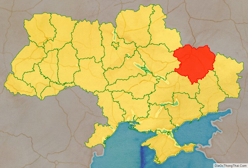
Location map of Kharkiv oblast, Ukraine

Political map of Kharkiv oblast
Kharkiv oblast streeet map
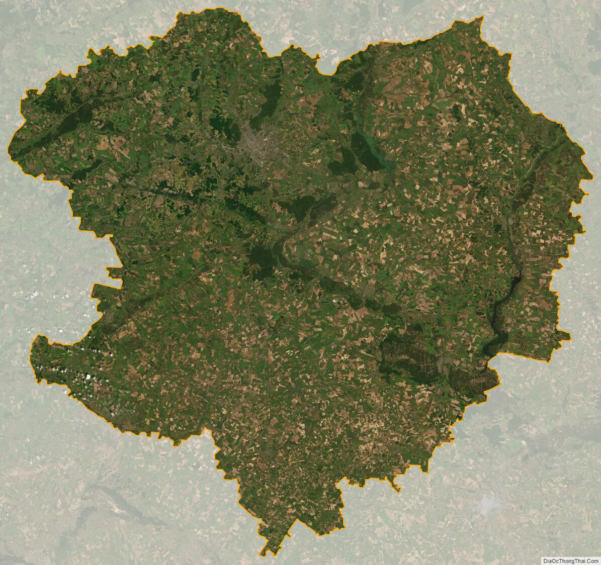
Kharkiv oblast satellite map