Todd County is a county in the central part of the U.S. state of Minnesota. As of the 2020 census, the population was 25,262. Its county seat is Long Prairie.
| Name: | Todd County |
|---|---|
| FIPS code: | 27-153 |
| State: | Minnesota |
| Founded: | 1855 |
| Named for: | John Blair Smith Todd |
| Seat: | Long Prairie |
| Largest city: | Long Prairie |
| Total Area: | 980 sq mi (2,500 km²) |
| Land Area: | 945 sq mi (2,450 km²) |
| Total Population: | 25,262 |
| Population Density: | 26/sq mi (10.0/km²) |
| Time zone: | UTC−6 (Central) |
| Summer Time Zone (DST): | UTC−5 (CDT) |
| Website: | www.co.todd.mn.us |
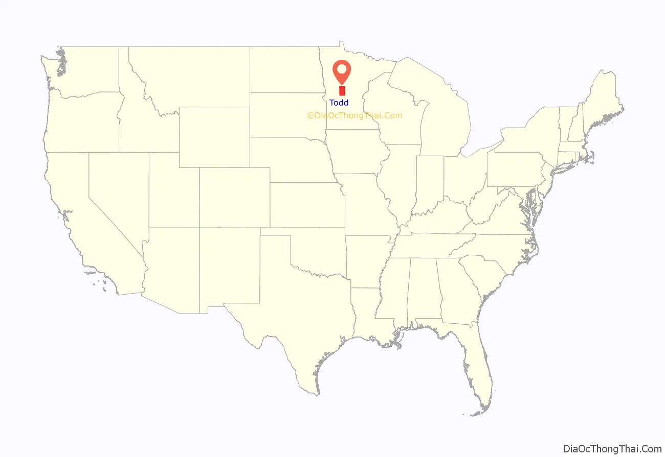
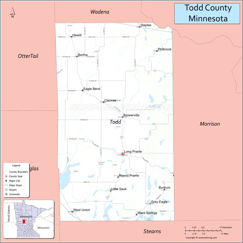
Todd County location map. Where is Todd County?
History
The county was created by the Minnesota Territorial legislature on February 20, 1855, although the county government was not organized until January 1, 1867, with Long Prairie as the county seat. It was named for John Blair Smith Todd, who was a delegate from Dakota Territory to the United States House of Representatives, and general in the Union Army during the American Civil War.
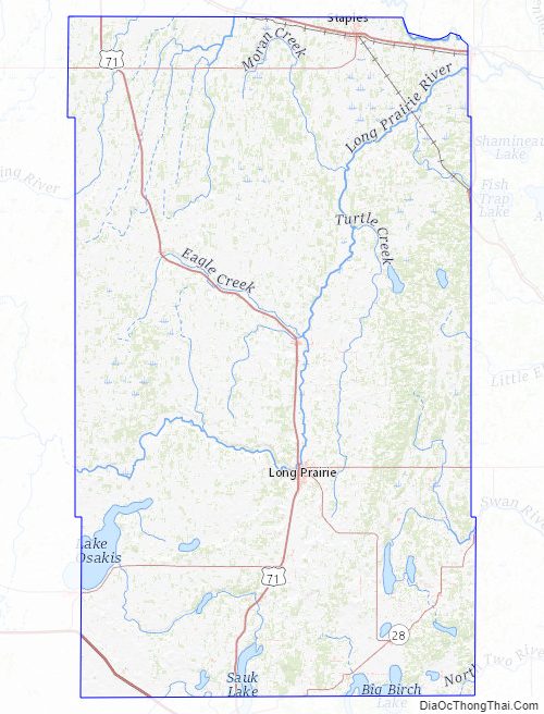
Todd County Road Map
Geography
The Crow Wing River flows southeastward along the northeastern border of Todd County. The Long Prairie River flows east-northeast through the central part of the county, discharging into the Crow Wing on the county’s northeastern border. The Wing River, northwest of the Long Prairie River, also flows into the Crow Wing. The county terrain consists of rolling hills, dotted with lakes and etched with drainages. The area is devoted to agriculture. The terrain slopes to the east and south, with its highest point on the west border at 1,483′ (452m) ASL. The county has a total area of 980 sq mi (2538 km), of which 945 sq mi (2448 km) is land and 35 sq mi (90.7 km)(3.5%) is water.
Major highways
- Interstate 94
- U.S. Highway 10
- U.S. Highway 52
- U.S. Highway 71
- Minnesota State Highway 27
- Minnesota State Highway 28
- Minnesota State Highway 210
- Minnesota State Highway 287
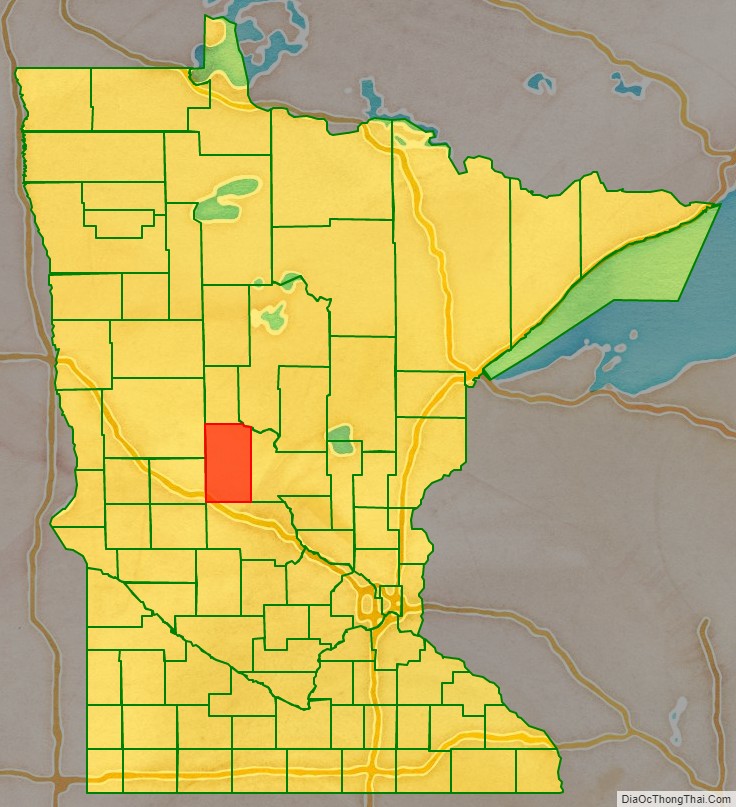
Adjacent counties
- Wadena County (north)
- Cass County (northeast)
- Morrison County (east)
- Stearns County (south)
- Douglas County (west)
- Otter Tail County (northwest)
Lakes
- Bass Lake
- Beauty Lake
- Big Birch Lake (part)
- Big Lake
- Big Swan Lake
- Buckhorn Lake
- Bunker Lake
- Cedar Lake
- Charlotte Lake
- Coal Lake
- Fairly Lake
- Fawn Lake
- Felix Lake
- Goose Lake
- Guernsey Lake
- Hayden Lake
- Juergens Lake
- Keller Lake
- Lady Lake
- Lake Osakis (part)
- Latimer Lake
- Lawrence Lake
- Little Birch Lake (part)
- Little Sauk Lake
- Long Lake (Birchdale Twp.)
- Long Lake (Burnhamville Twp.)
- Maple Lake
- Mary Lake (part)
- McCarrahan Lake
- Mill Lake
- Mud Lake
- Pauley Lake
- Pendergast Lake
- Pine Island Lake
- Rice Lake
- Sauk Lake (part)
- Schreiers Lake
- Sheet Lake
- Trace Lake
- Twin Lakes (part)
- West Union Lake
Protected areas
- Aurzada Wildlife Management Area
- Buckhorn Lake State Wildlife Management Area
- Burleene State Wildlife Management Area
- Dower State Wildlife Management Area
- Elgin Woods Wildlife Management Area
- Iona Wildlife Management Area
- Ireland State Wildlife Management Area
- Long Prairie River Wildlife Management Area
- Oak Ridge State Wildlife Management Area
- Ojakis Wildlife Management Area (part)
- Owen-Hinz Wildlife Management Area
- Quistorff Wildlife Management Area
- Randall State Wildlife Management Area
- Santer Wildlife Management Area
- Sheet Lake Wildlife Management Area
- West Union Wildlife Management Area
Todd County Topographic Map
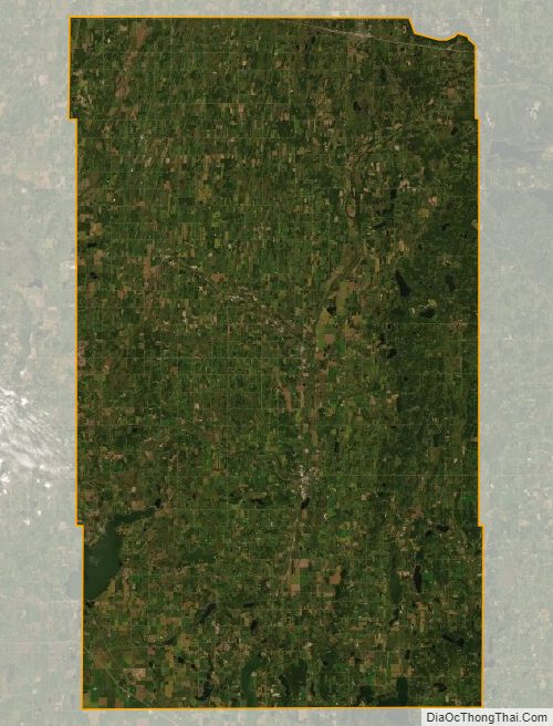
Todd County Satellite Map
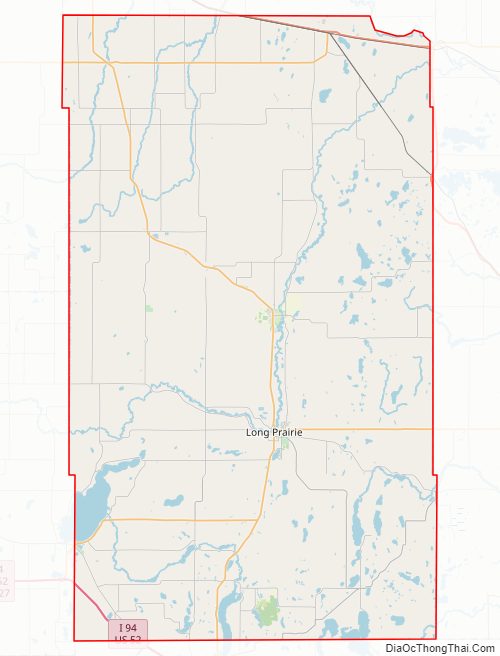
Todd County Outline Map