Stearns County is a county in the U.S. state of Minnesota. As of the 2020 census, the population was 158,292. Its county seat and largest city is St. Cloud. The county was founded in 1855. It was originally named for Isaac Ingalls Stevens, then renamed for Charles Thomas Stearns. Stearns County is part of the St. Cloud Metropolitan Statistical Area, which is also included in the Minneapolis-St. Paul Combined Statistical Area.
| Name: | Stearns County |
|---|---|
| FIPS code: | 27-145 |
| State: | Minnesota |
| Founded: | 1855 |
| Named for: | Charles Thomas Stearns |
| Seat: | St. Cloud |
| Largest city: | St. Cloud |
| Total Area: | 1,390 sq mi (3,600 km²) |
| Land Area: | 1,343 sq mi (3,480 km²) |
| Total Population: | 158,292 |
| Population Density: | 110/sq mi (44/km²) |
| Time zone: | UTC−6 (Central) |
| Summer Time Zone (DST): | UTC−5 (CDT) |
| Website: | www.co.stearns.mn.us |
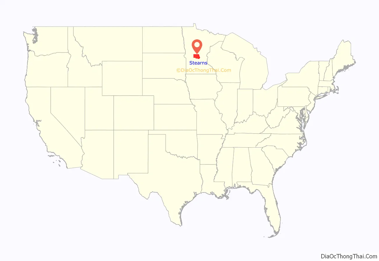
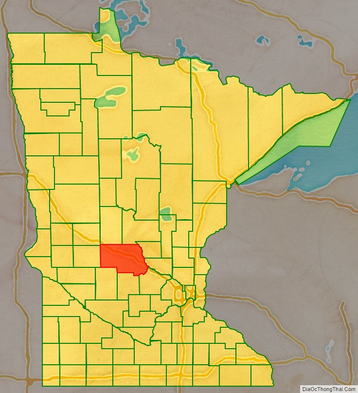
Stearns County location map. Where is Stearns County?
History
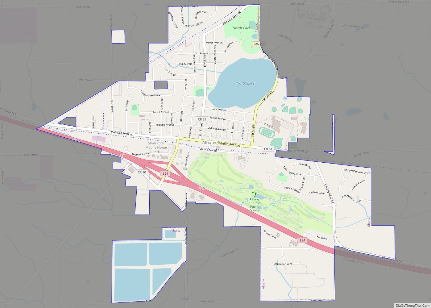
The Stearns County area was formerly occupied by numerous indigenous tribes, such as the Sioux (Dakota), Chippewa (Ojibwe) and Winnebago (Ho-chunk). The first large immigration was of German Catholics in the 1850s. Early arrivals also came from eastern states. The Wisconsin Territory was established by the federal government effective July 3, 1836, and existed until its eastern portion was granted statehood (as Wisconsin) in 1848. The federal government set up the Minnesota Territory effective March 3, 1849. The newly organized territorial legislature created nine counties across the territory in October of that year. The original counties had portions partitioned off in 1851 to create Cass County and in 1853 to create Sibley, Pierce, and Nicollet counties. In 1855 parts of those counties were partitioned off to create Stearns County. It was to be named Stevens County for territorial governor Isaac Ingalls Stevens, who had conducted an expedition through the area in 1853, but due to a clerical error, the county was named Stearns for Charles Thomas Stearns, a member of the Territorial Council. (To compensate for this error the area two counties west was later named Stevens County.) The February 20, 1855, act that created the county directed the naming of three county commissioners and specified St. Cloud as the county seat. The first courthouse was put into service on July 12, 1864, and it remained in use until the present courthouse was dedicated in 1922. In 1913 a campaign was mounted to shift the county seat to Albany, due to its more central location. The effort was not successful.
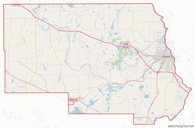
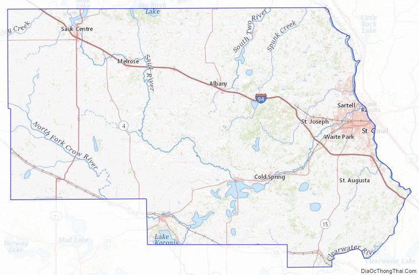
Stearns County Road Map
Geography
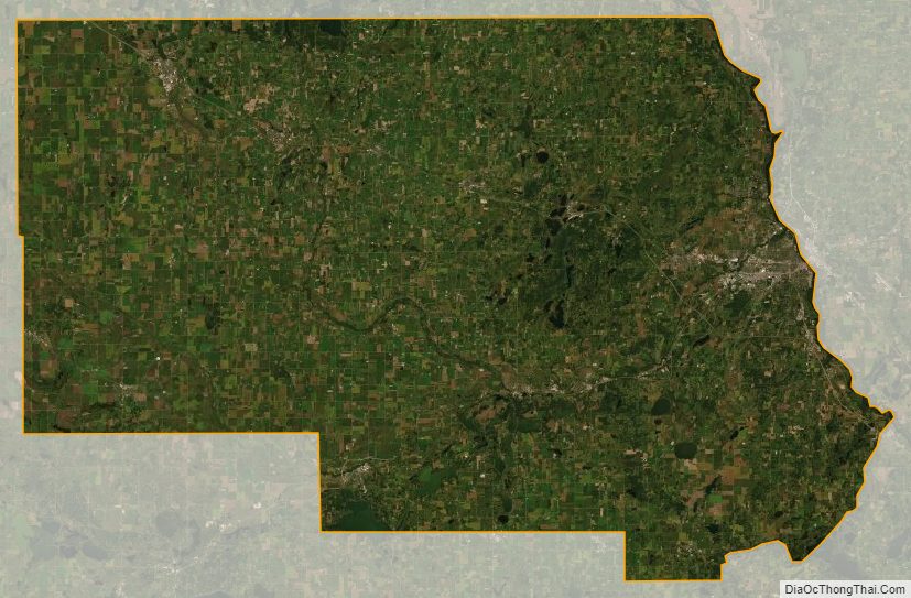
Stearns County borders nine counties. The Mississippi River flows southeast along its northeast border, and the Sauk River drains the central part of the county into the Mississippi at St. Cloud. The county terrain consists of low rolling hills, lightly wooded, dotted with lakes and ponds, and carved with drainages. All available area is devoted to agriculture or has been developed. The terrain slopes to the east and south, with its highest point a local protuberance at 7.6 miles (12.2 km) west and 1.6 mile (2.6 km) south of St. Joseph, at 1,461′ (445m) ASL. The county’s total area is 1,390 square miles (3,600 km), of which 1,343 square miles (3,480 km) is land and 47 square miles (120 km) (3.4%) is water.
The northeastern border of Stearns County is formed by the Mississippi River. The land consists of rolling hills, scenic lakes, prairies, savannas and woodlands of a mixture of coniferous and deciduous trees. Stearns is one of 17 Minnesota savanna region counties with more savanna soils than either prairie or forest soils. The county has 166 lakes.
Major highways
- Interstate 94
- U.S. Highway 52
- U.S. Highway 71
- Minnesota State Highway 4
- Minnesota State Highway 15
- Minnesota State Highway 22
- Minnesota State Highway 23
- Minnesota State Highway 24
- Minnesota State Highway 28
- Minnesota State Highway 55
- Minnesota State Highway 237
- Minnesota State Highway 238
- List of county roads
Airports
Source:
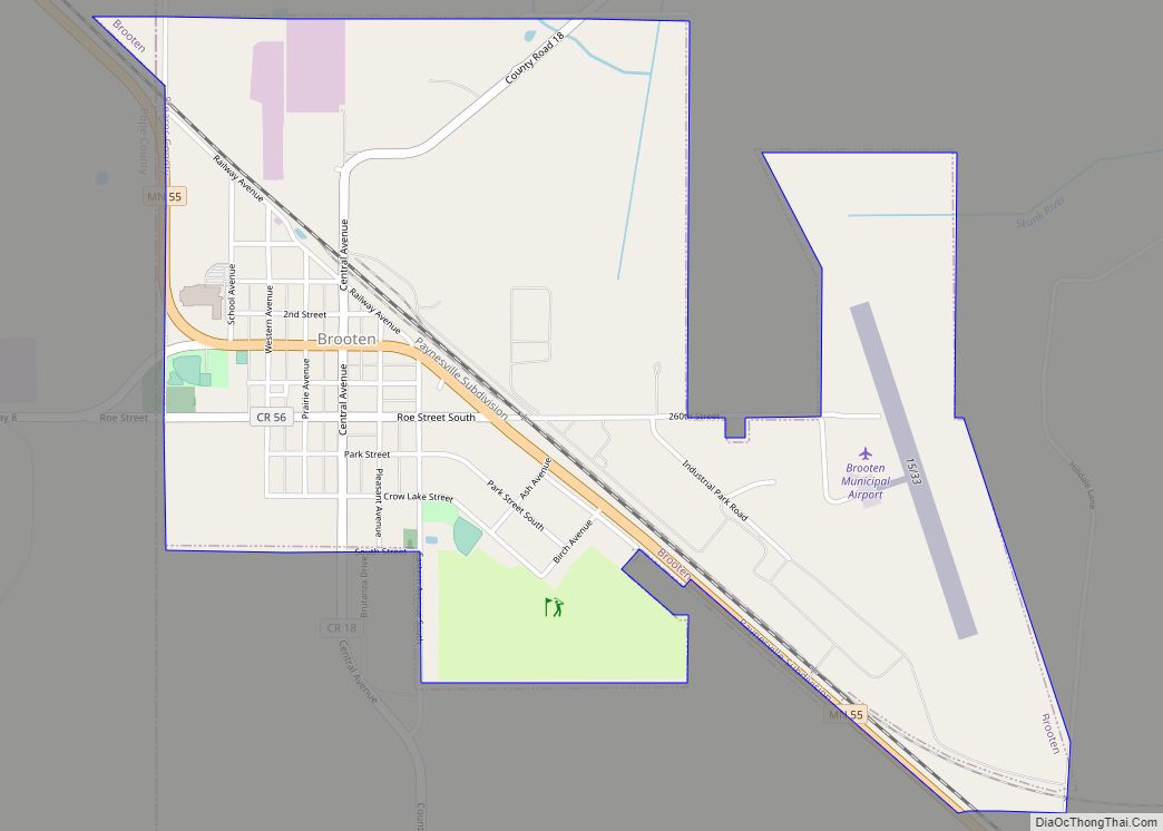
- Brooten Municipal Airport (6D1) – east of Brooten
- Paynesville Municipal Airport (PEX) – west of Paynesville
- Sauk Centre Municipal Airport (D39) – south-southeast of Sauk Centre
- St. Cloud Regional Airport (STC) – east-southeast of St. Cloud
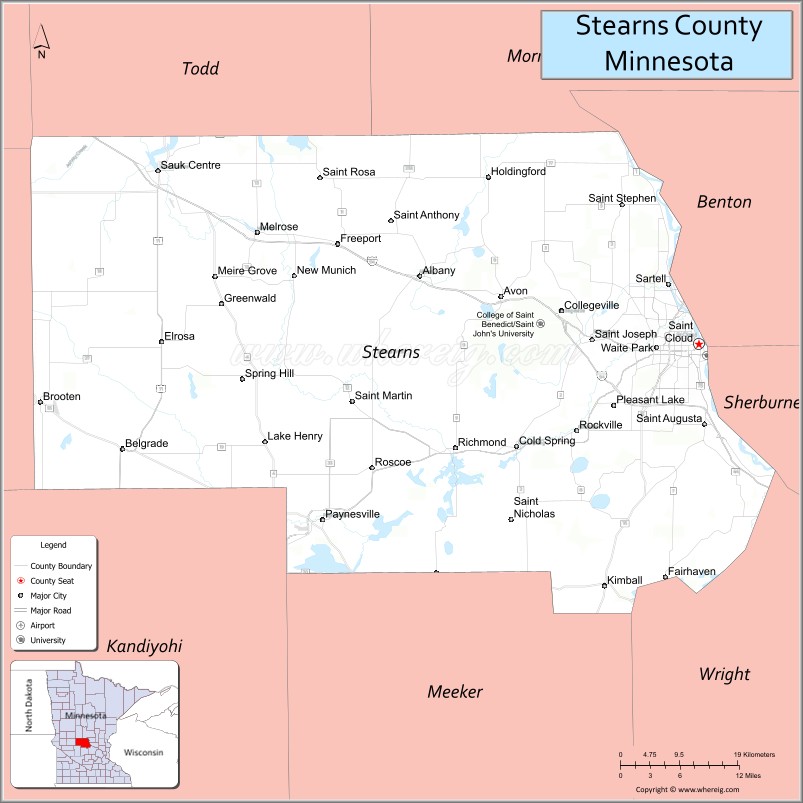
Adjacent counties
- Todd County – north
- Morrison County – northeast
- Benton County – northeast
- Sherburne County – east
- Wright County – southeast
- Meeker County – south
- Kandiyohi County – southwest
- Pope County – west
- Douglas County – northwest
Protected areas
Sources:
- Aron Hills Forest Scientific and Natural Area
- Birch Lakes State Forest
- Christopher Kurilla Wildlife Management Area
- Cold Spring Heron Colony Scientific and Natural Area
- Crow River Wildlife Management Area
- Edward Raymond Mohs Wildlife Management Area
- Follies Wildlife Management Area (part)
- Lake Koronis Regional Park
- Legacy Marsh Wildlife Management Area
- Miller Wildlife Management Area
- Milton Kjedahl Wildlife Management Area
- Norman T. Dahlman Wildlife Management Area
- Oxcart Crossing Wildlife Management Area
- Padua State Wildlife Management Area
- Patch Woods Scientific and Natural Area
- Quarry Park and Nature Preserve
- Quarry Park Scientific and Natural Area
- Rockville County Park and Nature Preserve
- Roscoe Prairie Scientific and Natural Area
- Saint Wendel Tamarack Bog Scientific and Natural Area
- Sauk River Wildlife Management Area
- Sedan Brook Prairie Scientific and Natural Area
- Stearns Prairie Heritage Wildlife Management Area
- Tamarack State Wildlife Management Area
- Tower State Wildlife Management Area
- Tribute Wildlife Management Area
- Victor Winder Wildlife Management Area
- Warner Lake County Park
- Zion State Wildlife Management Area
Stearns County Topographic Map
Stearns County Satellite Map
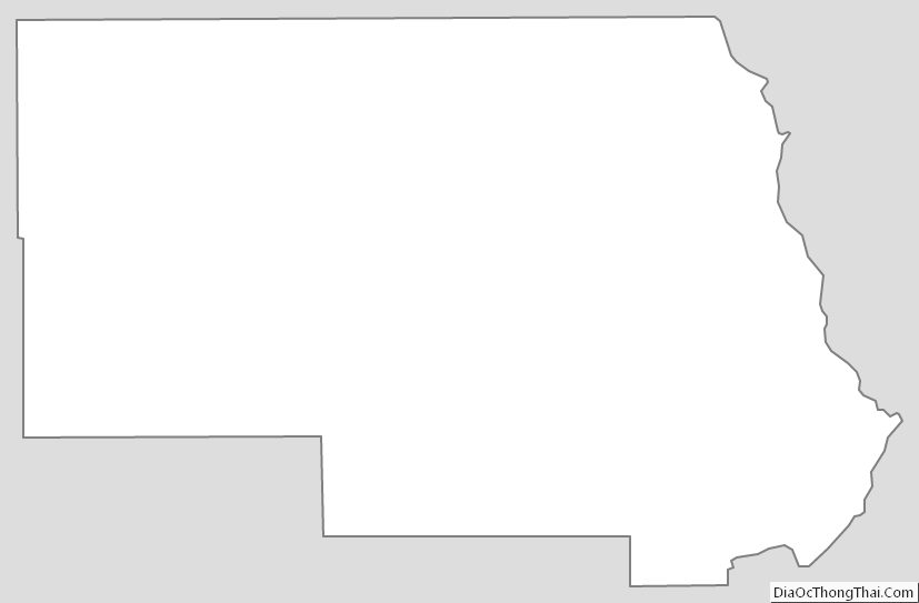
Stearns County Outline Map


I am looking for Siamese kittens that is south of Paynesville. Does anyone know where this might be? Please let me know. We got a kitten from here and we would like another.