Map of Gainesville city, Florida

Map of Gainesville city, Florida

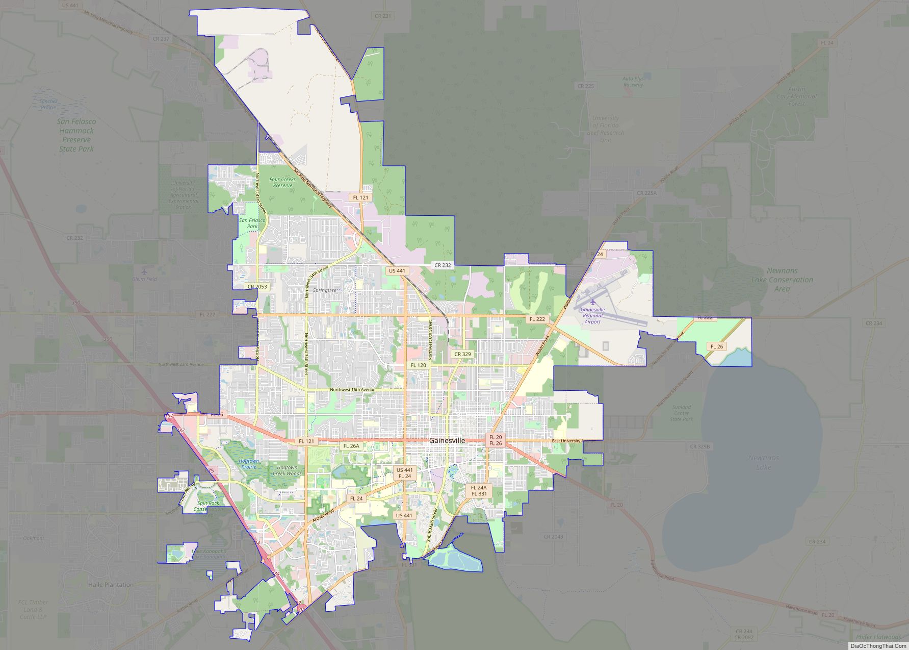
Gainesville is the county seat of Alachua County, Florida, and the largest city in North Central Florida, with a population of 141,085 in 2020. It is the principal city of the Gainesville metropolitan area, which had a population of 339,247 in 2020. Gainesville is home to the University of Florida, the fourth-largest public university campus … Read more

Map of Miramar city

Map of Miramar city

Miramar is a city in southern Broward County, Florida, United States. As of the 2020 census, the population was 134,721. It is a principal city of the Miami metropolitan area, which is home to approximately six million people. Miramar city overview: Name: Miramar city LSAD Code: 25 LSAD Description: city (suffix) State: Florida County: Broward … Read more

Map of Coral Springs city

Map of Coral Springs city

Coral Springs, officially the City of Coral Springs, is a city in Broward County, Florida, United States. The city is located approximately 20 miles (32 km) northwest of Fort Lauderdale. As of the 2020 U.S. Census, the city had a population of 134,394. It is a principal city of the Miami metropolitan area, which was home … Read more

Map of Palm Bay city

Map of Palm Bay city

Palm Bay is a city in Brevard County, Florida. The city’s population was 119,760 at the 2020 United States census, making it the most populous city in the county and the largest by land mass. The historic section of the city lies on the mouth of the Turkey Creek and the Palm Bay. Palm Bay … Read more

Map of Lakeland city

Map of Lakeland city, Florida

Lakeland is the most populous city in Polk County, Florida, part of the Tampa Bay Area, located along Interstate 4 east of Tampa. According to the 2020 U.S. Census Bureau release, the city had a population of 112,641. Lakeland is a principal city of the Lakeland–Winter Haven Metropolitan Statistical Area. European-American settlers arrived in Lakeland … Read more

Map of Miami Gardens city

Map of Miami Gardens city

Miami Gardens is a city in north-central Miami-Dade County, Florida, United States. It is located 16 miles (26 km) north of Downtown Miami with city boundaries that stretch from I-95 and Northeast 2nd Avenue to its east to Northwest 47th and Northwest 57th Avenues to its west, and from the Broward County line to its north … Read more

Map of Pompano Beach city

Map of Pompano Beach city

Pompano Beach (/ˈpɒmpənoʊ/ POMP-ə-noh) is a city in Broward County, Florida, United States. It is located along the coast of the Atlantic Ocean, just north of Fort Lauderdale. The nearby Hillsboro Inlet forms part of the Atlantic Intracoastal Waterway. As of the 2020 census, the city’s population was 112,046. Located 36 miles (58 km) north of … Read more

Map of Pensacola city

Map of Pensacola city, Florida

Pensacola (/ˌpɛnsəˈkoʊlə/ pen-SAH-koh-LAH) is the westernmost city in the Florida Panhandle, and the county seat and only incorporated city of Escambia County, Florida. Pensacola is the principal city of the Pensacola Metropolitan Area, which had an estimated 502,629 residents in 2019. At the 2020 United States census, the population was 54,312. Pensacola is the site … Read more

Map of Key West city

Map of Key West city

Key West (Spanish: Cayo Hueso) is an island in the Straits of Florida, within the U.S. state of Florida. Together with all or parts of the separate islands of Dredgers Key, Fleming Key, Sunset Key, and the northern part of Stock Island, it constitutes the City of Key West. The island of Key West is … Read more

Map of Daytona Beach city

Map of Daytona Beach city

Daytona Beach, or simply Daytona, is a coastal resort city in east-central Florida. Located on the eastern edge of Volusia County near the Atlantic coastline, its population was 72,647 at the 2020 census. Daytona Beach is approximately 42 miles (67.6 km) northeast of Orlando, 90 miles (144.8 km) southeast of Jacksonville, and 231 miles (371.8 km) northwest of … Read more