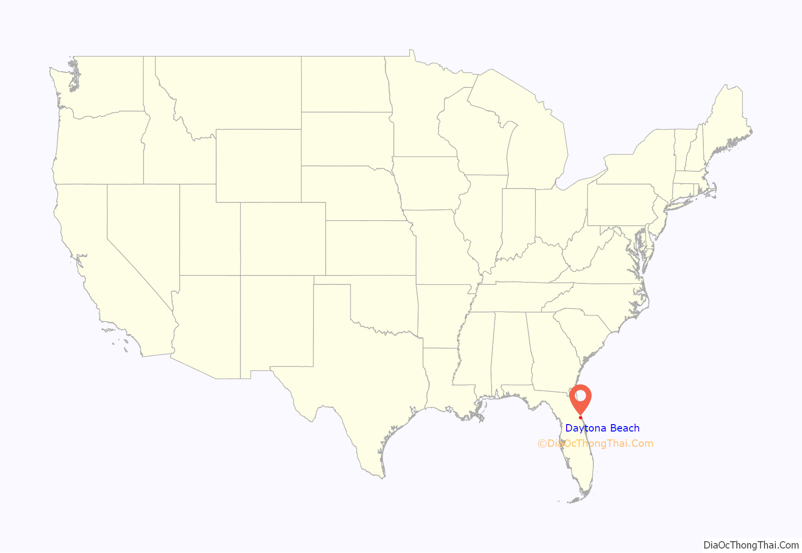
Daytona Beach, or simply Daytona, is a coastal resort city in east-central Florida. Located on the eastern edge of Volusia County near the Atlantic coastline, its population was 72,647 at the 2020 census. Daytona Beach is approximately 42 miles (67.6 km) northeast of Orlando, 90 miles (144.8 km) southeast of Jacksonville, and 231 miles (371.8 km) northwest of Miami. It is part of the Deltona–Daytona Beach–Ormond Beach metropolitan area which has a population of about 600,000 and is also a principal city of the Fun Coast region of Florida.
Daytona Beach is historically known for its beach, where the hard-packed sand allows motorized vehicles on the beach in restricted areas. This hard-packed sand made Daytona Beach a mecca for motorsports, and the old Daytona Beach and Road Course hosted races for over 50 years. This was replaced in 1959 by Daytona International Speedway. The city is also the headquarters of NASCAR.
Daytona Beach hosts large groups of out-of-towners during the year, who visit the city for various events, notably Speedweeks in early February when over 200,000 NASCAR fans come to attend the season-opening Daytona 500. Other events include the NASCAR Coke Zero Sugar 400 race in August, Bike Week in early March, Biketoberfest in late October, and the 24 Hours of Daytona endurance race in January.
| Name: | Daytona Beach city |
|---|---|
| LSAD Code: | 25 |
| LSAD Description: | city (suffix) |
| State: | Florida |
| County: | Volusia County |
| Founded: | 1870 |
| Incorporated: | July 1876 |
| Elevation: | 13 ft (4 m) |
| Land Area: | 65.59 sq mi (169.89 km²) |
| Water Area: | 2.60 sq mi (6.74 km²) |
| Population Density: | 1,107.54/sq mi (427.62/km²) |
| Area code: | 386 |
| FIPS code: | 1216525 |
| GNISfeature ID: | 0281353 |
| Website: | www.codb.us |
Discover Daytona Beach, Florida with this incredible map collection. From highways/roads to major landmarks, and things to do, this map collection has it all. Relax on one of the sandy, pristine beaches or play a round of golf. Otherwise, the city is all about competitive racing. Home to the Daytona 500, the Daytona International Speedway is the most prestigious NASCAR event in the United States! Besides its beaches and races, Daytona Beach also features a beautiful boardwalk, an array of hotels and resorts, and a population of close to 70,000. Explore this amazing city with our map collection.
Online Interactive Map
Click on ![]() to view map in "full screen" mode.
to view map in "full screen" mode.
Want to plan your next vacation? Decide where your next family vacation will take you? Or just explore the area? This interactive map is the perfect way to get started. Visit the famous Daytona speedways, beaches, restaurants, bars, and more. The city, which sits on the Atlantic Ocean, is a popular getaway for Florida residents and tourists alike.
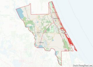
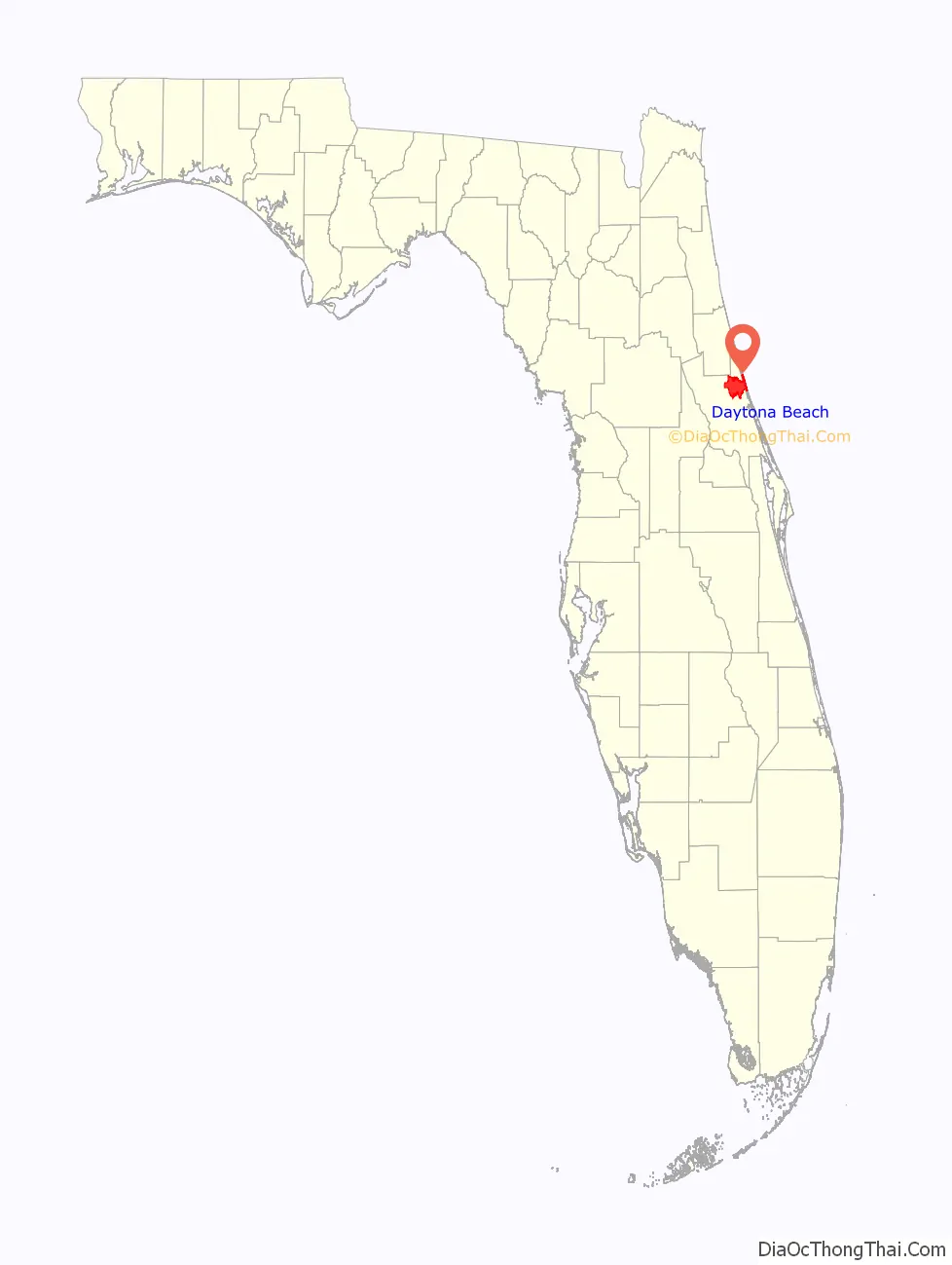
Daytona Beach location map. Where is Daytona Beach city?
History
The area where Daytona Beach is located was once inhabited by the indigenous Timucuan Indians who lived in fortified villages. The Timucuas were nearly exterminated by contact with Europeans through war, enslavement and disease and became extinct as a racial entity through assimilation and attrition during the 18th century. The Seminole Indians, descendants of Creek Indians from Georgia and Alabama, frequented the area prior to the Second Seminole War.
During the era of British rule of Florida between 1763 and 1783, the King’s Road passed through present-day Daytona Beach. The road extended from Saint Augustine, the capital of East Florida, to Andrew Turnbull’s experimental colony in New Smyrna. In 1804 Samuel Williams received a land grant of 3,000 acres (12 km) from the Spanish Crown, which had regained Florida from the British after the American Revolutionary War. This land grant encompassed the area that would become Daytona Beach. Williams built a slave-labor-based plantation to grow cotton, rice and sugar cane. His son Samuel Hill Williams would abandon the plantation during the Second Seminole War, when the Seminoles burned it to the ground.
The area now known as the Daytona Beach Historical District was once the Orange Grove Plantation, a citrus and sugar cane plantation granted to Samuel Williams in 1787. The plantation was situated on the west bank of the tidal channel known as the Halifax River, 12 miles north of Mosquito Inlet. Williams was a British loyalist from North Carolina who fled to the Bahamas with his family until the Spanish reopened Florida to non-Spanish immigration. After his death in 1810, the plantation was run by his family until it was burned down in 1835. In 1871, Mathias Day Jr. of Mansfield, Ohio, purchased the 3,200-acre tract of the former Orange Grove Plantation. He built a hotel around which the initial section of town arose. In 1872, due to financial troubles, Day lost title to his land; nonetheless, residents decided to name the city Daytona in his honor, and incorporated the town in 1876.
In 1886, the St. Johns & Halifax River Railway arrived in Daytona. The line would be purchased in 1889 by Henry M. Flagler, who made it part of his Florida East Coast Railway. The separate towns of Daytona, Daytona Beach, Kingston, and Seabreeze merged as “Daytona Beach” in 1926, at the urging of civic leader J. B. Kahn and others. By the 1920s, it was dubbed “The World’s Most Famous Beach”.
Daytona’s wide beach of smooth, compacted sand attracted automobile and motorcycle races beginning in 1902, as pioneers in the industry tested their inventions. It hosted land speed record attempts beginning in 1904, when William K. Vanderbilt set an unofficial record of 92.307 mph (148.554 km/h). Land speed racers from Barney Oldfield to Henry Segrave to Malcolm Campbell would visit Daytona repeatedly and make the 23 mi (37 km) beach course famous. Record attempts, including numerous fatal endeavors such as Frank Lockhart (Stutz Black Hawk, 1928) and Lee Bible (Triplex Special, 1929), would continue until Campbell’s March 7, 1935 effort, which set the record at 276.816 mph (445.492 km/h) and marked the end of Daytona’s land speed racing days.
On March 8, 1936, the first stock car race was held on the Daytona Beach Road Course, located in the present-day Town of Ponce Inlet. In 1958, William France Sr. and NASCAR created the Daytona International Speedway to replace the beach course. Automobiles are still permitted on most areas of the beach, at a maximum speed of 10 mph (16 km/h).
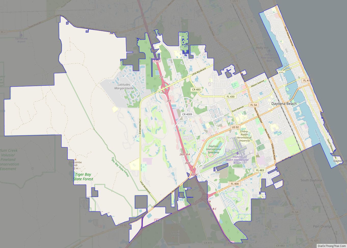
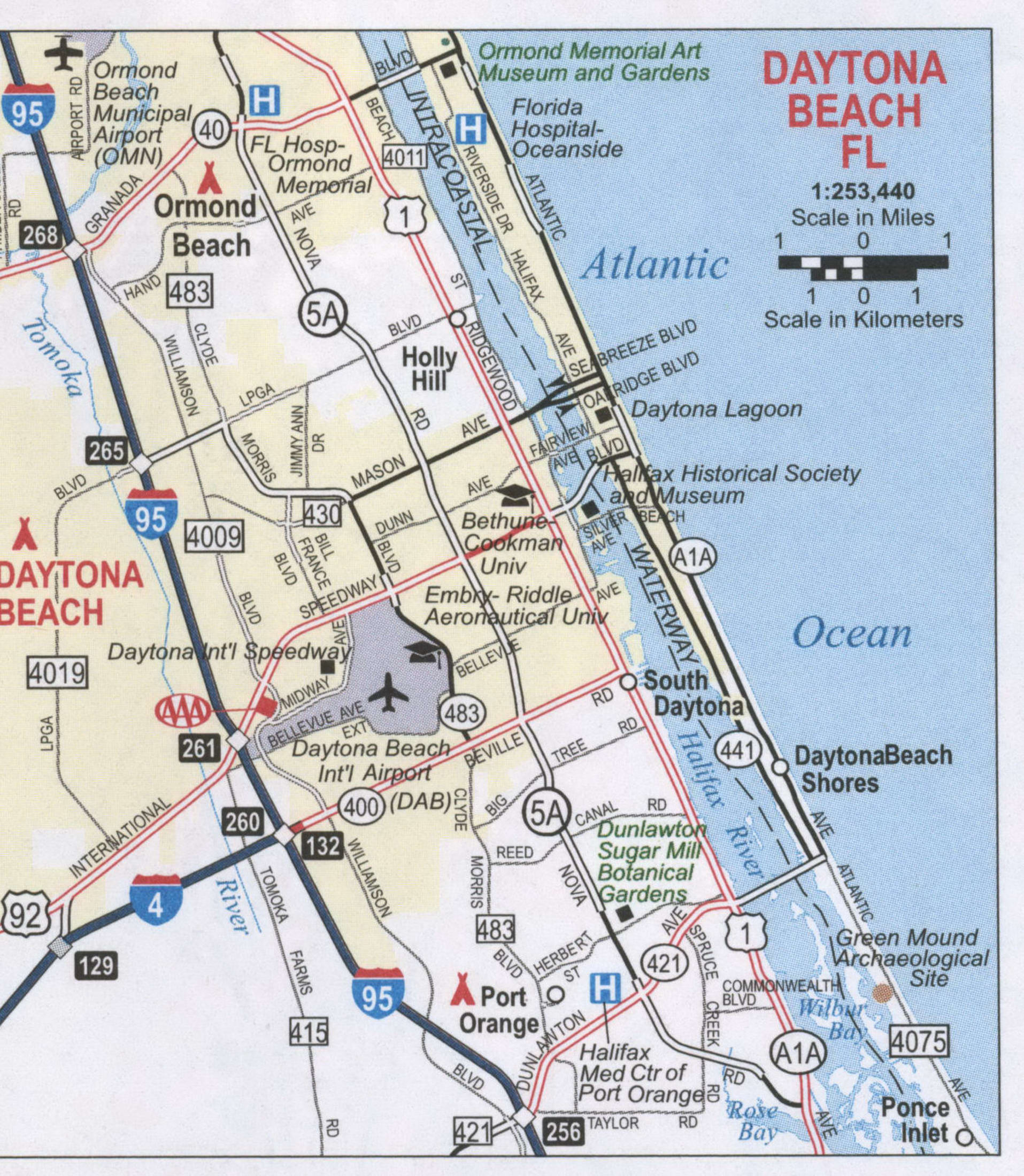
Daytona Beach Road Map
This Daytona Beach road map is the perfect way to plan your vacation! Daytona Beach has a lot of things to do and see, so keeping this map nearby will help you figure out what your next adventure will be. This map is designed to give you a general overview of the city and will show you all the main roads you might travel on. But if you plan on traveling outside the city, use a Florida road map to navigate around the state.
Interstate Highways: I-4, I-95
US Highways: 1, 5A, 92, 400,
Parkways: Aviation Center Pky
Major Roads: 2nd Ave, 415 Rd, 430 Rd, 483 Rd, 4009 Rd, 4010 Rd, 4068 Rd, Atlantic Ave, Beach St, Bellevue Ave, Beville Rd, Big Tree Rd, Center Ave, Center St, Clyde Morris Blvd, Dr. Mary Mcleod Bethune Blvd, Fairview Ave, Florida State A1A Rd, George W Engram Blvd, Halifax Ave, International Speedway Blvd, LPGA Blvd, Main St, Mason Ave, Midway Ave, Nova Rd, Oakridge Blvd, Old Big Tree Rd, Orange Ave, Peninsula Dr, Pine St, Ridgewood Ave, Seabreeze Blvd, Silver Beach Ave, Tomoka Farms Rd, White St, Wilder Blvd, Williamson Blvd


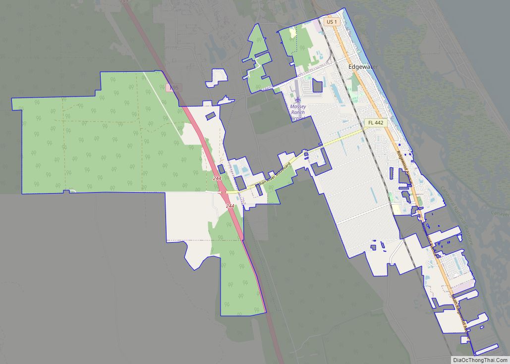
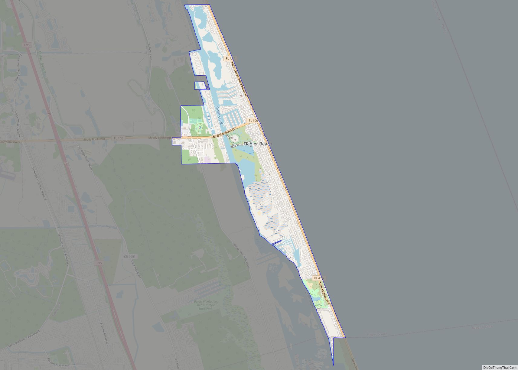
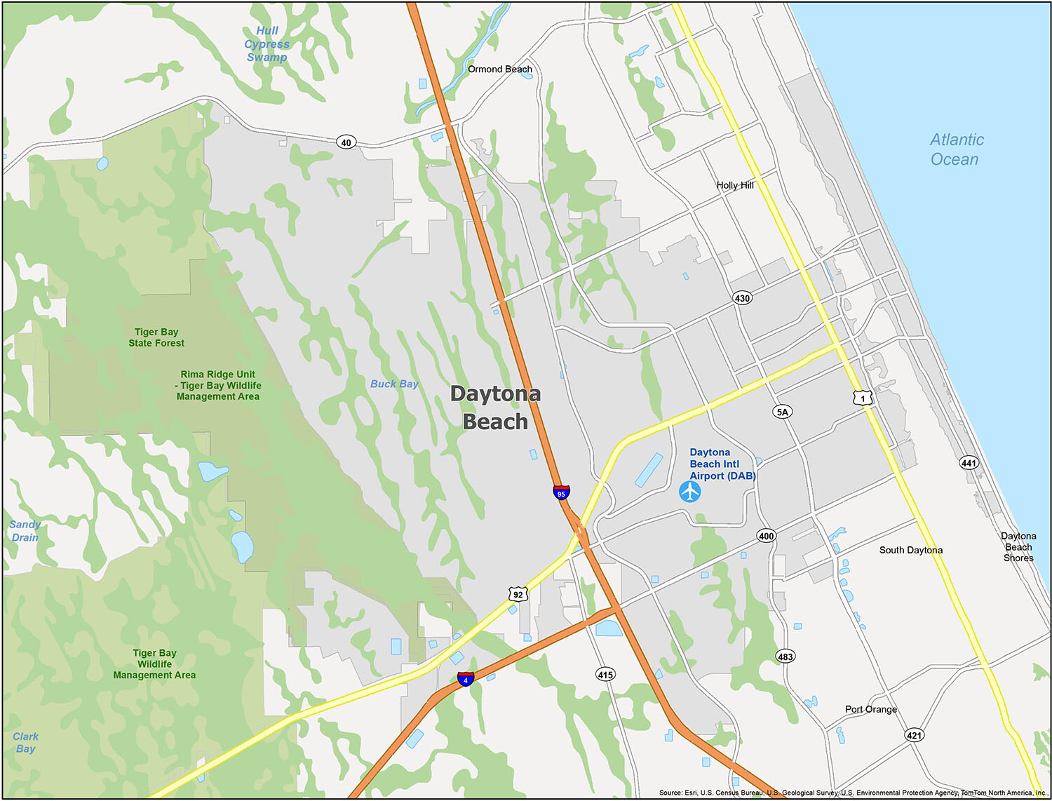
Travelling to Florida? Look no further than this map for the perfect companion. This ultra-handy tool will guide you to the best local sights and destinations, as well as tell you about wildlife areas, swamps, and bays. Airport: Daytona Beach International Airport (DAB). Cities: Daytona Beach, Daytona Beach Shores, Holly Hill, Ormond Beach, Port Orange, South Daytona. Water Features: Atlantic Ocean, Buck Bay, Hull Cypress Swamp. Forests: Tiger Bay State Forest.
10 things to do in Daytona Beach city
Daytona Beach is a must-visit destination for anyone looking to experience the best of Florida. From the world-famous Daytona International Speedway to the unique attractions along the Daytona Beach Boardwalk, there are plenty of things to do in this city. Furthermore, don’t forget the top 10 attractions we’ve listed above. Make sure to explore them all on your next trip to Daytona Beach!
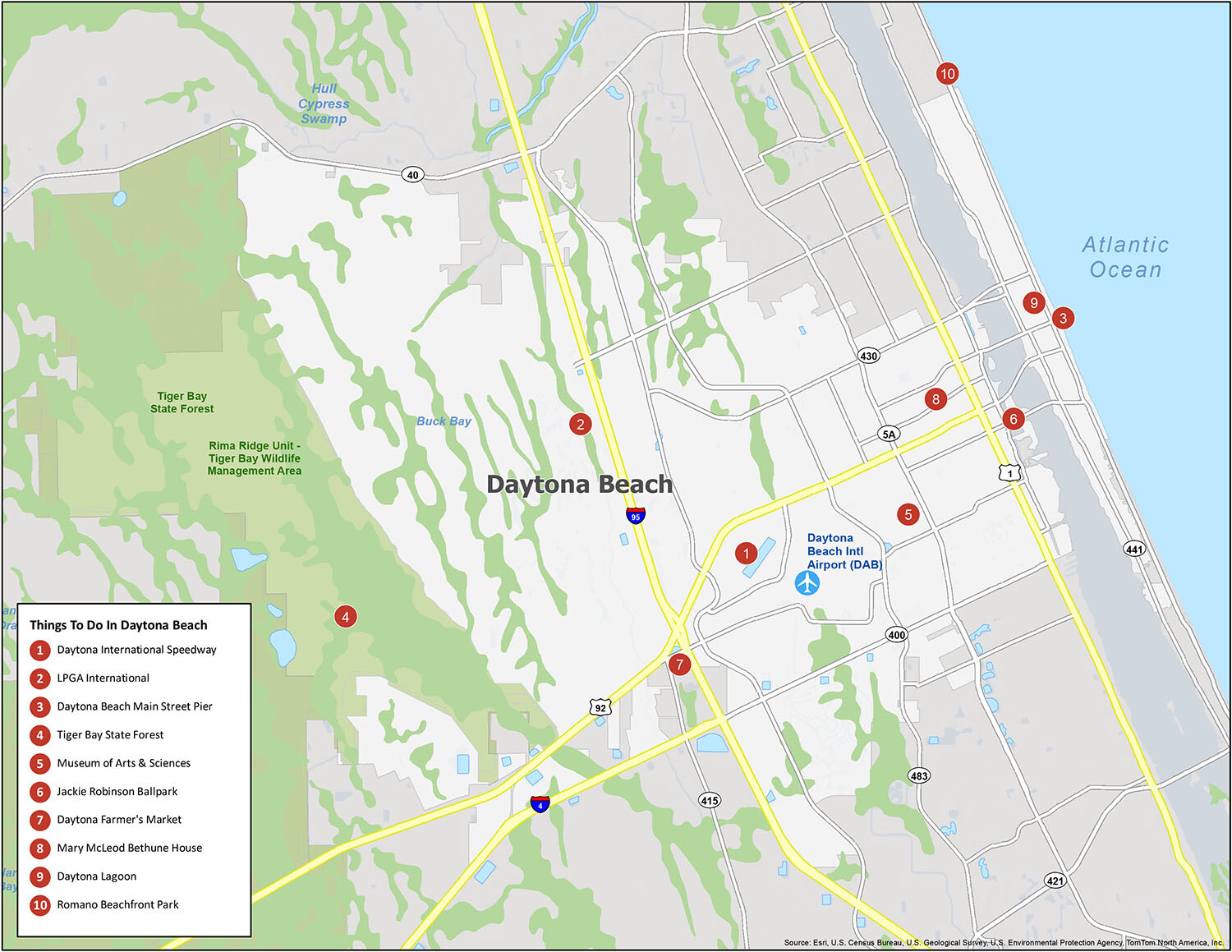
Daytona Beach is an exciting destination for all ages with an array of unique attractions and experiences. From the world-famous Daytona International Speedway to the iconic Daytona Beach Boardwalk, there’s something for everyone. There are also plenty of things to do in the area, including the top 10 attractions we’ve listed above. Whether you’re looking for a thrilling adventure or a relaxing day at the beach, Daytona Beach is the perfect place to visit. So, don’t wait any longer and plan your trip today!
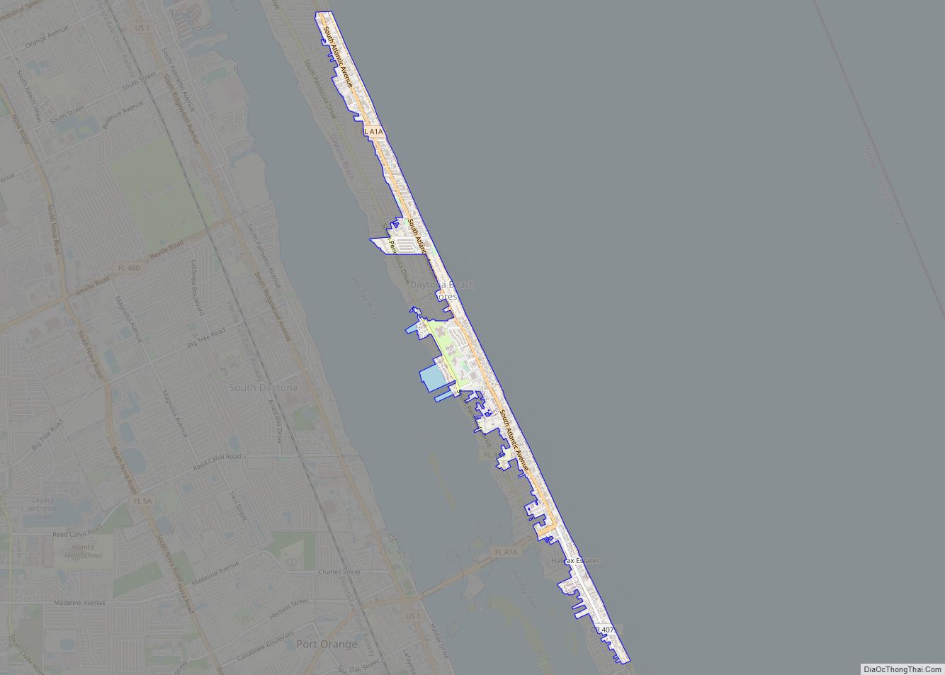
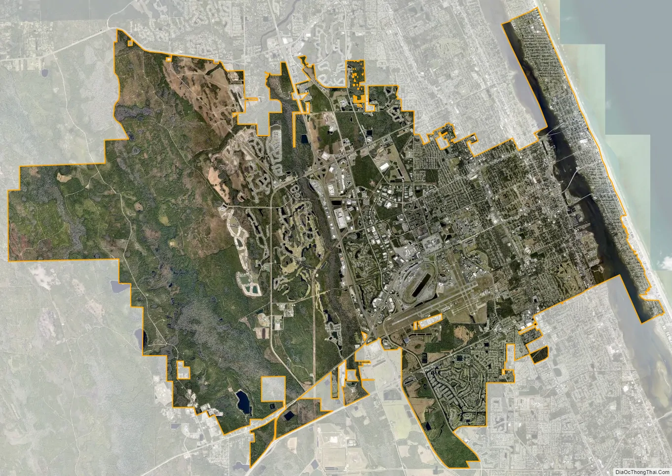
Daytona Beach city Satellite Map
Geography
Daytona Beach is located at 29°12′N 81°2′W (29.2073, −81.0379). According to the United States Census Bureau, the city has a total area of 64.93 sq mi (168 km). of which 58.68 sq mi (152 km) is land and 6.25 sq mi (16 km) is water, with water thus comprising 9.6% of the total area.
The city of Daytona Beach is split in two by the Halifax River lagoon, part of the Intracoastal Waterway, and sits on the Atlantic Ocean. It is bordered on the north by Holly Hill and Ormond Beach and on the south by Daytona Beach Shores, South Daytona and Port Orange.
Climate
Daytona Beach has a humid subtropical climate (Köppen climate classification Cfa), which is typical of the Gulf and South Atlantic states. As is typical of much of Florida, there are two seasons in Daytona Beach; the warmer, wetter season (late May through October) and the cooler and drier season (November through April).
In summer, temperatures are relatively stable and there is an average of only 8 days annually with a maximum at or above 95 °F (35 °C); the last 100 °F (38 °C) reading was seen on August 2, 1999. The Bermuda High pumps hot and unstable tropical air from the Bahamas and Gulf of Mexico, resulting in daily, but brief thundershowers. This results in the months of June through September accounting for a majority of the average annual rainfall of 51.25 in (1,302 mm).
In winter, Daytona Beach has weather conditions typical of other cities on the Florida peninsula. On average, the coolest month is January, with a normal monthly mean temperature of 58.8 °F (14.9 °C). It is the only month where the average high temperature falls below 70.0 °F (21.1 °C). Occasional cold fronts can bring freezes, which from 1991 to 2020 were seen on an average of 3.0 nights annually; however, minima below 25 °F (−4 °C) are very rare, and were last seen on December 28, 2010. Like much of Florida, Daytona Beach often can be very dry in late winter and early spring, and brush fires and water restrictions can be an issue.
Official record temperatures range from 15 °F (−9 °C) on January 21, 1985, up to 102 °F (39 °C) on July 15, 1981, and June 24, 1944; the record cold daily maximum is 33 °F (1 °C) on Christmas day 1983, while, conversely, the record warm daily minimum is 82 °F (28 °C) on September 1 and 10–11, 2008 and August 25, 2020. Annual rainfall has ranged from 31.36 in (797 mm) in 2006 and 1956, up to 79.29 in (2,014 mm) in 1953. The most rainfall to have occurred in a calendar day was 12.85 in (326 mm) on October 10, 1924, which contributed to 24.82 in (630 mm) of rain that fell that month, the most of any calendar month.
Hurricanes and tornadoes
Typically tropical cyclones pass offshore once they reach the northern portion of the Atlantic coast of Florida. As such, the hurricane risk for Daytona Beach is significantly lower than areas of southern Florida like Miami and Key West. The 2004 hurricane season was by far the most active in the Daytona Beach area in the last 50 years. However, since 1950 there has only been one direct hit by a tropical cyclone to the Daytona Beach area, Hurricane Donna in 1960.
Although Daytona Beach has a significantly lesser tornado risk than areas like the Great Plains and Midwest, there have been a few deadly and destructive tornadoes in the last 100 years in Daytona Beach area. Most recently, on February 22, 1998, a tornado killed three people, injured 70, and caused $31 million in damages.
Rogue wave
On July 3, 1992, a 28-mile (45 km) long rogue wave hit the Volusia County beaches. The wave’s range was from Ormond Beach in the north, to New Smyrna Beach on the south. The crest was 9 feet (2.7 m) high and centered at Daytona Beach. Sailboats crashed ashore onto cars and many people suffered cuts and bruises from glass and debris. Two people required hospitalization and 200 vehicles were damaged. Seventy five injuries were reported. The prevailing theory is that an underwater landslide caused the rogue wave, although others have theorized that it was the result of a squall line.
See also
Map of Florida State and its subdivision:- Alachua
- Baker
- Bay
- Bradford
- Brevard
- Broward
- Calhoun
- Charlotte
- Citrus
- Clay
- Collier
- Columbia
- Desoto
- Dixie
- Duval
- Escambia
- Flagler
- Franklin
- Gadsden
- Gilchrist
- Glades
- Gulf
- Hamilton
- Hardee
- Hendry
- Hernando
- Highlands
- Hillsborough
- Holmes
- Indian River
- Jackson
- Jefferson
- Lafayette
- Lake
- Lee
- Leon
- Levy
- Liberty
- Madison
- Manatee
- Marion
- Martin
- Miami-Dade
- Monroe
- Nassau
- Okaloosa
- Okeechobee
- Orange
- Osceola
- Palm Beach
- Pasco
- Pinellas
- Polk
- Putnam
- Saint Johns
- Saint Lucie
- Santa Rosa
- Sarasota
- Seminole
- Sumter
- Suwannee
- Taylor
- Union
- Volusia
- Wakulla
- Walton
- Washington
- Alabama
- Alaska
- Arizona
- Arkansas
- California
- Colorado
- Connecticut
- Delaware
- District of Columbia
- Florida
- Georgia
- Hawaii
- Idaho
- Illinois
- Indiana
- Iowa
- Kansas
- Kentucky
- Louisiana
- Maine
- Maryland
- Massachusetts
- Michigan
- Minnesota
- Mississippi
- Missouri
- Montana
- Nebraska
- Nevada
- New Hampshire
- New Jersey
- New Mexico
- New York
- North Carolina
- North Dakota
- Ohio
- Oklahoma
- Oregon
- Pennsylvania
- Rhode Island
- South Carolina
- South Dakota
- Tennessee
- Texas
- Utah
- Vermont
- Virginia
- Washington
- West Virginia
- Wisconsin
- Wyoming