Palm Bay is a city in Brevard County, Florida. The city’s population was 119,760 at the 2020 United States census, making it the most populous city in the county and the largest by land mass. The historic section of the city lies on the mouth of the Turkey Creek and the Palm Bay. Palm Bay has historically expanded south and to the west. The newer section is mostly situated west of Interstate 95 and south of the Tillman Canal.
Palm Bay is a principal city of the Palm Bay−Melbourne−Titusville Metropolitan Statistical Area, which had a population of 606,612 at the 2020 census.
| Name: | Palm Bay city |
|---|---|
| LSAD Code: | 25 |
| LSAD Description: | city (suffix) |
| State: | Florida |
| County: | Brevard County |
| Elevation: | 19 ft (5 m) |
| Land Area: | 86.42 sq mi (223.82 km²) |
| Water Area: | 3.18 sq mi (8.23 km²) 4.56% |
| Population Density: | 1,385.82/sq mi (535.07/km²) |
| ZIP code: | 32905-32911 |
| Area code: | 321 |
| FIPS code: | 1254000 |
| GNISfeature ID: | 0288389 |
| Website: | palmbayflorida.org |
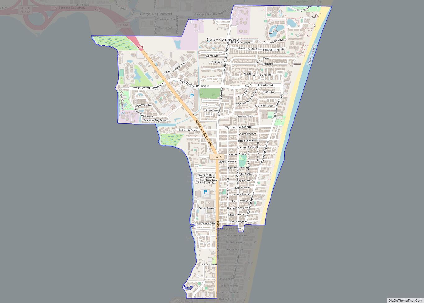
Online Interactive Map
Click on ![]() to view map in "full screen" mode.
to view map in "full screen" mode.
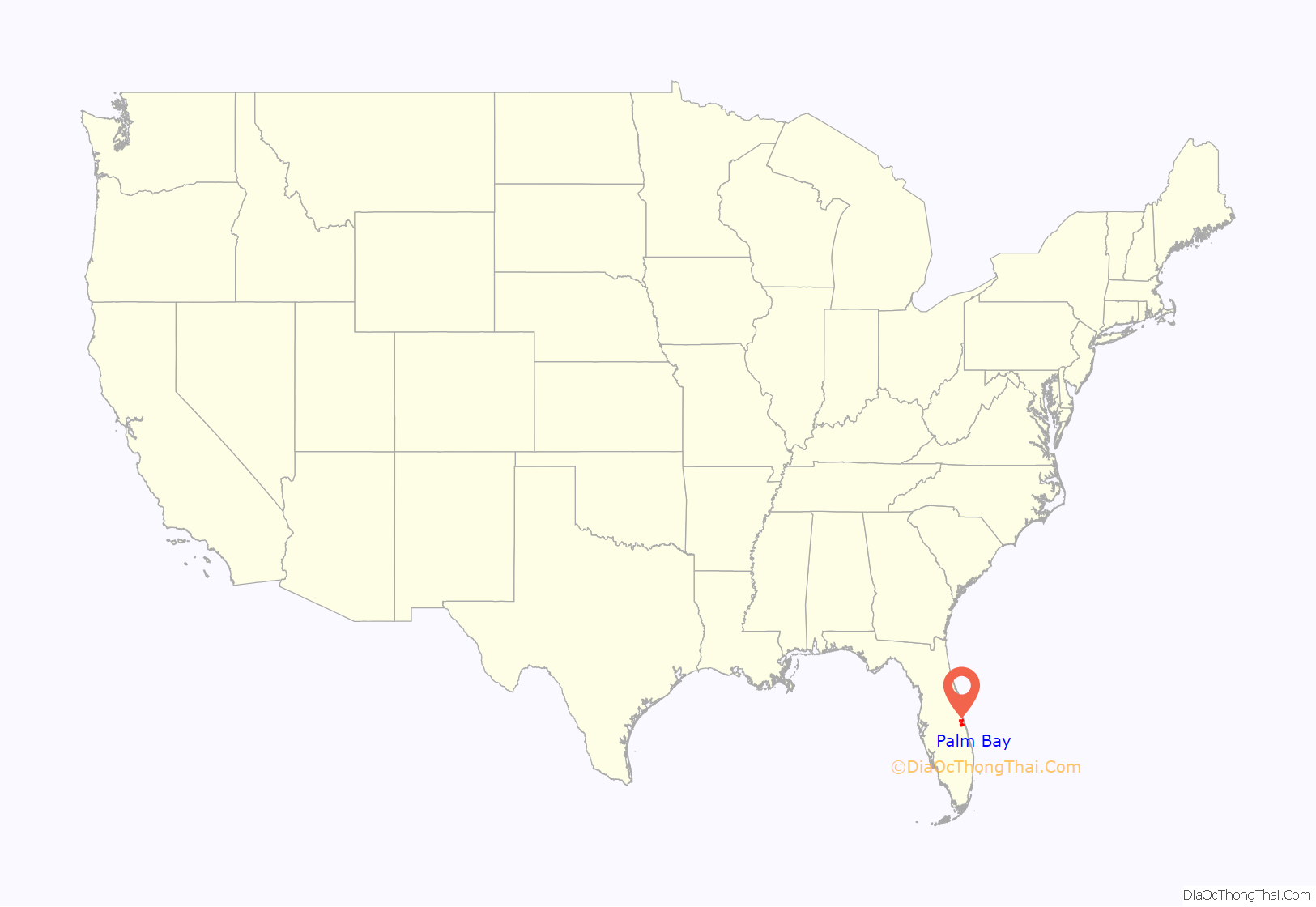
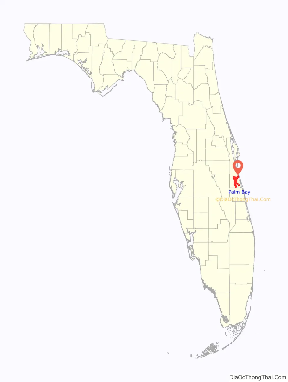
Palm Bay location map. Where is Palm Bay city?
History
The Ais people, attracted to the mouth of Turkey Creek at the Indian River by freshwater springs, fish, oysters, and wildlife, are thought to have been the first inhabitants in the Palm Bay area.
The earliest place names for this area on early maps of the late 1700s were Turkey Creek, Elbow Creek and Crane Creek. An 1870 map of the Indian River by John Andrew Bostrom shows the area void of any settlements within about 15 miles of Turkey Creek. The first prominent European-American settler was John Tillman in the late 1870s. Tillman’s wharf marked the mouth of Turkey Creek at what became known as Palm Bay on the Indian River.
By the late 1880s, Tillman was operating a profitable orange and banana grove on the north shore of the creek. He had the most notable banana grove on the Indian River. Tillman’s wharf also attracted settlers, as it was a steamboat stop.
By the mid-nineteenth century, there was a lumber operation, orange groves, and packing house. Growth was slow until the arrival of the railroad in 1894. Then goods were brought in and produce was shipped to market faster.
1900s
Between 1910 and 1914, a land company known as the Indian River Catholic Colony became established at Tillman. Attempting to grow two crops a season, farmers quickly depleted the soil, and the colony failed. Those remaining built St. Joseph’s Church on Miller Street, the oldest building still standing.
In the 1920s, the city was renamed as Palm Bay, after the bay bordered with sabal palm trees known as Palm Bay, located at the mouth of Turkey Creek. A group of Tillman businessmen established the Melbourne-Tillman Drainage District, and issued $1.5 million worth of bonds. Starting in 1922, a 180 miles (290 km) grid of 80 canals was dug to drain 40,000 acres (160 km) of swampy land west of Palm Bay for other uses. The canals made it possible to control flooding and redevelop marsh lands to agricultural use. These actions had the unintended consequences of leaving the land more vulnerable to flooding from storms and destroying important habitats for complex ecology.
Farmers planted citrus groves and truck farms which shipped winter produce by the Florida East Coast Railroad to northern markets. Farmers sold timber and land to paper companies. Based on use of the Tillman and Hopkins canals, ranchers raised beef cattle in West Melbourne.
In 1926, a fire among the dredges and a severe hurricane caused extensive damage, leading to an economic downturn in Palm Bay. The Melbourne-Tillman Drainage District went bankrupt.
In 1959, General Development Corporation purchased and platted extensive tracts of land in Palm Bay for a large residential project known as Port Malabar. The city of Palm Bay incorporated on January 16, 1960. Prior to expanding its borders, the city population was 2,808 that year.
The active development of the city after that point was intertwined with GDC, which laid out and built many of the streets, sold and built many of the city’s homes, and built a water treatment plant. This was later purchased by the city of Palm Bay after GDC filed for bankruptcy in 1991.
The Melbourne-Tillman Water District was revived under the auspices of the County Government. In 2019, it controlled 100 square miles (260 km) of land.
On April 23, 1987, William Bryan Cruse, Jr. (November 21, 1927 – November 29, 2009) shot and killed six people, including two college students and two police officers, at a local shopping center. He also wounded ten other people. The shooting by the 59-year-old, who was retired or unemployed and caring for a chronically ill wife, made national news. Convicted and sentenced to death, Cruse died on Florida’s death row in 2009.
In October 1994 $500,000 of gold and gems stolen from a jewelry store which was at the time the largest single robbery in the city’s history. Police suspected a connection with a similar robbery in May 1994 in Daytona Beach. Larry Lawton was later charged in 1996 with the crime after fingerprint evidence linked him to the crime.
2000s
For three consecutive years between 2003 and 2005, Palm Bay was a finalist for the All-America City Award.
In 2008, the city was named in an article from US News & World Report as the second “Drunkest City” in the US behind Reno, Nevada.
In 2008, the former Port Malabar Country Club property was revalued at $300,000. This was considered an essentially “worthless” valuation because arsenic had been found in the groundwater and remediation would cost an estimated $12 million to clean up.
Hundreds of miles of roads in the city are in such poor condition that the city Public Works Department considers them unserviceable. The voters have consistently defeated measures to raise money to invest in infrastructure to improve the roads, which are described as the worst in Brevard County. In 2005 they voted down a $58.7 million bond measure. In 2009, they defeated a $75.2 million tax referendum. In 2010, voters living in areas with the worst roads voted 9–1 against $44.7 million assessment for repairing them. In 2011, the city government created a Palm Bay Road Maintenance District that they hope can levy taxes and alleviate the situation.
In 2008, fires on Mother’s Day destroyed 37 homes in the southwest area of the city. Arson has been blamed as the cause of at least a few of the numerous fires.
In 2009, the Brevard Zoo moved the remaining 15 Florida scrub jay families native to the city to Buck Lake Conservation Area in Mims. The Florida scrub jay is a threatened species due to it being territorial; it is unable to move to better grounds when its habitat is jeopardized.
2010s
In 2010, plans were revealed by a private company to develop Emerald City, a large planned development within the city limits. The company intends to develop a multi-use, eco-friendly urban community to include residential zones consisting of townhouses, and commercial zones consisting of state-of-the-art medical facilities, research and development centers for technology firms, and urbanized retail shopping centers. As of February 2016, Emerald City is in the development phase.
City fiscal concern over firefighters’ pensions rose during 2010. Firefighters’ salaries averaged $71,100 annually plus $5,590 overtime pay. They were eligible for 100% of base pay after 28 years of service.
In 2012, construction began on the St. John’s Heritage Parkway (also known as the Palm Bay Parkway), an arterial roadway that runs north to south along with the western limits of the city. A portion of the parkway opened to the public in 2015. The project was in development for more than a decade. It is intended to alleviate traffic for commuters on the main thoroughfares of SR 507, CR 509, and I-95. Later phases of the project will bring the roadway further south and then east following the lower city limits, eventually connecting to I-95 just north of Micco Road. A state roadway improvement project includes planned widening SR 507 (Babcock Street) from four lanes to six.
In 2015, the Harris Corporation constructed a new 464,000-square-foot technology center near Palm Bay Road and Troutman Boulevard. The building is one of the largest in the northeast section of the city and is reported to house approximately 1,400 scientists and engineers for the company.
In 2017, construction began on the southern Interstate 95 interchange and the southern portion of the St. John’s Heritage Parkway. The Florida Department of Transportation (FDOT) is constructing a new diverging diamond interchange (DDI) on Interstate 95 just north of Micco Road within the city limits. The city is working on the southern portion of the parkway to extend from Babcock Street SE to Micco Road. The project is intended to improve traffic capacity, operations, and safety, as well as promote economic development in southern Brevard County.
The city formerly monitored some intersections with radar cameras, resulting in the issuing of traffic tickets to drivers who ran red lights. In 2013, these monitored intersections were found to be no safer than unmonitored ones. These cameras were removed in 2014.
In 2018, voters passed a referendum in the November 2018 elections, electing to fund a city-wide road repair project with a general obligation bond worth $150,000,000 payable from annual ad valorem taxes. Planning, design, and construction for the cities four quadrants are currently underway with a tentative 8-year plan projected. Construction of several units began in August 2019.
Palm Bay Road Map
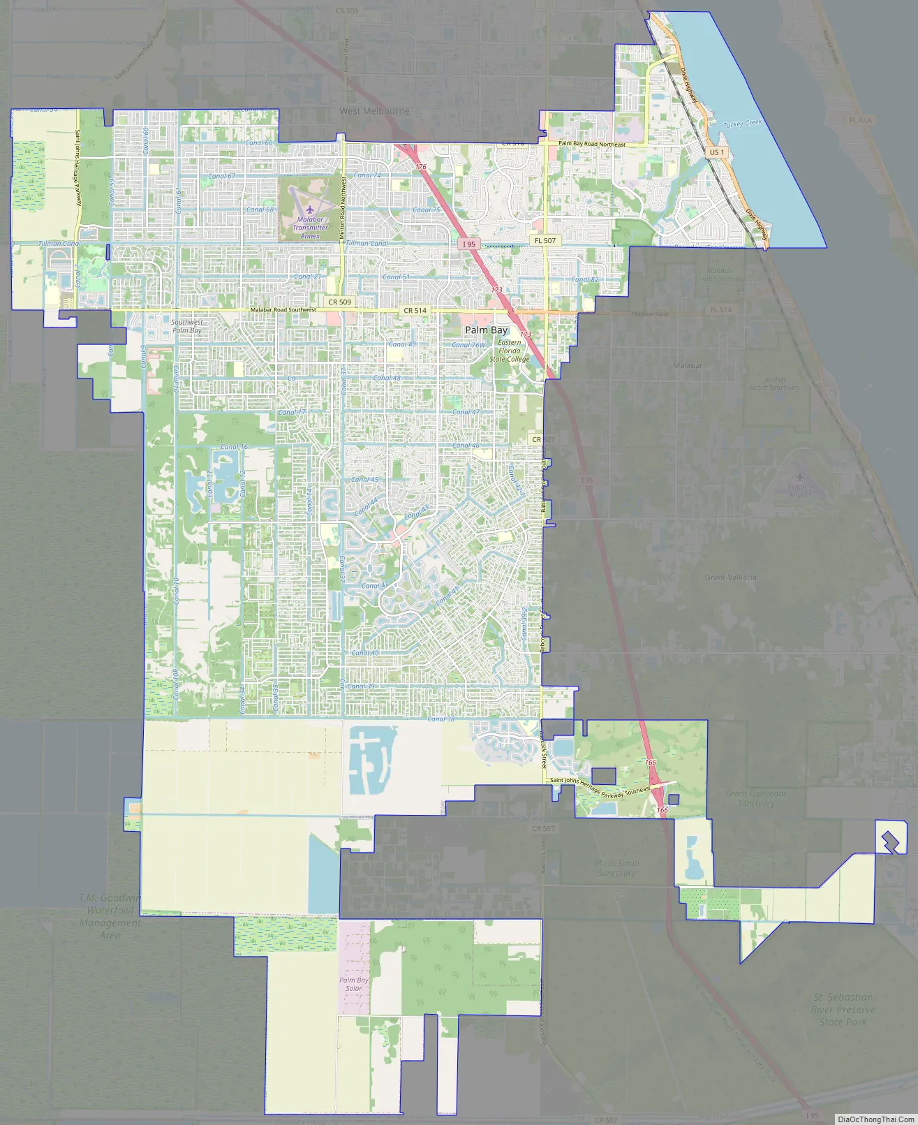
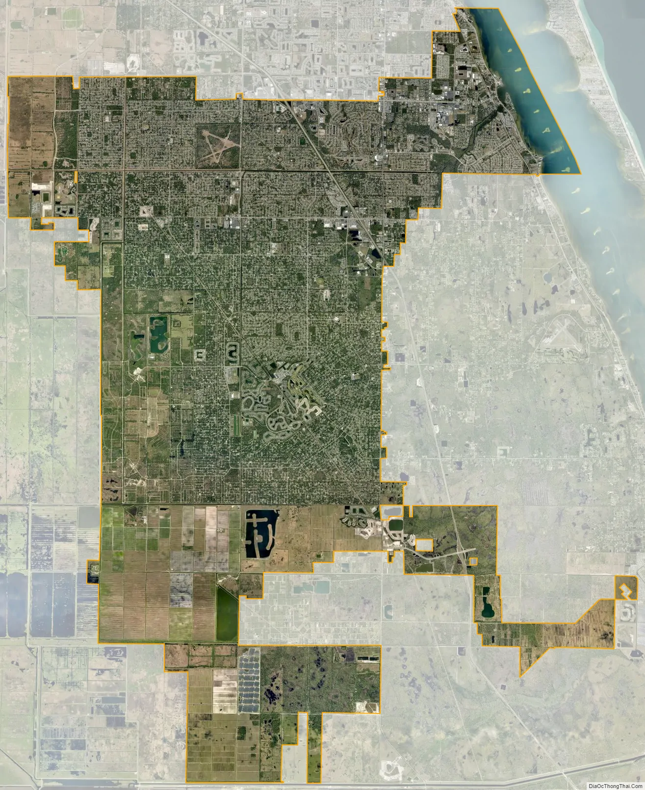
Palm Bay city Satellite Map
Geography
According to the United States Census Bureau, the city has a total area of 101.4 miles (101.4 mi), of which 97.86 miles (97.86 mi) is land and 3.1 square miles (8.1 km), or 4.56%, is water.
The city is often referred to in four quadrants: Northwest, Northeast, Southwest, and Southeast, each containing multiple zip codes. The most urban area is in Northeast. The most rural area is in Southwest, containing an area called The Compound. This area is home to Bombardier Recreational Products. “The compound” area is primarily used by recreational off road vehicles and persons engaging in various recreational activities.
During the early 1990s, Fred Poppe Regional Park (formerly Palm Bay Regional Park), a soccer and athletic complex in the western part of the city, was constructed. It is the largest of a citywide system of parks and recreation areas. The Turkey Creek Sanctuary is a small nature reserve in the northeast part of the city.
Climate
Surrounding areas
- St. Johns River; Sawgrass Lake; Lake Hell ‘n Blazes; Osceola County
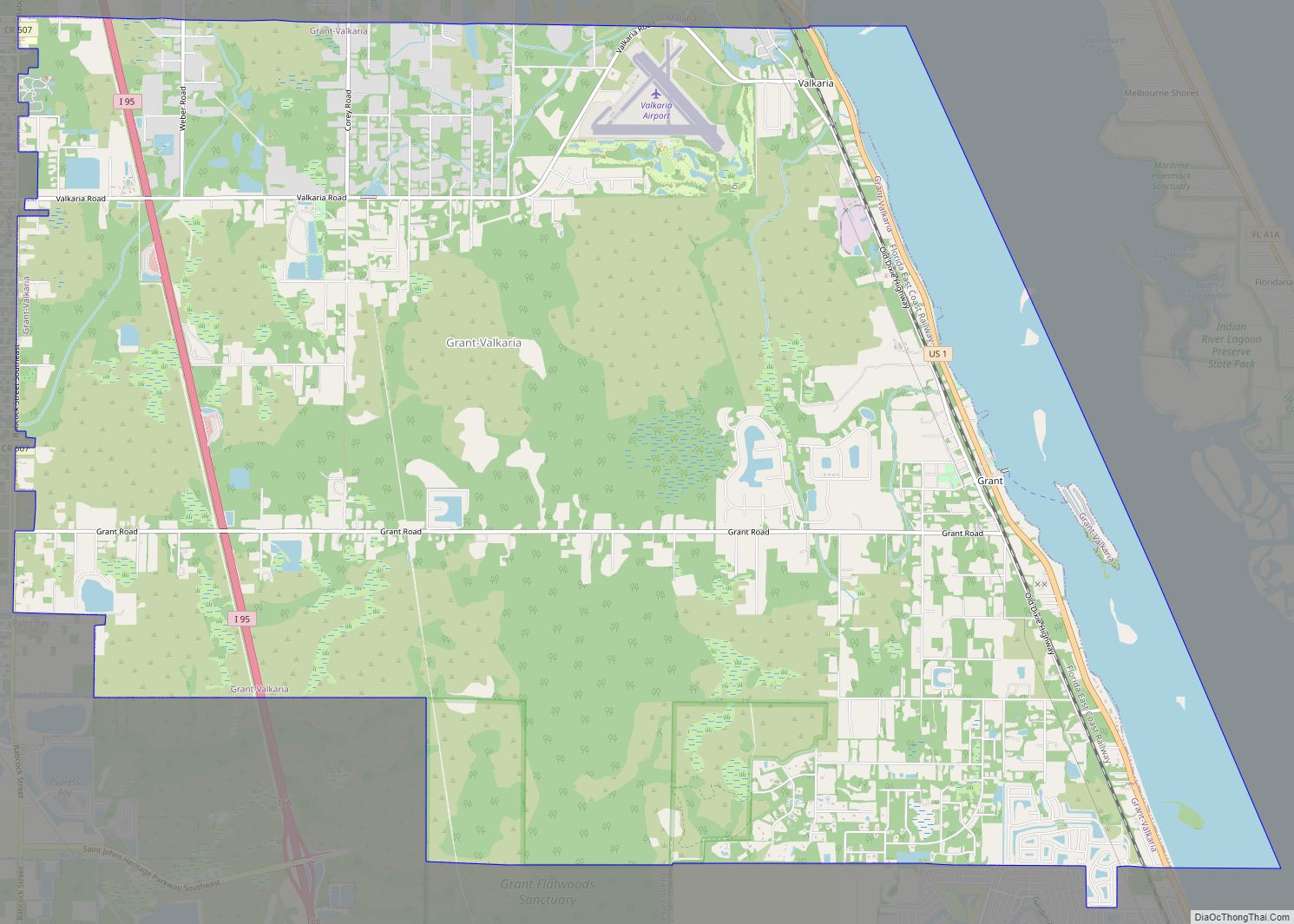
- Grant-Valkaria; Malabar; Indian River Lagoon
- West Melbourne; Melbourne
- Indian River County
See also
Map of Florida State and its subdivision:- Alachua
- Baker
- Bay
- Bradford
- Brevard
- Broward
- Calhoun
- Charlotte
- Citrus
- Clay
- Collier
- Columbia
- Desoto
- Dixie
- Duval
- Escambia
- Flagler
- Franklin
- Gadsden
- Gilchrist
- Glades
- Gulf
- Hamilton
- Hardee
- Hendry
- Hernando
- Highlands
- Hillsborough
- Holmes
- Indian River
- Jackson
- Jefferson
- Lafayette
- Lake
- Lee
- Leon
- Levy
- Liberty
- Madison
- Manatee
- Marion
- Martin
- Miami-Dade
- Monroe
- Nassau
- Okaloosa
- Okeechobee
- Orange
- Osceola
- Palm Beach
- Pasco
- Pinellas
- Polk
- Putnam
- Saint Johns
- Saint Lucie
- Santa Rosa
- Sarasota
- Seminole
- Sumter
- Suwannee
- Taylor
- Union
- Volusia
- Wakulla
- Walton
- Washington
- Alabama
- Alaska
- Arizona
- Arkansas
- California
- Colorado
- Connecticut
- Delaware
- District of Columbia
- Florida
- Georgia
- Hawaii
- Idaho
- Illinois
- Indiana
- Iowa
- Kansas
- Kentucky
- Louisiana
- Maine
- Maryland
- Massachusetts
- Michigan
- Minnesota
- Mississippi
- Missouri
- Montana
- Nebraska
- Nevada
- New Hampshire
- New Jersey
- New Mexico
- New York
- North Carolina
- North Dakota
- Ohio
- Oklahoma
- Oregon
- Pennsylvania
- Rhode Island
- South Carolina
- South Dakota
- Tennessee
- Texas
- Utah
- Vermont
- Virginia
- Washington
- West Virginia
- Wisconsin
- Wyoming