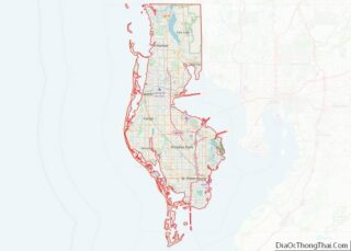
Clearwater is a city located in Pinellas County, Florida, United States, west of Tampa and north of St. Petersburg. To the west of Clearwater lies the Gulf of Mexico and to the southeast lies Tampa Bay. As of the 2020 census, the city had a population of 117,292. Clearwater is the county seat of Pinellas County and is the smallest of the three principal cities in the Tampa–St. Petersburg–Clearwater metropolitan area, most commonly referred to as the Tampa Bay Area.
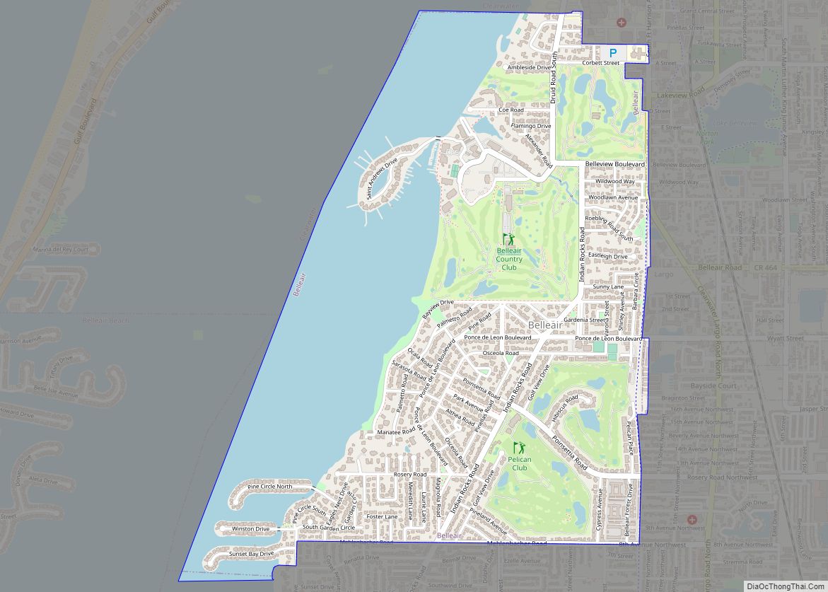
Clearwater Beach is part of the city of Clearwater, but is separated from it by the Intracoastal Waterway. Cleveland Street is one of the city’s historic avenues, and the city includes BayCare Ballpark and Coachman Park.
The Church of Scientology owns the majority of property in the Clearwater downtown core district.
| Name: | Clearwater city |
|---|---|
| LSAD Code: | 25 |
| LSAD Description: | city (suffix) |
| State: | Florida |
| County: | Pinellas County |
| Incorporated: | 1891 |
| Elevation: | 30 ft (9 m) |
| Land Area: | 26.13 sq mi (67.68 km²) |
| Water Area: | 9.79 sq mi (25.36 km²) |
| Population Density: | 4,488.62/sq mi (1,733.06/km²) |
| Area code: | 727 |
| FIPS code: | 1212875 |
| GNISfeature ID: | 0280543 |
| Website: | www.myclearwater.com |
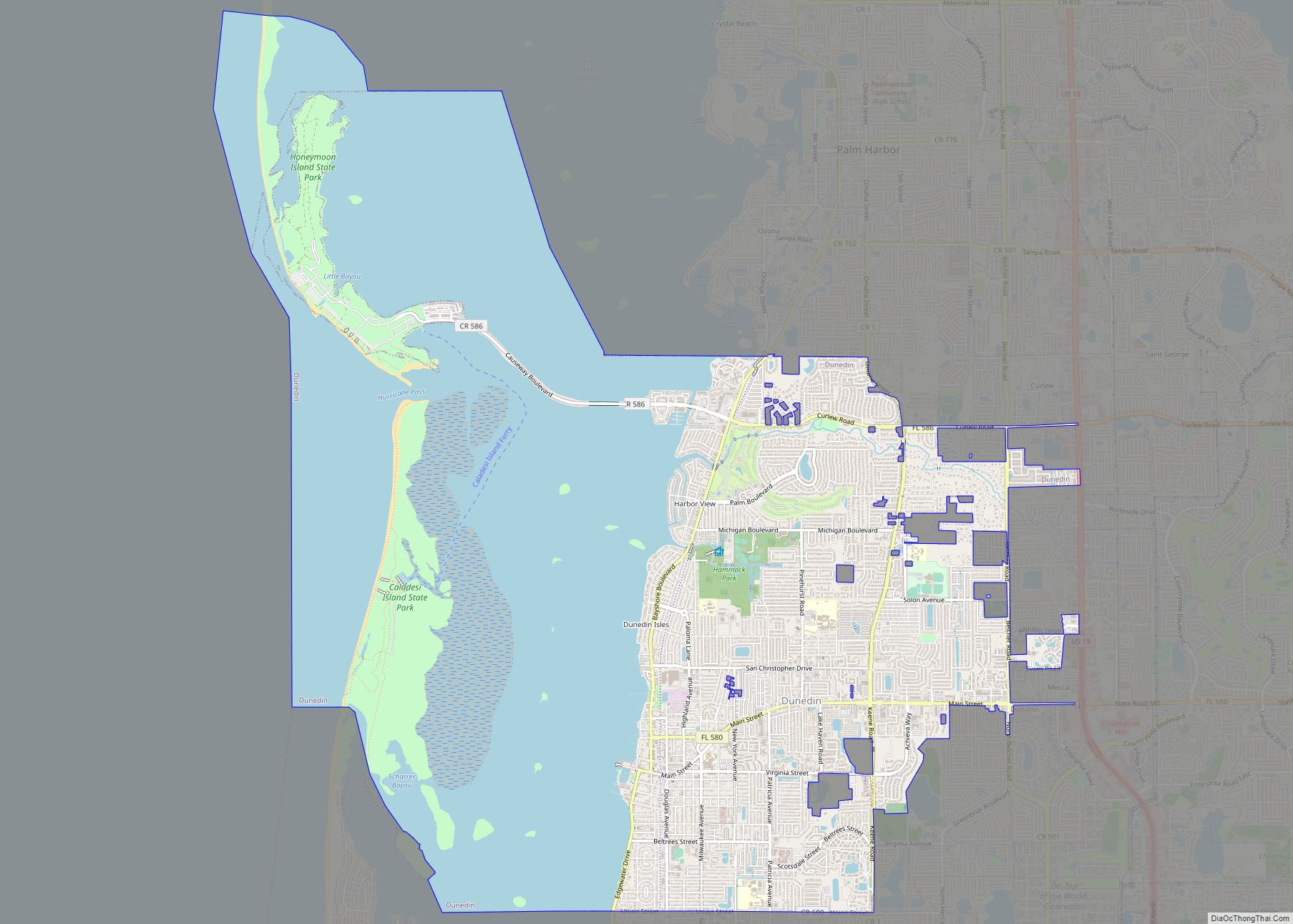
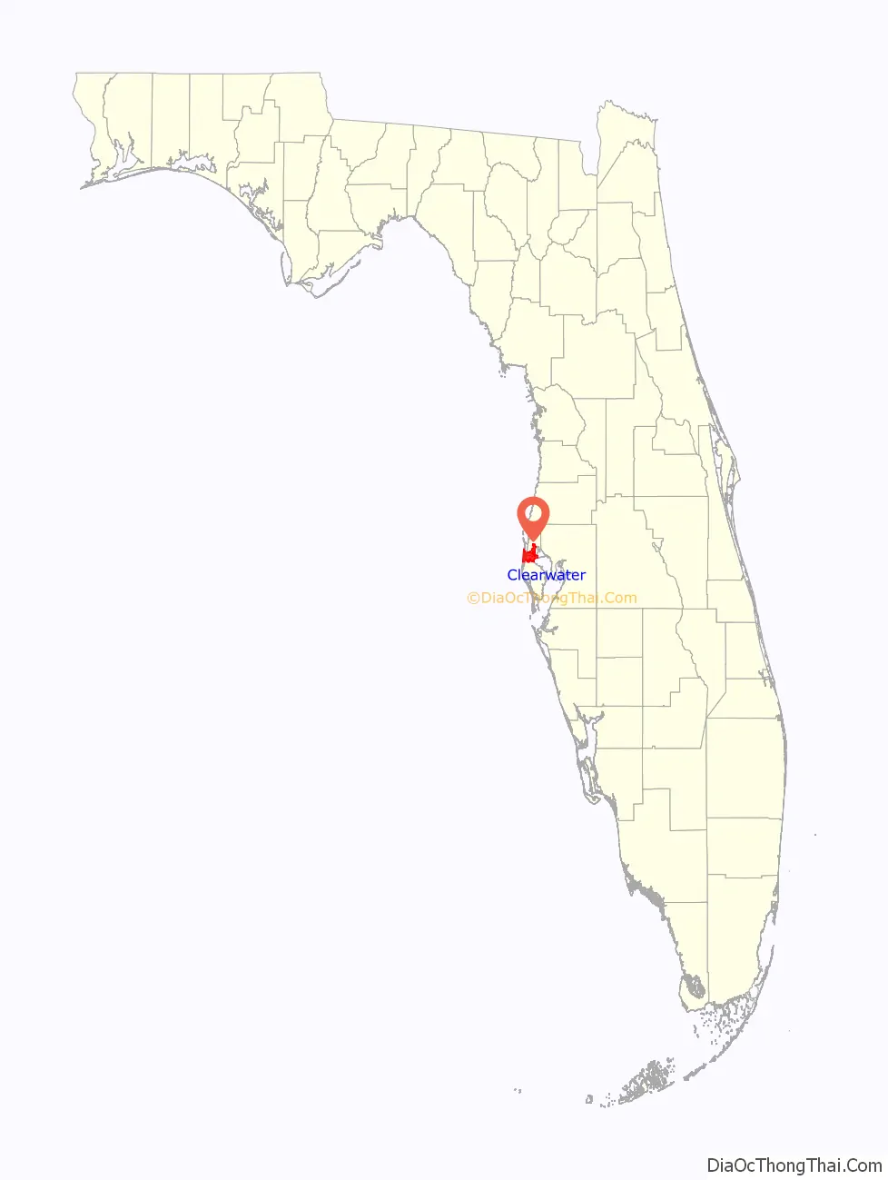
Online Interactive Map
Click on ![]() to view map in "full screen" mode.
to view map in "full screen" mode.
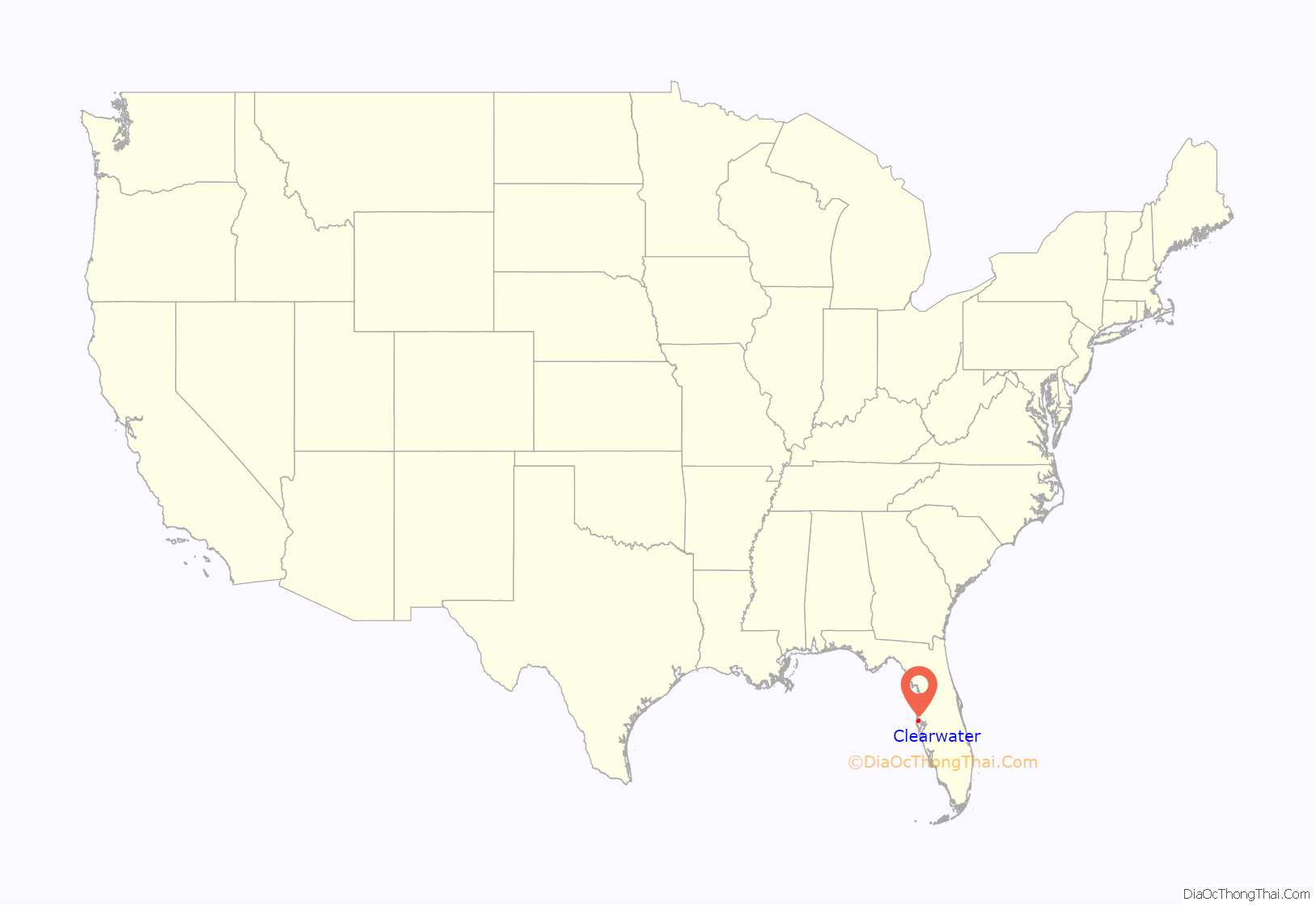
Clearwater location map. Where is Clearwater city?
History
Present-day Clearwater was originally the home of the Tocobaga people. Around 1835, the United States Army began construction of Fort Harrison, named after William Henry Harrison, as an outpost during the Seminole Wars. The fort was located on a bluff overlooking Clearwater Harbor, which later became part of an early 20th-century residential development called Harbor Oaks. University of South Florida archaeologists excavated the site in 1962 after Mark Wyllie discovered an underground ammunition bunker while planting a tree in his yard.
The area’s population grew after the Federal Armed Occupation Act of 1842 offered 160 acres (0.65 km) to anyone who would bear arms and cultivate the land. Early settlers included the Stevens, Stevenson, Sever and McMullen families, who claimed and farmed large tracts of land. Prior to 1906, the area was known as Clear Water Harbor. The name “Clear Water” is thought to have come from a fresh water spring flowing from near where the City Hall building is located today. There were many other freshwater springs that dotted the bluff, many in the bay or harbor itself.
Originally part of Hillsborough County, the first road joining Clearwater and Tampa was built in 1849, which dramatically reduced the prior day-long commute between the cities.
During the American Civil War, Union gunboats repeatedly raided the community’s supplies, as most of the able-bodied men were away fighting for the Confederate Army. The town began developing in the late nineteenth century, prompted by Peter Demens’ completion of the first passenger railroad line into the city in 1888. Clearwater was incorporated in 1891, with James E. Crane becoming the first mayor. The area’s popularity as a vacation destination grew after railroad magnate Henry B. Plant built a sprawling Victorian resort hotel named Belleview Biltmore just south of Clearwater in 1897.
By the early 1900s, Clearwater’s population had grown to around 400, ballooning to nearly 1,000 in the winter. Clearwater’s oldest existing newspaper, the Clearwater Sun, was first published on March 14, 1914. Clearwater was reincorporated, this time as a city, on May 27, 1915, and was designated the county seat for Pinellas County, which broke from Hillsborough County in 1912. In 1915, a bridge was built across Clearwater Harbor, joining the city with Clearwater Beach to the west. Clearwater Beach, although located on a separate barrier island, belongs to the city of Clearwater and fronts the Gulf of Mexico. A new, much higher bridge now arcs over the bay, replacing the former drawbridge; the connecting road is part of State Road 60 and is called Clearwater Memorial Causeway.
During World War II, Clearwater became a major training base for US troops destined for Europe and the Pacific. Virtually every hotel in the area, including the Belleview Biltmore and the Fort Harrison Hotel, was used as a barracks for new recruits. Vehicle traffic was regularly stopped for companies of soldiers marching through downtown, and nighttime blackouts to confuse potential enemy bombers were common practice. The remote and isolated Dan’s Island, now the highrise-dominated Sand Key, was used as a target by U.S. Army Air Corps fighter-bombers for strafing and bombing practice.
Timeline
- 1888
- Settlement of Clear Water Harbor founded.
- “Narrow-gauge railroad” begins operating.
- 1891
- Town of Clear Water Harbor incorporated.
- 1894 – Orange Belt Railroad begins operating.
- 1897 – Belleview Hotel in business in nearby Belleair.
- 1900 – Population: 343.
- 1905 – Population: 610.
- 1906 – Clear Water Harbor renamed “Clearwater”.
- 1911 – Clearwater Yacht Club formed.
- 1912 – Clearwater designated seat of newly created Pinellas County.
- 1914
- Clearwater Evening Sun newspaper begins publication.
- Tampa and Gulf Coast Railroad begins operating.
- 1915 – City of Clearwater incorporated.
- 1916 – Public library and bridge to Clearwater Beach built.
- 1918 – Pinellas County Courthouse built.
- 1920 – Population: 2,427.
- 1921 – Capitol Theatre in business.
- 1923 – Peace Memorial Church built.
- 1926 – Fort Harrison Hotel rebuilt.
- 1930 – Population: 7,607.
- 1948 – WTAN radio begins broadcasting.
- 1950 – Population: 15,581.
- 1953 – Palm Drive-In cinema in business.
- 1959 – WAZE radio begins broadcasting.
- 1970 – Population: 52,074.
- 1972 – Marine Science Center established.
- 1976
- Church of Scientology headquartered in Clearwater.
- Countryside Six cinema in business.
- 1978 – May 4: Tornado occurs.
- 1980 – Population: 85,170.
- 1984 – Regional Pinellas Suncoast Transit Authority formed.
- 1998 – City website online (approximate date).
- 2004 – Clearwater Public Library new building opens.
- 2005 – Clearwater Memorial Causeway opens.
- 2010 – Population: 107,685.
- 2012 – George Cretekos becomes mayor.
- 2013 – Church of Scientology’s Super Power Building dedicated.
- 2017 – Charlie Crist becomes U.S. representative for Florida’s 13th congressional district.
- 2018 – The shooting of Markeis McGlockton receives national attention and triggers a debate regarding stand-your-ground laws.
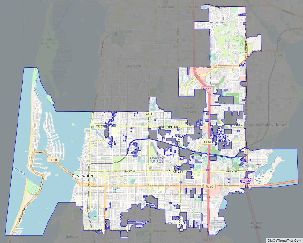
Clearwater Road Map
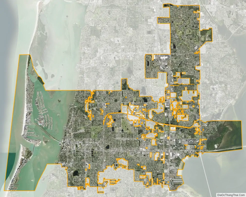
Clearwater city Satellite Map
Geography
Clearwater is located at 27°58′25″N 82°45′51″W / 27.973644°N 82.764271°W / 27.973644; -82.764271.
According to the United States Census Bureau, the city has a total area of 39.2 square miles (101.6 km), of which 25.6 square miles (66.2 km) is land and 13.7 square miles (35.4 km) (34.86%) is water.
Downtown
Clearwater’s downtown has been undergoing major redevelopment in recent years. General beautification has been done along with completion of several high-rise condos and a large marina. New bars, restaurants, and other amenities are coming to the area, renamed the “Cleveland Street District”. Royalty Theatre is also slated to be renovated.
Climate
Clearwater has a humid subtropical climate. Clearwater is far enough south that it lies in the broad transition zone from subtropical to tropical climates. As such, Clearwater is mostly warm to hot year round, with few nights of frost. Most of the annual rainfall comes in the wet season (June through September), when daily thundershowers erupt due to the strong solar heating. The dry season starts in October and runs through May, at which time the weather is sunny, dry, and there is little change in daily weather.
See also
Map of Florida State and its subdivision:- Alachua
- Baker
- Bay
- Bradford
- Brevard
- Broward
- Calhoun
- Charlotte
- Citrus
- Clay
- Collier
- Columbia
- Desoto
- Dixie
- Duval
- Escambia
- Flagler
- Franklin
- Gadsden
- Gilchrist
- Glades
- Gulf
- Hamilton
- Hardee
- Hendry
- Hernando
- Highlands
- Hillsborough
- Holmes
- Indian River
- Jackson
- Jefferson
- Lafayette
- Lake
- Lee
- Leon
- Levy
- Liberty
- Madison
- Manatee
- Marion
- Martin
- Miami-Dade
- Monroe
- Nassau
- Okaloosa
- Okeechobee
- Orange
- Osceola
- Palm Beach
- Pasco
- Pinellas
- Polk
- Putnam
- Saint Johns
- Saint Lucie
- Santa Rosa
- Sarasota
- Seminole
- Sumter
- Suwannee
- Taylor
- Union
- Volusia
- Wakulla
- Walton
- Washington
- Alabama
- Alaska
- Arizona
- Arkansas
- California
- Colorado
- Connecticut
- Delaware
- District of Columbia
- Florida
- Georgia
- Hawaii
- Idaho
- Illinois
- Indiana
- Iowa
- Kansas
- Kentucky
- Louisiana
- Maine
- Maryland
- Massachusetts
- Michigan
- Minnesota
- Mississippi
- Missouri
- Montana
- Nebraska
- Nevada
- New Hampshire
- New Jersey
- New Mexico
- New York
- North Carolina
- North Dakota
- Ohio
- Oklahoma
- Oregon
- Pennsylvania
- Rhode Island
- South Carolina
- South Dakota
- Tennessee
- Texas
- Utah
- Vermont
- Virginia
- Washington
- West Virginia
- Wisconsin
- Wyoming