Map of Jackson city, Michigan

Map of Jackson city, Michigan

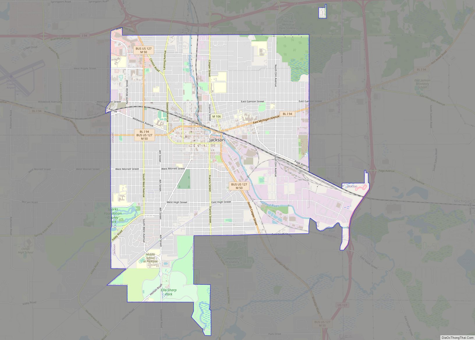
Jackson is the only city and county seat of Jackson County in the U.S. state of Michigan. As of the 2020 census, the city population was 31,309. Located along Interstate 94 and U.S. Route 127, it is approximately 40 miles (64 km) west of Ann Arbor and 35 miles (56 km) south of Lansing. Jackson is the … Read more

Map of Ithaca city

Map of Ithaca city, Michigan

Ithaca is a city and the county seat of Gratiot County, Michigan. It is located very near the geographical center of the state’s lower peninsula. The population was 2,910 at the 2010 census. Ithaca is run as a council-manager government. It sits at the conjunction of four townships in the center of the county: Emerson … Read more

Map of Ishpeming city

Map of Ishpeming city

Ishpeming (/ˈɪʃpəmɪŋ/ ISH-pə-ming) is a city in Marquette County in the Upper Peninsula of the U.S. state of Michigan. The population was 6,140 at the 2020 census, less than it was in the 1950s and 1960s when the iron ore mines employed more workers. A statue of a Native American figure, erected in 1884 in … Read more

Map of Ironwood city

Map of Ironwood city

Ironwood is a city in Gogebic County in the Upper Peninsula of the U.S. state of Michigan, about 18 miles (29 km) south of Lake Superior. The city is on US Highway 2 across the Montreal River from Hurley, Wisconsin. It is the westernmost city in Michigan, situated on the same line of longitude (90.2 degrees … Read more

Map of Kalamazoo city

Map of Kalamazoo city

Kalamazoo (/ˌkæləməˈzuː/ KAL-ə-mə-ZOO) is a city in the southwest region of the U.S. state of Michigan. It is the county seat of Kalamazoo County. At the 2010 census, Kalamazoo had a population of 74,262. Kalamazoo is the major city of the Kalamazoo-Portage Metropolitan Statistical Area, which had a population of 335,340 in 2015. Kalamazoo is … Read more

Map of K. I. Sawyer CDP

Map of K. I. Sawyer CDP

K. I. Sawyer Air Force Base is a decommissioned United States Air Force (USAF) installation in Marquette County, Michigan, south of the city of Marquette. Near the center of Michigan’s Upper Peninsula, the base operated for nearly forty years and closed in 1995. The county airport, Sawyer International, now occupies a portion of the base … Read more

Map of Jonesville city, Michigan

Map of Jonesville city, Michigan

Jonesville is a city in Hillsdale County in the U.S. state of Michigan. The population was 2,176 at the 2020 census. Jonesville city overview: Name: Jonesville city LSAD Code: 25 LSAD Description: city (suffix) State: Michigan County: Hillsdale County Founded: 1828 Incorporated: 1855 (village)2014 (city) Elevation: 1,076 ft (328 m) Total Area: 2.83 sq mi (7.33 km²) Land Area: 2.79 sq mi … Read more

Map of Jennings CDP, Michigan

Map of Jennings CDP, Michigan

Jennings is an unincorporated community and census-designated place (CDP) in Missaukee County in the U.S. state of Michigan. The population was 264 at the 2010 census. The CDP is located mostly in Lake Township with a small portion extending north into Caldwell Township. Jennings CDP overview: Name: Jennings CDP LSAD Code: 57 LSAD Description: CDP … Read more

Map of Jenison CDP

Map of Jenison CDP

Jenison is a census-designated place (CDP) in Ottawa County in the U.S. state of Michigan. The community is located within Georgetown Charter Township. The population of the CDP was 17,211 as of the 2000 census. The current estimated population for the entire Jenison ZIP code, 49428, is 25,770. The geographical boundaries of the ZIP code … Read more

Map of Kent City village

Map of Kent City village

Kent City is a village in Kent County in the U.S. state of Michigan. The population was 1,262 at the 2020 census. The village is located within Tyrone Township. The village is part of the Grand Rapids metropolitan area and is located about 20 miles (32.2 km) north of the city of Grand Rapids. Kent City … Read more

Map of Keego Harbor city

Map of Keego Harbor city

Keego Harbor is a city in Oakland County in the U.S. state of Michigan. The population was 2,970 at the 2010 census. With a land area of 0.50 square miles (1.29 km), Keego Harbor is the third-smallest city by land area in the state of Michigan after the cities of Petersburg and Clarkston. Keego Harbor city … Read more

Map of Kalkaska village

Map of Kalkaska village

Kalkaska (/kælˈkæskə/ kal-KASS-kə) is a village in the U.S. state of Michigan. Kalkaska is the county seat and only incorporated community of Kalkaska County, and is considered part of Northern Michigan. The population was 2,132 at the 2020 census, an increase from 2,020 at the 2010 census. Kalkaska is part of the Traverse City micropolitan … Read more