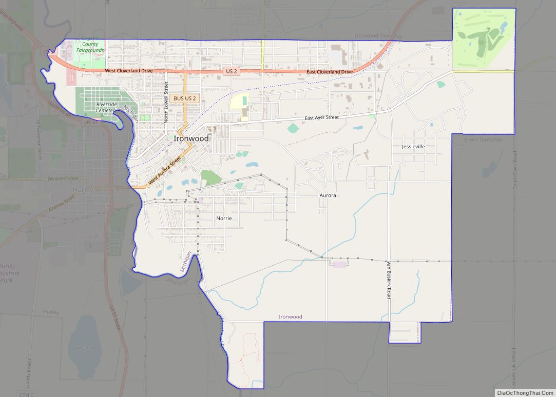
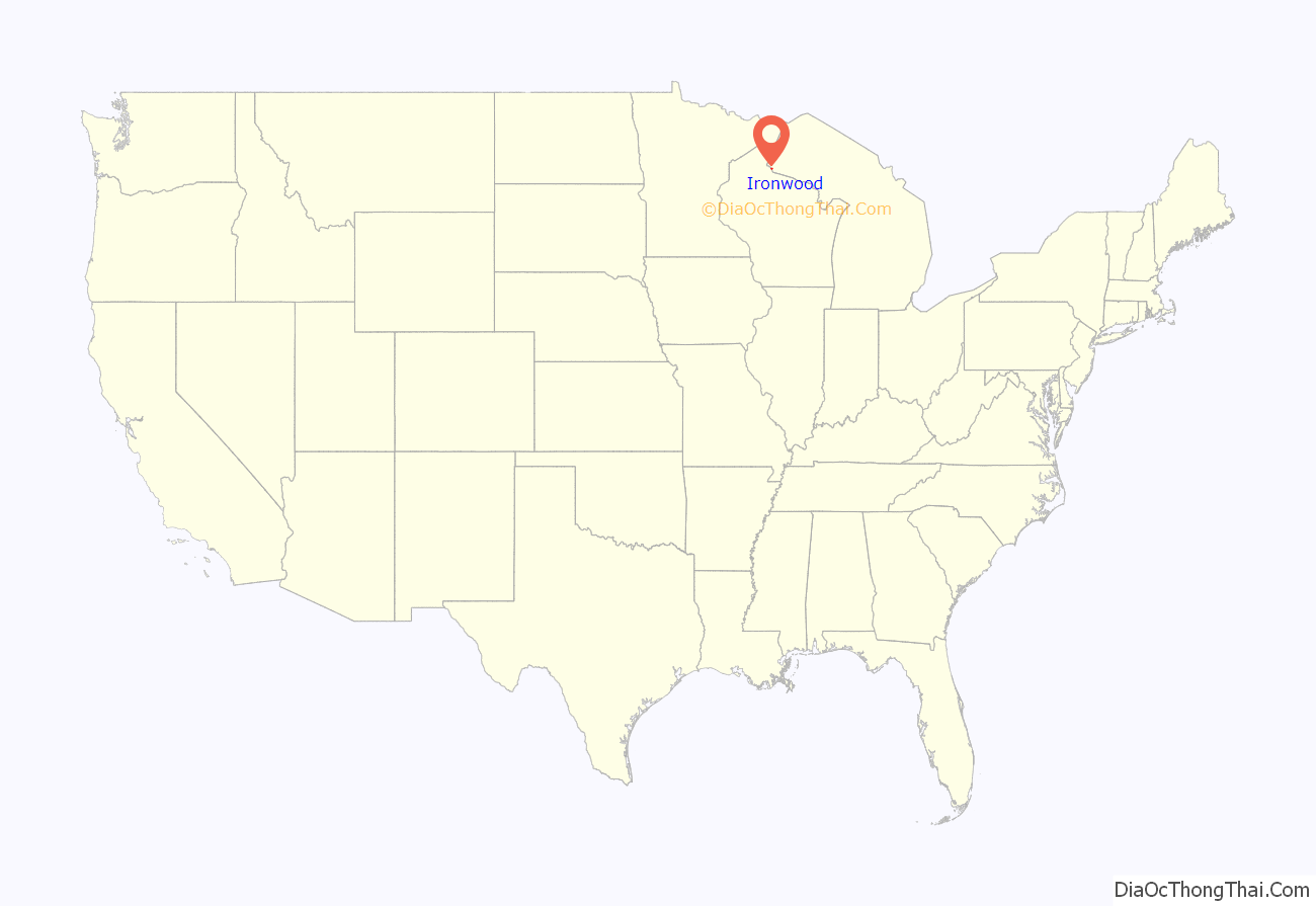
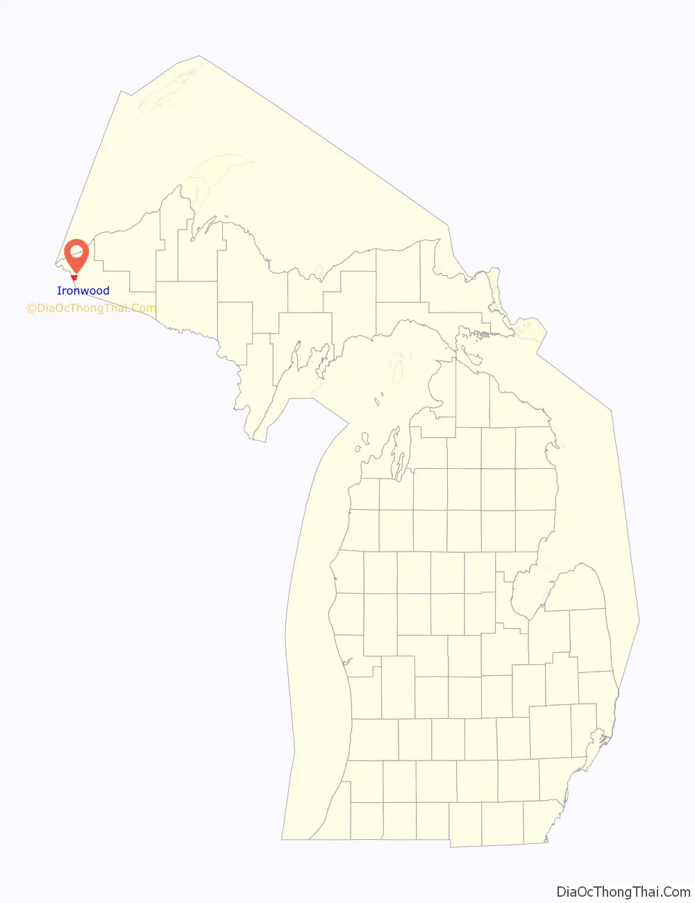
Ironwood is a city in Gogebic County in the Upper Peninsula of the U.S. state of Michigan, about 18 miles (29 km) south of Lake Superior. The city is on US Highway 2 across the Montreal River from Hurley, Wisconsin. It is the westernmost city in Michigan, situated on the same line of longitude (90.2 degrees West) as Clinton, Iowa and St. Louis, Missouri. The population was 5,045 at the 2020 census, down from 5,387 at the 2010 census. The city is bordered by Ironwood Township to the north, but the two are administered automously.
While originally an iron mining town, the area is now known for its downhill skiing resorts, including Big Powderhorn, Black River, Snow River, Mount Zion and Whitecap as well as its cross country skiing at the Wolverine Nordic Trail System and the ABR Nordic Center.
Ironwood is home of the “World’s Tallest Indian,” a 52 ft (15.8 m) fiberglass statue of tribal leader Hiawatha.
| Name: | Ironwood city |
|---|---|
| LSAD Code: | 25 |
| LSAD Description: | city (suffix) |
| State: | Michigan |
| County: | Gogebic County |
| Incorporated: | 1887 (village) 1889 (city) |
| Elevation: | 1,506 ft (459 m) |
| Total Area: | 6.58 sq mi (17.04 km²) |
| Land Area: | 6.58 sq mi (17.04 km²) |
| Water Area: | 0.00 sq mi (0.00 km²) |
| Total Population: | 5,045 |
| Population Density: | 766.95/sq mi (296.13/km²) |
| Area code: | 906 |
| FIPS code: | 2641060 |
| GNISfeature ID: | 0629087 |
Online Interactive Map
Click on ![]() to view map in "full screen" mode.
to view map in "full screen" mode.
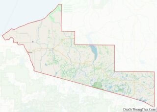
Ironwood location map. Where is Ironwood city?
History
Ironwood was settled in the spring of 1885. The town was incorporated as a village in 1887 and as a city on April 8, 1889. The township area north of the city was incorporated as Ironwood Township on April 8, 1889. In 1890 the population of Ironwood passed 7500 and in 1900 it reached 10000. Ironwood reputedly acquired its name when Frederic W. Rhinelander, president of the Milwaukee Lake Shore and Western Railroad line, arriving by train at what was then little more than a wilderness camp, chose it to honor one of his employees, mining captain James (Iron) Wood.
Ironwood is located within the now inactive Gogebic Iron Range. Iron ore was found in the area in the 1870s. The arrival of the railroad in the mid-1880s gave an impetus to more extensive development of the area’s ore deposits. Several mines, such as the Norrie, Aurora, Ashland, Newport, and Pabst, were opened in Ironwood. The mines and the lumber works attracted newcomers from other parts of the US and from European countries such as England, Finland, Germany, Italy, Poland, and Sweden.
On September 17, 1887, a disastrous fire swept over half the business area, although the buildings that were lost were quickly rebuilt. In 1926, the Pabst Mine Disaster occurred, killing three electricians and trapping forty-three miners for up to five days.
By the early 1890s, twelve churches had been established in Ironwood by the various immigrant communities:
- The Methodist Episcopal Church
- The Jessieville Methodist Episcopal Church
- St Ambrose Church (Catholic)
- St Michael’s Church (Catholic)
- First Swedish Baptist Church
- Swedish Methodist Episcopal Church
- Swedish Mission Church (Covenant Church)
- Swedish Lutheran Church
- First Finnish Lutheran Church
- The First Presbyterian Church
- St Pauls Episcopal Church
- The First Apostolic Lutheran Church
In the early 1960s, the U.S. Air Force established a Strategic Air Command (SAC) Radar Bomb Scoring site atop Norrie hill to track and score high altitude and treetop level simulated bomb runs by B-52s and B-47s on targets in the Ironwood area. A monument is erected south of Hurley, Wisconsin to remember those crew members killed in two B-47 low level runs. The site was moved to Charlevoix, Michigan in the mid-1960s.
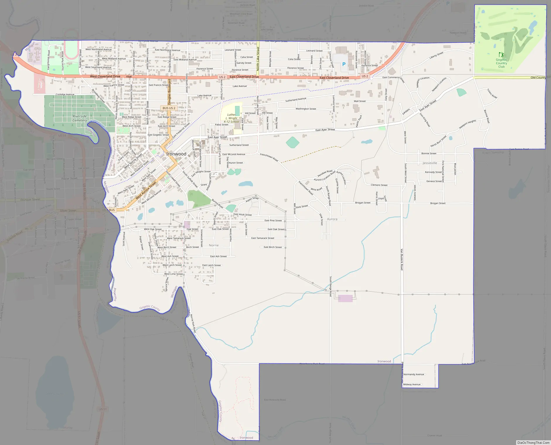
Ironwood Road Map
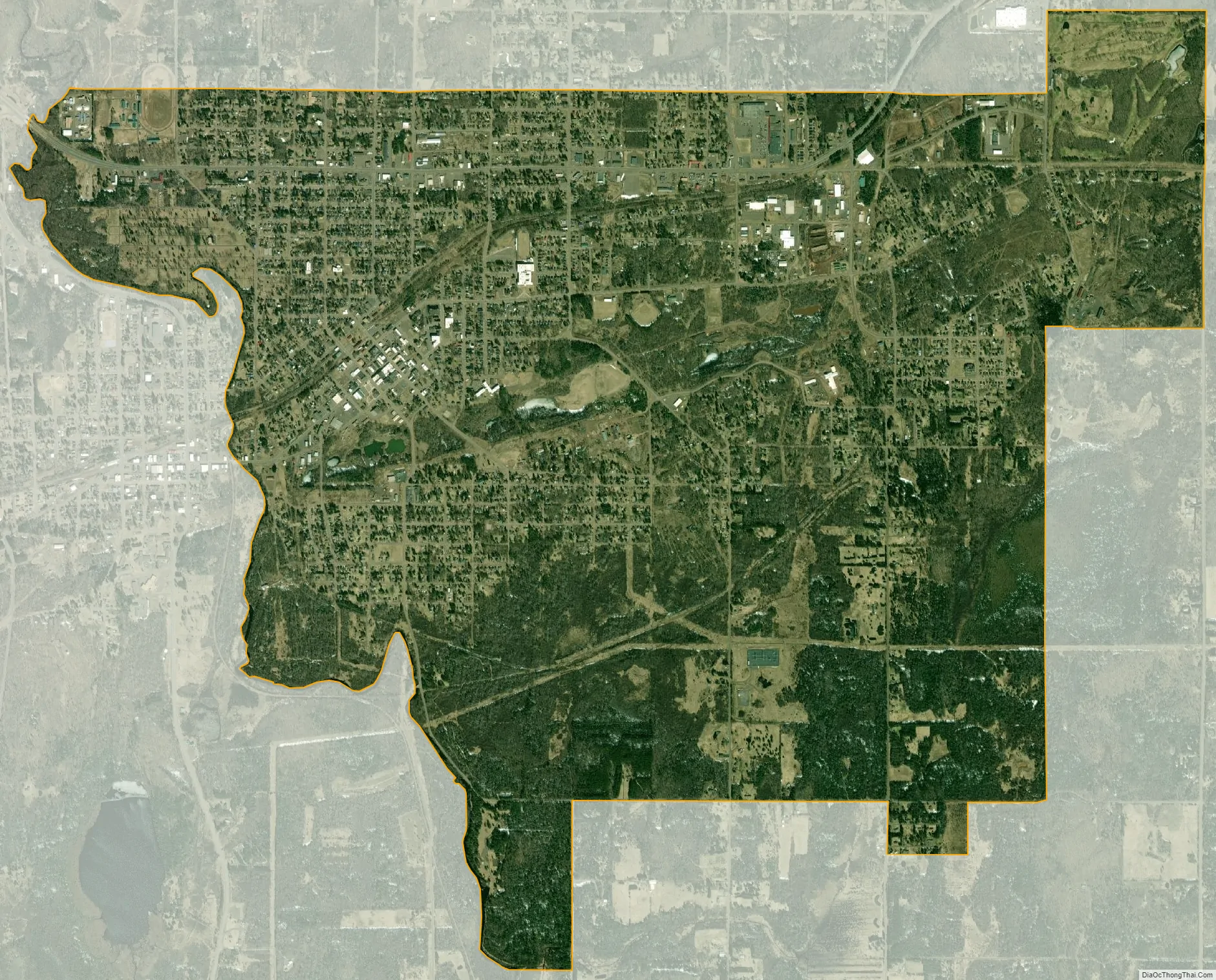
Ironwood city Satellite Map
Geography
According to the United States Census Bureau, the city has a total area of 6.42 square miles (16.63 km), all of it land. Ironwood is one of the snowiest places in Michigan, and has an average seasonal snowfall of 188.2 inches (4.78 m). The deepest snow cover, 71 inches (1.80 m), was measured on February 23, 1904.
See also
Map of Michigan State and its subdivision:- Alcona
- Alger
- Allegan
- Alpena
- Antrim
- Arenac
- Baraga
- Barry
- Bay
- Benzie
- Berrien
- Branch
- Calhoun
- Cass
- Charlevoix
- Cheboygan
- Chippewa
- Clare
- Clinton
- Crawford
- Delta
- Dickinson
- Eaton
- Emmet
- Genesee
- Gladwin
- Gogebic
- Grand Traverse
- Gratiot
- Hillsdale
- Houghton
- Huron
- Ingham
- Ionia
- Iosco
- Iron
- Isabella
- Jackson
- Kalamazoo
- Kalkaska
- Kent
- Keweenaw
- Lake
- Lake Hurron
- Lake Michigan
- Lake St. Clair
- Lake Superior
- Lapeer
- Leelanau
- Lenawee
- Livingston
- Luce
- Mackinac
- Macomb
- Manistee
- Marquette
- Mason
- Mecosta
- Menominee
- Midland
- Missaukee
- Monroe
- Montcalm
- Montmorency
- Muskegon
- Newaygo
- Oakland
- Oceana
- Ogemaw
- Ontonagon
- Osceola
- Oscoda
- Otsego
- Ottawa
- Presque Isle
- Roscommon
- Saginaw
- Saint Clair
- Saint Joseph
- Sanilac
- Schoolcraft
- Shiawassee
- Tuscola
- Van Buren
- Washtenaw
- Wayne
- Wexford
- Alabama
- Alaska
- Arizona
- Arkansas
- California
- Colorado
- Connecticut
- Delaware
- District of Columbia
- Florida
- Georgia
- Hawaii
- Idaho
- Illinois
- Indiana
- Iowa
- Kansas
- Kentucky
- Louisiana
- Maine
- Maryland
- Massachusetts
- Michigan
- Minnesota
- Mississippi
- Missouri
- Montana
- Nebraska
- Nevada
- New Hampshire
- New Jersey
- New Mexico
- New York
- North Carolina
- North Dakota
- Ohio
- Oklahoma
- Oregon
- Pennsylvania
- Rhode Island
- South Carolina
- South Dakota
- Tennessee
- Texas
- Utah
- Vermont
- Virginia
- Washington
- West Virginia
- Wisconsin
- Wyoming