Kalamazoo (/ˌkæləməˈzuː/ KAL-ə-mə-ZOO) is a city in the southwest region of the U.S. state of Michigan. It is the county seat of Kalamazoo County. At the 2010 census, Kalamazoo had a population of 74,262. Kalamazoo is the major city of the Kalamazoo-Portage Metropolitan Statistical Area, which had a population of 335,340 in 2015. Kalamazoo is equidistant from Chicago and Detroit, being about 140 miles (230 km) away from both.
One of Kalamazoo’s most notable features is the Kalamazoo Mall, an outdoor pedestrian shopping mall. The city created the mall in 1959 by closing part of Burdick Street to auto traffic, although two of the mall’s four blocks have been reopened to auto traffic since 1999. Kalamazoo is home to Western Michigan University, a large public university, Kalamazoo College, a private liberal arts college, and Kalamazoo Valley Community College, a two-year community college.
| Name: | Kalamazoo city |
|---|---|
| LSAD Code: | 25 |
| LSAD Description: | city (suffix) |
| State: | Michigan |
| County: | Kalamazoo County |
| Elevation: | 784 ft (239 m) |
| Land Area: | 24.69 sq mi (63.96 km²) |
| Water Area: | 0.45 sq mi (1.16 km²) |
| Population Density: | 2,980.52/sq mi (1,150.77/km²) |
| ZIP code: | 49001, 49003, 49004, 49005, 49006, 49007, 49008, 49009, 49019, 49048 |
| Area code: | 269 |
| FIPS code: | 2642160 |
| GNISfeature ID: | 0629439 |
| Website: | www.kalamazoocity.org |
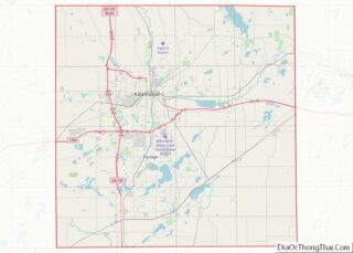
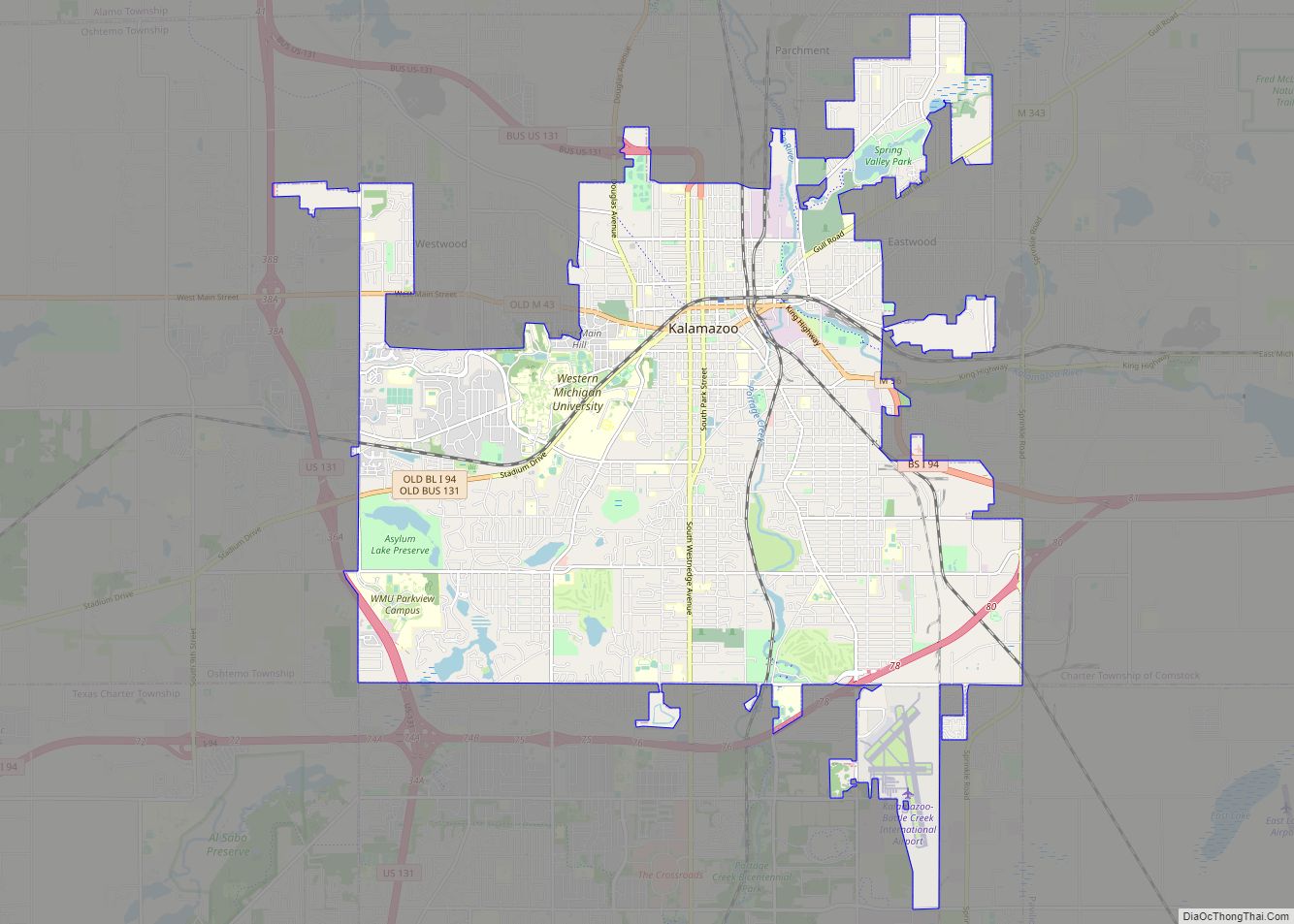
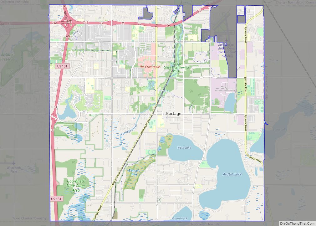
Online Interactive Map
Click on ![]() to view map in "full screen" mode.
to view map in "full screen" mode.
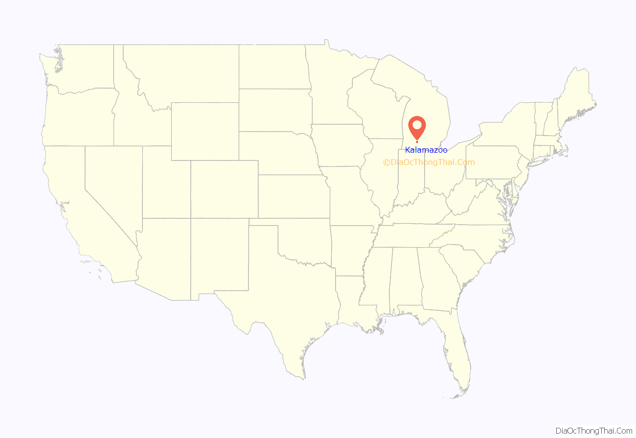
Kalamazoo location map. Where is Kalamazoo city?
History
The area on which the modern city of Kalamazoo stands was once home to Native Americans of the Hopewell tradition, who migrated into the area sometime before the first millennium. Evidence of their early residency remains in the form of a small mound in downtown’s Bronson Park. The Hopewell civilization began to decline after the 8th century and was replaced by other groups. The Potawatomi culture lived in the area when the first European explorers arrived.
René-Robert Cavelier, Sieur de La Salle, passed just southeast of the present city of Kalamazoo in late March 1680. The first Europeans to reside in the area were itinerant fur traders in the late 18th and early 19th century. There are records of several traders wintering in the area, and by the 1820s at least one trading post had been established.
During the War of 1812, the British established a smithy and a prison camp in the area.
The 1821 Treaty of Chicago ceded the territory south of the Grand River to the United States federal government. However, the area around present-day Kalamazoo was reserved as the village of Potawatomi Chief Match-E-Be-Nash-She-Wish. Six years later, as a result of the 1827 Treaty of St. Joseph, the tract that became the city of Kalamazoo was also ceded.
In 1829, Titus Bronson, originally from Connecticut, became the first white settler to build a cabin within the present city limits of Kalamazoo. He platted the town in 1831 and named it the village of Bronson—not to be confused with the much smaller Bronson, Michigan, about fifty miles (80 km) to the south-southeast of Kalamazoo.
Bronson, frequently described as “eccentric” and argumentative, was later run out of town. The village was renamed Kalamazoo in 1836, due in part to Bronson’s being fined for stealing a cherry tree. Today, a hospital and a downtown park, among other things, are named for Bronson. Kalamazoo was legally incorporated as a village in 1838 and as a city in 1883.
The fertile farmlands attracted prosperous Yankee farmers who settled the surrounding area, and sent their sons to Kalamazoo to become businessmen, professionals and entrepreneurs who started numerous factories. Most of the original settlers of Kalamazoo were New Englanders or were from upstate New York.
On August 27, 1856, Abraham Lincoln gave a speech in Kalamazoo during a campaign rally for John C. Fremont, the first Republican presidential candidate. The text of the speech was found by Lincoln historian Thomas I. Starr in a copy of the Detroit Daily Advertiser and published in a booklet. This was the only trip Lincoln ever made to Michigan. In July, 2022, a local non-profit, the Kalamazoo Abraham Lincoln Institute was given permission by the city to place a statue of Lincoln in Bronson Park to commemorate the event.
In the 1940s, the city became the first to install curb cuts.
In 1959, the city created the Kalamazoo Mall, the first outdoor pedestrian shopping mall in the United States, by closing part of Burdick Street to auto traffic. The Mall was designed by Victor Gruen, who also designed the country’s first enclosed shopping mall, which had opened three years earlier. Two of the mall’s four blocks were reopened to auto traffic in 1999 after much debate.
An F3 tornado struck downtown Kalamazoo on May 13, 1980, killing five and injuring 79.
On February 20, 2016, Kalamazoo became the site of a random series of shootings in which six people were killed. A prime suspect was apprehended by police without incident.
North Burdick St. in 1908
Academy St. in 1908
Old public library in 1908
Paper mills in 1908
Economic history
In the past, Kalamazoo was known for its production of windmills, mandolins, buggies, automobiles, cigars, stoves, paper, and paper products. Agriculturally, it once was noted for celery. Although much of it has become suburbanized, the surrounding area still produces farm crops, primarily corn and soybeans.
Kalamazoo was the original home of Gibson Guitar Corporation, which spawned the still-local Heritage Guitars. The company was incorporated as “Gibson Mandolin – Guitar Co., Ltd” on October 11, 1902, by the craftsman Orville Gibson. One budget model was named the Gibson Kalamazoo “Melody Maker” Electric Guitar. Operations were moved gradually from Kalamazoo to Memphis, Tennessee, (Electric Division) and Bozeman, Montana, (Acoustic Division) in the 1980s. Some workers from the original factory stayed in Kalamazoo to create the Heritage Guitar company.
Kalamazoo was once known as the “Paper City” because of the paper mills in and near the city. The Allied Paper Corporation operated several mills and employed 1,300 people in Kalamazoo during the late 1960s. As the forests of West Michigan were logged, paper mills closed.
Early in the 20th century, Kalamazoo was home to the brass era automobile company Barley.
Kalamazoo was also headquarters of the Checker Motors Company, the former manufacturer of the Checker Cab, which also stamped sheet metal parts for other auto manufacturers. Checker closed on June 25, 2009, a victim of the Late-2000s recession.
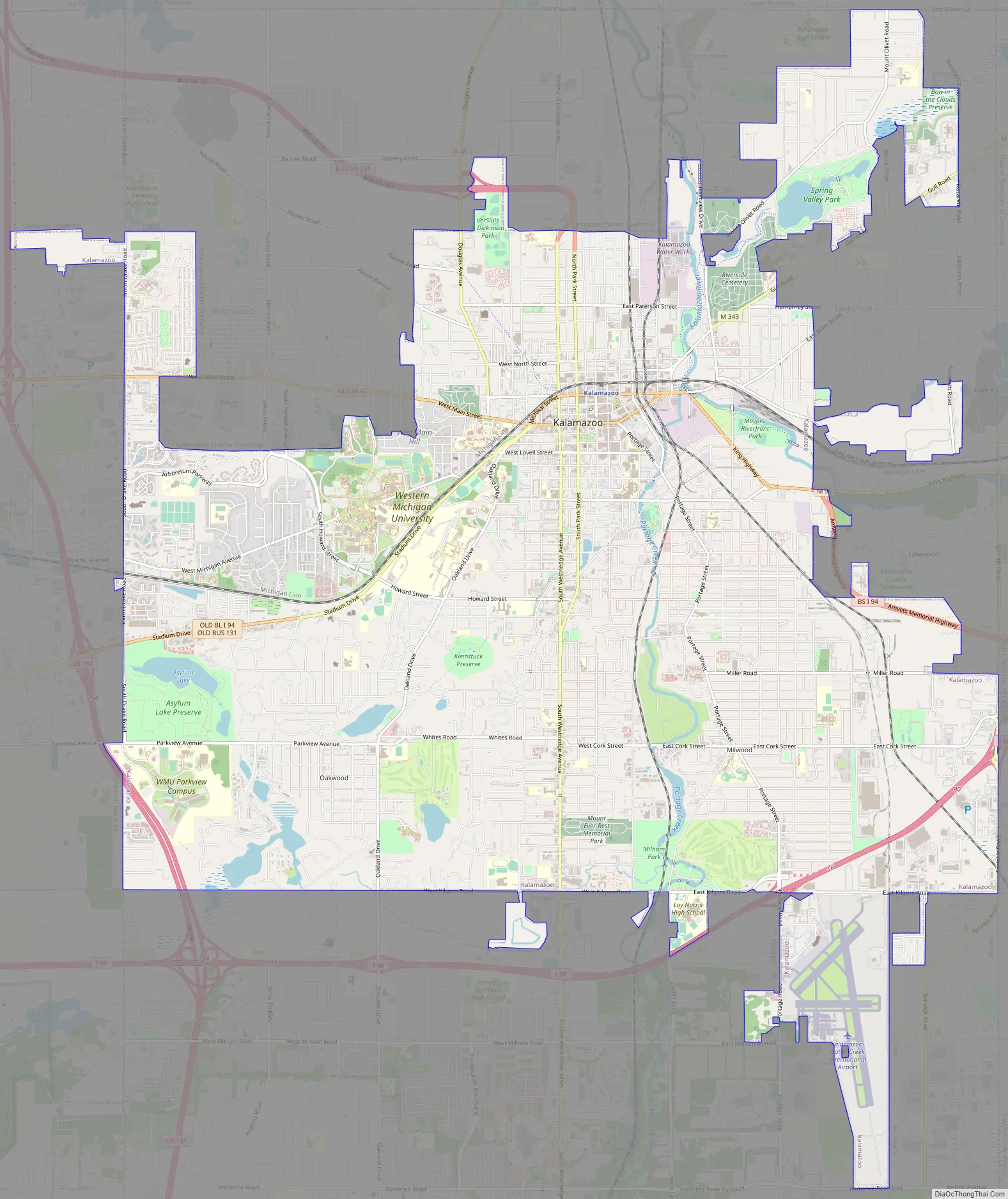
Kalamazoo Road Map
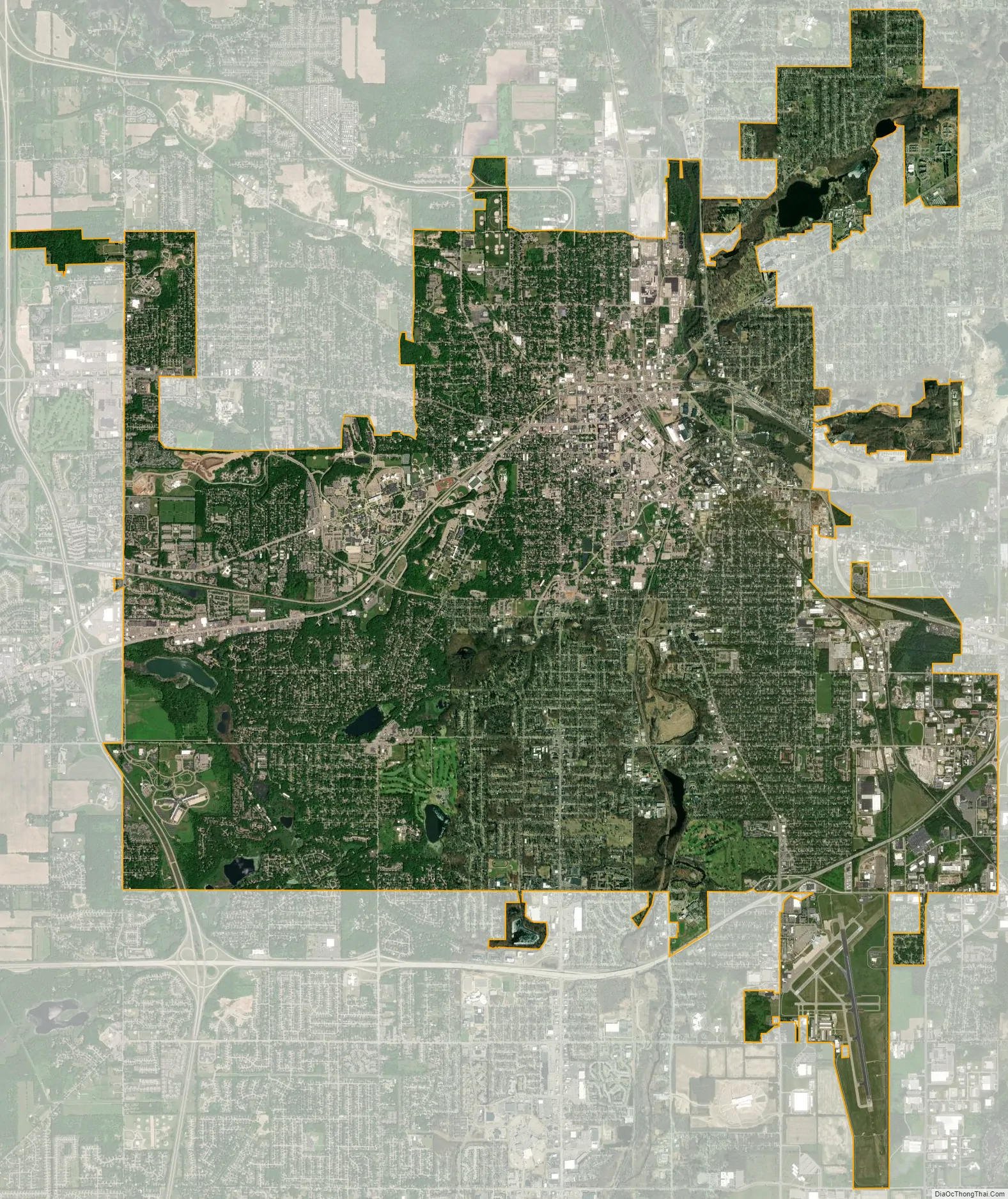
Kalamazoo city Satellite Map
Geography
Most of Kalamazoo is on the southwest bank of a major bend in the Kalamazoo River, with a small portion, about 2.8 square miles (7.3 km), on the opposite bank. Several small tributaries of the Kalamazoo River, including Arcadia Creek and Portage Creek, wind through the city. The northeastern portion of Kalamazoo sits in the broad, flat Kalamazoo Valley, while the western portions of Kalamazoo climb into low hills to the west and south. Several small lakes are found throughout the area.
According to the United States Census Bureau, Kalamazoo has a total area of 25.11 square miles (65.03 km), of which 24.68 square miles (63.92 km) is land and 0.43 square miles (1.11 km) is water.
Kalamazoo’s suburban population is located primarily to the south, in the city of Portage, and to the west in Oshtemo and Texas townships.
At least part of the municipal water supply for Kalamazoo is provided by the watershed contained within the Al Sabo Preserve in Texas Charter Township, Michigan, immediately southwest of Kalamazoo.
Another watershed, Kleinstuck Marsh, is popular with hikers and birdwatchers. Kleinstuck Marsh is south of Maple Street, between Oakland Drive and Westnedge Avenue, Kalamazoo’s major north–south artery.
See also
Map of Michigan State and its subdivision:- Alcona
- Alger
- Allegan
- Alpena
- Antrim
- Arenac
- Baraga
- Barry
- Bay
- Benzie
- Berrien
- Branch
- Calhoun
- Cass
- Charlevoix
- Cheboygan
- Chippewa
- Clare
- Clinton
- Crawford
- Delta
- Dickinson
- Eaton
- Emmet
- Genesee
- Gladwin
- Gogebic
- Grand Traverse
- Gratiot
- Hillsdale
- Houghton
- Huron
- Ingham
- Ionia
- Iosco
- Iron
- Isabella
- Jackson
- Kalamazoo
- Kalkaska
- Kent
- Keweenaw
- Lake
- Lake Hurron
- Lake Michigan
- Lake St. Clair
- Lake Superior
- Lapeer
- Leelanau
- Lenawee
- Livingston
- Luce
- Mackinac
- Macomb
- Manistee
- Marquette
- Mason
- Mecosta
- Menominee
- Midland
- Missaukee
- Monroe
- Montcalm
- Montmorency
- Muskegon
- Newaygo
- Oakland
- Oceana
- Ogemaw
- Ontonagon
- Osceola
- Oscoda
- Otsego
- Ottawa
- Presque Isle
- Roscommon
- Saginaw
- Saint Clair
- Saint Joseph
- Sanilac
- Schoolcraft
- Shiawassee
- Tuscola
- Van Buren
- Washtenaw
- Wayne
- Wexford
- Alabama
- Alaska
- Arizona
- Arkansas
- California
- Colorado
- Connecticut
- Delaware
- District of Columbia
- Florida
- Georgia
- Hawaii
- Idaho
- Illinois
- Indiana
- Iowa
- Kansas
- Kentucky
- Louisiana
- Maine
- Maryland
- Massachusetts
- Michigan
- Minnesota
- Mississippi
- Missouri
- Montana
- Nebraska
- Nevada
- New Hampshire
- New Jersey
- New Mexico
- New York
- North Carolina
- North Dakota
- Ohio
- Oklahoma
- Oregon
- Pennsylvania
- Rhode Island
- South Carolina
- South Dakota
- Tennessee
- Texas
- Utah
- Vermont
- Virginia
- Washington
- West Virginia
- Wisconsin
- Wyoming