Ithaca is a city and the county seat of Gratiot County, Michigan. It is located very near the geographical center of the state’s lower peninsula. The population was 2,910 at the 2010 census. Ithaca is run as a council-manager government. It sits at the conjunction of four townships in the center of the county: Emerson Township to the northeast, Arcada Township to the northwest, Newark Township to the southwest, and North Star Township to the southeast, but is administratively autonomous.
| Name: | Ithaca city |
|---|---|
| LSAD Code: | 25 |
| LSAD Description: | city (suffix) |
| State: | Michigan |
| County: | Gratiot County |
| Elevation: | 794 ft (242 m) |
| Total Area: | 5.88 sq mi (15.24 km²) |
| Land Area: | 5.72 sq mi (14.82 km²) |
| Water Area: | 0.16 sq mi (0.41 km²) |
| Total Population: | 2,853 |
| Population Density: | 498.43/sq mi (192.45/km²) |
| ZIP code: | 48847 |
| Area code: | 989 |
| FIPS code: | 2641340 |
| GNISfeature ID: | 0629141 |
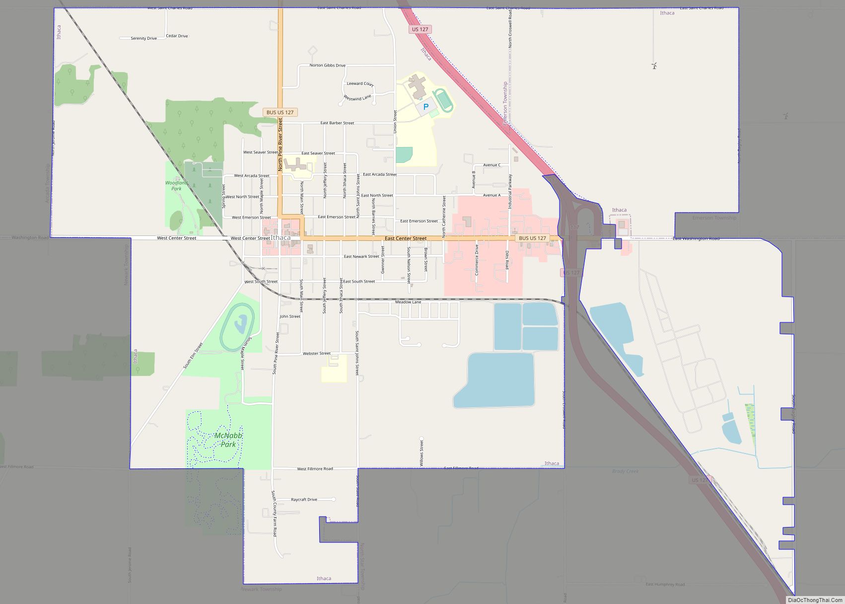
Online Interactive Map
Click on ![]() to view map in "full screen" mode.
to view map in "full screen" mode.
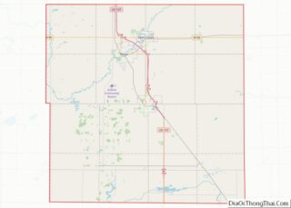
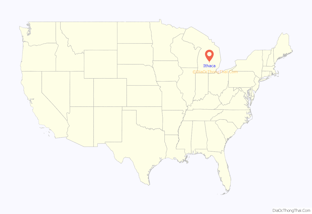
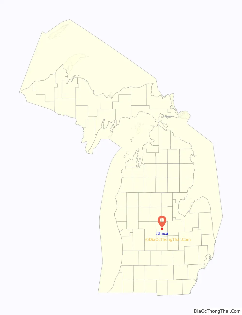
Ithaca location map. Where is Ithaca city?
History
Along with the Native Americans, the first recorded settler in Ithaca was James J. Bush from Howell, Michigan in 1850. John Jeffery, from New York State, bought land in 1853, and permanently relocated on the land in 1855. He platted the area in 1856, assisted by Sidney S. Hastings, calling it Gratiot Center and laying out streets, lots, blocks, and even alleys. Gratiot Center was the name of its first post office, granted on November 16, 1855 with John Knight as the first postmaster. In 1856 the site was named as the county seat of Gratiot County. The settlement’s name was changed on April 13, 1857 to Ithaca, after Ithaca, New York. Ithaca was incorporated as a village in 1869 and became a city in 1961.
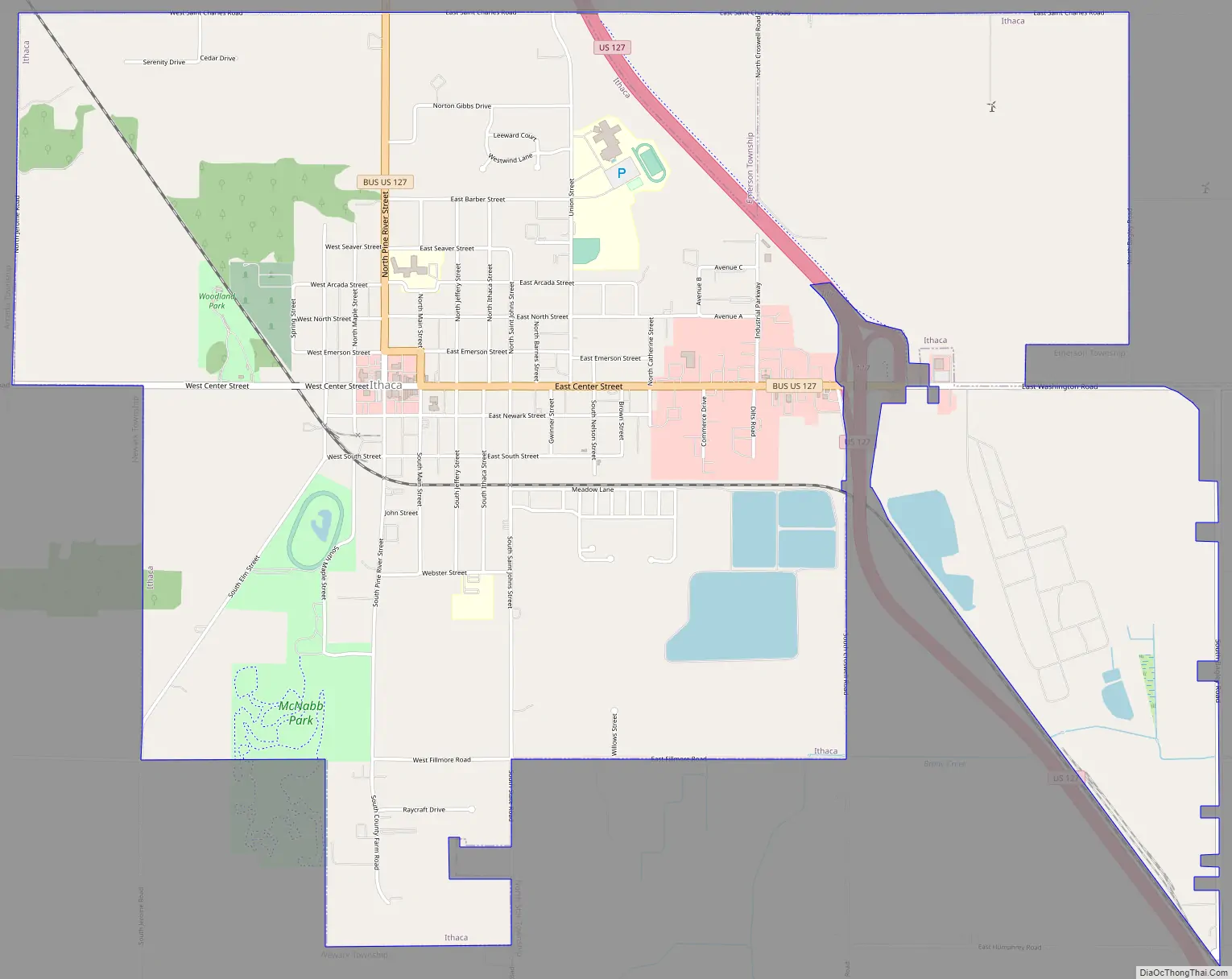
Ithaca Road Map
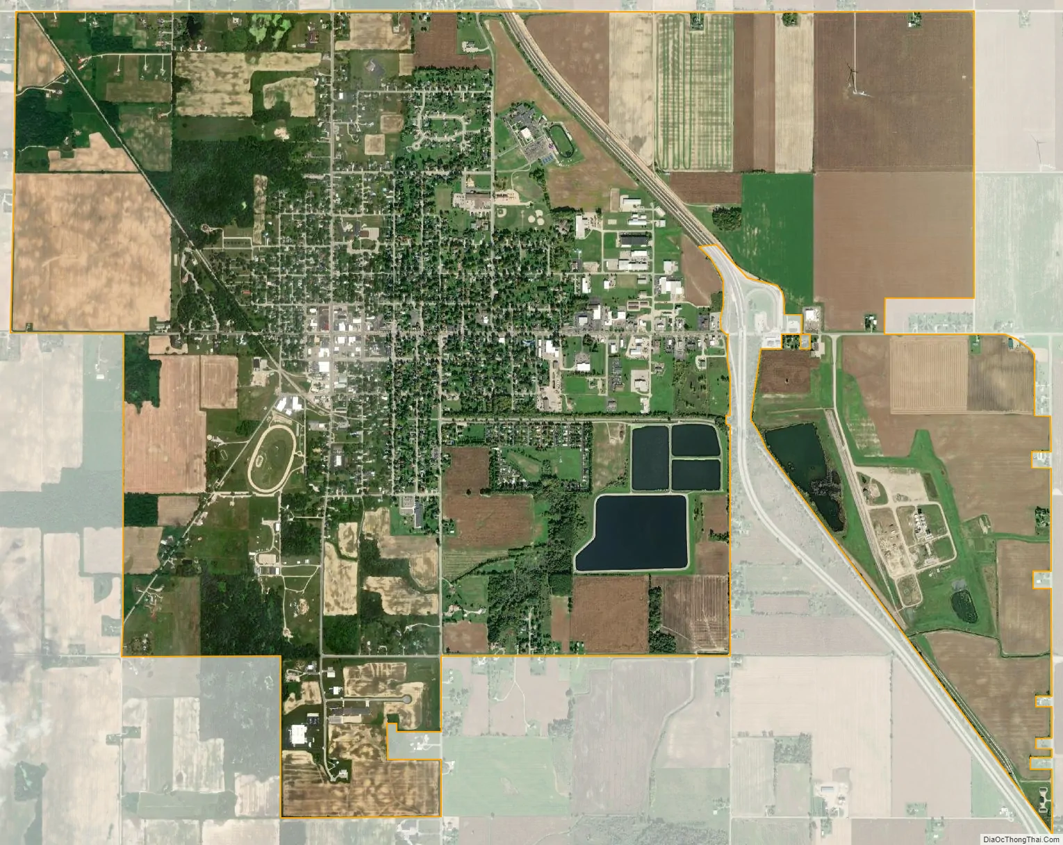
Ithaca city Satellite Map
Geography
According to the United States Census Bureau, the city has a total area of 5.28 square miles (13.68 km), of which 5.23 square miles (13.55 km) is land and 0.05 square miles (0.13 km) is water.
See also
Map of Michigan State and its subdivision:- Alcona
- Alger
- Allegan
- Alpena
- Antrim
- Arenac
- Baraga
- Barry
- Bay
- Benzie
- Berrien
- Branch
- Calhoun
- Cass
- Charlevoix
- Cheboygan
- Chippewa
- Clare
- Clinton
- Crawford
- Delta
- Dickinson
- Eaton
- Emmet
- Genesee
- Gladwin
- Gogebic
- Grand Traverse
- Gratiot
- Hillsdale
- Houghton
- Huron
- Ingham
- Ionia
- Iosco
- Iron
- Isabella
- Jackson
- Kalamazoo
- Kalkaska
- Kent
- Keweenaw
- Lake
- Lake Hurron
- Lake Michigan
- Lake St. Clair
- Lake Superior
- Lapeer
- Leelanau
- Lenawee
- Livingston
- Luce
- Mackinac
- Macomb
- Manistee
- Marquette
- Mason
- Mecosta
- Menominee
- Midland
- Missaukee
- Monroe
- Montcalm
- Montmorency
- Muskegon
- Newaygo
- Oakland
- Oceana
- Ogemaw
- Ontonagon
- Osceola
- Oscoda
- Otsego
- Ottawa
- Presque Isle
- Roscommon
- Saginaw
- Saint Clair
- Saint Joseph
- Sanilac
- Schoolcraft
- Shiawassee
- Tuscola
- Van Buren
- Washtenaw
- Wayne
- Wexford
- Alabama
- Alaska
- Arizona
- Arkansas
- California
- Colorado
- Connecticut
- Delaware
- District of Columbia
- Florida
- Georgia
- Hawaii
- Idaho
- Illinois
- Indiana
- Iowa
- Kansas
- Kentucky
- Louisiana
- Maine
- Maryland
- Massachusetts
- Michigan
- Minnesota
- Mississippi
- Missouri
- Montana
- Nebraska
- Nevada
- New Hampshire
- New Jersey
- New Mexico
- New York
- North Carolina
- North Dakota
- Ohio
- Oklahoma
- Oregon
- Pennsylvania
- Rhode Island
- South Carolina
- South Dakota
- Tennessee
- Texas
- Utah
- Vermont
- Virginia
- Washington
- West Virginia
- Wisconsin
- Wyoming