Adrian is a city in Nobles County, Minnesota, United States. The population was 1,209 at the 2010 census.
| Name: | Adrian city |
|---|---|
| LSAD Code: | 25 |
| LSAD Description: | city (suffix) |
| State: | Minnesota |
| County: | Nobles County |
| Elevation: | 1,562 ft (476 m) |
| Total Area: | 1.17 sq mi (3.03 km²) |
| Land Area: | 1.17 sq mi (3.03 km²) |
| Water Area: | 0.00 sq mi (0.00 km²) |
| Total Population: | 1,194 |
| Population Density: | 1,021.39/sq mi (394.47/km²) |
| ZIP code: | 56110 |
| Area code: | 507 |
| FIPS code: | 2700262 |
| GNISfeature ID: | 0639217 |
| Website: | www.adrian.govoffice2.com |
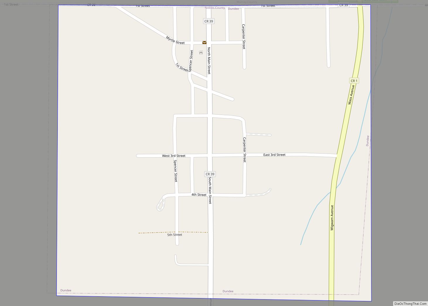
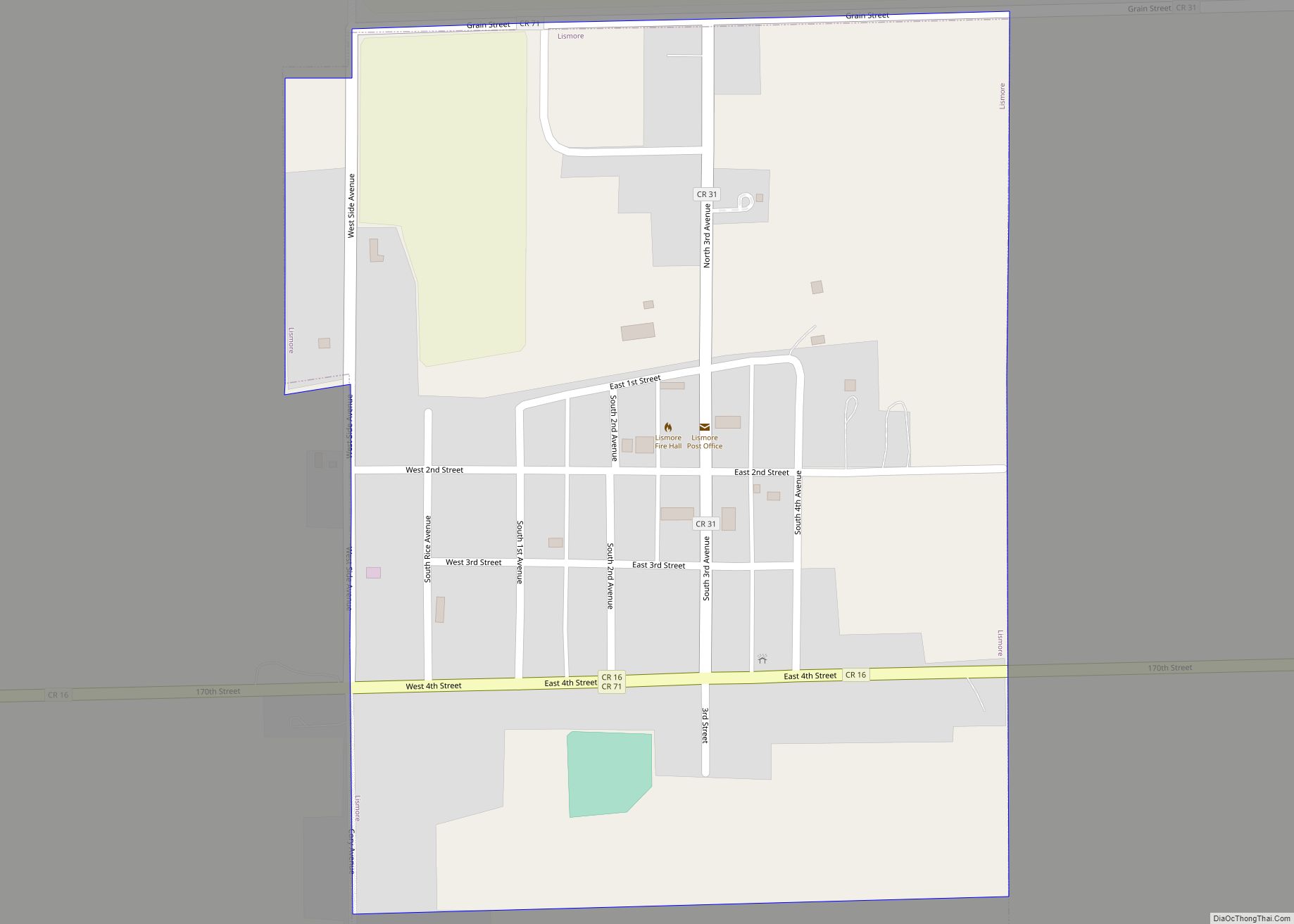
Online Interactive Map
Click on ![]() to view map in "full screen" mode.
to view map in "full screen" mode.
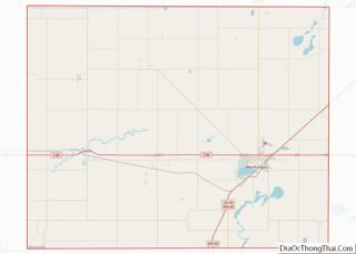
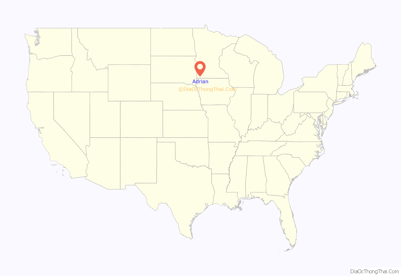
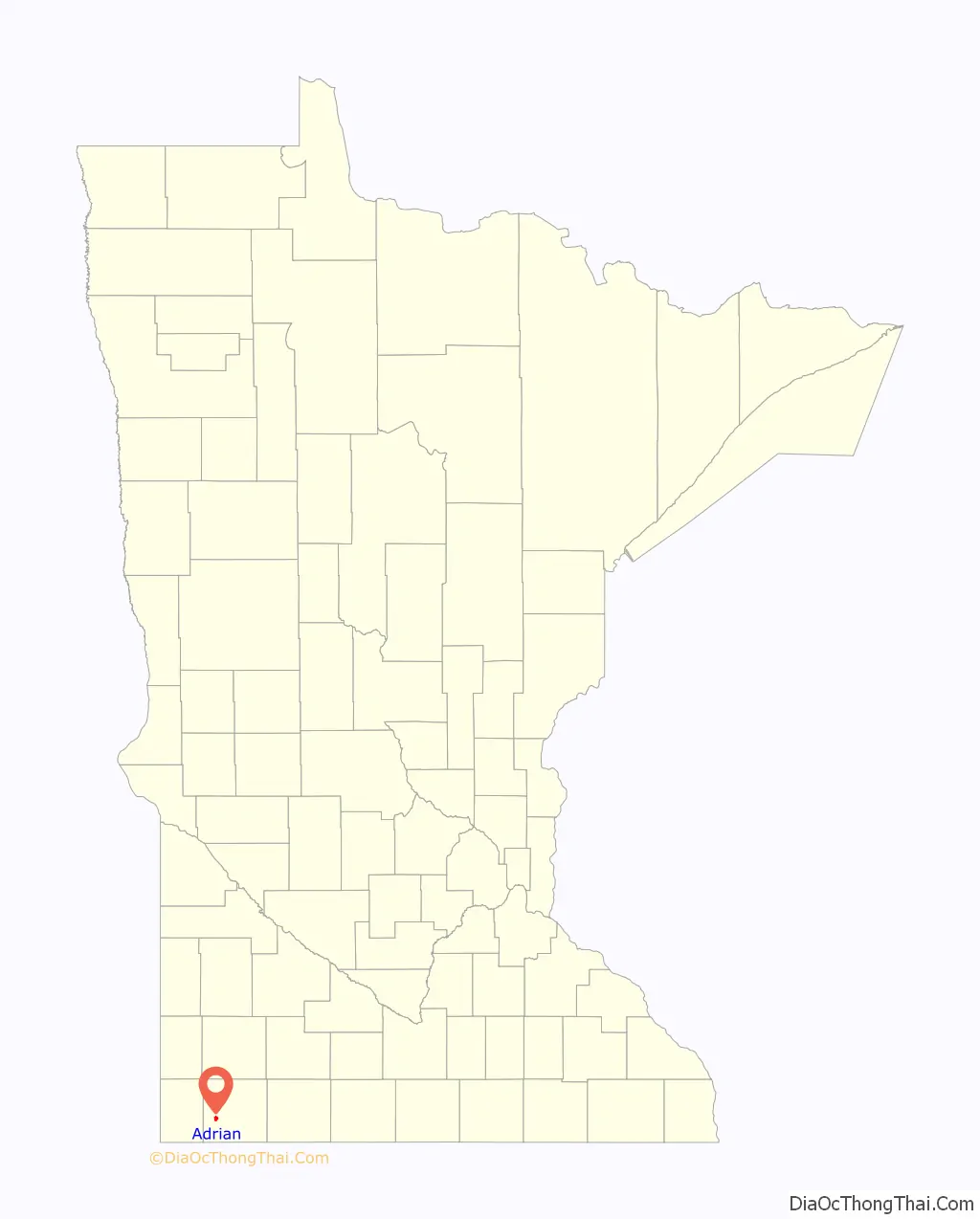
Adrian location map. Where is Adrian city?
History
Adrian owes its birth to the St. Paul and Dakota Railroad Company, a branch of the Sioux City and St. Paul Railroad. Railroad employee O.D. Brown surveyed a 16-block town site in May 1876 and track-laying crews arrived in August of that same year. A city plat was dedicated on August 28 and filed on October 4.
Name
Railroad company history states that the city was named after Adrian Iselin, a large stockholder in the Sioux City and St. Paul Railroad. A copy of a portrait of Iselin’s wife, painted by John Singer Sargent, has been displayed for years in Adrian City Hall.
Railroad era
Adrian’s early development was largely fostered by the efforts of John Ireland, bishop of the St. Paul Roman Catholic Diocese. Through the Catholic press, he encouraged Catholics from eastern cities to come to Minnesota, and he used his personal wealth to buy land near Adrian to sell to the new arrivals. In 1877, he bought 20,000 acres (81 km) of land; seven months later he made an additional purchase of 35,000 acres (140 km).
In 1877, 100,000 bushels of grain were shipped from the Adrian station, and the town population totaled 193 people as of 1880. By 1882 the local parish reported 250 Catholic families living in the area. The town population increased to 671 in 1890 and 1,258 in 1900. Growth slowed thereafter, as some of Adrian’s rail trade had shifted to the towns of Ellsworth, Lismore and Wilmont. In 1893, Adrian tried but failed to split Nobles County into two parts in order to become a county seat.
St. Adrian Catholic Church
The first St. Adrian Catholic Church was established in 1877. The building burned to the ground Christmas Eve, 1899. The young town responded by building the current church, which was completed in 1901. St. Adrian Church is on the National Register of Historic Places along with the Hotel Slade.
Interstate highway era
At 2:00 p.m., November 4, 1967, the section of Interstate Highway 90 passing Adrian officially opened to traffic. The previously used highway, U.S. Highway 16, passed directly through town. The by-passing of all east/west traffic forever sealed the character of Adrian as a small town.
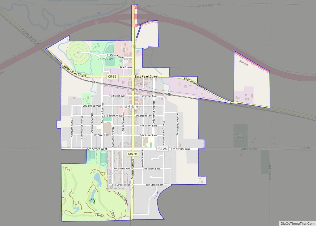
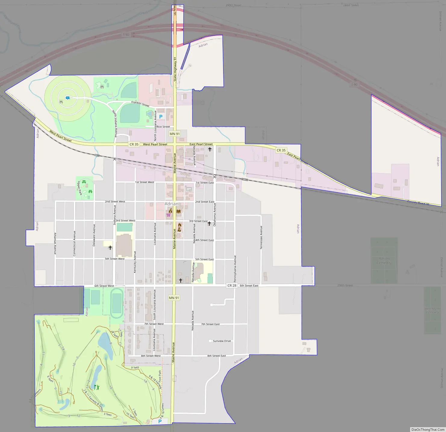
Adrian Road Map
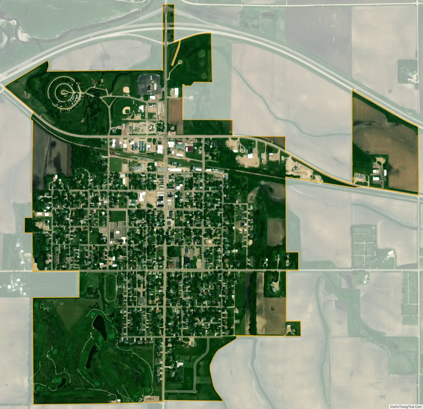
Adrian city Satellite Map
Geography
According to the United States Census Bureau, the city has a total area of 1.11 square miles (2.87 km), all land.
Main highways include:
- Interstate 90
- Minnesota State Highway 91
- Nobles County Road 35
See also
Map of Minnesota State and its subdivision:- Aitkin
- Anoka
- Becker
- Beltrami
- Benton
- Big Stone
- Blue Earth
- Brown
- Carlton
- Carver
- Cass
- Chippewa
- Chisago
- Clay
- Clearwater
- Cook
- Cottonwood
- Crow Wing
- Dakota
- Dodge
- Douglas
- Faribault
- Fillmore
- Freeborn
- Goodhue
- Grant
- Hennepin
- Houston
- Hubbard
- Isanti
- Itasca
- Jackson
- Kanabec
- Kandiyohi
- Kittson
- Koochiching
- Lac qui Parle
- Lake
- Lake of the Woods
- Lake Superior
- Le Sueur
- Lincoln
- Lyon
- Mahnomen
- Marshall
- Martin
- McLeod
- Meeker
- Mille Lacs
- Morrison
- Mower
- Murray
- Nicollet
- Nobles
- Norman
- Olmsted
- Otter Tail
- Pennington
- Pine
- Pipestone
- Polk
- Pope
- Ramsey
- Red Lake
- Redwood
- Renville
- Rice
- Rock
- Roseau
- Saint Louis
- Scott
- Sherburne
- Sibley
- Stearns
- Steele
- Stevens
- Swift
- Todd
- Traverse
- Wabasha
- Wadena
- Waseca
- Washington
- Watonwan
- Wilkin
- Winona
- Wright
- Yellow Medicine
- Alabama
- Alaska
- Arizona
- Arkansas
- California
- Colorado
- Connecticut
- Delaware
- District of Columbia
- Florida
- Georgia
- Hawaii
- Idaho
- Illinois
- Indiana
- Iowa
- Kansas
- Kentucky
- Louisiana
- Maine
- Maryland
- Massachusetts
- Michigan
- Minnesota
- Mississippi
- Missouri
- Montana
- Nebraska
- Nevada
- New Hampshire
- New Jersey
- New Mexico
- New York
- North Carolina
- North Dakota
- Ohio
- Oklahoma
- Oregon
- Pennsylvania
- Rhode Island
- South Carolina
- South Dakota
- Tennessee
- Texas
- Utah
- Vermont
- Virginia
- Washington
- West Virginia
- Wisconsin
- Wyoming