Duluth (/dəˈluːθ/ (listen) də-LOOTH) is a port city in the U.S. state of Minnesota and the county seat of St. Louis County. Located on Lake Superior in Minnesota’s Arrowhead Region, the city is a hub for cargo shipping. Commodities shipped from the Port of Duluth include coal, iron ore, grain, limestone, cement, salt, wood pulp, steel coil, and wind turbine components. Duluth is south of the Iron Range and the Boundary Waters Canoe Area Wilderness.
Duluth is named after Daniel Greysolon, Sieur du Lhut, the area’s first known European explorer. The population was 86,697 at the 2020 census, making it Minnesota’s fifth-largest city. Duluth forms a metropolitan area with neighboring Superior, Wisconsin. The two cities are commonly called the Twin Ports.
Situated on the north shore of Lake Superior at the westernmost point of the Great Lakes, Duluth is the largest metropolitan area, the second-largest city and the largest U.S. city on the lake, and is accessible to the Atlantic Ocean 2,300 miles (3,700 km) away via the Great Lakes Waterway and St. Lawrence Seaway. The Port of Duluth is the world’s farthest inland port accessible to oceangoing ships, and by far the largest and busiest port on the Great Lakes. The port is among the top 20 U.S. ports by tonnage.
A tourist destination for the Midwest, Duluth has the nation’s only all-freshwater aquarium, the Great Lakes Aquarium; the Aerial Lift Bridge, which is adjacent to Canal Park and spans the Duluth Ship Canal into the Duluth–Superior harbor; and Minnesota Point (known locally as Park Point), the world’s longest freshwater baymouth bar, spanning 6 miles (10 km). The city is also the starting point for vehicle trips touring the North Shore of Lake Superior toward Thunder Bay, Ontario, Canada.
| Name: | Duluth city |
|---|---|
| LSAD Code: | 25 |
| LSAD Description: | city (suffix) |
| State: | Minnesota |
| County: | St. Louis County |
| Incorporated: | 1857 |
| Elevation: | 705 ft (215 m) |
| Land Area: | 71.66 sq mi (185.59 km²) |
| Water Area: | 8.50 sq mi (22.02 km²) 22.46% |
| Population Density: | 1,209.91/sq mi (467.15/km²) |
| ZIP code: | 55801 – 55808, 55810 – 55812 |
| Area code: | 218 |
| FIPS code: | 2717000 |
| GNISfeature ID: | 661145 |
| Website: | duluthmn.gov |
Online Interactive Map
Click on ![]() to view map in "full screen" mode.
to view map in "full screen" mode.
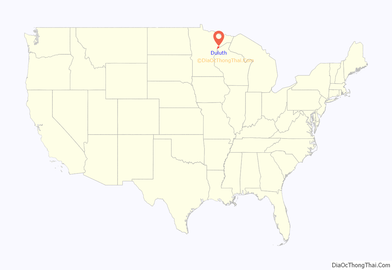
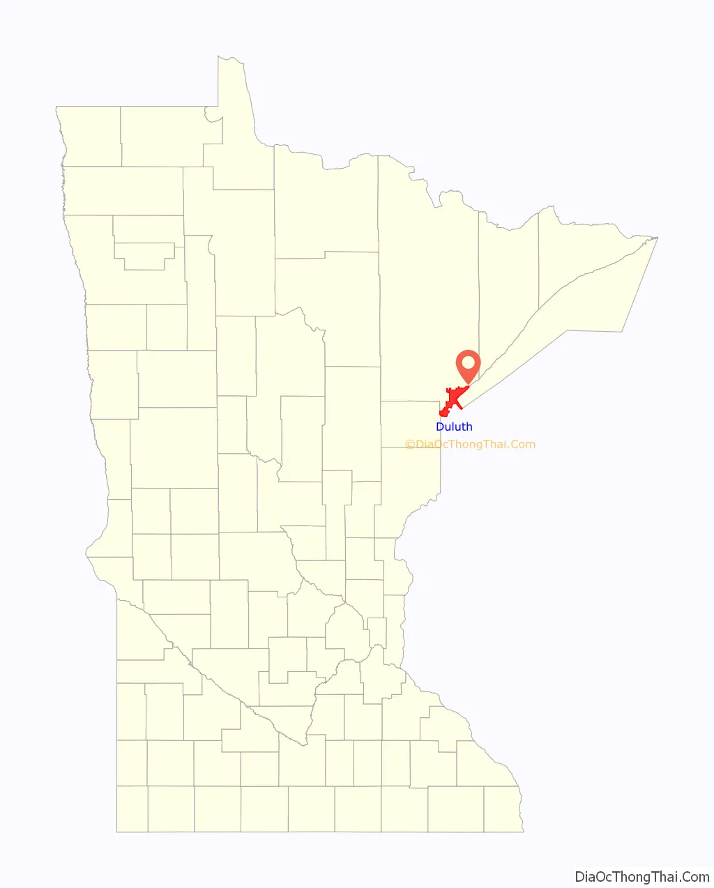
Duluth location map. Where is Duluth city?
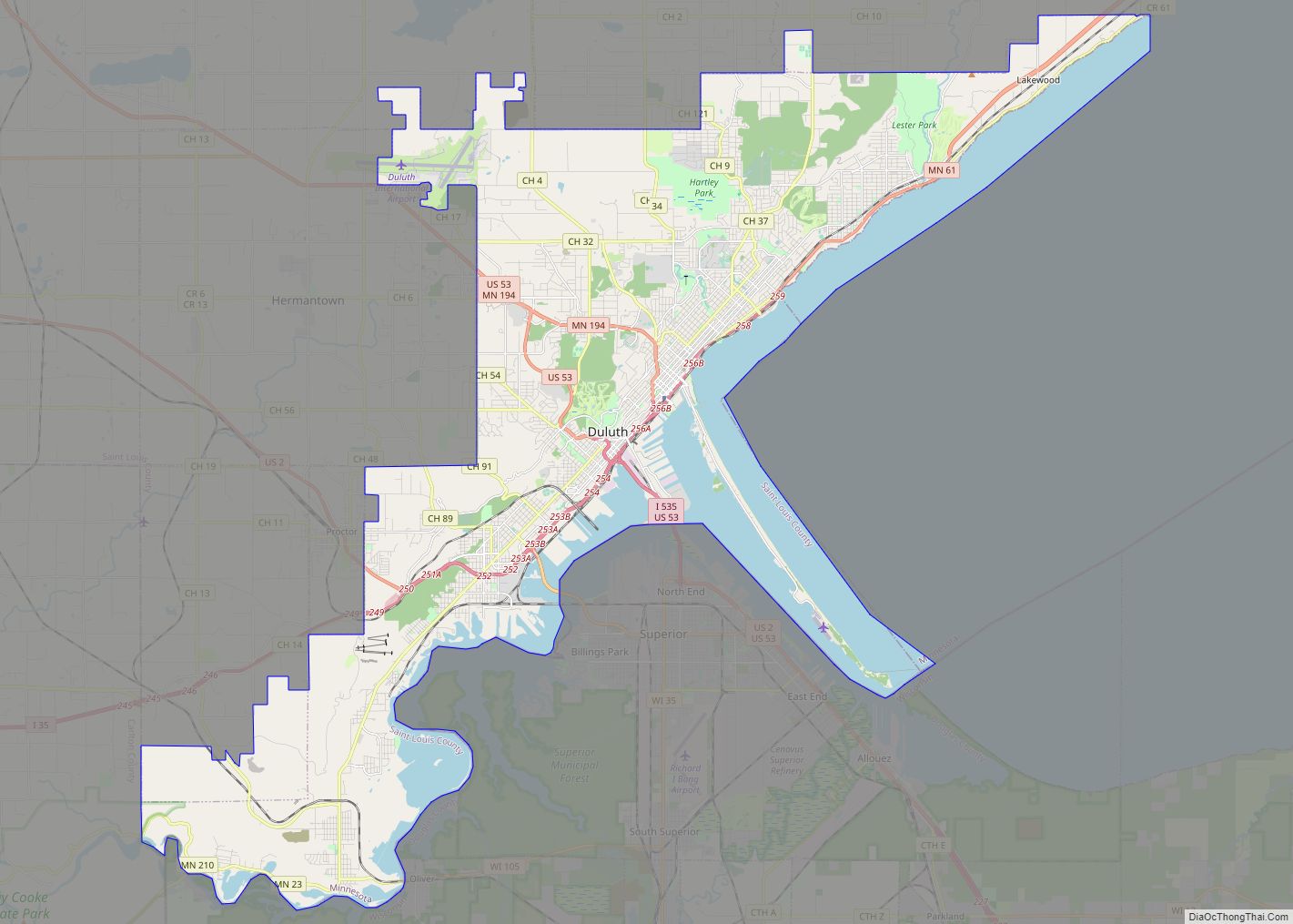
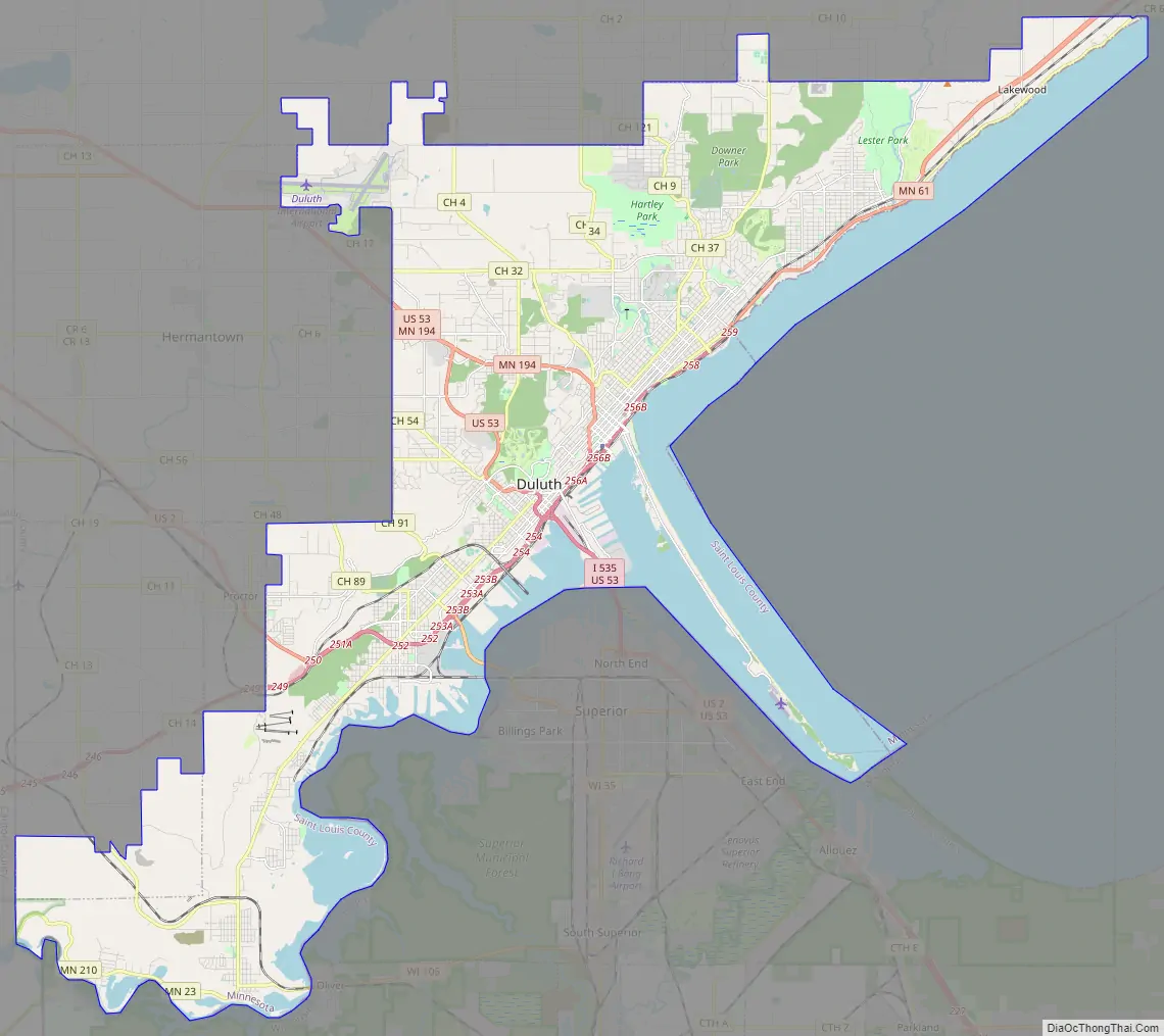
Duluth Road Map
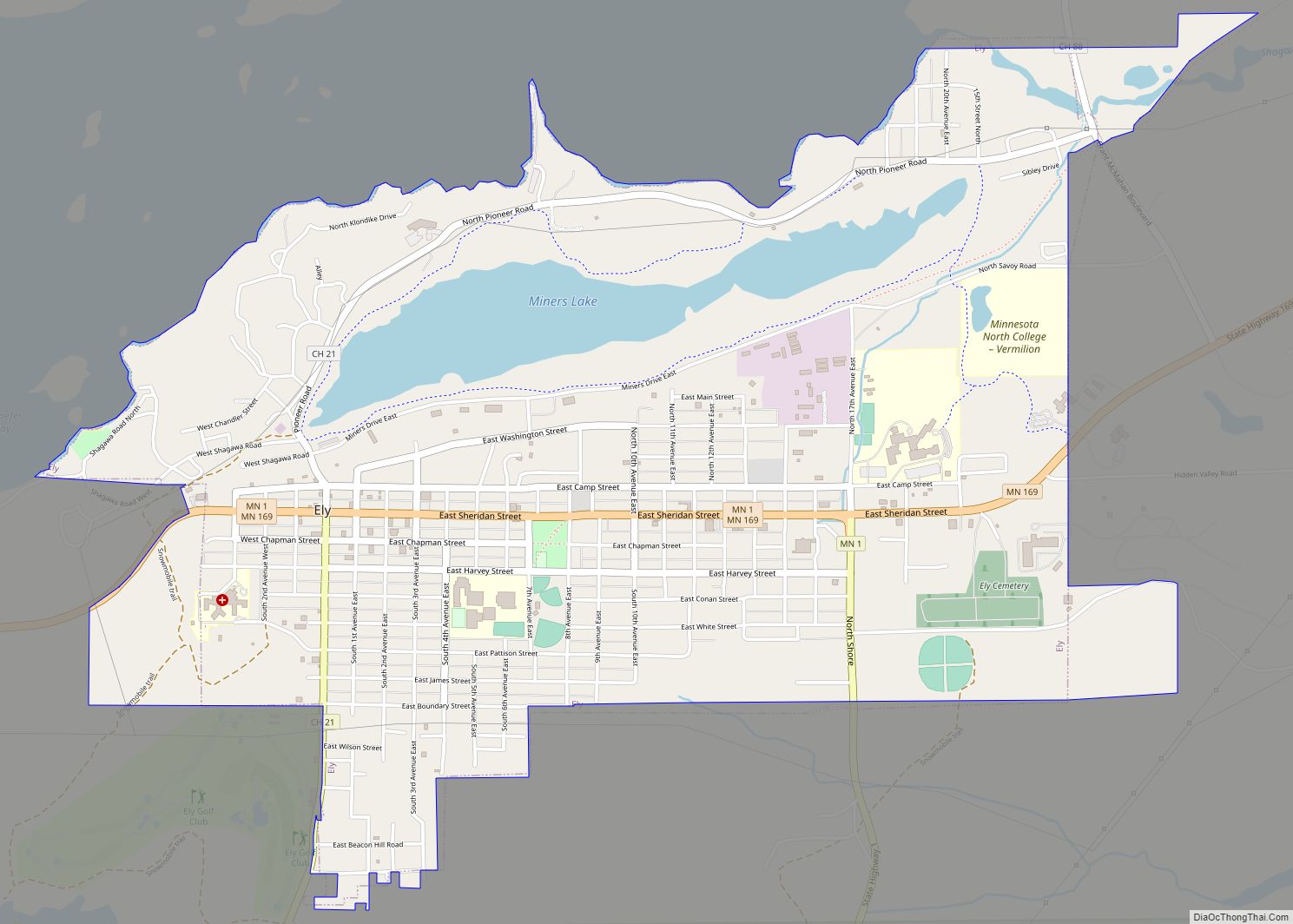
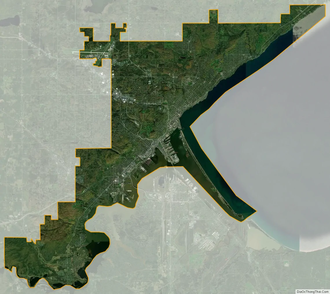
Duluth city Satellite Map
Geography
According to the United States Census Bureau, the city has a total area of 87.43 square miles (226.44 km); 67.79 square miles (175.58 km) is land and 19.64 square miles (50.87 km) is water. It is Minnesota’s second-largest city by land area, surpassed only by Hibbing. Duluth’s canal connects Lake Superior to the Duluth–Superior harbor and the Saint Louis River. It is spanned by the Aerial Lift Bridge, which connects Canal Park with Minnesota Point (or “Park Point”). Minnesota Point is about 7 miles (11 km) long, and when included with adjacent Wisconsin Point, which extends 3 miles (4.8 km) from the city of Superior, Wisconsin, is the largest freshwater baymouth bar in the world at a total of 10 miles (16 km).
Duluth’s topography is dominated by a steep hillside that climbs from Lake Superior to high inland elevations. Duluth has been called “the San Francisco of the Midwest,” alluding to San Francisco‘s similar water-to-hilltop topography. This similarity was most evident before World War II, when Duluth had a network of streetcars and an inclined railroad, the 7th Avenue West Incline Railway, that, like San Francisco’s cable cars, climbed a steep hill. The change in elevation is illustrated by Duluth’s two airports. The weather station at the lakeside Sky Harbor Airport on Minnesota Point has an elevation of 607 feet (185 m), while Duluth International Airport, atop the hill, is 820 feet (250 m) higher at 1,427 feet (435 m).
Even as the city has grown, its populace has tended to hug Lake Superior’s shoreline, so Duluth is primarily a southwest–northeast city. The considerable development on the hill has given Duluth many steep streets. Some neighborhoods, such as Piedmont Heights and Bayview Heights, are atop the hill with scenic views of the city. Skyline Parkway is a scenic roadway that extends from Becks Road above the Gary – New Duluth neighborhood near the western end of the city to the Lester Park neighborhood on the east side. It crosses nearly Duluth’s entire length and affords views of Lake Superior, the Aerial Lift Bridge, Canal Park, and the many industries that inhabit the largest inland port.
A developing part of the city is the Miller Hill Mall area and the adjacent big-box retailer shopping strips “over the hill” along the Miller Trunk Highway corridor. The 2009–10 road reconstruction project in Duluth’s Miller Hill area improved movement through the U.S. Highway 53 corridor from Trinity Road to Maple Grove Road. The highway project reconstructed connector roads, intersections, and adjacent roadways. A new international airport terminal was completed in 2013 as part of the federal government’s Stimulus Reconstruction Program.
Geological history
The geology of Duluth demonstrates the Midcontinent Rift, formed as the North American continent began to split apart about 1.1 billion years ago. As the earth’s crust thinned, magma rose toward the surface. These intrusions formed a 16 km (9.9 mi)-thick sill, primarily of gabbro, which is known as the Duluth Complex. An intrusion of the Duluth Complex can be seen at Enger Tower, which is built on a knob of exposed gabbro.
The lava flows formed the conditions for the creation of Lake Superior agates. As the lava solidified, gas trapped within the flows formed an amygdaloidal texture (literally, rock filled with small vesicles). Later, groundwater transported dissolved minerals through the vesicles depositing concentric bands of fine-grained quartz called chalcedony. The color scheme is caused by the concentration of iron present in the groundwater at the time that each new layer was being deposited. The process went on until the cavity had been completely filled. Over time erosion freed the agates from the solidified lava, which is not as hard as quartz. Lake Superior agates are the Minnesota gemstone.
The creation of the Lake Superior basin reflects the erosive power of continental glaciers that advanced and retreated over Minnesota several times in the past 2 million years. The mile-thick ice sheets easily eroded the sandstone that filled the axis of the rift valley but encountered more resistance from the igneous rocks forming the flanks of the rift, now the margins of the lake basin. As the last glacier retreated, meltwaters filled the lake to as high as 500 feet (150 m) above the current level; the Skyline Parkway roughly follows one of the highest levels of the ancient Lake Superior, Glacial Lake Duluth. The sandstone that buried the igneous rocks of the rift is exposed near Fond du Lac. At one time a large number of quarries produced the stone, sold as Fond du Lac or Lake Superior brownstone. It was widely used in Duluth buildings and also shipped to Minneapolis, Chicago, and Milwaukee, where it was also used extensively. The weathered sandstone forms the sandy lake bottom and shores of Park Point.
Climate
Duluth has a humid continental climate (Köppen Dfb), slightly moderated by its proximity to Lake Superior. Winters are long, snowy, and very cold, normally seeing maximum temperatures remaining at or below 32 °F (0 °C) on 100 days (the second-most of any city in the contiguous US behind International Falls), falling to or below 0 °F (−18 °C) on 38 nights and bringing consistent snow cover from late November to early April. Winter storms that pass south or east of Duluth can often set up easterly or northeasterly flow, which leads to occasional upslope lake-effect snow events that bring 1 foot (30 cm) or more of snow to the city while areas 50 miles (80 km) inland receive considerably less. The average annual snowfall is 90.2 inches (2,290 mm). The lake steams in the winter when moist, lake-warmed air at the surface rises and cools, losing some of its moisture-carrying capacity.
Duluth has been called “The Air-Conditioned City” because of the summertime cooling effect of Lake Superior. Using data on the minimum monthly temperature between 1981 and 2010, the National Oceanic and Atmospheric Administration developed a Comparative Climatic Data report. With a minimum average monthly low temperature of 1.5 °F (−16.9 °C) and a maximum average monthly low temperature of 55.4 °F (13.0 °C), Duluth was found to be the fifth-coldest city in the United States.
Summers are warm, although nights are generally cool, with daytime temperatures averaging 78 °F (26 °C) in July, with that figure being a few degrees warmer inland. Temperatures reach or exceed 90 °F (32 °C) on average, only two days per year, while the city has officially seen 100 °F (38 °C) temperatures on only three days, all during the July 1936 heat wave, part of the Dust Bowl years. The phrase “cooler by the lake” can be heard often in weather forecasts during the summer, especially on days when an easterly wind is expected. Great local variations are also common because of the rapid change in elevation between the nearly 900-foot (270 m) hilltop and shoreside. Often this variation manifests itself as snow in higher elevations while rain falls near Lake Superior.
The record low temperature in Duluth is −41 °F (−41 °C), set on January 2, 1885, and the record high temperature is 106 °F (41 °C), set on July 13, 1936. On average, the first freezing temperature occurs on September 30, and the last on May 14, although a freezing temperature has occurred in August; the average window for measurable (≥0.1 in or 0.25 cm) snowfall is October 22 through April 26.
2012 flooding
From June 19–20, 2012, Duluth suffered the worst flood in its history, caused by nine inches (230 mm) of rain throughout the course of thirty hours. Combined with its rocky sediments, hard soil and 43 streams and creeks, the city could not handle the massive rainfall. Mayor Don Ness declared a state of emergency, asking for national assistance. Minnesota Governor Mark Dayton declared a state of emergency, sending the National Guard and the Red Cross to assist in the relief efforts. Several sinkholes opened throughout the city, causing massive property damage. Several feet of standing water accumulated in many city alleys and parking lots. Streets were turned into rapids and many roads split apart due to the heavy flow of water. A portion of West Skyline Parkway tumbled down the hill, isolating a neighborhood. The Saint Louis River, in Duluth’s Fond du Lac neighborhood, flooded Highway 23, isolating that neighborhood as well, and damaging roadways and bridges.
The Lake Superior Zoo flooded in the early hours of June 20; 11 barnyard animals drowned, as did a turkey vulture, a raven and a snowy owl. The rising waters enabled a polar bear to escape her exhibit, though she was quickly found on zoo grounds, tranquilized and moved to safety. Two harbor seals escaped the zoo grounds but were later found on Grand Avenue. All three animals were moved to Como Park Zoo in Saint Paul for a temporary, but indeterminate, amount of time. The polar bear was transferred to the Kansas City Zoo in late 2012 as part of the American Zoological Association’s (AZA) Species Survival Program breeding recommendation.
2012 tornado
Tornadoes are uncommon in Duluth, considering its latitude and location next to the climate-moderating Lake Superior. However, on August 9, 2012, at around 11 AM, a tornado touched down on Minnesota Point. It had originally started as a waterspout in Superior Bay, two miles (3.2 km) from Sky Harbor Airport, but briefly found its way onto the sandbar’s shoreline, making it a true tornado. It quickly dissipated, but soon touched down again on Superior’s Barker’s Island, where it again quickly dissipated. It caused no serious damage; the tornado was categorized as an EF0 on the Enhanced Fujita Scale. At the time the National Weather Service reported that it was Duluth’s first tornado. Further investigation showed that more than 60 years ago, on May 26, 1958, Duluth had a “miniature tornado” that collapsed a garage and damaged two area lake cabins. It lasted only five minutes. The News-Tribune reported a possible twister on July 11, 1935: “Swirling into the city on the wings of a torrential rain, a miniature tornado struck in the heart of the Gary-New Duluth district shortly before 8 a.m. yesterday, flattening a row of coal sheds (and) a frame garage and causing general damage to trees in the vicinity. The United States weather bureau had no means of officially recording the twister, the high wind having limited itself to the Gary-New Duluth district.”
See also
Map of Minnesota State and its subdivision:- Aitkin
- Anoka
- Becker
- Beltrami
- Benton
- Big Stone
- Blue Earth
- Brown
- Carlton
- Carver
- Cass
- Chippewa
- Chisago
- Clay
- Clearwater
- Cook
- Cottonwood
- Crow Wing
- Dakota
- Dodge
- Douglas
- Faribault
- Fillmore
- Freeborn
- Goodhue
- Grant
- Hennepin
- Houston
- Hubbard
- Isanti
- Itasca
- Jackson
- Kanabec
- Kandiyohi
- Kittson
- Koochiching
- Lac qui Parle
- Lake
- Lake of the Woods
- Lake Superior
- Le Sueur
- Lincoln
- Lyon
- Mahnomen
- Marshall
- Martin
- McLeod
- Meeker
- Mille Lacs
- Morrison
- Mower
- Murray
- Nicollet
- Nobles
- Norman
- Olmsted
- Otter Tail
- Pennington
- Pine
- Pipestone
- Polk
- Pope
- Ramsey
- Red Lake
- Redwood
- Renville
- Rice
- Rock
- Roseau
- Saint Louis
- Scott
- Sherburne
- Sibley
- Stearns
- Steele
- Stevens
- Swift
- Todd
- Traverse
- Wabasha
- Wadena
- Waseca
- Washington
- Watonwan
- Wilkin
- Winona
- Wright
- Yellow Medicine
- Alabama
- Alaska
- Arizona
- Arkansas
- California
- Colorado
- Connecticut
- Delaware
- District of Columbia
- Florida
- Georgia
- Hawaii
- Idaho
- Illinois
- Indiana
- Iowa
- Kansas
- Kentucky
- Louisiana
- Maine
- Maryland
- Massachusetts
- Michigan
- Minnesota
- Mississippi
- Missouri
- Montana
- Nebraska
- Nevada
- New Hampshire
- New Jersey
- New Mexico
- New York
- North Carolina
- North Dakota
- Ohio
- Oklahoma
- Oregon
- Pennsylvania
- Rhode Island
- South Carolina
- South Dakota
- Tennessee
- Texas
- Utah
- Vermont
- Virginia
- Washington
- West Virginia
- Wisconsin
- Wyoming