Map of Lamont CDP, Florida
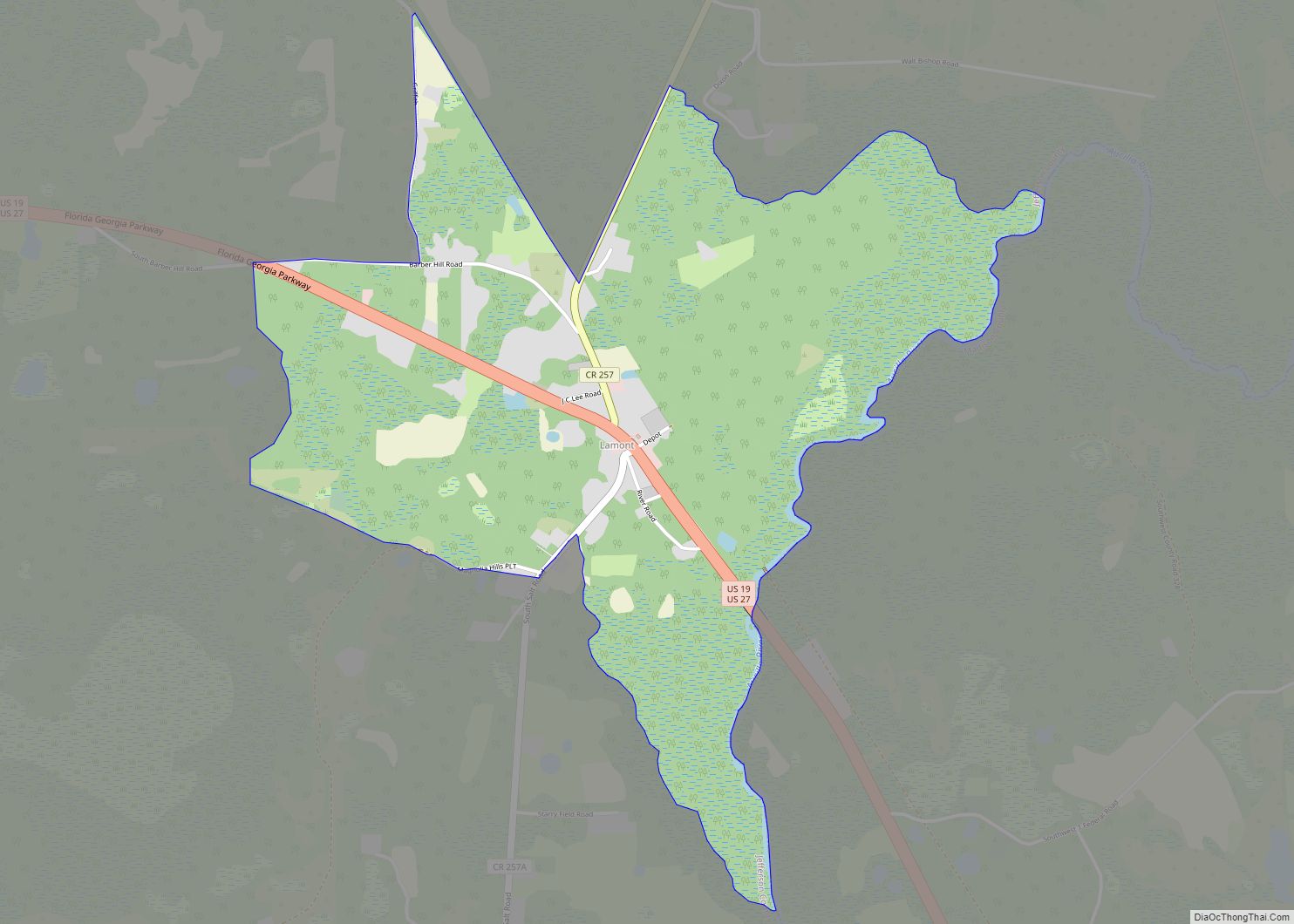
Lamont is an unincorporated community and census-designated place (CDP) in Jefferson County, Florida, United States. As of the 2020 census,the population was 170. Lamont CDP overview: Name: Lamont CDP LSAD Code: 57 LSAD Description: CDP (suffix) State: Florida County: Jefferson County Elevation: 66 ft (20 m) Total Area: 2.35 sq mi (6.08 km²) Land Area: 2.35 sq mi (6.08 km²) Water Area: 0.00 sq mi ... Read more
Map of Lamont CDP, Florida
Map of Lakewood Park CDP, Florida
Lakewood Park is a Census-designated place in St. Lucie County, Florida, United States. The population was 11,323 at the 2010 census. It is part of the Port St. Lucie Metropolitan Statistical Area. Lakewood Park CDP overview: Name: Lakewood Park CDP LSAD Code: 57 LSAD Description: CDP (suffix) State: Florida County: St. Lucie County Elevation: 20 ft ... Read more
Map of Lakewood Park CDP, Florida
Map of Lauderdale-by-the-Sea town
Lauderdale-by-the-Sea is a town in Broward County, Florida, United States, situated 33 miles north of Miami. As of the 2020 census, the population was 6,198. It is part of the Miami–Fort Lauderdale–West Palm Beach Metropolitan Statistical Area, which was home to 5,564,635 people at the 2010 census. Lauderdale-by-the-Sea town overview: Name: Lauderdale-by-the-Sea town LSAD Code: ... Read more
Map of Lauderdale-by-the-Sea town
Map of Largo city, Florida
Largo is the third largest city in Pinellas County, Florida, United States, as well as the fourth largest in the Tampa Bay area. As of the 2020 Census, the city had a population of 82,500, up from 69,371 in 2000. Largo was first incorporated in 1905. In 1913, it became the first municipality in Pinellas ... Read more
Map of Largo city, Florida
Map of Lantana town, Florida
Lantana is a town in Palm Beach County, Florida, United States. It is 37 miles north from Fort Lauderdale. This town is part of the Miami metropolitan area. The population was 10,423 at the 2010 United States Census. Lantana town overview: Name: Lantana town LSAD Code: 43 LSAD Description: town (suffix) State: Florida County: Palm ... Read more
Map of Lantana town, Florida
Map of Laurel Hill city, Florida
Laurel Hill is a city in Okaloosa County, Florida, United States. The population was 537 at the 2010 census. It is part of the Fort Walton Beach–Crestview–Destin Metropolitan Statistical Area. Laurel Hill city overview: Name: Laurel Hill city LSAD Code: 25 LSAD Description: city (suffix) State: Florida County: Okaloosa County Elevation: 282 ft (86 m) Total Area: ... Read more
Map of Laurel Hill city, Florida
Map of Lauderhill city
Lauderhill, officially the City of Lauderhill, is a city in Broward County, Florida, United States. As of the 2020 census, the city’s population was 74,482. It is a principal city of the Miami metropolitan area, which was home to an estimated 6,012,331 people in 2015. Lauderhill city overview: Name: Lauderhill city LSAD Code: 25 LSAD ... Read more
Map of Lauderhill city
Map of Lauderdale Lakes city, Florida
Lauderdale Lakes, officially the City of Lauderdale Lakes, is a city in Broward County, Florida, United States. As of the 2020 United States Census, the city’s population was 35,954. It is part of the Miami–Fort Lauderdale–West Palm Beach Metropolitan Statistical Area, which is home to 5,564,635 people. Lauderdale Lakes city overview: Name: Lauderdale Lakes city ... Read more
Map of Lauderdale Lakes city, Florida
Map of Layton city, Florida
Layton is a city on the island of Long Key in Monroe County, Florida, United States. The population was 210 at the 2020 census. Layton city overview: Name: Layton city LSAD Code: 25 LSAD Description: city (suffix) State: Florida County: Monroe County Elevation: 3 ft (0.9 m) Total Area: 0.22 sq mi (0.58 km²) Land Area: 0.16 sq mi (0.42 km²) Water Area: ... Read more
Map of Layton city, Florida
Map of Lawtey city
Lawtey is a city in Bradford County, Florida, United States. The population was 730 at the 2010 census, up from 656 in 2000. The city has received national attention and earned the dubious distinction of being one of only two official speed traps designated by the American Automobile Association (the other being Waldo a few ... Read more
Map of Lawtey city
Map of Laurel CDP, Florida
Laurel is a census-designated place (CDP) in Sarasota County, Florida, United States. The population was 12,186 as of 2020 census. Laurel is part of the North Port–Sarasota–Bradenton Metropolitan Statistical Area. Laurel CDP overview: Name: Laurel CDP LSAD Code: 57 LSAD Description: CDP (suffix) State: Florida County: Sarasota County Elevation: 10 ft (3 m) Total Area: 10.18 sq mi (26.38 km²) Land ... Read more
Map of Laurel CDP, Florida
Map of Lecanto CDP
Lecanto is an unincorporated community and census-designated place (CDP) in Citrus County, Florida, United States. As of the 2010 census it had a population of 5,882, up from 5,161 in 2000. It is home to several county government facilities such as the Citrus County Sheriff’s Office and the Citrus Campus of the College of Central ... Read more
Map of Lecanto CDP