Lauderhill, officially the City of Lauderhill, is a city in Broward County, Florida, United States. As of the 2020 census, the city’s population was 74,482. It is a principal city of the Miami metropolitan area, which was home to an estimated 6,012,331 people in 2015.
| Name: | Lauderhill city |
|---|---|
| LSAD Code: | 25 |
| LSAD Description: | city (suffix) |
| State: | Florida |
| County: | Broward County |
| Incorporated: | June 20, 1959 |
| Elevation: | 9 ft (3 m) |
| Land Area: | 8.52 sq mi (22.06 km²) |
| Water Area: | 0.05 sq mi (0.13 km²) |
| Population Density: | 8,746.12/sq mi (3,377.10/km²) |
| Area code: | 954, 754 |
| FIPS code: | 1239550 |
| GNISfeature ID: | 0285368 |
| Website: | www.Lauderhill-FL.gov |
Online Interactive Map
Click on ![]() to view map in "full screen" mode.
to view map in "full screen" mode.
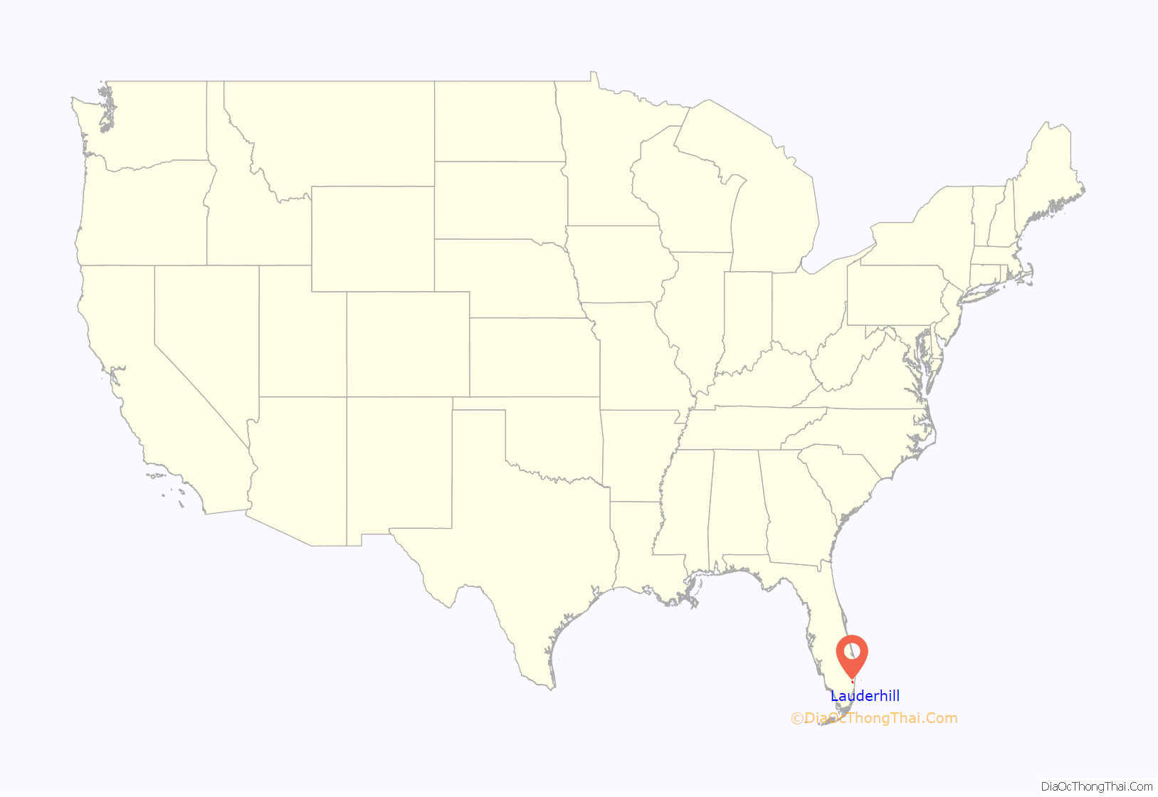
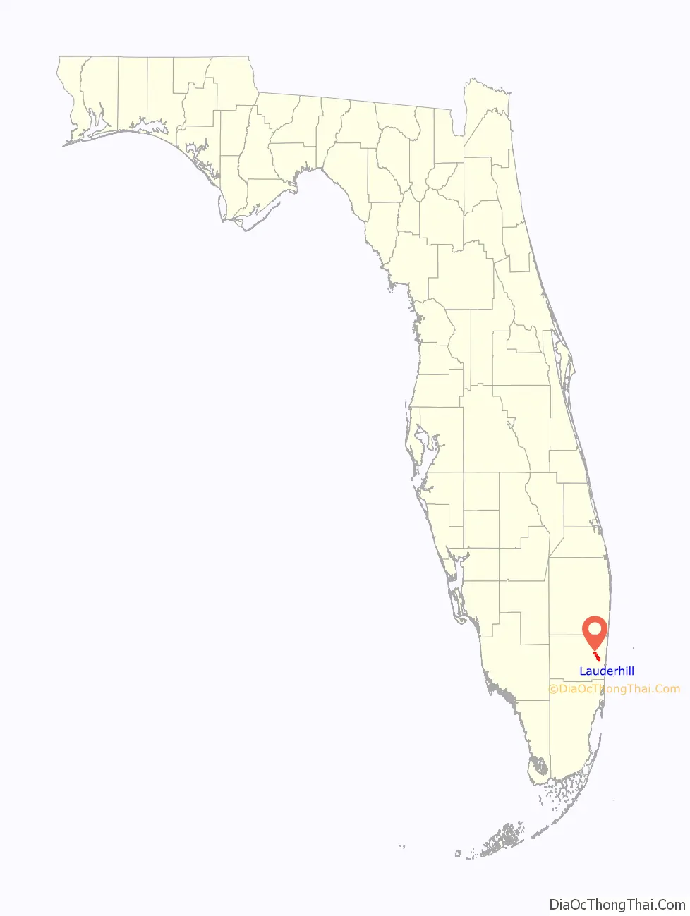
Lauderhill location map. Where is Lauderhill city?
History
Lauderhill was one of two developments (the other in New York) that began largely as off-the-shelf architectural designs which had been available to the public at Macy’s department store. The homes, which had been designed by Andrew Geller, had originally been on display at the “Typical American Houses” at the American Exhibition in Moscow. Following a group of approximately 200 of the homes constructed in Montauk, New York in 1963 and 1964, the same developer, Herbert Sadkin of the New York-based All-State Properties reprised his success in New York, building a series of similar homes in Florida, calling the development Lauderhill.
In 2003, the New York Times described the Macy’s homes:
The Inverrary Country Club was built in 1970, and two years later, its East golf course became home to the new Jackie Gleason Inverrary Classic on the PGA Tour, which it hosted through 1983. Gleason himself built his final home on the golf course.
Up until the late 1980s-early 1990s, Lauderhill was mostly a retirement community for Jews and a second home for snowbirds (especially in the Inverrary neighborhood). It is now home to mostly Jamaicans, West Indians, and African Americans, but it still has a sizeable white, Jewish, and Hispanic population in the Northwest section and the Inverrary neighborhood, located north of Oakland Park Boulevard and east of University Drive).
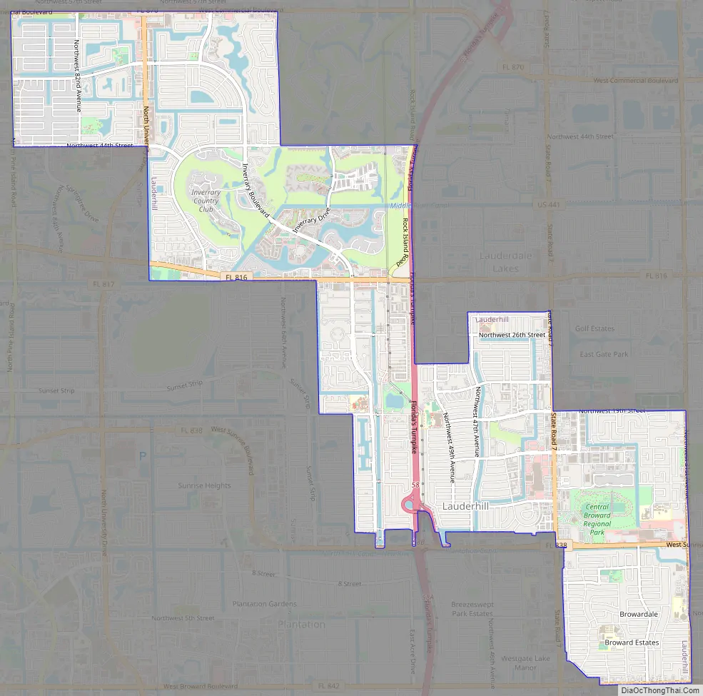
Lauderhill Road Map
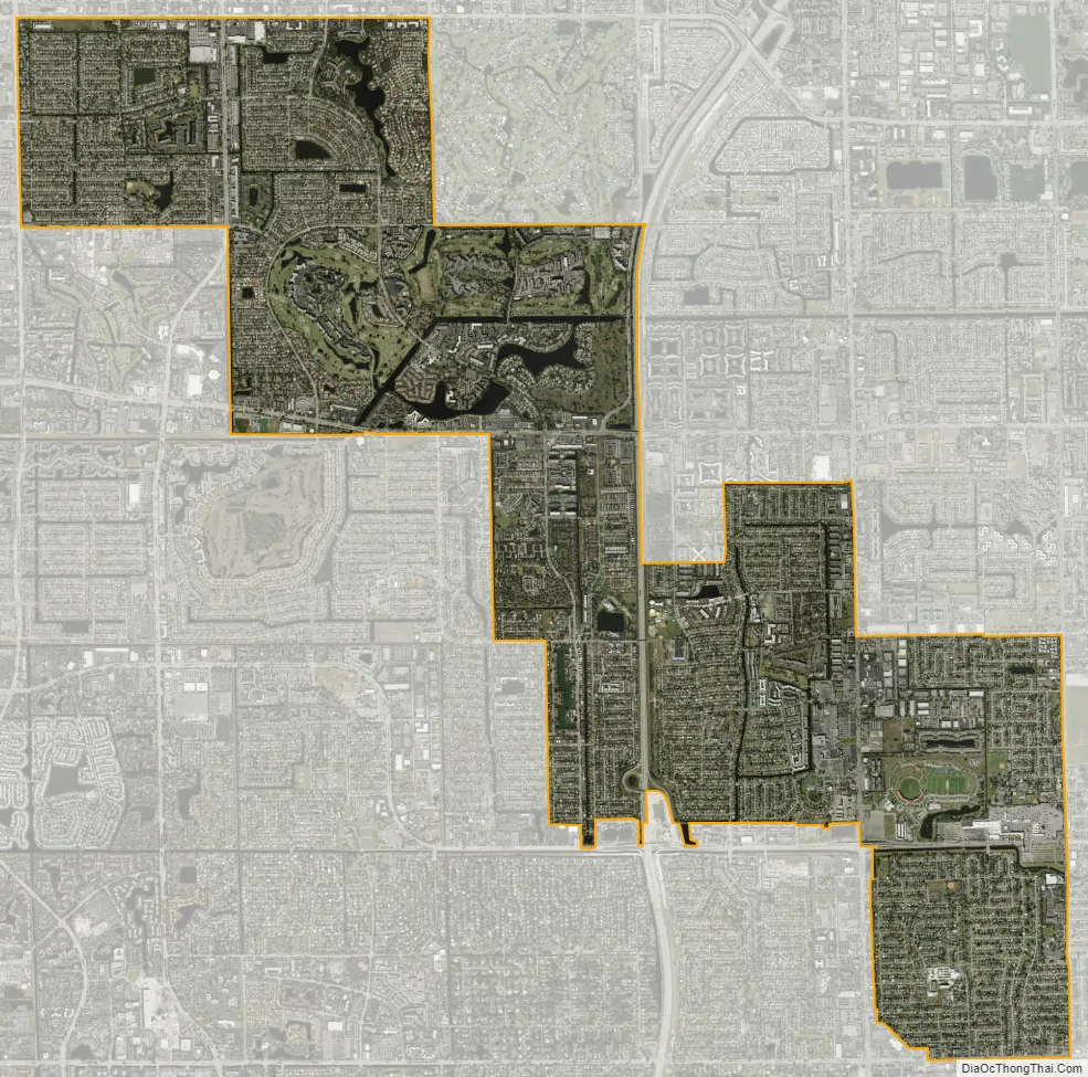
Lauderhill city Satellite Map
Geography
Lauderhill is located at 26°9′56″N 80°13′57″W / 26.16556°N 80.23250°W / 26.16556; -80.23250 (26.165679, –80.232589) in north-central Broward County.
The city borders the following municipalities:
- On its north and northeast:
- On its northeast:
- On its east:
- On its south:
- On its southwest and west:
According to the United States Census Bureau, the city has a total area of 8.6 square miles (22.2 km), of which 8.5 square miles (22.1 km) is land and 0.04 square miles (0.1 km) is water (0.37%).
See also
Map of Florida State and its subdivision:- Alachua
- Baker
- Bay
- Bradford
- Brevard
- Broward
- Calhoun
- Charlotte
- Citrus
- Clay
- Collier
- Columbia
- Desoto
- Dixie
- Duval
- Escambia
- Flagler
- Franklin
- Gadsden
- Gilchrist
- Glades
- Gulf
- Hamilton
- Hardee
- Hendry
- Hernando
- Highlands
- Hillsborough
- Holmes
- Indian River
- Jackson
- Jefferson
- Lafayette
- Lake
- Lee
- Leon
- Levy
- Liberty
- Madison
- Manatee
- Marion
- Martin
- Miami-Dade
- Monroe
- Nassau
- Okaloosa
- Okeechobee
- Orange
- Osceola
- Palm Beach
- Pasco
- Pinellas
- Polk
- Putnam
- Saint Johns
- Saint Lucie
- Santa Rosa
- Sarasota
- Seminole
- Sumter
- Suwannee
- Taylor
- Union
- Volusia
- Wakulla
- Walton
- Washington
- Alabama
- Alaska
- Arizona
- Arkansas
- California
- Colorado
- Connecticut
- Delaware
- District of Columbia
- Florida
- Georgia
- Hawaii
- Idaho
- Illinois
- Indiana
- Iowa
- Kansas
- Kentucky
- Louisiana
- Maine
- Maryland
- Massachusetts
- Michigan
- Minnesota
- Mississippi
- Missouri
- Montana
- Nebraska
- Nevada
- New Hampshire
- New Jersey
- New Mexico
- New York
- North Carolina
- North Dakota
- Ohio
- Oklahoma
- Oregon
- Pennsylvania
- Rhode Island
- South Carolina
- South Dakota
- Tennessee
- Texas
- Utah
- Vermont
- Virginia
- Washington
- West Virginia
- Wisconsin
- Wyoming


