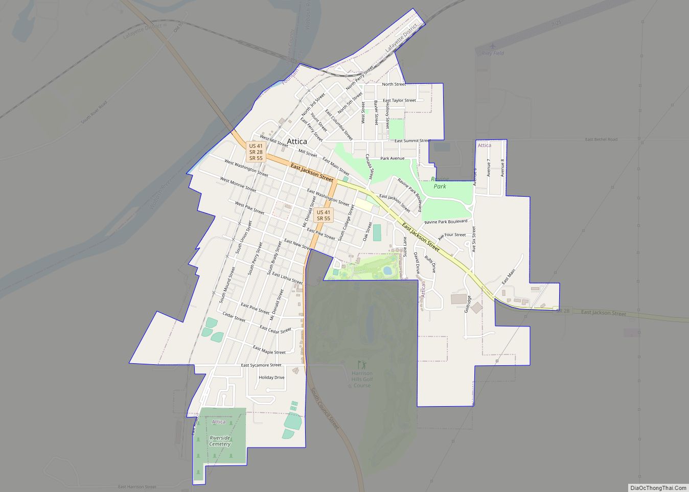
Attica is a city in Logan Township, Fountain County, Indiana, United States.
| Name: | Attica city |
|---|---|
| LSAD Code: | 25 |
| LSAD Description: | city (suffix) |
| State: | Indiana |
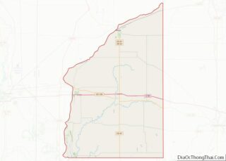
| County: | Fountain County |
| Elevation: | 545 ft (166 m) |
| Total Area: | 1.80 sq mi (4.67 km²) |
| Land Area: | 1.80 sq mi (4.67 km²) |
| Water Area: | 0.00 sq mi (0.00 km²) |
| Total Population: | 3,036 |
| Population Density: | 1,682.93/sq mi (649.85/km²) |
| ZIP code: | 47918 |
| Area code: | 765 |
| FIPS code: | 1802620 |
| Website: | attica-in.gov |
Online Interactive Map
Click on ![]() to view map in "full screen" mode.
to view map in "full screen" mode.
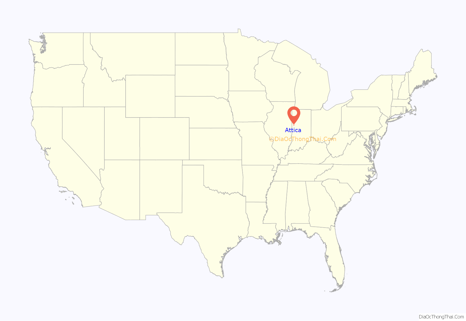
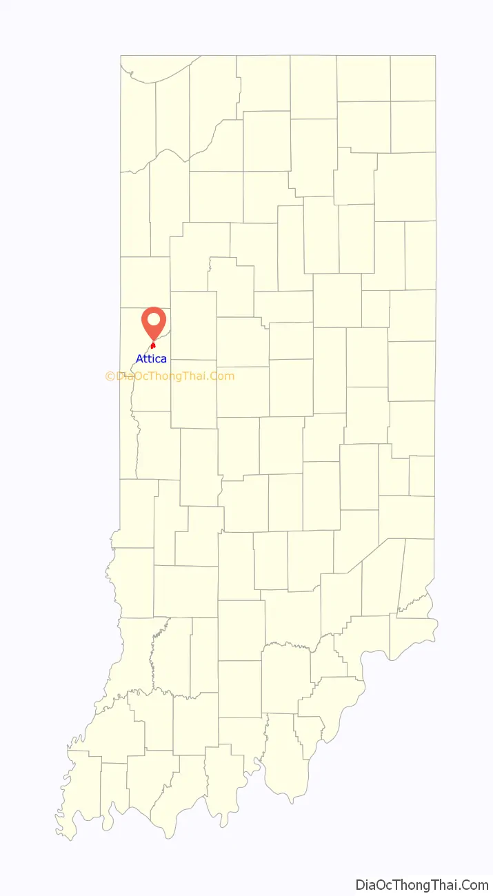
Attica location map. Where is Attica city?
History
Attica was laid out by George Hollingsworth and platted by David Stump in 1825. The completion of the Wabash and Erie Canal through the town in 1847 brought a considerable amount of growth to the area, and ended (in Attica’s favor) a long-standing rivalry with the neighboring communities of Rob Roy, Williamsport and Covington.
Attica is the nearest town to the location where Paul Dresser is believed to have written the state song, “On the Banks of the Wabash, Far Away”, and the bridge over the Wabash River bears his name.
The Attica Downtown Historic District, Attica Main Street Historic District, Brady Street Historic District, Marshall M. Milford House, and Old East Historic District are listed on the National Register of Historic Places.
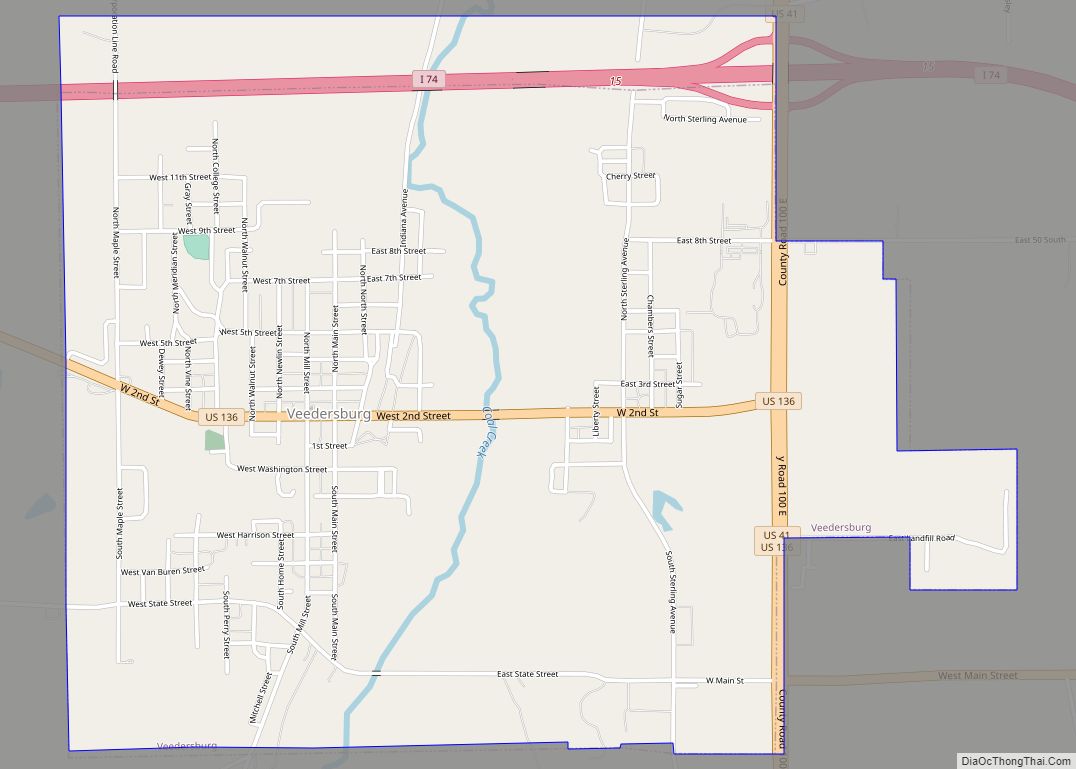
Attica Road Map
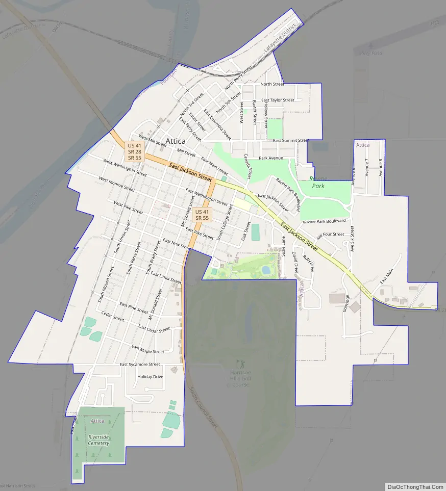
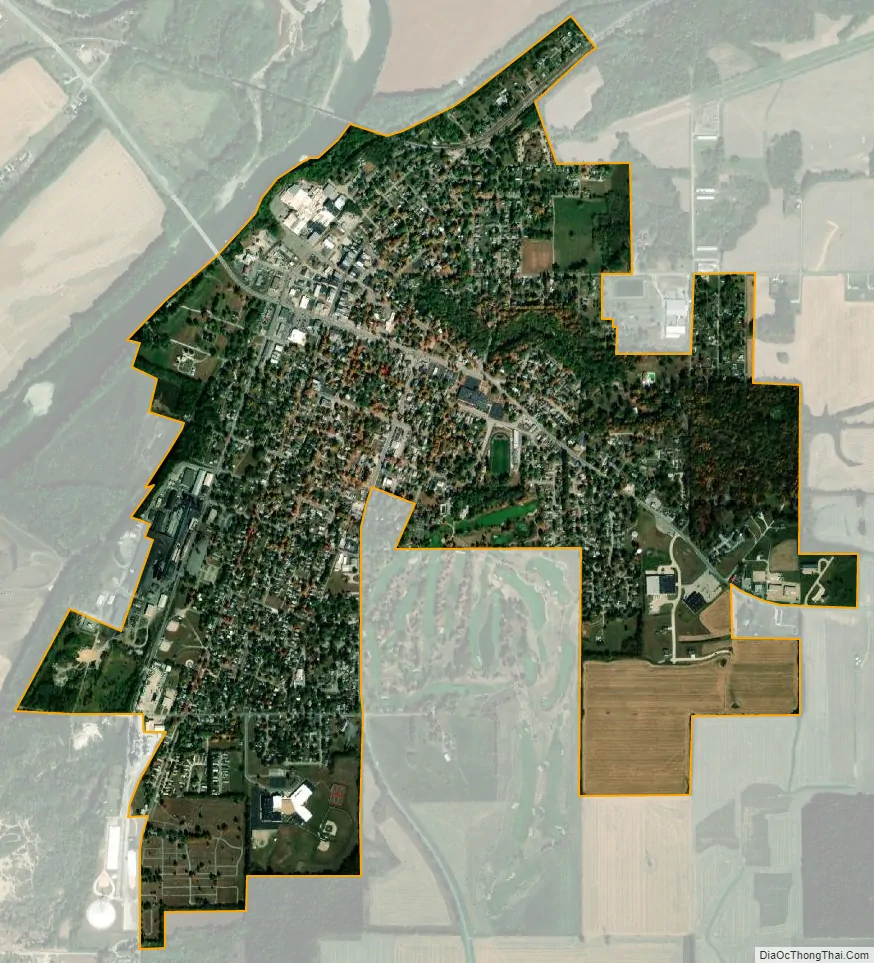
Attica city Satellite Map
Geography
Attica is located at 40°17′25″N 87°14′49″W / 40.29028°N 87.24694°W / 40.29028; -87.24694 (40.290227, -87.246973) along the Wabash River in Logan Township. U.S. Route 41, State Road 28, and State Road 55 intersect at Attica.
According to the 2010 census, Attica has a total area of 1.6 square miles (4.14 km), all land.
See also
Map of Indiana State and its subdivision:- Adams
- Allen
- Bartholomew
- Benton
- Blackford
- Boone
- Brown
- Carroll
- Cass
- Clark
- Clay
- Clinton
- Crawford
- Daviess
- De Kalb
- Dearborn
- Decatur
- Delaware
- Dubois
- Elkhart
- Fayette
- Floyd
- Fountain
- Franklin
- Fulton
- Gibson
- Grant
- Greene
- Hamilton
- Hancock
- Harrison
- Hendricks
- Henry
- Howard
- Huntington
- Jackson
- Jasper
- Jay
- Jefferson
- Jennings
- Johnson
- Knox
- Kosciusko
- LaGrange
- Lake
- Lake Michigan
- LaPorte
- Lawrence
- Madison
- Marion
- Marshall
- Martin
- Miami
- Monroe
- Montgomery
- Morgan
- Newton
- Noble
- Ohio
- Orange
- Owen
- Parke
- Perry
- Pike
- Porter
- Posey
- Pulaski
- Putnam
- Randolph
- Ripley
- Rush
- Saint Joseph
- Scott
- Shelby
- Spencer
- Starke
- Steuben
- Sullivan
- Switzerland
- Tippecanoe
- Tipton
- Union
- Vanderburgh
- Vermillion
- Vigo
- Wabash
- Warren
- Warrick
- Washington
- Wayne
- Wells
- White
- Whitley
- Alabama
- Alaska
- Arizona
- Arkansas
- California
- Colorado
- Connecticut
- Delaware
- District of Columbia
- Florida
- Georgia
- Hawaii
- Idaho
- Illinois
- Indiana
- Iowa
- Kansas
- Kentucky
- Louisiana
- Maine
- Maryland
- Massachusetts
- Michigan
- Minnesota
- Mississippi
- Missouri
- Montana
- Nebraska
- Nevada
- New Hampshire
- New Jersey
- New Mexico
- New York
- North Carolina
- North Dakota
- Ohio
- Oklahoma
- Oregon
- Pennsylvania
- Rhode Island
- South Carolina
- South Dakota
- Tennessee
- Texas
- Utah
- Vermont
- Virginia
- Washington
- West Virginia
- Wisconsin
- Wyoming