Map of Ardmore city, Tennessee
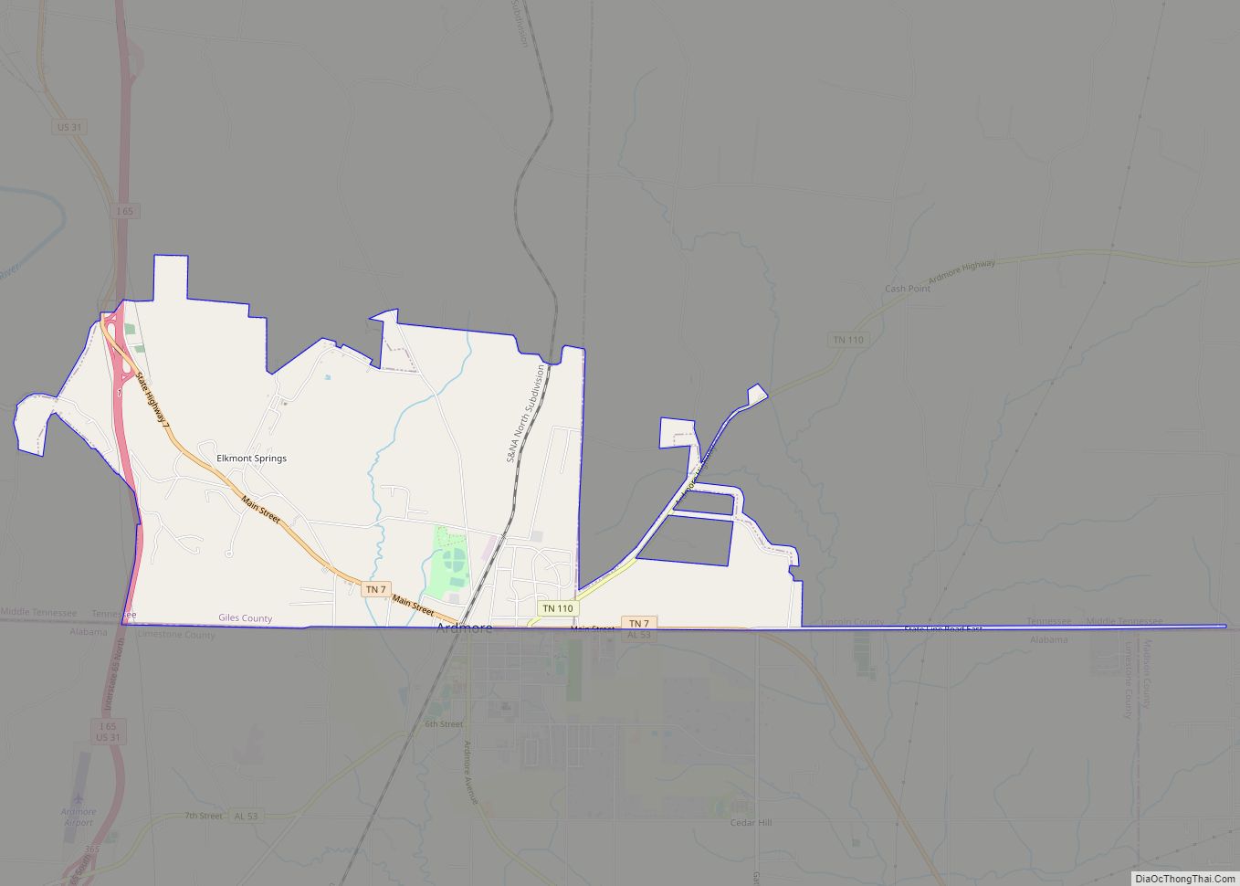
Ardmore is a city in Giles and Lincoln counties, Tennessee. The population was 1,213 at the 2010 census. Ardmore is the site of a Tennessee Department of Tourist Development Welcome Center. It borders its sister city, Ardmore, Alabama. Ardmore city overview: Name: Ardmore city LSAD Code: 25 LSAD Description: city (suffix) State: Tennessee County: Giles ... Read more
Map of Ardmore city, Tennessee
Map of Apison CDP
Apison is an unincorporated community and census-designated place (CDP) in Hamilton County, Tennessee, United States. It is a rural area east of the city of Chattanooga, and borders Ooltewah, Collegedale, and north Georgia to the south. It is part of the Chattanooga, TN–GA Metropolitan Statistical Area. As of the 2020 census, its population was 4,428. ... Read more
Map of Apison CDP
Map of Andersonville CDP, Tennessee
Andersonville is an unincorporated community in Anderson County, Tennessee. Beginning with the 2010 census, it is treated as a census-designated place (CDP). The CDP had a population of 472 in 2010. Andersonville is located on Tennessee State Route 61 east of Norris and south of Norris Lake. The Andersonville post office is assigned zip code ... Read more
Map of Andersonville CDP, Tennessee
Map of Altamont town, Tennessee
Altamont is a town in Grundy County, Tennessee, United States. The population was 1,117 at the 2020 census. It is the county seat of Grundy County. Altamont town overview: Name: Altamont town LSAD Code: 43 LSAD Description: town (suffix) State: Tennessee County: Grundy County Incorporated: 1854 Elevation: 1,854 ft (565 m) Total Area: 19.82 sq mi (51.35 km²) Land Area: ... Read more
Map of Altamont town, Tennessee
Map of Allardt city
Allardt is a city in Fentress County, Tennessee, United States. The population was 555 at the 2020 census. The current mayor Ms. Patricia (Pat) Brown Clark was elected in 2018. According to the city charter, there are three city council board members, currently (as of 2018) Chris Crabtree, Thomas Potter, and Michael Wiley. Allardt city ... Read more
Map of Allardt city
Map of Algood city
Algood is a city in Putnam County, Tennessee, United States. The population was 3,963 at the 2020 census. It is part of the Cookeville Micropolitan Statistical Area. Algood city overview: Name: Algood city LSAD Code: 25 LSAD Description: city (suffix) State: Tennessee County: Putnam County Incorporated: 1911 Elevation: 1,112 ft (339 m) Total Area: 4.09 sq mi (10.59 km²) Land ... Read more
Map of Algood city
Map of Bartlett city, Tennessee
Bartlett is a city in Shelby County, Tennessee, United States. The population was 57,786 at the 2020 U.S. Census. Bartlett city overview: Name: Bartlett city LSAD Code: 25 LSAD Description: city (suffix) State: Tennessee County: Shelby County Founded: 1829 Incorporated: 1866 Elevation: 298 ft (90.8 m) Total Area: 32.31 sq mi (83.68 km²) Land Area: 32.30 sq mi (83.64 km²) Water Area: 0.01 sq mi ... Read more
Map of Bartlett city, Tennessee
Map of Banner Hill CDP
Banner Hill is a census-designated place (CDP) in Unicoi County, Tennessee, United States. The population was 1,497 at the 2010 census. It is part of the Johnson City Metropolitan Statistical Area, which is a component of the Johnson City–Kingsport–Bristol, TN-VA Combined Statistical Area – commonly known as the “Tri-Cities” region. Banner Hill is a suburb ... Read more
Map of Banner Hill CDP
Map of Baneberry city
Baneberry is a city in Jefferson County, Tennessee, United States. It is part of the Morristown, Tennessee Metropolitan Statistical Area. The population was 523 at the 2020 census. The community was named for native baneberry bushes near the original town site. Baneberry city overview: Name: Baneberry city LSAD Code: 25 LSAD Description: city (suffix) State: ... Read more
Map of Baneberry city
Map of Baileyton town, Tennessee
Baileyton is a town in northern Greene County, Tennessee, United States. The population was 431 at the 2010 census, down from 504 at the 2000 census. Baileyton is located 13 miles (21 km) north of Greeneville and 18 miles (29 km) southeast of Rogersville. Baileyton town overview: Name: Baileyton town LSAD Code: 43 LSAD Description: town (suffix) ... Read more
Map of Baileyton town, Tennessee
Map of Auburntown town
Auburntown is a town in Cannon County, Tennessee, United States. The population was 272 as of the 2020 census, up from 269 at the 2010 census. Auburntown town overview: Name: Auburntown town LSAD Code: 43 LSAD Description: town (suffix) State: Tennessee County: Cannon County Incorporated: 1949 Elevation: 715 ft (218 m) Total Area: 0.58 sq mi (1.50 km²) Land Area: ... Read more
Map of Auburntown town
Map of Atwood town, Tennessee
Atwood is a town in Carroll County, Tennessee, United States. The population was 1,008 at the 2020 census. Atwood was incorporated as a town in 1941. Atwood town overview: Name: Atwood town LSAD Code: 43 LSAD Description: town (suffix) State: Tennessee County: Carroll County Incorporated: 1941 Elevation: 443 ft (135 m) Total Area: 1.73 sq mi (4.49 km²) Land Area: ... Read more
Map of Atwood town, Tennessee