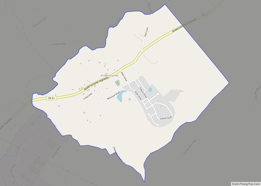
Andersonville is an unincorporated community in Anderson County, Tennessee. Beginning with the 2010 census, it is treated as a census-designated place (CDP). The CDP had a population of 472 in 2010.
Andersonville is located on Tennessee State Route 61 east of Norris and south of Norris Lake. The Andersonville post office is assigned zip code 37705, which includes much of northeastern Anderson County, portions of adjacent Union County and the some of the city limits of Norris.
| Name: | Andersonville CDP |
|---|---|
| LSAD Code: | 57 |
| LSAD Description: | CDP (suffix) |
| State: | Tennessee |
| County: | Anderson County |
| Elevation: | 968 ft (295 m) |
| Total Area: | 1.62 sq mi (4.19 km²) |
| Land Area: | 1.62 sq mi (4.19 km²) |
| Water Area: | 0.00 sq mi (0.00 km²) |
| Total Population: | 508 |
| Population Density: | 313.97/sq mi (121.19/km²) |
| ZIP code: | 37705 |
| FIPS code: | 4701220 |
| GNISfeature ID: | 1307594 |
Online Interactive Map
Click on ![]() to view map in "full screen" mode.
to view map in "full screen" mode.
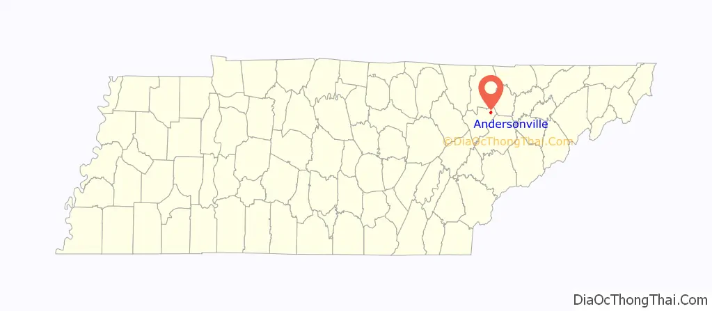
Andersonville location map. Where is Andersonville CDP?

History
The community’s founding family donated land for the community’s first grade school, which was started in 1830. It was replaced in 1873 by Big Valley Academy, a grade school financed through stock purchases by local citizens. It was renamed Andersonville Institute in 1898, after the Clinton Baptist Association purchased the school building and added high school grades. Andersonville Institute was served by a pair of dormitories for boarding students, who comprised the majority of the high school enrollment. The Anderson County School Board assumed ownership and responsibility for the school in 1923. In 1938 Andersonville’s high school students were moved to the new Norris High School in Norris and Andersonville’s school became an elementary school again. The old two-story school building was torn down in 1958 and replaced by a new single-story building on the same site that reopened three years later as Andersonville Elementary School.
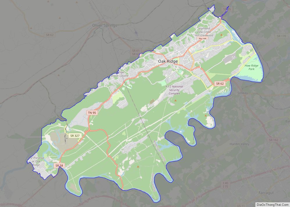
Andersonville Road Map

Andersonville city Satellite Map

See also
Map of Tennessee State and its subdivision:- Anderson
- Bedford
- Benton
- Bledsoe
- Blount
- Bradley
- Campbell
- Cannon
- Carroll
- Carter
- Cheatham
- Chester
- Claiborne
- Clay
- Cocke
- Coffee
- Crockett
- Cumberland
- Davidson
- Decatur
- DeKalb
- Dickson
- Dyer
- Fayette
- Fentress
- Franklin
- Gibson
- Giles
- Grainger
- Greene
- Grundy
- Hamblen
- Hamilton
- Hancock
- Hardeman
- Hardin
- Hawkins
- Haywood
- Henderson
- Henry
- Hickman
- Houston
- Humphreys
- Jackson
- Jefferson
- Johnson
- Knox
- Lake
- Lauderdale
- Lawrence
- Lewis
- Lincoln
- Loudon
- Macon
- Madison
- Marion
- Marshall
- Maury
- McMinn
- McNairy
- Meigs
- Monroe
- Montgomery
- Moore
- Morgan
- Obion
- Overton
- Perry
- Pickett
- Polk
- Putnam
- Rhea
- Roane
- Robertson
- Rutherford
- Scott
- Sequatchie
- Sevier
- Shelby
- Smith
- Stewart
- Sullivan
- Sumner
- Tipton
- Trousdale
- Unicoi
- Union
- Van Buren
- Warren
- Washington
- Wayne
- Weakley
- White
- Williamson
- Wilson
- Alabama
- Alaska
- Arizona
- Arkansas
- California
- Colorado
- Connecticut
- Delaware
- District of Columbia
- Florida
- Georgia
- Hawaii
- Idaho
- Illinois
- Indiana
- Iowa
- Kansas
- Kentucky
- Louisiana
- Maine
- Maryland
- Massachusetts
- Michigan
- Minnesota
- Mississippi
- Missouri
- Montana
- Nebraska
- Nevada
- New Hampshire
- New Jersey
- New Mexico
- New York
- North Carolina
- North Dakota
- Ohio
- Oklahoma
- Oregon
- Pennsylvania
- Rhode Island
- South Carolina
- South Dakota
- Tennessee
- Texas
- Utah
- Vermont
- Virginia
- Washington
- West Virginia
- Wisconsin
- Wyoming