Map of South Pittsburg city

Map of South Pittsburg city

South Pittsburg is a city in Marion County, Tennessee, United States. It is part of the Chattanooga, TN–GA Metropolitan Statistical Area. The population was 3,106 at the 2020 census. South Pittsburg is home to the National Cornbread Festival. South Pittsburg city overview: Name: South Pittsburg city LSAD Code: 25 LSAD Description: city (suffix) State: Tennessee … Read more

Map of South Fulton city, Tennessee

Map of South Fulton city, Tennessee

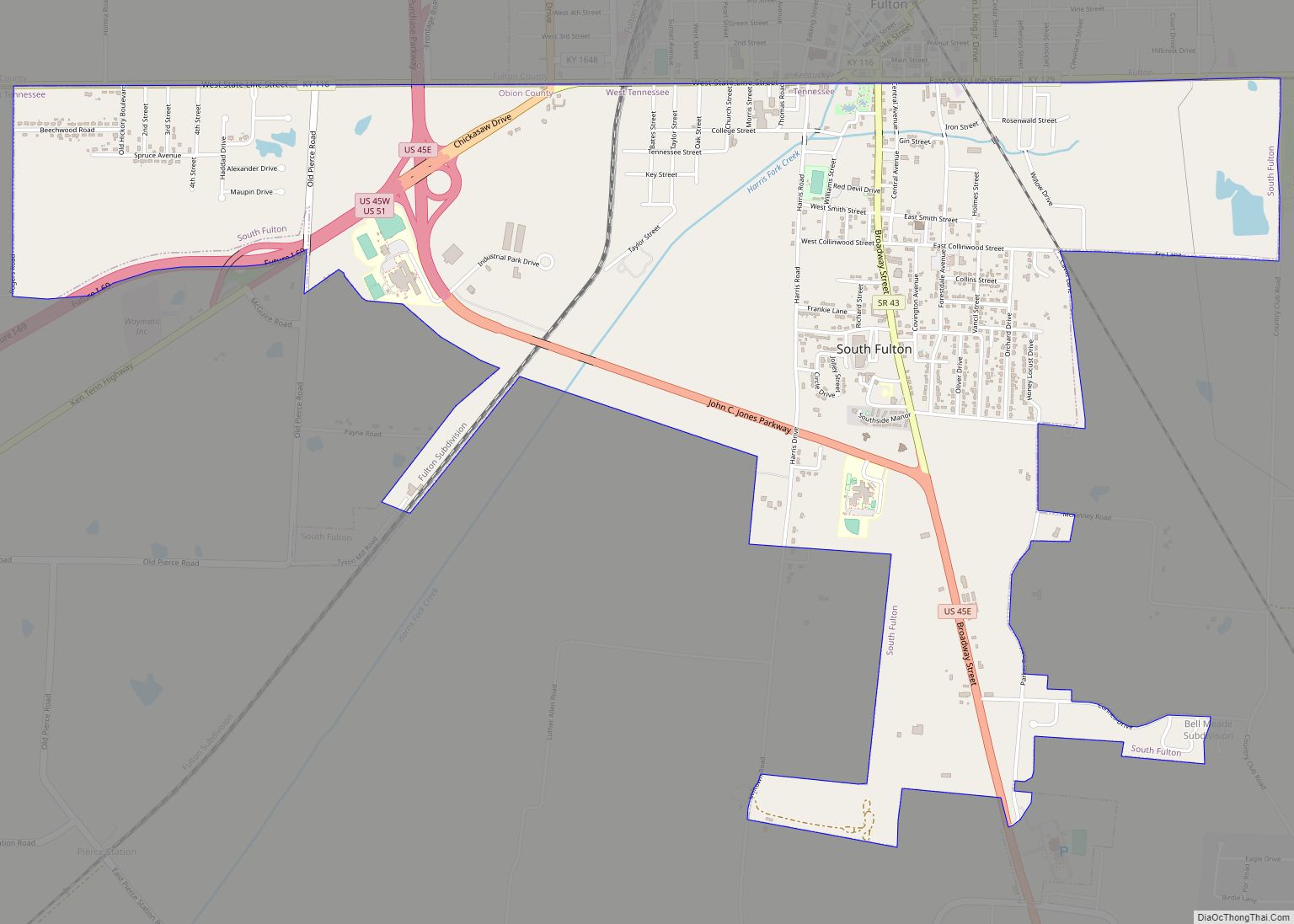
South Fulton is a city in Obion County, Tennessee, United States. The population was 2,245 at the 2020 census. It is part of the Union City, TN–KY Micropolitan Statistical Area. South Fulton city overview: Name: South Fulton city LSAD Code: 25 LSAD Description: city (suffix) State: Tennessee County: Obion County Elevation: 354 ft (108 m) Total Area: … Read more

Map of South Cleveland CDP

Map of South Cleveland CDP

South Cleveland is a census-designated place (CDP) in Bradley County, Tennessee, United States. The population was 7,673 at the 2020 census. The community is located directly south of the city of Cleveland, Tennessee. It is included in the Cleveland Metropolitan Statistical Area. South Cleveland CDP overview: Name: South Cleveland CDP LSAD Code: 57 LSAD Description: … Read more

Map of South Carthage town

Map of South Carthage town

South Carthage is a town in Smith County, Tennessee, United States. The population was 1,322 at the 2010 census. The town is located along the Cumberland River opposite Carthage. South Carthage town overview: Name: South Carthage town LSAD Code: 43 LSAD Description: town (suffix) State: Tennessee County: Smith County Elevation: 509 ft (155 m) Total Area: 2.64 sq mi … Read more

Map of Somerville town, Tennessee

Map of Somerville town, Tennessee

Somerville is a town in Fayette County, Tennessee, United States. It is part of the Memphis metropolitan area. The population was 3,415 at the 2020 census, up from 3,094 at the 2010 census. It is the county seat of Fayette County. Somerville town overview: Name: Somerville town LSAD Code: 43 LSAD Description: town (suffix) State: … Read more

Map of Soddy-Daisy city

Map of Soddy-Daisy city

Soddy-Daisy is a city in Hamilton County, Tennessee, United States. The population was 13,070 at the 2020 census and estimated to be 13,619 in 2022. The city was formed in 1969 when the communities of Soddy (to the north) and Daisy (to the south), along with nearby developed areas along U.S. Highway 27, merged to … Read more

Map of Sneedville town

Map of Sneedville town

Sneedville is the only city in and the county seat of Hancock County, Tennessee, United States. The population was 1,282 per the 2020 census. Sneedville town overview: Name: Sneedville town LSAD Code: 43 LSAD Description: town (suffix) State: Tennessee County: Hancock County Incorporated: 1850 Elevation: 1,171 ft (357 m) Total Area: 2.30 sq mi (5.95 km²) Land Area: 2.30 sq mi (5.95 km²) … Read more

Map of Stantonville town

Map of Stantonville town

Stantonville is a town in McNairy County, Tennessee. The population was 312 at the 2000 census and 283 at the 2010 census. Stantonville town overview: Name: Stantonville town LSAD Code: 43 LSAD Description: town (suffix) State: Tennessee County: McNairy County Elevation: 482 ft (147 m) Total Area: 1.13 sq mi (2.92 km²) Land Area: 1.13 sq mi (2.92 km²) Water Area: 0.00 sq mi (0.00 km²) … Read more

Map of Stanton town, Tennessee

Map of Stanton town, Tennessee

Stanton is a town in Haywood County, Tennessee. The population was 615 as of the 2000 census and 452 at the 2010 census, showing a population decrease of 163. Stanton town overview: Name: Stanton town LSAD Code: 43 LSAD Description: town (suffix) State: Tennessee County: Haywood County Elevation: 315 ft (96 m) Total Area: 0.52 sq mi (1.34 km²) Land … Read more

Map of St. Joseph city, Tennessee

Map of St. Joseph city, Tennessee

Saint Joseph (usually shortened to St. Joseph) is a city in Lawrence County, Tennessee, United States. The population was 782 at the 2010 census, down from 829 in 2000. St. Joseph city overview: Name: St. Joseph city LSAD Code: 25 LSAD Description: city (suffix) State: Tennessee County: Lawrence County Elevation: 794 ft (242 m) Total Area: 3.77 sq mi … Read more

Map of Spurgeon CDP, Tennessee

Map of Spurgeon CDP, Tennessee

Spurgeon is a census-designated place (CDP) in Sullivan and Washington counties in the U.S. state of Tennessee. The population was 3,957 at the 2010 census. The Washington County portion of Spurgeon is part of the Johnson City Metropolitan Statistical Area, while the Sullivan County portion is part of the Kingsport–Bristol (TN)–Bristol (VA) Metropolitan Statistical Area. … Read more

Map of Springfield city, Tennessee

Map of Springfield city, Tennessee

Springfield is a city in and the county seat of Robertson County, which is located in Middle Tennessee on the northern border of the state. As of the 2020 census, the city’s population was 18,782. Springfield city overview: Name: Springfield city LSAD Code: 25 LSAD Description: city (suffix) State: Tennessee County: Robertson County Elevation: 666 ft … Read more