Somerville is a town in Fayette County, Tennessee, United States. It is part of the Memphis metropolitan area. The population was 3,415 at the 2020 census, up from 3,094 at the 2010 census. It is the county seat of Fayette County.
| Name: | Somerville town |
|---|---|
| LSAD Code: | 43 |
| LSAD Description: | town (suffix) |
| State: | Tennessee |
| County: | Fayette County |
| Elevation: | 397 ft (121 m) |
| Total Area: | 13.70 sq mi (35.49 km²) |
| Land Area: | 13.57 sq mi (35.14 km²) |
| Water Area: | 0.14 sq mi (0.36 km²) |
| Total Population: | 3,415 |
| Population Density: | 251.71/sq mi (97.19/km²) |
| ZIP code: | 38068 |
| Area code: | 901 |
| FIPS code: | 4769620 |
| GNISfeature ID: | 1303713 |
| Website: | www.somervilletn.org |
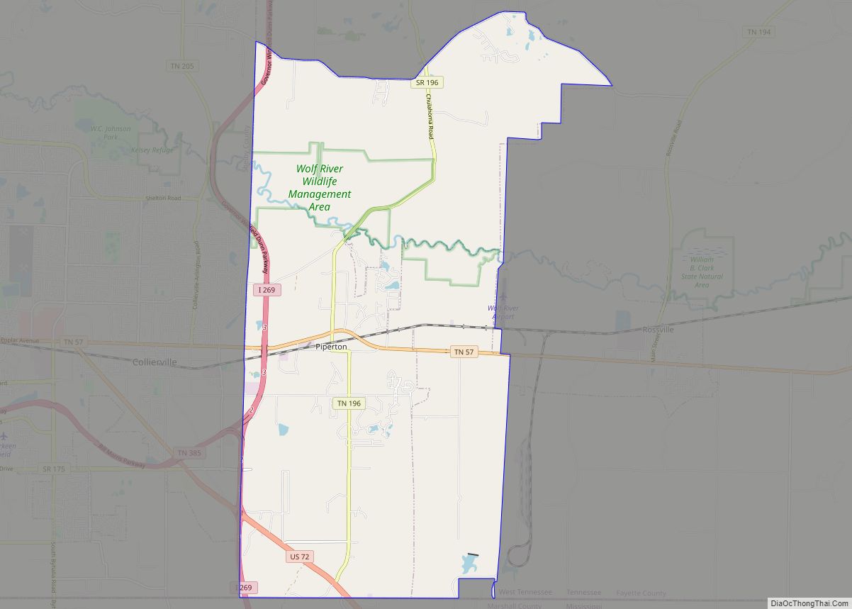
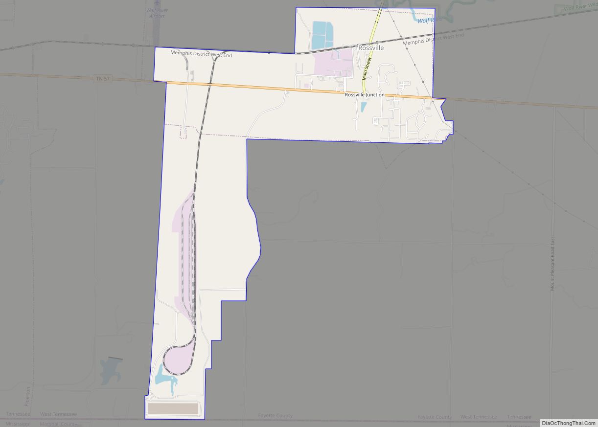
Online Interactive Map
Click on ![]() to view map in "full screen" mode.
to view map in "full screen" mode.
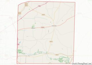
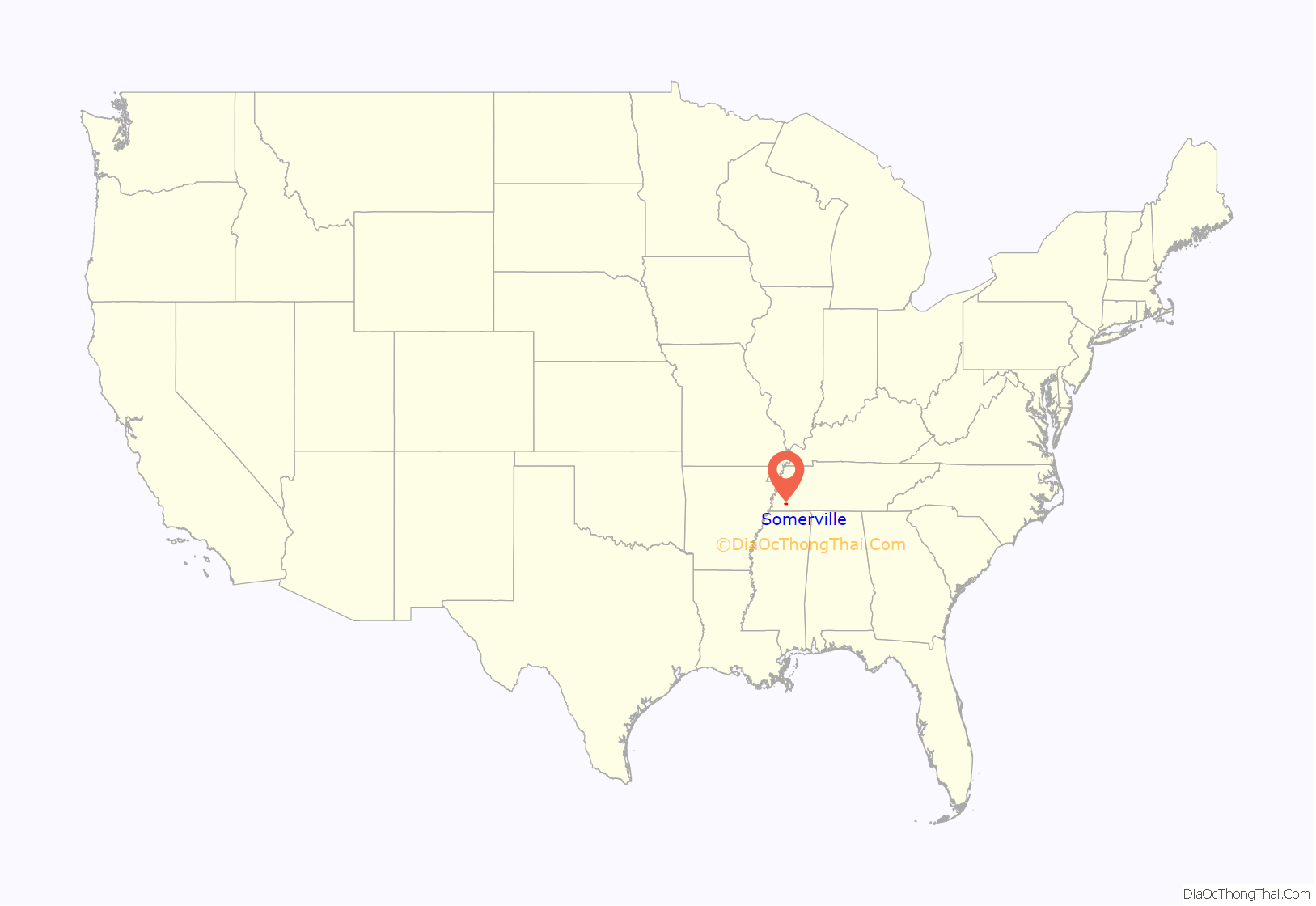
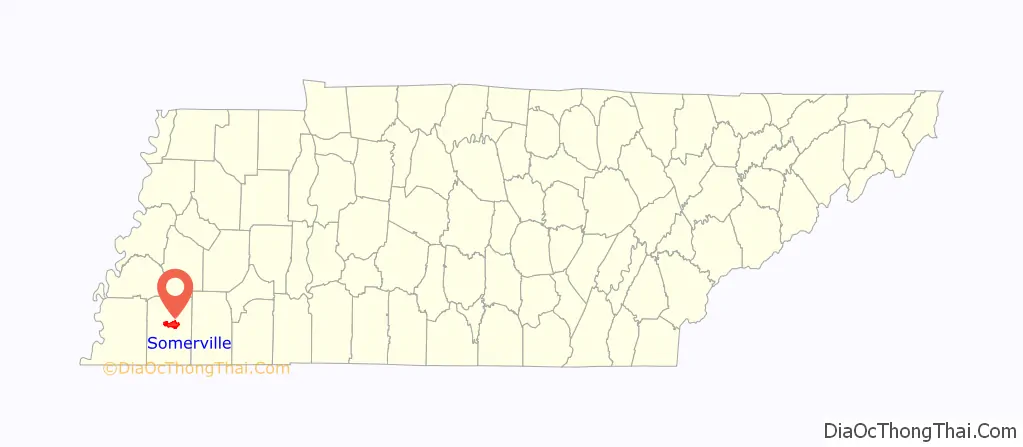
Somerville location map. Where is Somerville town?
History
The town was named to honor Lieutenant Robert Somerville, who was killed in 1814 during the Battle of Horseshoe Bend in central Alabama while serving under General Andrew Jackson. Somerville was incorporated in 1836.
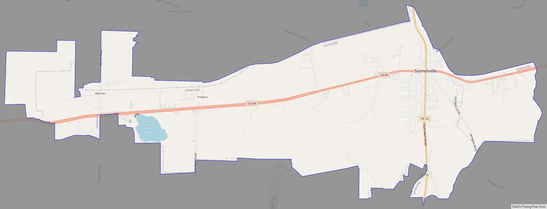
Somerville Road Map
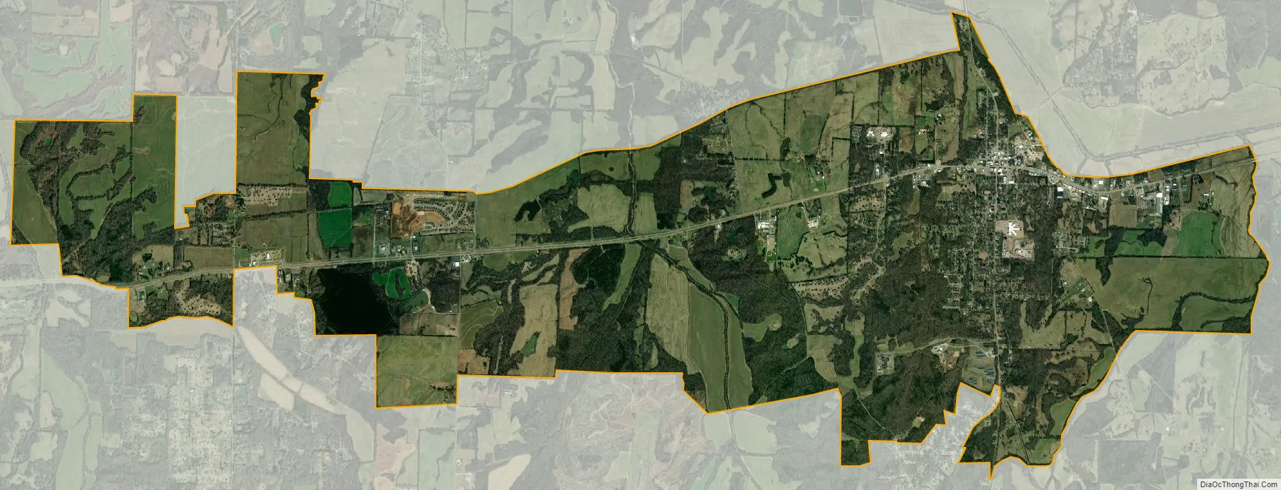
Somerville city Satellite Map
Geography
Somerville is located slightly northeast of the center of Fayette County at 35°14′15″N 89°21′30″W / 35.23750°N 89.35833°W / 35.23750; -89.35833 (35.237623, -89.358400). U.S. Route 64 runs through the center of town as Fayette Street, leading northeast 13 miles (21 km) to Whiteville and west 9 miles (14 km) to Oakland. Downtown Memphis is 41 miles (66 km) to the west. Tennessee State Route 76 crosses US 64 at the center of town. North of US 64, it is the town’s Main Street and leads 26 miles (42 km) to Brownsville. To the south it is South Street, leading 13 miles (21 km) to Moscow.
According to the United States Census Bureau, the town has a total area of 11.4 square miles (30 km), of which 11.2 square miles (29 km) is land and 0.2 square miles (0.52 km) (1.58%) is water. The Loosahatchie River, a west-flowing tributary of the Mississippi, runs past the northern end of the town.
See also
Map of Tennessee State and its subdivision:- Anderson
- Bedford
- Benton
- Bledsoe
- Blount
- Bradley
- Campbell
- Cannon
- Carroll
- Carter
- Cheatham
- Chester
- Claiborne
- Clay
- Cocke
- Coffee
- Crockett
- Cumberland
- Davidson
- Decatur
- DeKalb
- Dickson
- Dyer
- Fayette
- Fentress
- Franklin
- Gibson
- Giles
- Grainger
- Greene
- Grundy
- Hamblen
- Hamilton
- Hancock
- Hardeman
- Hardin
- Hawkins
- Haywood
- Henderson
- Henry
- Hickman
- Houston
- Humphreys
- Jackson
- Jefferson
- Johnson
- Knox
- Lake
- Lauderdale
- Lawrence
- Lewis
- Lincoln
- Loudon
- Macon
- Madison
- Marion
- Marshall
- Maury
- McMinn
- McNairy
- Meigs
- Monroe
- Montgomery
- Moore
- Morgan
- Obion
- Overton
- Perry
- Pickett
- Polk
- Putnam
- Rhea
- Roane
- Robertson
- Rutherford
- Scott
- Sequatchie
- Sevier
- Shelby
- Smith
- Stewart
- Sullivan
- Sumner
- Tipton
- Trousdale
- Unicoi
- Union
- Van Buren
- Warren
- Washington
- Wayne
- Weakley
- White
- Williamson
- Wilson
- Alabama
- Alaska
- Arizona
- Arkansas
- California
- Colorado
- Connecticut
- Delaware
- District of Columbia
- Florida
- Georgia
- Hawaii
- Idaho
- Illinois
- Indiana
- Iowa
- Kansas
- Kentucky
- Louisiana
- Maine
- Maryland
- Massachusetts
- Michigan
- Minnesota
- Mississippi
- Missouri
- Montana
- Nebraska
- Nevada
- New Hampshire
- New Jersey
- New Mexico
- New York
- North Carolina
- North Dakota
- Ohio
- Oklahoma
- Oregon
- Pennsylvania
- Rhode Island
- South Carolina
- South Dakota
- Tennessee
- Texas
- Utah
- Vermont
- Virginia
- Washington
- West Virginia
- Wisconsin
- Wyoming