Sparta is a city in and the county seat of White County, Tennessee, United States. The population was 5,001 in 2020.
The Calfkiller River flows through the city. Seven sites in Sparta are listed on the National Register of Historic Places.
| Name: | Sparta city |
|---|---|
| LSAD Code: | 25 |
| LSAD Description: | city (suffix) |
| State: | Tennessee |
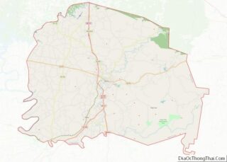
| County: | White County |
| Elevation: | 919 ft (280 m) |
| Total Area: | 6.72 sq mi (17.41 km²) |
| Land Area: | 6.72 sq mi (17.41 km²) |
| Water Area: | 0.00 sq mi (0.00 km²) |
| Total Population: | 4,998 |
| Population Density: | 743.42/sq mi (287.05/km²) |
| ZIP code: | 38583 |
| Area code: | 931 |
| FIPS code: | 4770180 |
| GNISfeature ID: | 1269179 |
| Website: | spartatn.com |
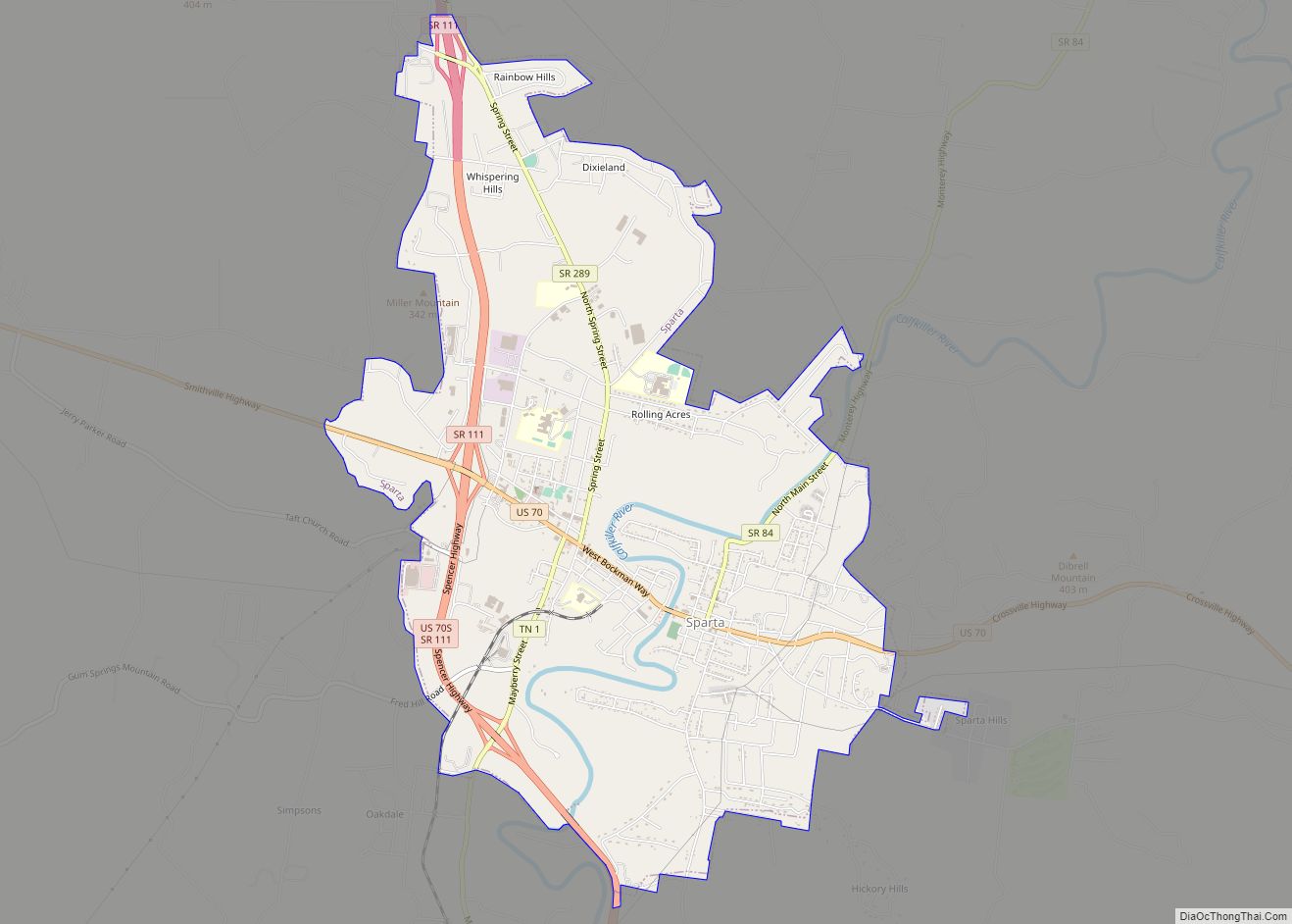
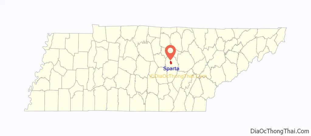
Online Interactive Map
Click on ![]() to view map in "full screen" mode.
to view map in "full screen" mode.
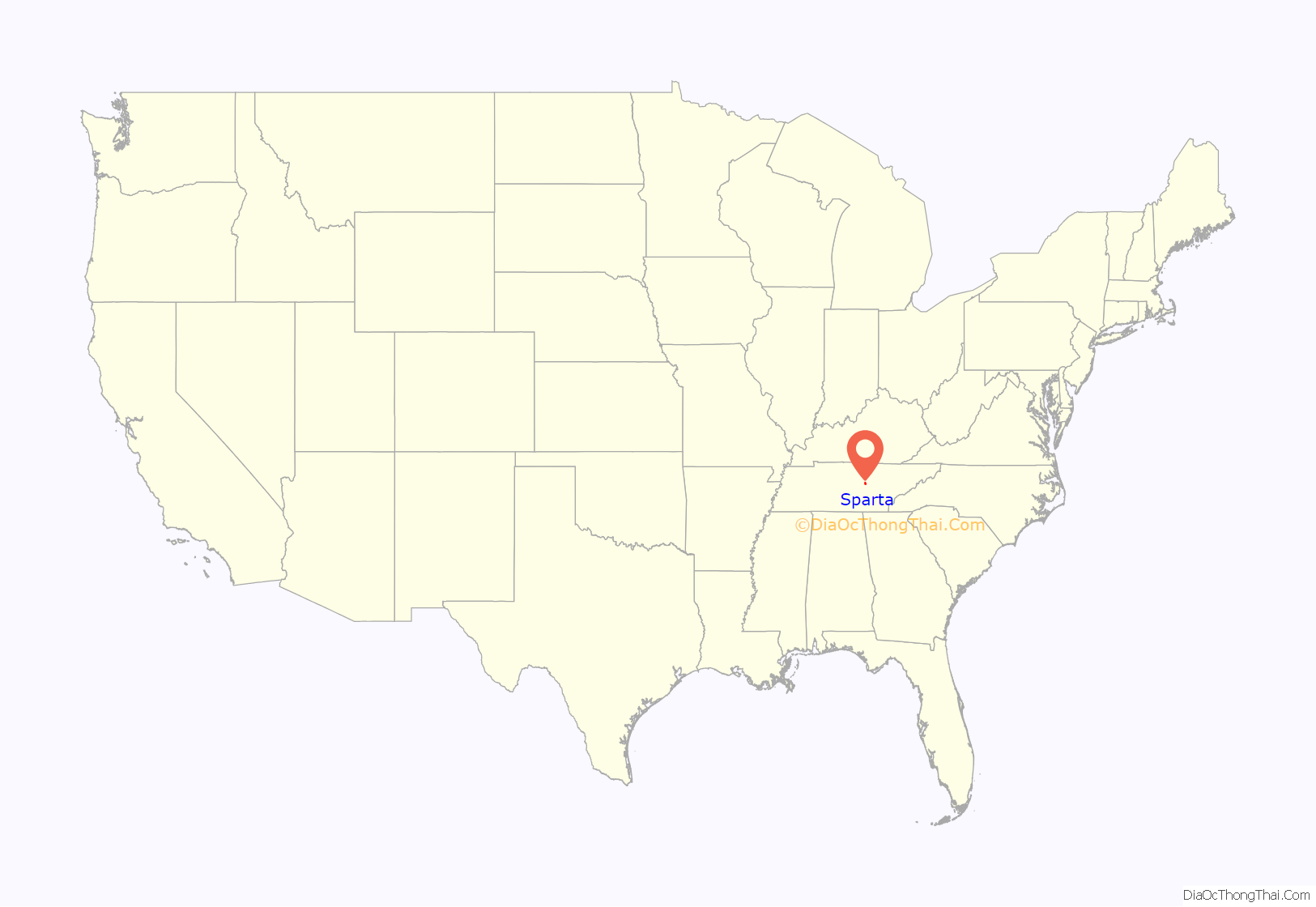
Sparta location map. Where is Sparta city?
History
Sparta was established in 1809 as a county seat for White County, which had been created in 1806. The city was named after the ancient Greek city-state Sparta.
Sparta nearly became the capital of the state of Tennessee, as, early in the history of Tennessee, the state legislature voted to choose a location for the permanent state capital. The final vote resulted in a near tie between Sparta and Nashville. Sparta lost to Nashville by one vote.
Sparta grew quickly due to its location along the stage road between Knoxville and Nashville. In the 1830s, brothers Barlow and Madison Fisk built the Sparta Rock House, which served as an inn along the stage road. The Rock House, strategically situated in an area where the Cumberland Plateau gives way to the Calfkiller valley, was a common stopover for figures important to the early history of the state, including Andrew Jackson and Sam Houston. The building is now a state historic site and is listed on the National Register of Historic Places.
Sparta is notable as a place where two renowned airmen lost their lives. Hawthorne C. Gray, an aviation record holder, died in a balloon-basket mishap over Sparta in 1927, and Lansing Colton Holden Jr., a World War I flying ace, crashed his plane near Sparta in 1938.
Teenagers Erin Foster and Jeremy Bechtel went missing in Sparta in 2000, and were not discovered until February 2022 when scuba diver Jeremy Sides found Foster’s vehicle in the Calfkiller River.
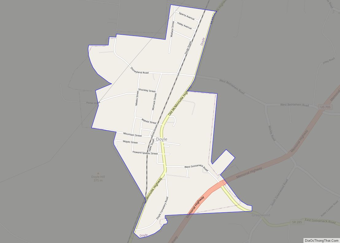
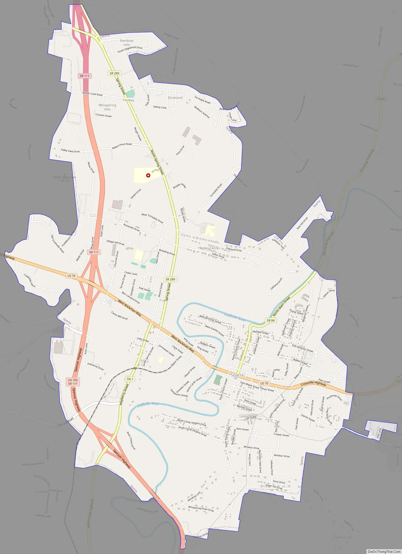
Sparta Road Map
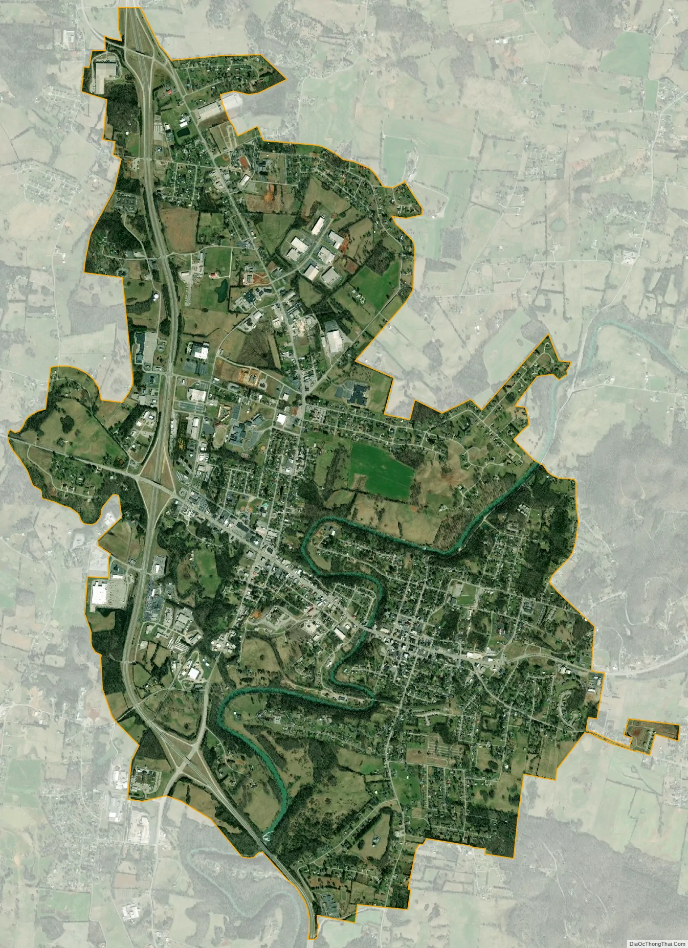
Sparta city Satellite Map
Geography
Sparta is located at 35°55′56″N 85°28′11″W / 35.93222°N 85.46972°W / 35.93222; -85.46972 (35.932335, -85.469837), approximately fifteen miles south of Cookeville. The city is situated on the Highland Rim, near the western base of the Cumberland Plateau. The Calfkiller River traverses Sparta north-to-south en route to its confluence with the Caney Fork several miles to the south.
Sparta is traditionally concentrated around its courthouse square along U.S. Route 70 (signed locally as Bockman Way), which connects Sparta with Crossville to the east and Smithville to the west. State Route 111, which traverses the western part of Sparta, connects the city with Cookeville to the north and Spencer to the south. A modern commercial area has developed around the intersection of US 70 and SR 111. State Route 84 winds its away up the Calfkiller Valley, connecting Sparta with Monterey atop the Plateau to the northeast. U.S. Route 70S connects Sparta with McMinnville to the southwest.
The Upper Cumberland Regional Airport is 11 mi (18 km) north of Sparta.
According to the United States Census Bureau, the city has a total area of 6.3 square miles (16 km), all land.
See also
Map of Tennessee State and its subdivision:- Anderson
- Bedford
- Benton
- Bledsoe
- Blount
- Bradley
- Campbell
- Cannon
- Carroll
- Carter
- Cheatham
- Chester
- Claiborne
- Clay
- Cocke
- Coffee
- Crockett
- Cumberland
- Davidson
- Decatur
- DeKalb
- Dickson
- Dyer
- Fayette
- Fentress
- Franklin
- Gibson
- Giles
- Grainger
- Greene
- Grundy
- Hamblen
- Hamilton
- Hancock
- Hardeman
- Hardin
- Hawkins
- Haywood
- Henderson
- Henry
- Hickman
- Houston
- Humphreys
- Jackson
- Jefferson
- Johnson
- Knox
- Lake
- Lauderdale
- Lawrence
- Lewis
- Lincoln
- Loudon
- Macon
- Madison
- Marion
- Marshall
- Maury
- McMinn
- McNairy
- Meigs
- Monroe
- Montgomery
- Moore
- Morgan
- Obion
- Overton
- Perry
- Pickett
- Polk
- Putnam
- Rhea
- Roane
- Robertson
- Rutherford
- Scott
- Sequatchie
- Sevier
- Shelby
- Smith
- Stewart
- Sullivan
- Sumner
- Tipton
- Trousdale
- Unicoi
- Union
- Van Buren
- Warren
- Washington
- Wayne
- Weakley
- White
- Williamson
- Wilson
- Alabama
- Alaska
- Arizona
- Arkansas
- California
- Colorado
- Connecticut
- Delaware
- District of Columbia
- Florida
- Georgia
- Hawaii
- Idaho
- Illinois
- Indiana
- Iowa
- Kansas
- Kentucky
- Louisiana
- Maine
- Maryland
- Massachusetts
- Michigan
- Minnesota
- Mississippi
- Missouri
- Montana
- Nebraska
- Nevada
- New Hampshire
- New Jersey
- New Mexico
- New York
- North Carolina
- North Dakota
- Ohio
- Oklahoma
- Oregon
- Pennsylvania
- Rhode Island
- South Carolina
- South Dakota
- Tennessee
- Texas
- Utah
- Vermont
- Virginia
- Washington
- West Virginia
- Wisconsin
- Wyoming