Sneedville is the only city in and the county seat of Hancock County, Tennessee, United States. The population was 1,282 per the 2020 census.
| Name: | Sneedville town |
|---|---|
| LSAD Code: | 43 |
| LSAD Description: | town (suffix) |
| State: | Tennessee |
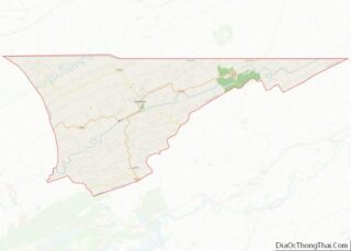
| County: | Hancock County |
| Incorporated: | 1850 |
| Elevation: | 1,171 ft (357 m) |
| Total Area: | 2.30 sq mi (5.95 km²) |
| Land Area: | 2.30 sq mi (5.95 km²) |
| Water Area: | 0.00 sq mi (0.00 km²) |
| Total Population: | 1,282 |
| Population Density: | 558.12/sq mi (215.50/km²) |
| ZIP code: | 37869 |
| Area code: | 423 |
| FIPS code: | 4769460 |
| GNISfeature ID: | 1303706 |
| Website: | www.hancockcountytn.com/Sneedville-City-Government.php |
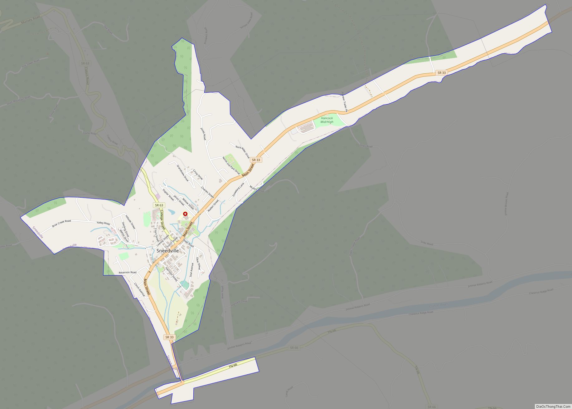
Online Interactive Map
Click on ![]() to view map in "full screen" mode.
to view map in "full screen" mode.
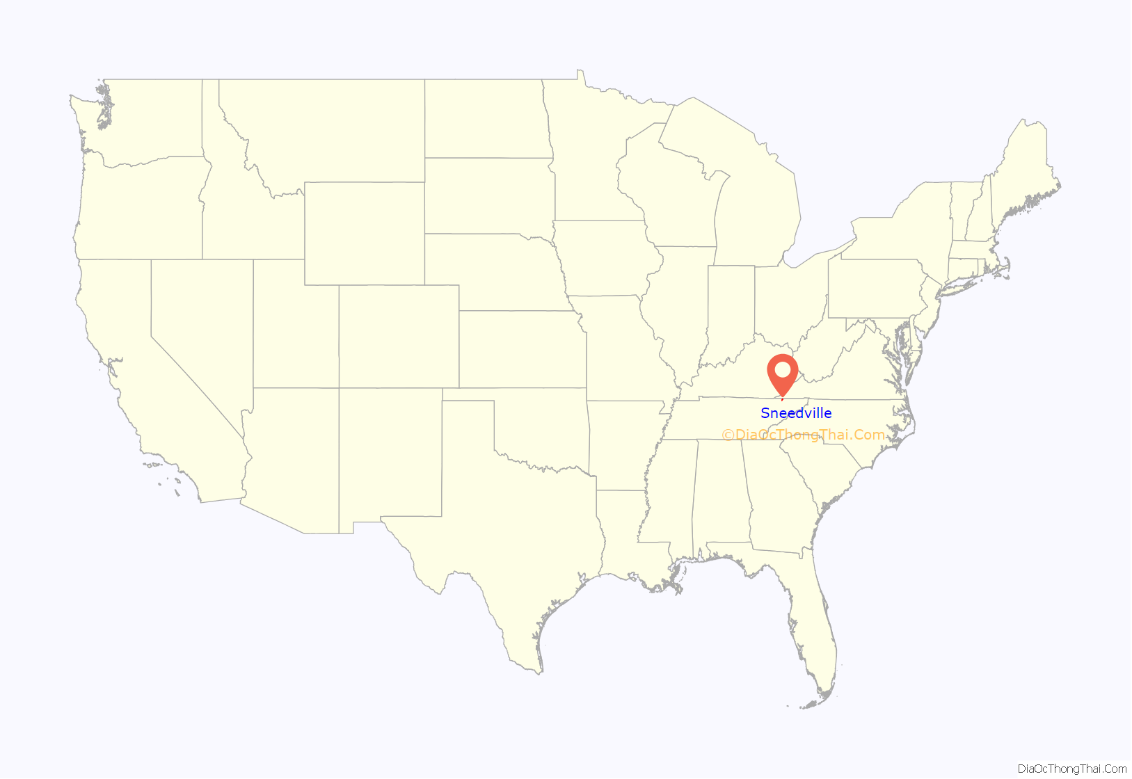
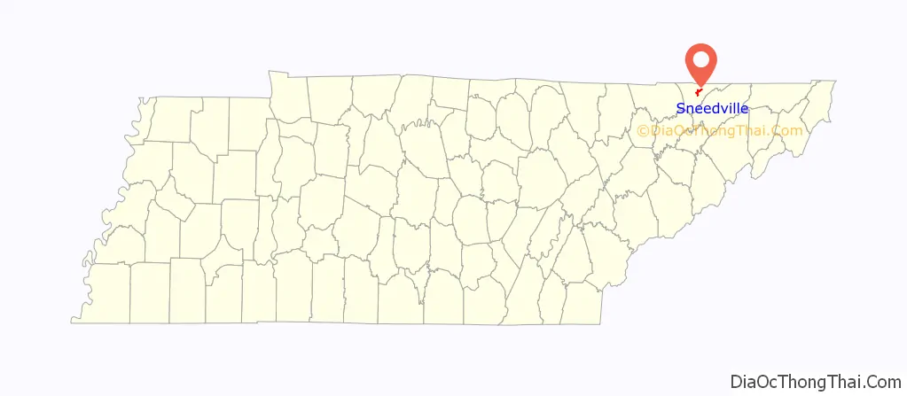
Sneedville location map. Where is Sneedville town?
History
Settlement began in the 1790s, following the American Revolutionary War, as migrants moved into the area from the Piedmont frontiers of Virginia and North Carolina. Such migrants had formed families in colonial Virginia. Among them was a multi-racial group of settlers who became known as Melungeon. They have been documented as having primarily European and sub-Saharan African ancestry. They also have a lesser amount of Native American heritage.
The county historical society asserts that French traders noted encountering the Melungeons in the late 1600s in the area that is now east Tennessee. Such early settlement is not supported by the research of Edward Price, a cultural geographer who wrote a 1950 dissertation on the Melungeons; Dr. Virginia DeMarce, a professional genealogist; and Paul Heinegg, a genealogist; each of whom has documented the migration of ancestors of the first families known as Melungeon from Virginia and North Carolina in the late eighteenth century
When Hancock County was formed from parts of Hawkins and Claiborne counties in the 1840s, Greasy Rock was chosen as the county seat. The city was renamed in honor of William Henry Sneed (1812–1869), an attorney from Knoxville who helped defend the new county when several residents sued in an attempt to block its creation.
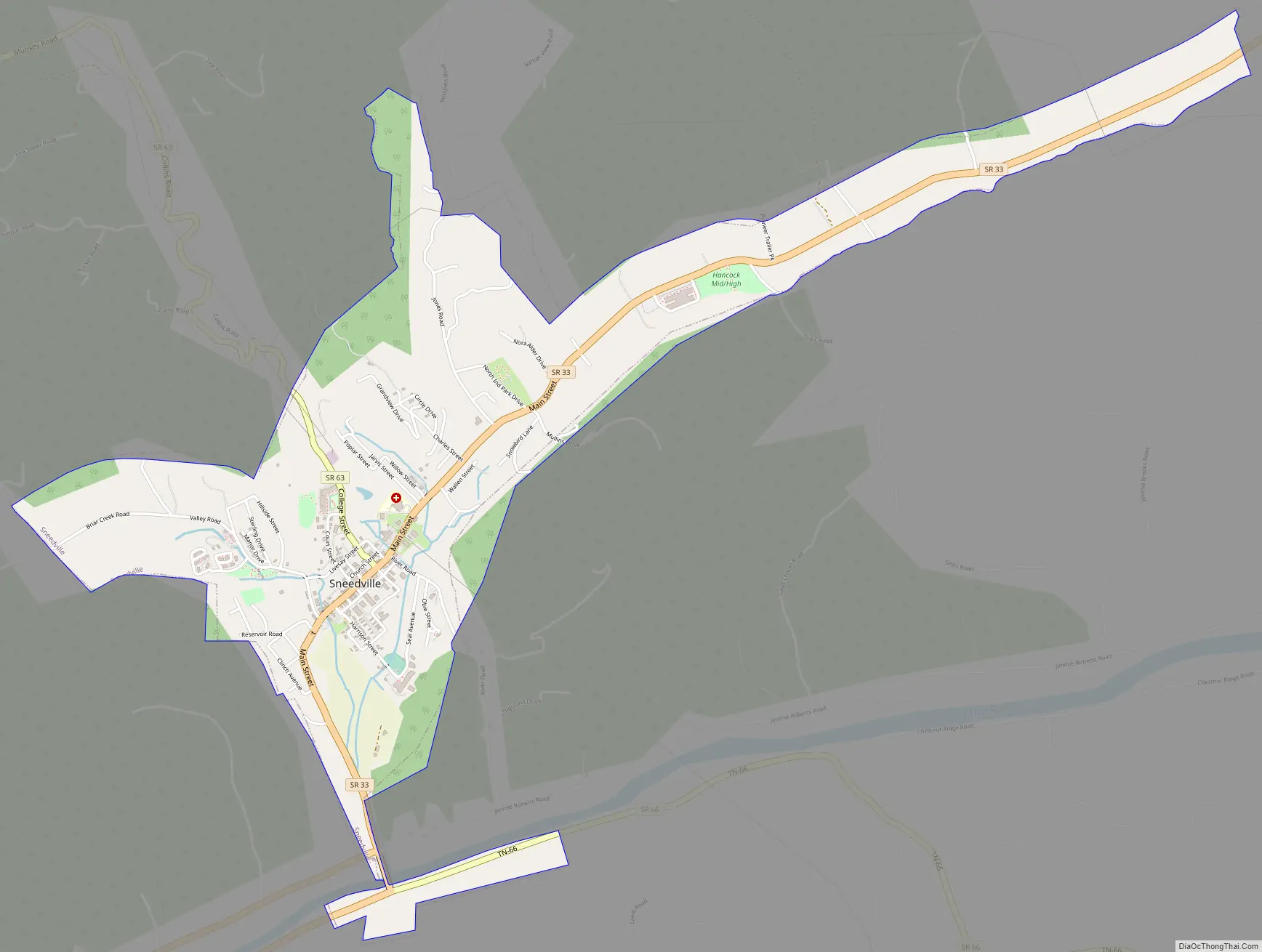
Sneedville Road Map
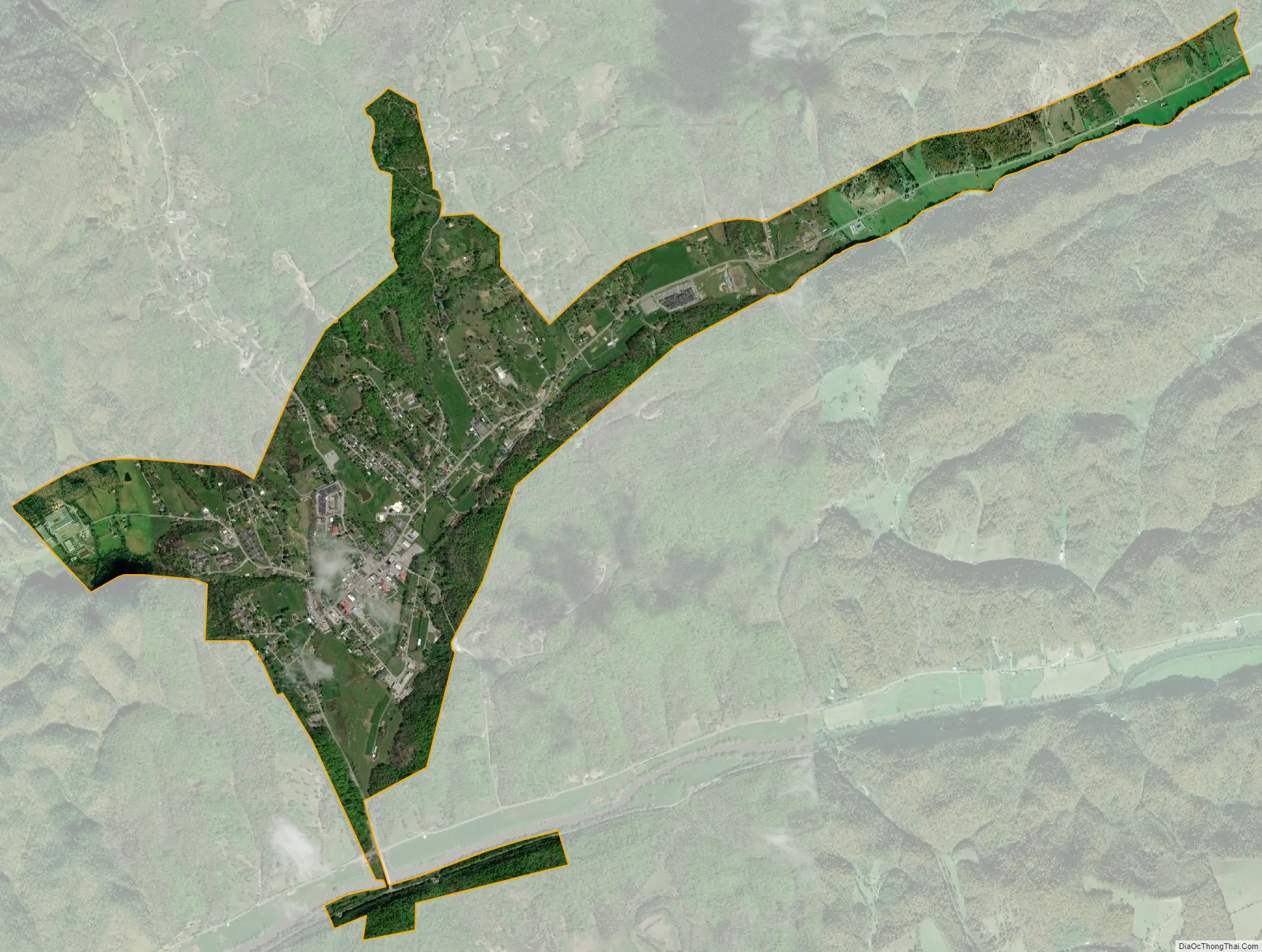
Sneedville city Satellite Map
Geography
Sneedville is located at 36°31′55″N 83°12′51″W / 36.53194°N 83.21417°W / 36.53194; -83.21417 (36.532062, -83.214140).
According to the United States Census Bureau, the city has a total area of 2.3 square miles (6.0 km), all land. The Clinch River passes within the city limits.
Climate
According to the Köppen climate classification, Sneedville has a humid subtropical climate, typical for Tennessee. The plant hardiness zone is 6b.
See also
Map of Tennessee State and its subdivision:- Anderson
- Bedford
- Benton
- Bledsoe
- Blount
- Bradley
- Campbell
- Cannon
- Carroll
- Carter
- Cheatham
- Chester
- Claiborne
- Clay
- Cocke
- Coffee
- Crockett
- Cumberland
- Davidson
- Decatur
- DeKalb
- Dickson
- Dyer
- Fayette
- Fentress
- Franklin
- Gibson
- Giles
- Grainger
- Greene
- Grundy
- Hamblen
- Hamilton
- Hancock
- Hardeman
- Hardin
- Hawkins
- Haywood
- Henderson
- Henry
- Hickman
- Houston
- Humphreys
- Jackson
- Jefferson
- Johnson
- Knox
- Lake
- Lauderdale
- Lawrence
- Lewis
- Lincoln
- Loudon
- Macon
- Madison
- Marion
- Marshall
- Maury
- McMinn
- McNairy
- Meigs
- Monroe
- Montgomery
- Moore
- Morgan
- Obion
- Overton
- Perry
- Pickett
- Polk
- Putnam
- Rhea
- Roane
- Robertson
- Rutherford
- Scott
- Sequatchie
- Sevier
- Shelby
- Smith
- Stewart
- Sullivan
- Sumner
- Tipton
- Trousdale
- Unicoi
- Union
- Van Buren
- Warren
- Washington
- Wayne
- Weakley
- White
- Williamson
- Wilson
- Alabama
- Alaska
- Arizona
- Arkansas
- California
- Colorado
- Connecticut
- Delaware
- District of Columbia
- Florida
- Georgia
- Hawaii
- Idaho
- Illinois
- Indiana
- Iowa
- Kansas
- Kentucky
- Louisiana
- Maine
- Maryland
- Massachusetts
- Michigan
- Minnesota
- Mississippi
- Missouri
- Montana
- Nebraska
- Nevada
- New Hampshire
- New Jersey
- New Mexico
- New York
- North Carolina
- North Dakota
- Ohio
- Oklahoma
- Oregon
- Pennsylvania
- Rhode Island
- South Carolina
- South Dakota
- Tennessee
- Texas
- Utah
- Vermont
- Virginia
- Washington
- West Virginia
- Wisconsin
- Wyoming