South Pittsburg is a city in Marion County, Tennessee, United States. It is part of the Chattanooga, TN–GA Metropolitan Statistical Area. The population was 3,106 at the 2020 census. South Pittsburg is home to the National Cornbread Festival.
| Name: | South Pittsburg city |
|---|---|
| LSAD Code: | 25 |
| LSAD Description: | city (suffix) |
| State: | Tennessee |
| County: | Marion County |
| Elevation: | 633 ft (193 m) |
| Total Area: | 8.22 sq mi (21.29 km²) |
| Land Area: | 8.22 sq mi (21.29 km²) |
| Water Area: | 0.00 sq mi (0.00 km²) |
| Total Population: | 3,106 |
| Population Density: | 377.86/sq mi (145.89/km²) |
| ZIP code: | 37380 |
| Area code: | 423 |
| FIPS code: | 4770060 |
| GNISfeature ID: | 1314091 |
| Website: | southpittsburgtn.org |
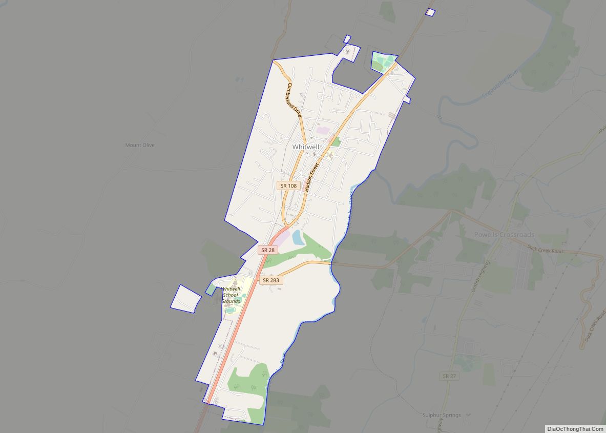
Online Interactive Map
Click on ![]() to view map in "full screen" mode.
to view map in "full screen" mode.
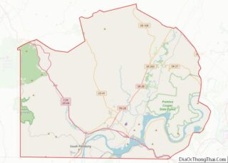
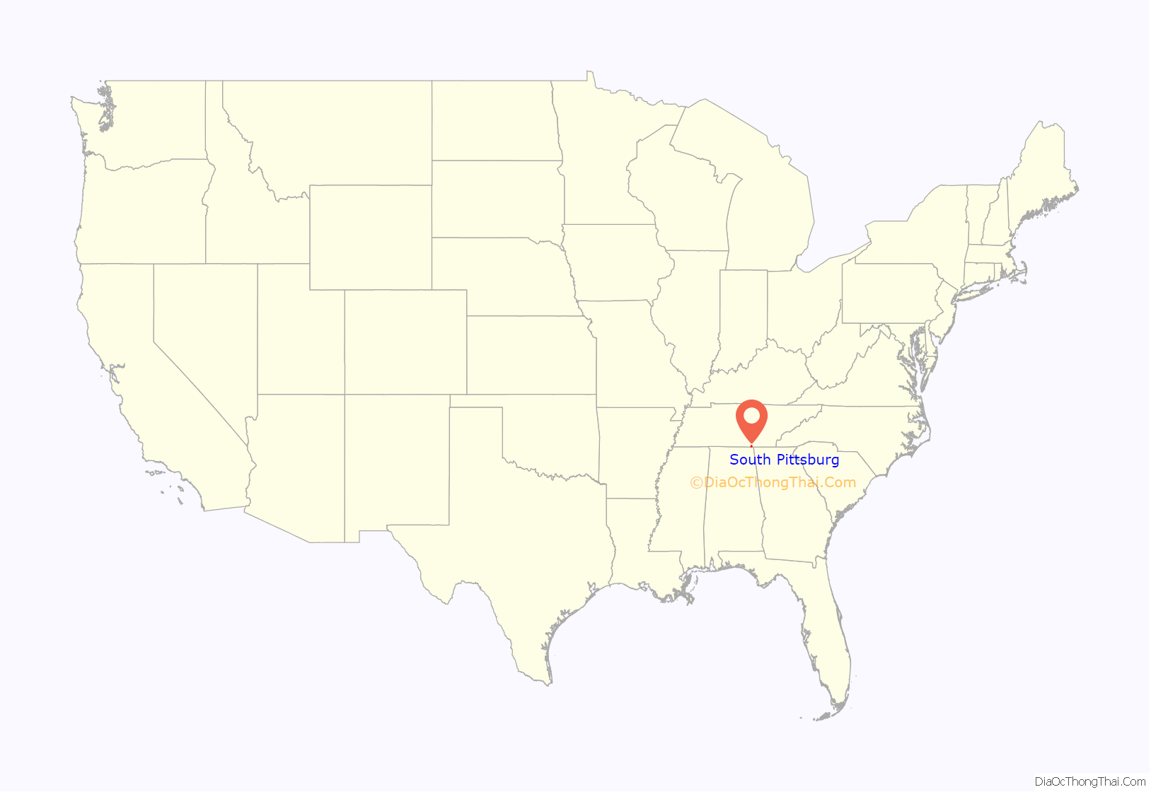
South Pittsburg location map. Where is South Pittsburg city?

History
What is now South Pittsburg remained a primarily agrarian area until the construction of a branch line of the Nashville and Chattanooga Railroad (later the Nashville, Chattanooga and St. Louis Railway) into the Sequatchie Valley in the late 1860s. Small-scale mining operations began during this period. When a post office was opened in 1869, the community was called Battle Creek Mines.
In the mid-1870s, several British investors formed the Southern States Coal, Iron and Land Company, in hopes of establishing a major industrial operation in the Sequatchie Valley. The company dispatched James Bowron to investigate the area for potential town and manufacturing sites. Bowron chose the Whitwell and Victoria areas in northwestern Marion County for the company’s coal mining and coke production operations, and the Battle Creek Mines area as the company’s iron production center and commercial hub. The latter site was chosen primarily for its immediate access to both the railroad and the Tennessee River. On May 23, 1876, the name of the Battle Creek Mines post office was changed to “South Pittsburg” in hopes that the city would one day grow to become a great iron manufacturing center like Pittsburgh, Pennsylvania.
The death of Bowron in 1877, along with several other key company officials within a short period of time, halted the Southern States operation. In 1882, the company was purchased by the Tennessee Coal, Iron and Railroad Company (TCI), which resumed the development of the mining and iron production facilities. In 1886, the townsite of South Pittsburg was purchased by Nashville banker William Duncan, who helped organize the South Pittsburg City Company in December of that year. The town was platted by F.P. Clute, and incorporated in 1887 with John G. Kelly as its first mayor. This revival of the city’s development roughly coincided with the completion of two large blast furnaces and a foundry, allowing large-scale iron production to begin. South Pittsburg experienced rapid growth in the 1890s, but struggled after TCI relocated to Alabama.
In 1906, the Dixie-Portland Cement Company (later Penn-Dixie) established a cement production center in what was then known as the Deptford area, south of South Pittsburg. The company hired New York insurance executive Richard Hardy to oversee the development of a company town, which became known as “Richard City” after Hardy. After becoming president of the company in 1914, Hardy initiated a major expansion project in Richard City. Many of the town’s houses, churches, businesses, and even utility poles were constructed using the company’s cement. The plant operated until 1980, when Penn-Dixie went out of business. The site was later purchased by Vulcan Materials. Richard City was annexed by South Pittsburg in 1985.
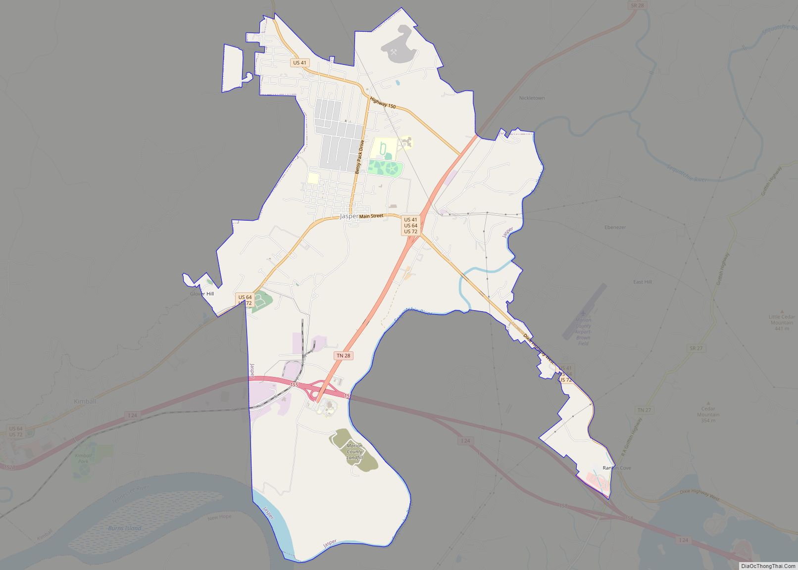
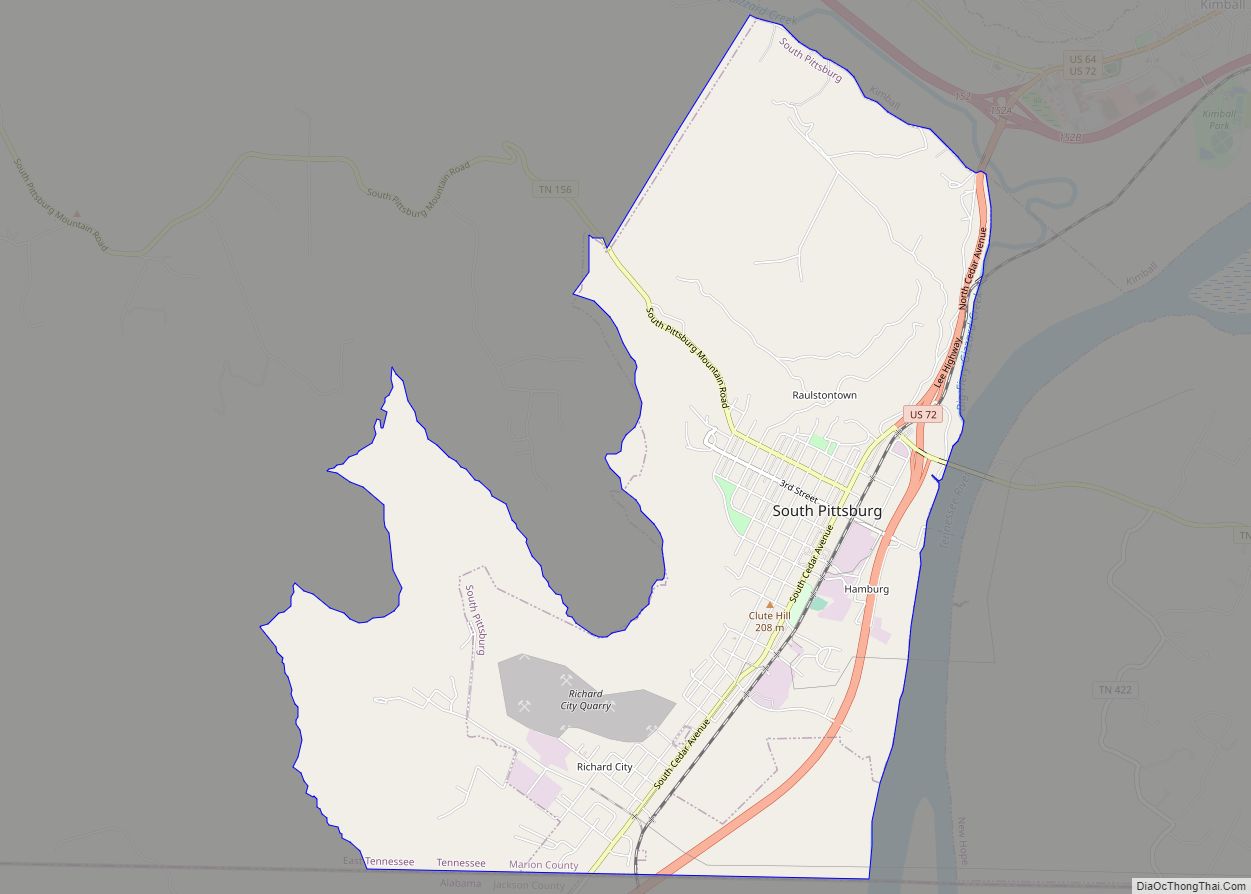
South Pittsburg Road Map

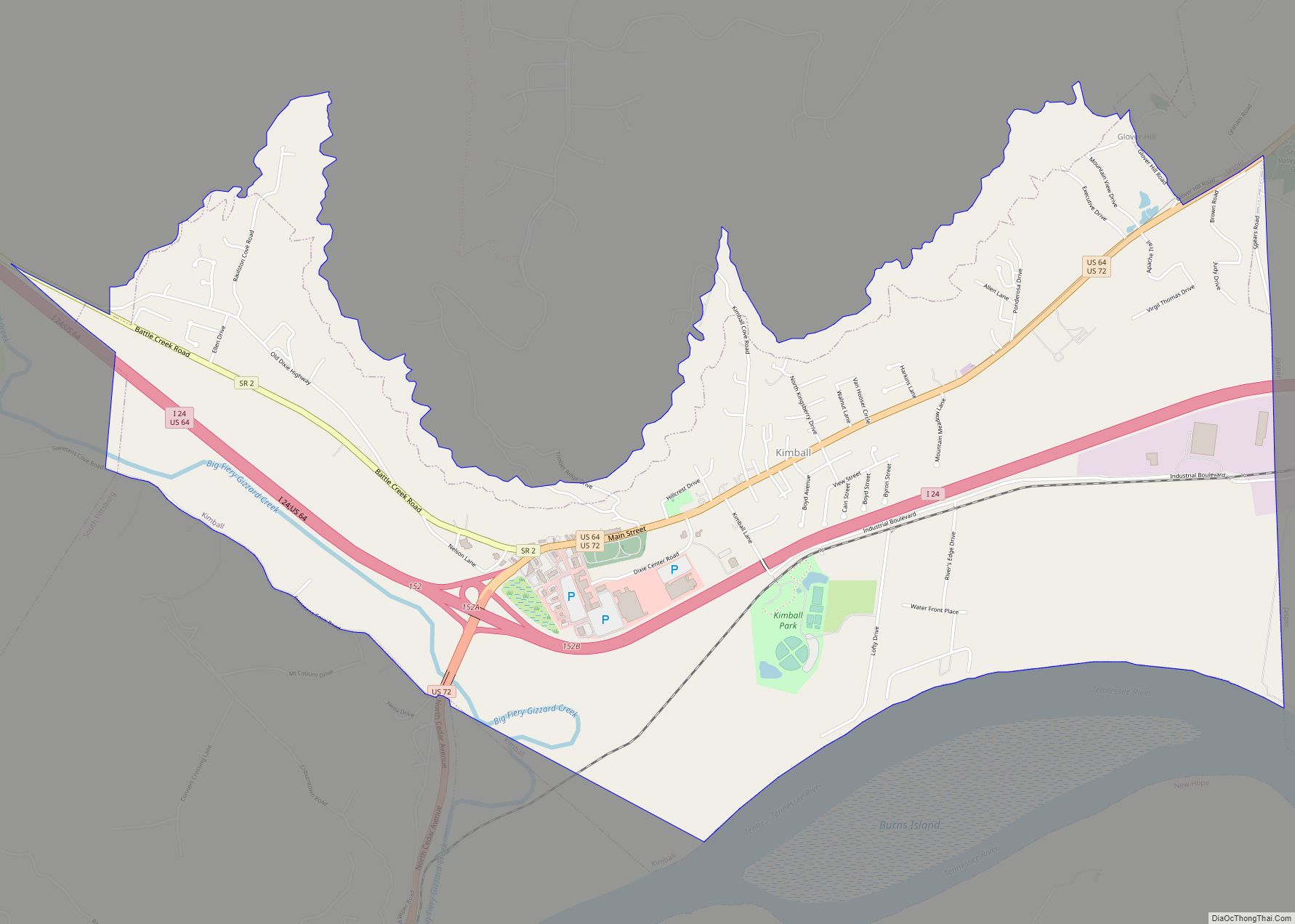
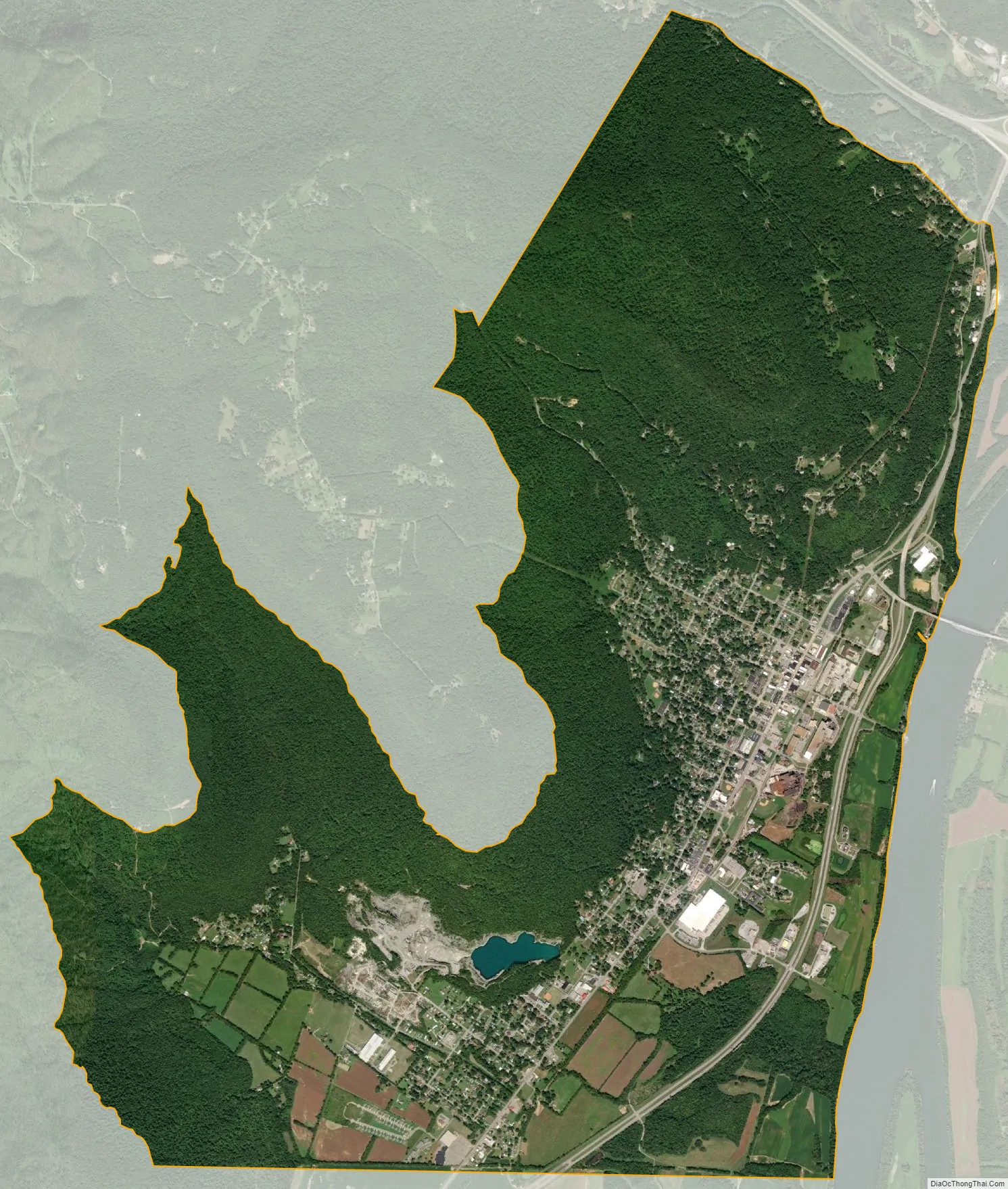
South Pittsburg city Satellite Map
Geography
South Pittsburg is located at 35°0′30″N 85°42′38″W / 35.00833°N 85.71056°W / 35.00833; -85.71056 (35.008342, -85.710645). The city is situated in the southwestern Sequatchie Valley between the Cumberland Plateau on the west and the Tennessee River (Guntersville Lake) on the east. Two steep ridges— Whitacre Point on the north and Lodge Point on the south— extend outward from the Plateau to “wall in” the main portion of the city on the north, west, and south. The Richard City area lies opposite Lodge Point to the south, and the Battle Creek area lies opposite Whitacre Point to the north. At an elevation of approximately 630 ft (190 m), South Pittsburg is the lowest incorporated city in the East Tennessee Grand Division.
The city’s municipal boundaries stretch southward to the Tennessee-Alabama state line. Kimball borders South Pittsburg to the north, and New Hope lies across the river to the east. Chattanooga is located approximately 25 miles (40 km) to the east.
U.S. Route 72 passes north-to-south through South Pittsburg, connecting the city with Jasper to the north and Bridgeport, Alabama, to the south. Tennessee State Route 156, which crosses the river via the Shelby Reinhart Bridge, connects the city with New Hope and Haletown to the east, and the Sewanee and Monteagle areas atop the Plateau to the west. Interstate 24 passes through Kimball, just north of South Pittsburg.
According to the United States Census Bureau, the city has a total area of 5.9 square miles (15 km), all land.
See also
Map of Tennessee State and its subdivision:- Anderson
- Bedford
- Benton
- Bledsoe
- Blount
- Bradley
- Campbell
- Cannon
- Carroll
- Carter
- Cheatham
- Chester
- Claiborne
- Clay
- Cocke
- Coffee
- Crockett
- Cumberland
- Davidson
- Decatur
- DeKalb
- Dickson
- Dyer
- Fayette
- Fentress
- Franklin
- Gibson
- Giles
- Grainger
- Greene
- Grundy
- Hamblen
- Hamilton
- Hancock
- Hardeman
- Hardin
- Hawkins
- Haywood
- Henderson
- Henry
- Hickman
- Houston
- Humphreys
- Jackson
- Jefferson
- Johnson
- Knox
- Lake
- Lauderdale
- Lawrence
- Lewis
- Lincoln
- Loudon
- Macon
- Madison
- Marion
- Marshall
- Maury
- McMinn
- McNairy
- Meigs
- Monroe
- Montgomery
- Moore
- Morgan
- Obion
- Overton
- Perry
- Pickett
- Polk
- Putnam
- Rhea
- Roane
- Robertson
- Rutherford
- Scott
- Sequatchie
- Sevier
- Shelby
- Smith
- Stewart
- Sullivan
- Sumner
- Tipton
- Trousdale
- Unicoi
- Union
- Van Buren
- Warren
- Washington
- Wayne
- Weakley
- White
- Williamson
- Wilson
- Alabama
- Alaska
- Arizona
- Arkansas
- California
- Colorado
- Connecticut
- Delaware
- District of Columbia
- Florida
- Georgia
- Hawaii
- Idaho
- Illinois
- Indiana
- Iowa
- Kansas
- Kentucky
- Louisiana
- Maine
- Maryland
- Massachusetts
- Michigan
- Minnesota
- Mississippi
- Missouri
- Montana
- Nebraska
- Nevada
- New Hampshire
- New Jersey
- New Mexico
- New York
- North Carolina
- North Dakota
- Ohio
- Oklahoma
- Oregon
- Pennsylvania
- Rhode Island
- South Carolina
- South Dakota
- Tennessee
- Texas
- Utah
- Vermont
- Virginia
- Washington
- West Virginia
- Wisconsin
- Wyoming