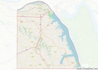
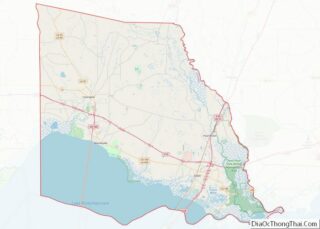
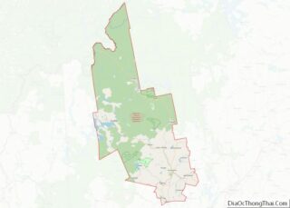
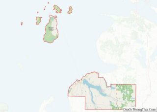
Map of Castro County

Map of Castro County, Texas

Castro County is a county located in the U.S. state of Texas. As of the 2020 census, its population was 7,371. Its county seat is Dimmitt. The county was named for Henri Castro, who was consul general to France for the Republic of Texas and the founder of a colony in Texas. The county was … Read more

Map of Cottle County

Map of Cottle County, Texas

Cottle County is a county in the U.S. state of Texas. As of the 2020 census, its population was 1,380. Its county seat is Paducah. The county was founded in 1876 and later organized in 1892. It is named for George Washington Cottle, who died defending the Alamo. Cottle County was formerly one of 46 … Read more

Map of Eastland County

Map of Eastland County, Texas

Eastland County overview: Name: Eastland County FIPS code: 48-133 State: Texas Founded: 1873 Seat: Eastland Largest city: Eastland Total Area: 932 sq mi (2,410 km²) Land Area: 926 sq mi (2,400 km²) Total Population: 17,725 Population Density: 19/sq mi (7.3/km²) Time zone: UTC−6 (Central) Summer Time Zone (DST): UTC−5 (CDT) Website: www.eastlandcountytexas.com Eastland County location map. Where is Eastland County? Eastland County … Read more

Map of Gaines County

Map of Gaines County, Texas

Gaines County is a county in the U.S. state of Texas. As of the 2020 census, its population was 21,598. The county seat is Seminole. Gaines County overview: Name: Gaines County FIPS code: 48-165 State: Texas Founded: 1905 Seat: Seminole Largest city: Seminole Total Area: 1,503 sq mi (3,890 km²) Land Area: 1,502 sq mi (3,890 km²) Total Population: 21,598 Population … Read more

Map of Hardeman County

Map of Hardeman County, Texas

Hardeman County (/ˈhɑːrdɪmən/ HAR-di-mən) is a county located in the U.S. state of Texas. As of the 2020 census, its population was 3,549. The county seat and largest city is Quanah. The county was created in 1858 and later organized in 1884. It is named for two brothers, Bailey Hardeman and Thomas Jones Hardeman, early … Read more

Map of Hudspeth County

Map of Hudspeth County, Texas

Hudspeth County is a county located in the U.S. state of Texas. As of the 2020 census, the population was 3,202. Its county seat is Sierra Blanca, and the largest community is Fort Hancock. The county is named for Claude Benton Hudspeth, a state senator and United States Representative from El Paso. It is northeast … Read more

Map of Kenedy County

Map of Kenedy County, Texas

Kenedy County is a county located in the U.S. state of Texas. As of the 2020 census, its population was 350. It is the third-least populous county in Texas and fourth-least populous in the United States. Its county seat is Sarita. The county was created in 1921 from parts of Hidalgo and Willacy counties and … Read more

Map of Limestone County

Map of Limestone County, Texas

Limestone County is a county in the U.S. state of Texas. As of the 2020 census, its population was 22,146. Its county seat is Groesbeck. The county was created in 1846. Limestone County overview: Name: Limestone County FIPS code: 48-293 State: Texas Founded: 1846 Seat: Groesbeck Largest city: Mexia Total Area: 933 sq mi (2,420 km²) Land Area: … Read more

Map of Medina County

Map of Medina County, Texas

Medina County is a county located in the U.S. state of Texas. As of the 2020 census, its population was 50,748. Its county seat is Hondo. The county is named for the Medina River. The extreme northern part of the county lies within the Edwards Plateau, which elevates into the Texas Hill Country. The Medina … Read more

Map of Ochiltree County

Map of Ochiltree County, Texas

Ochiltree County overview: Name: Ochiltree County FIPS code: 48-357 State: Texas Founded: 1889 Named for: W. B. Ochiltree Seat: Perryton Largest city: Perryton Total Area: 918 sq mi (2,380 km²) Land Area: 918 sq mi (2,380 km²) Total Population: 10,015 Population Density: 11/sq mi (4.2/km²) Time zone: UTC−6 (Central) Summer Time Zone (DST): UTC−5 (CDT) Website: www.co.ochiltree.tx.us Ochiltree County location map. Where … Read more

Map of Reeves County

Map of Reeves County, Texas

Reeves County is a county located in the U.S. state of Texas. As of the 2020 census, its population was 14,748. Its county seat and most populous city is Pecos. The county was created in 1883 and organized the next year. It is named for George R. Reeves, a Texas state legislator and colonel in … Read more

Map of Sherman County

Map of Sherman County, Texas

Sherman County is a county located in the U.S. state of Texas. As of the 2020 census, its population was 2,782. Its county seat is Stratford. The county was created in 1876 and organized in 1889. It is named for Sidney Sherman, who fought in the Texas Revolution. Though both Sherman County and Sherman, Texas, … Read more