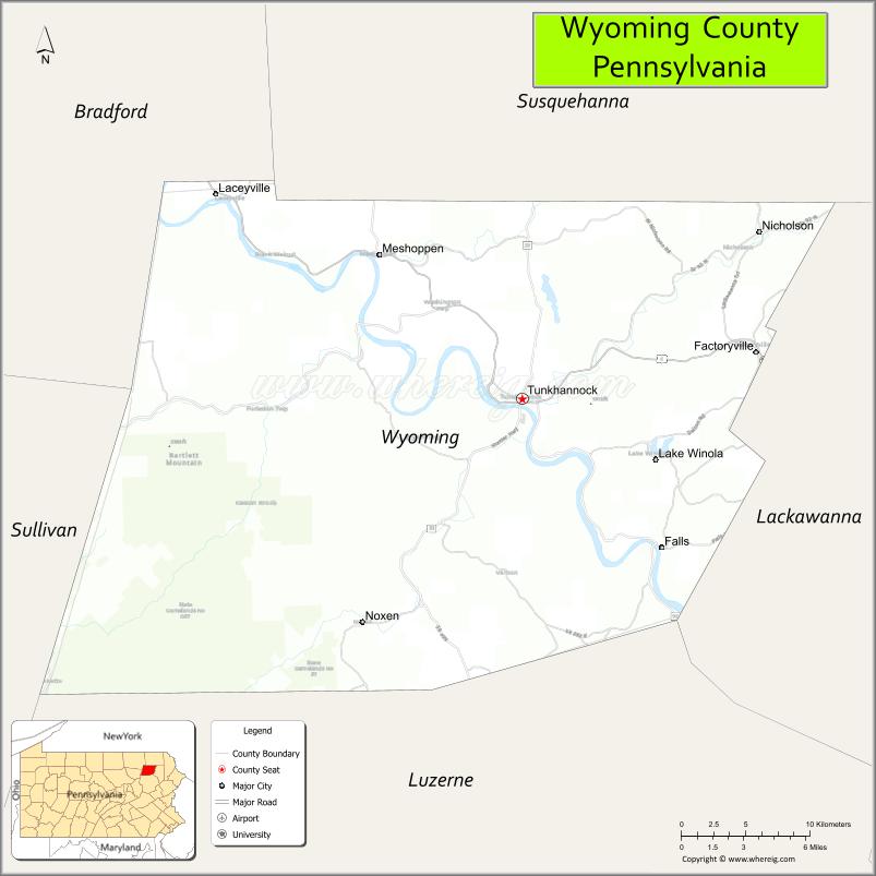
Wyoming County is a county in the Commonwealth of Pennsylvania. It is part of Northeastern Pennsylvania. As of the 2020 census, the population was 26,069. Its county seat is Tunkhannock. It was created in 1842 from part of Luzerne County.
Wyoming County is included in the Scranton—Wilkes-Barre—Hazleton, PA Metropolitan Statistical Area.
| Name: | Wyoming County |
|---|---|
| FIPS code: | 42-131 |
| State: | Pennsylvania |
| Founded: | April 4, 1842 |
| Named for: | Wyoming Valley |
| Seat: | Tunkhannock |
| Total Area: | 405 sq mi (1,050 km²) |
| Land Area: | 397 sq mi (1,030 km²) |
| Total Population: | 26,069 |
| Population Density: | 66/sq mi (25/km²) |
| Time zone: | UTC−5 (Eastern) |
| Summer Time Zone (DST): | UTC−4 (EDT) |
| Website: | www.wycopa.org |
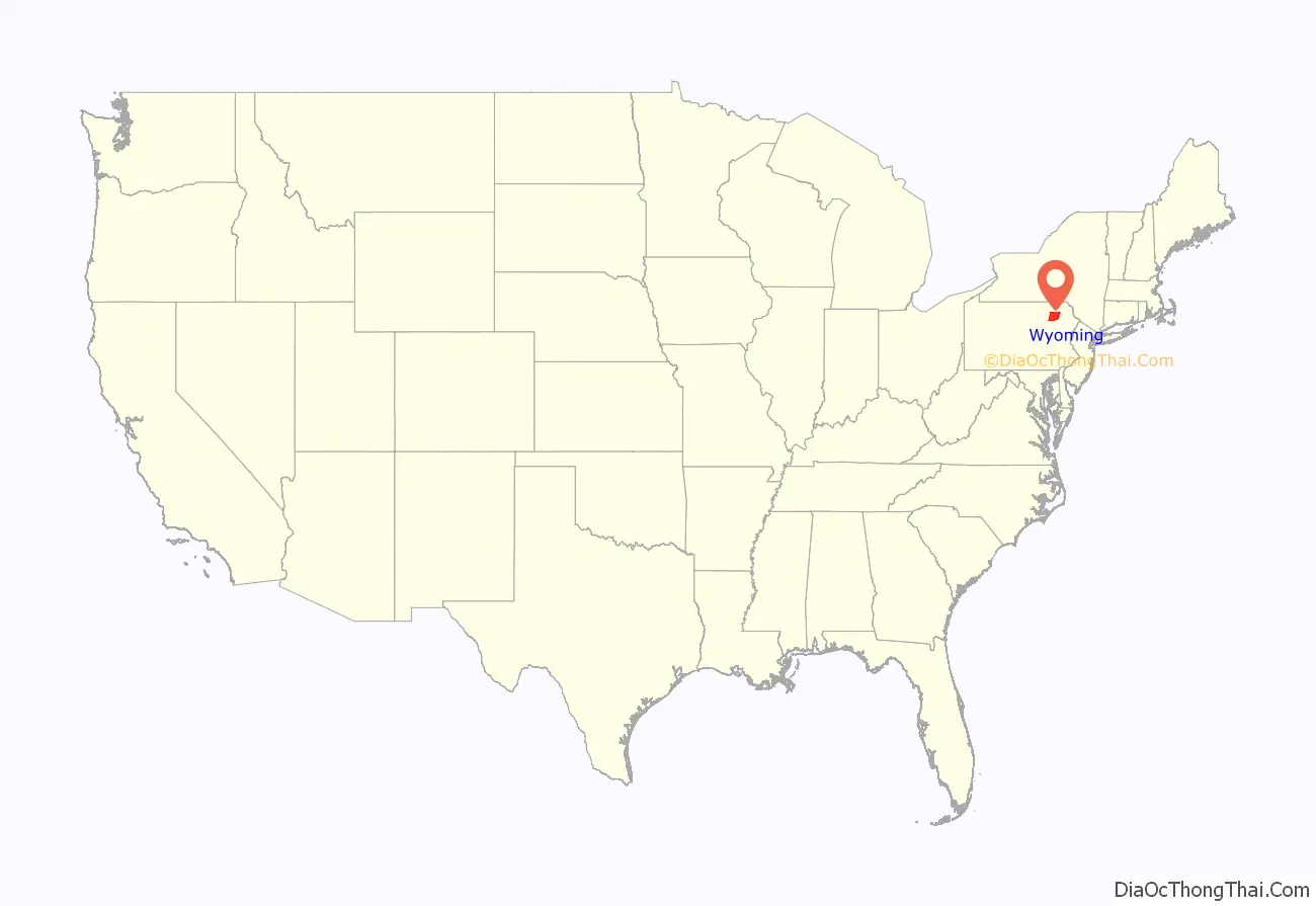
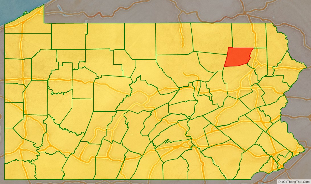
Wyoming County location map. Where is Wyoming County?
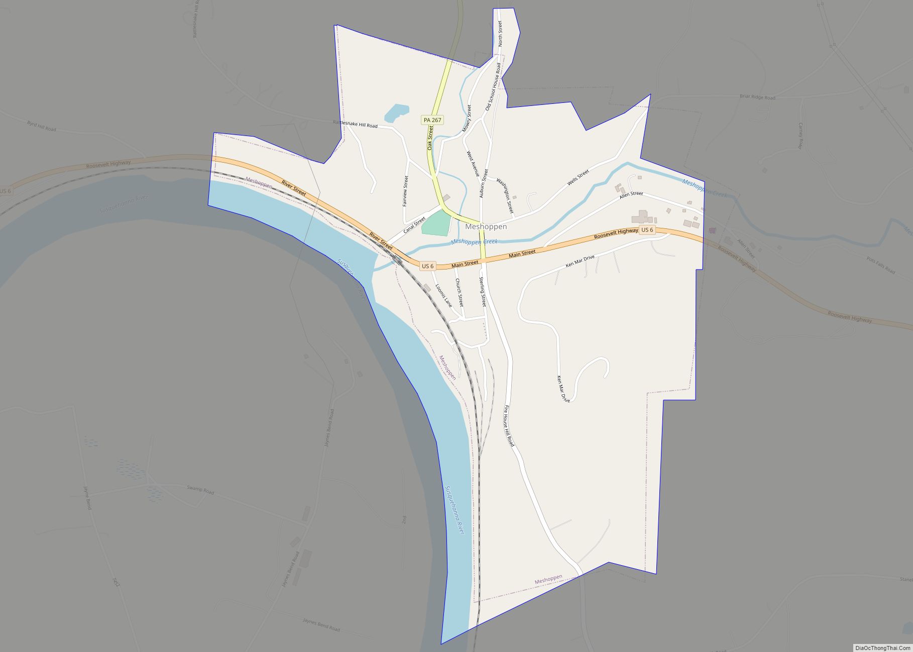
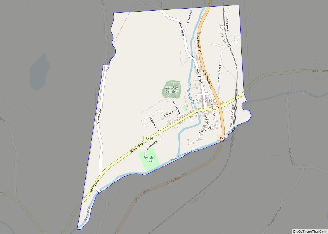
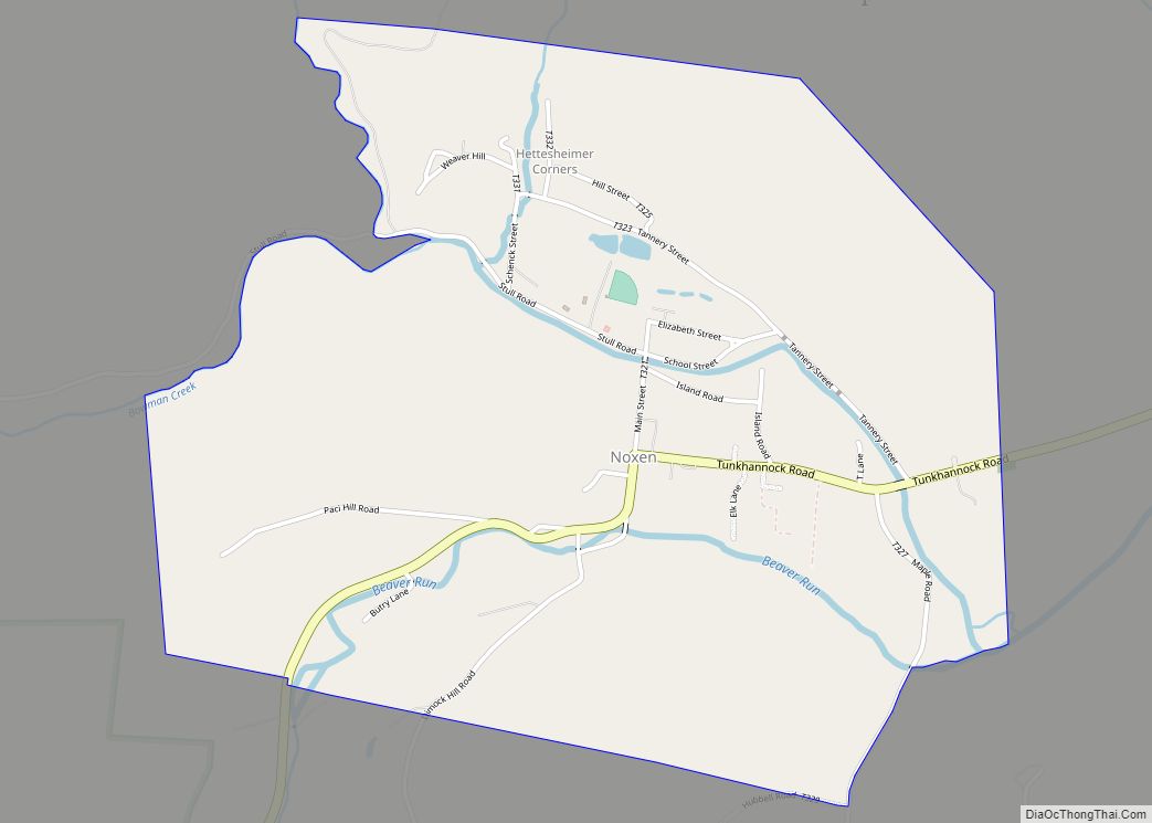
Wyoming County Road Map
Geography
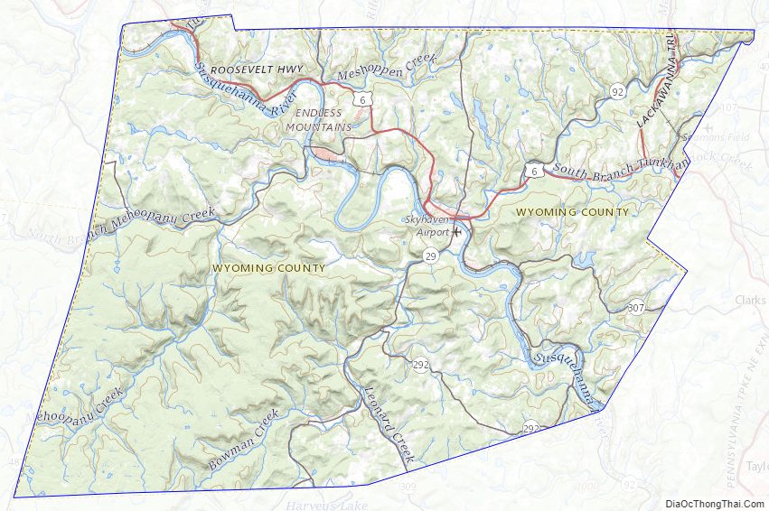
According to the U.S. Census Bureau, the county has a total area of 405 square miles (1,050 km), of which 397 square miles (1,030 km) is land and 7.7 square miles (20 km) (1.9%) is water. The county is intersected by the North Branch of the Susquehanna River, and drained by Tunkhannock, Mehoopany, and other large creeks. The land surface is generally hilly or mountainous, Mehoopany, Tunkhannock, Knob, and Bowman’s mountains occupying a portion. The soil is fertile. Timber, coal, and iron are very abundant.
Climate
The county has a humid continental climate which is warm-summer (Dfb) except along the river starting below Falls where it is hot-summer (Dfa). Average monthly temperatures in Tunkhannock range from 25.2 °F in January to 70.9 °F in July. [1]
Adjacent counties
- Susquehanna County (north)
- Lackawanna County (east)
- Luzerne County (south)
- Sullivan County (west)
- Bradford County (northwest)
Major roads
- US 6
- US 11
- PA 29
- PA 87
- PA 92
- PA 107
- PA 187
- PA 267
- PA 292
- PA 307
- PA 309
- PA 367
Wyoming County Topographic Map
Wyoming County Satellite Map
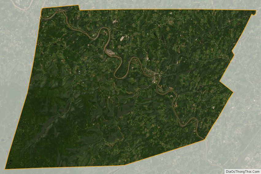
Wyoming County Outline Map