Perry County is a county in the Commonwealth of Pennsylvania. As of the 2020 census, the population was 45,842. The county seat is New Bloomfield. The county was created on March 22, 1820, and was named for Oliver Hazard Perry, a hero of the War of 1812, who had recently died. It was originally part of Cumberland County and was created in part because residents did not want to travel over the mountain to Carlisle, the county seat of Cumberland County. Landisburg became the temporary county seat before New Bloomfield was ultimately chosen.
Perry County is included in the Harrisburg–York–Lebanon combined statistical area. The county is served by the 717/223 area codes.
In 2010, the center of population of Pennsylvania was located in the eastern end of Perry County. Green Park, an unincorporated village located in northeastern Tyrone Township, serves as Perry County’s midpoint between the Conococheague Mountain in the west and the Susquehanna River to the east.
| Name: | Perry County |
|---|---|
| FIPS code: | 42-099 |
| State: | Pennsylvania |
| Founded: | 22 March 1820 |
| Named for: | Oliver Hazard Perry |
| Seat: | New Bloomfield |
| Total Area: | 556 sq mi (1,440 km²) |
| Land Area: | 551 sq mi (1,430 km²) |
| Total Population: | 45,842 |
| Population Density: | 82/sq mi (32/km²) |
| Time zone: | UTC−5 (Eastern) |
| Summer Time Zone (DST): | UTC−4 (EDT) |
| Website: | www.perryco.org |
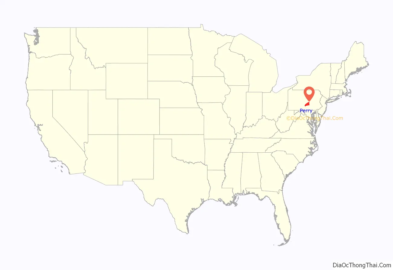
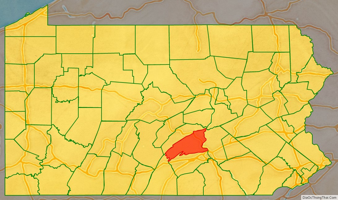
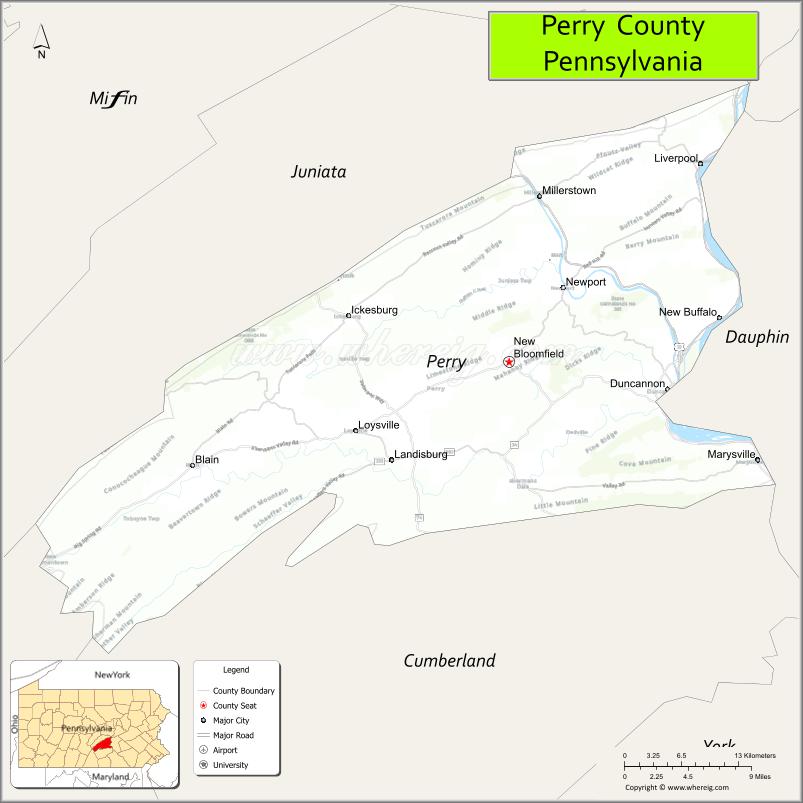
Perry County location map. Where is Perry County?
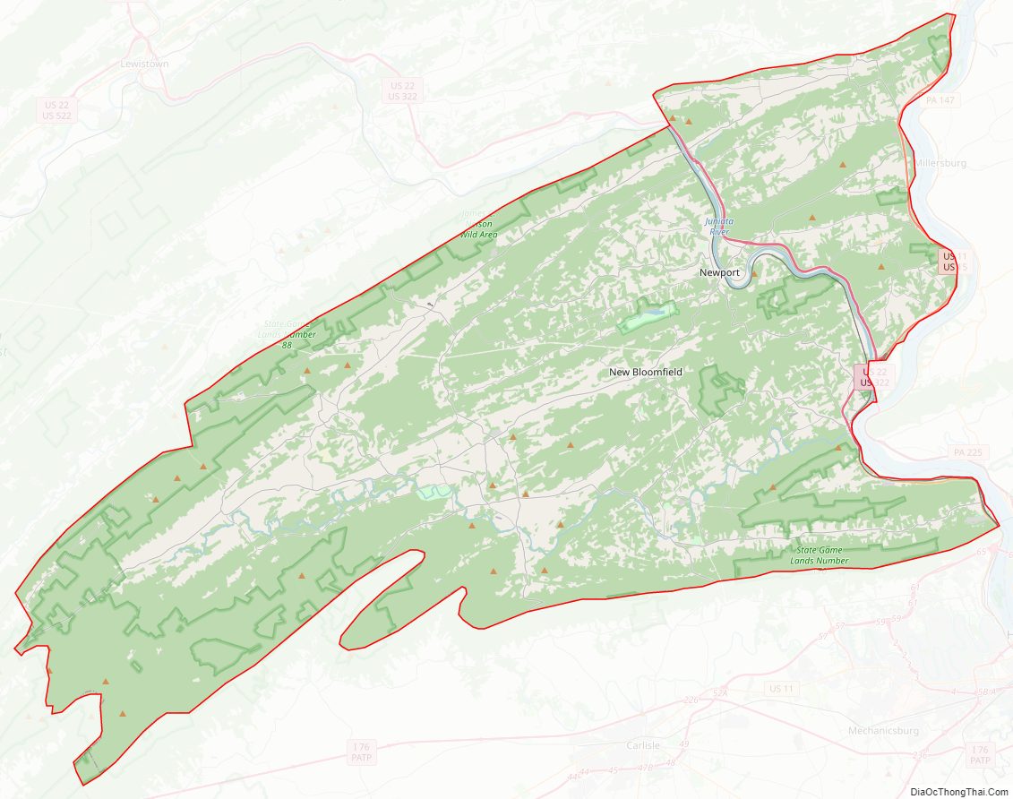
Perry County Road Map
Geography
The county terrain is formed by the folded Appalachian Mountain ridges which run from southwest to northeast across the county. The terrain slopes to the northeast, with its highest point on the Blue Mountain Ridge, which delineates the border between Perry and Cumberland counties. The ridge peaks at 0.83 mile (1.33 km) NE from Perry County’s southmost corner; it measures 2,269′ (692m) ASL. The county is drained by the south-flowing Susquehanna River, which forms almost all of its eastern boundary. The Juniata River enters Perry County from Juniata County near Millerstown, and flows southeast to its confluence with the Susquehanna River near Duncannon. The county also contains several creeks, runs, and lakes, which provide recreational and fishing opportunities, formerly powered mills throughout the county and provided transport venues. To this day, canoeing and kayaking are forms of recreation which utilise the Sherman Creek and other waters in the county.
The county has a total area of 556 square miles (1,440 km), of which 551 square miles (1,430 km) is land and 4.1 square miles (11 km) (0.7%) is water.
The Appalachian Trail runs through the town of Duncannon. The county is also famous for being the northern head of the Tuscarora Trail.
Perry County has a hot-summer humid continental climate (Dfa) and average monthly temperatures in New Bloomfield range from 28.5 °F in January to 73.2 °F in July. [2] The hardiness zone is 6b except in Marysville where it is 7a. [3] Archived 2021-06-18 at the Wayback Machine Common trees include red maple, Virginia pine, oak, eastern white pine, eastern hemlock, birch, shagbark hickory, and juniper, though American sycamore, ironwood, sugar maple, black walnut, elm, alder, and sassafras are also fairly common. Mosses of various species are common sights, especially on fallen tree logs, along streams, on tree trunks, and in sidewalk cracks, usually growing in shaded areas. Ferns also grow along streams and in shaded areas, and are also commonly seen in Perry County woodlands.
Adjacent counties
- Juniata County – north
- Northumberland County – northeast
- Dauphin County – east
- Cumberland County – south
- Franklin County – southwest
Major highways
- US 11 / US 15
- US 22 / US 322
- PA 17
- PA 34
- PA 74
- PA 104
- PA 233
- PA 235
- PA 274
- PA 849
- PA 850
Protected areas
- Big Spring State Forest Picnic Area
- Fowlers Hollow State Park
- Little Buffalo State Park
- Colonel Denning State Park (part)
- Hoverter and Sholl Box Huckleberry Natural Area
- State Game Lands Number 88
- State Game Lands Number 170
- State Game Lands Number 256
- State Game Lands Number 281
- Tuscarora State Forest (part)
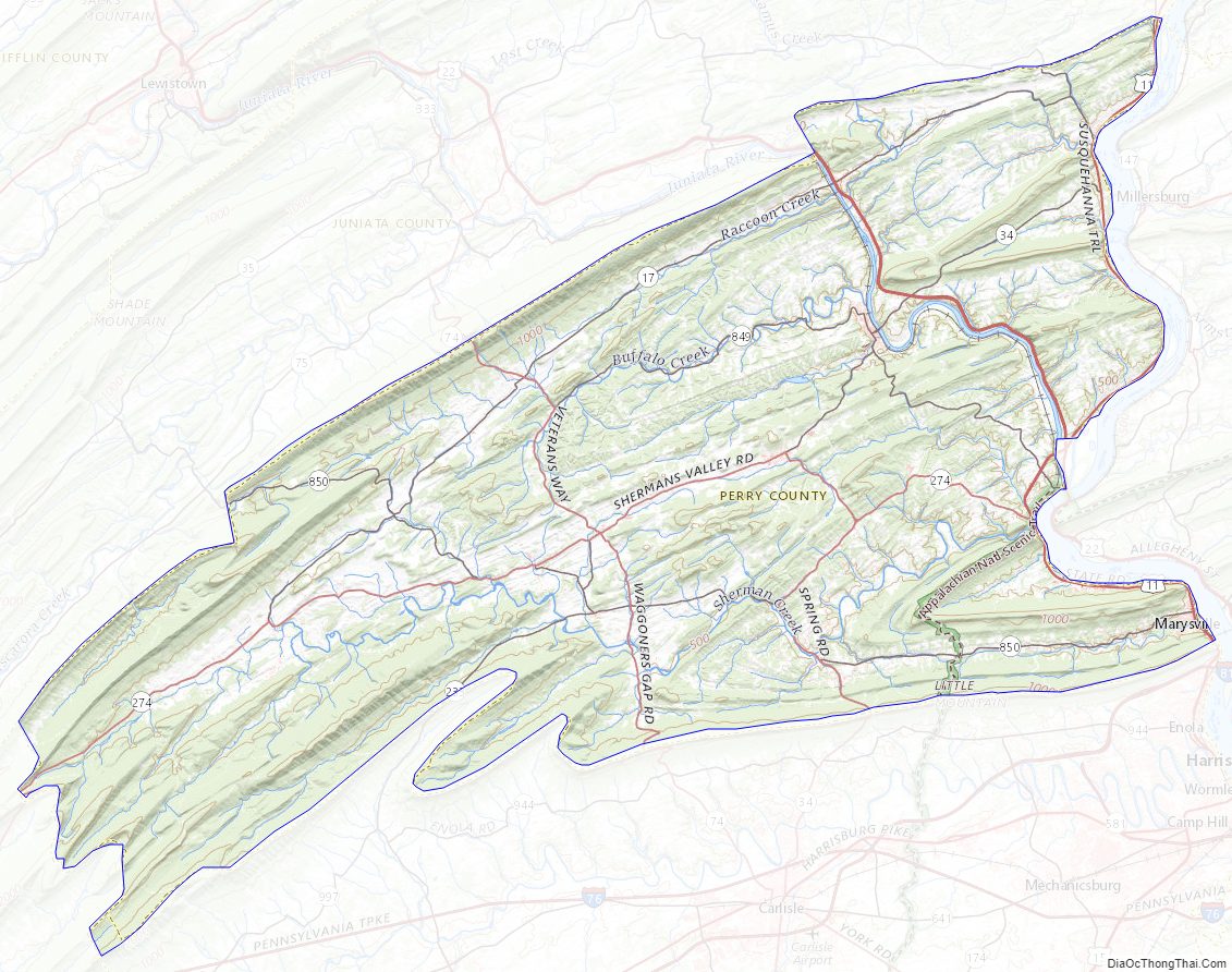
Perry County Topographic Map
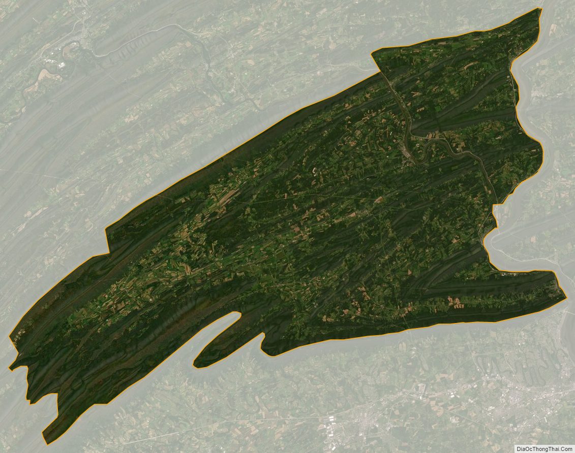
Perry County Satellite Map
Perry County Outline Map