Charleston County is located in the U.S. state of South Carolina along the Atlantic coast. As of the 2020 census, its population was 408,235, making it the third most populous county in South Carolina (behind Greenville and Richland counties). Its county seat is Charleston. It is also the largest county in the state by land area. The county was created in 1800 by an act of the South Carolina State Legislature.
Charleston County is included in the Charleston- North Charleston, SC Metropolitan Statistical Area. It is in the Lowcountry region of South Carolina.
| Name: | Charleston County |
|---|---|
| FIPS code: | 45-019 |
| State: | South Carolina |
| Founded: | January 1, 1800 |
| Named for: | King Charles II |
| Seat: | Charleston |
| Largest city: | Charleston |
| Total Area: | 1,358 sq mi (3,520 km²) |
| Land Area: | 916 sq mi (2,370 km²) |
| Total Population: | 413,024 |
| Population Density: | 450.9/sq mi (174.1/km²) |
| Time zone: | UTC−5 (Eastern) |
| Summer Time Zone (DST): | UTC−4 (EDT) |
| Website: | www.charlestoncounty.org |
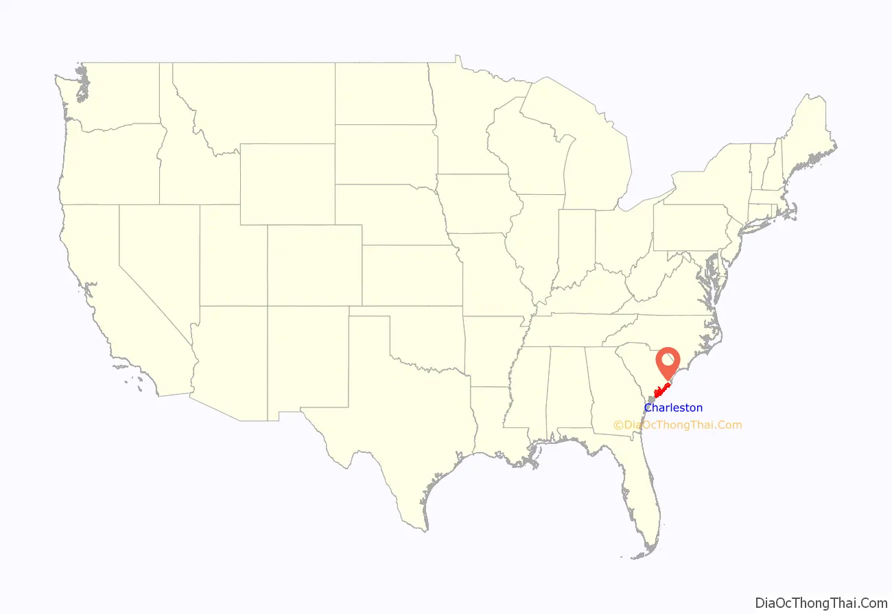
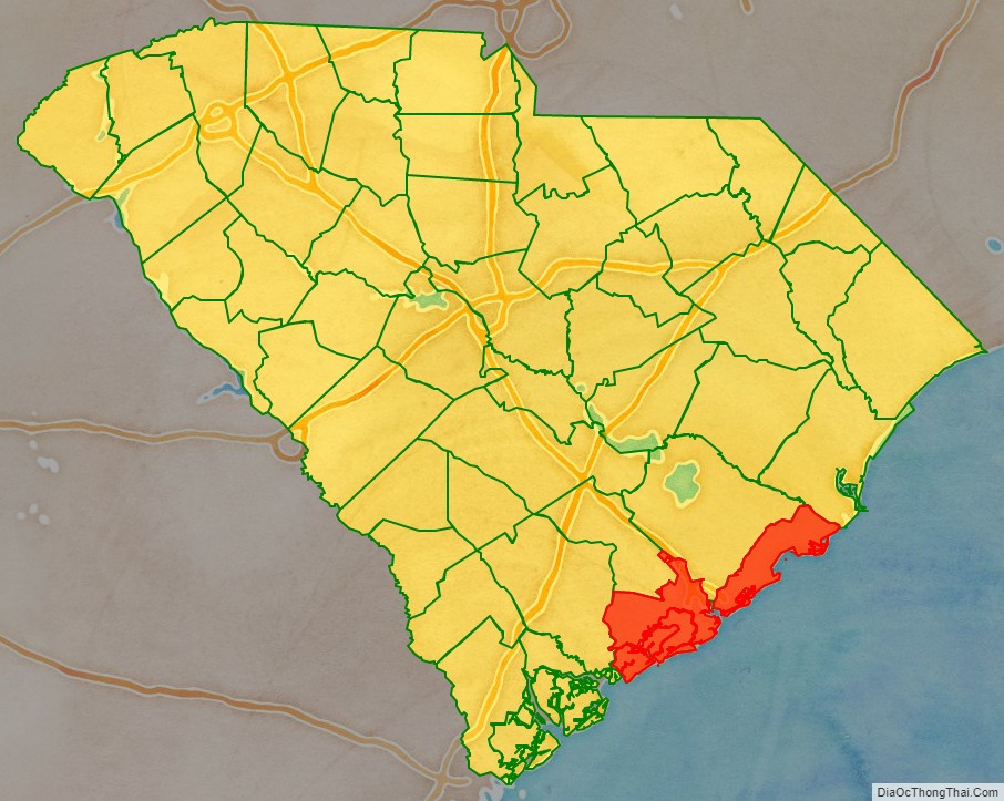
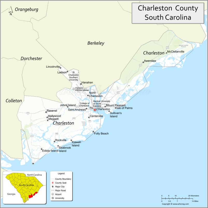
Charleston County location map. Where is Charleston County?
History
Charleston County was chartered in 1785 but was quickly dissolved after disputes by the residents about governance. The county was later redrawn in 1798 with the boundary lines taking effect on January 1, 1800. The county seat and largest city in both the county and state is Charleston. Both the county and town was named after King Charles II.
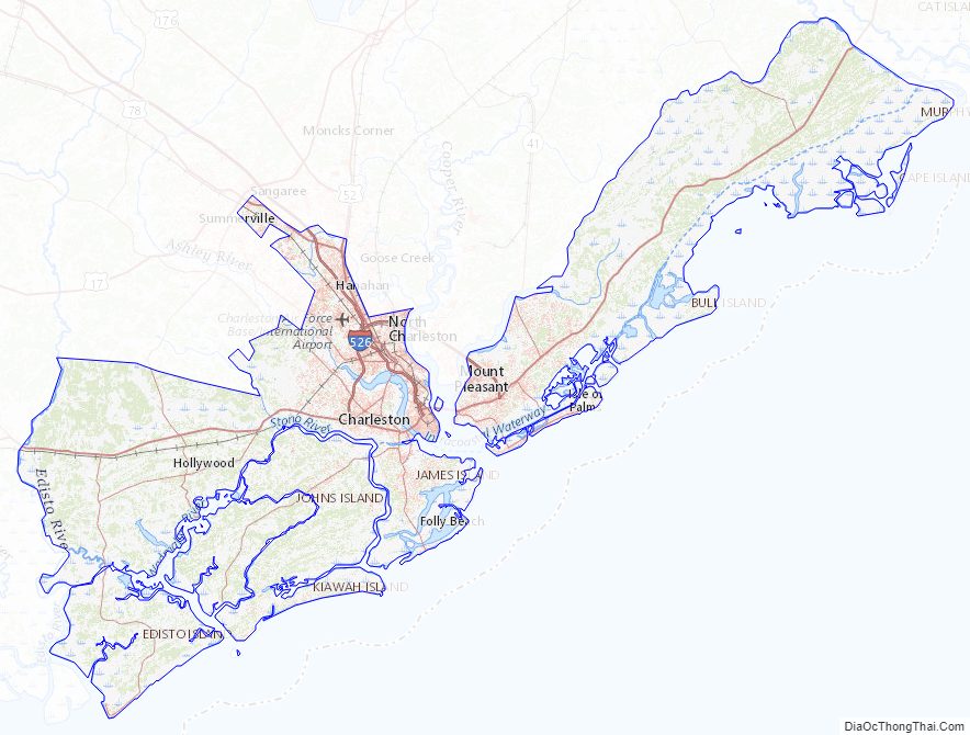
Charleston County Road Map
Geography
According to the U.S. Census Bureau, the county has a total area of 1,358 square miles (3,520 km), of which 916 square miles (2,370 km) is land and 442 square miles (1,140 km) (33%) is water. It is the largest county in South Carolina by total land and water area.
National protected areas
- Cape Romain National Wildlife Refuge
- Charles Pinckney National Historic Site
- Ernest F. Hollings ACE Basin National Wildlife Refuge (part)
- Fort Sumter and Fort Moultrie National Historical Park
- Francis Marion National Forest (part)
State and local protected areas/sites
- Boone Hall Plantation & Gardens
- Capers Island Heritage Preserve
- Charles Towne Landing State Historic Site
- Edisto Beach State Park
- Folly Beach County Park
- Fort Lamar Heritage Preserve
- Hampton Plantation State Historic Site
- James Island County Park
- Magnolia Plantation and Gardens
- Morris Island Lighthouse
- North Charleston Wannamaker County Park
- Santee Coastal Reserve (part)
- Stono River County Park
Major water bodies
- Ashley River
- Atlantic Ocean
- Cooper River
- Intracoastal Waterway
- Kiawah River
- South Edisto River
- South Santee River
- Stono River
- Wando River
Adjacent counties
- Berkeley County – north
- Georgetown County – northeast
- Colleton County – west
- Dorchester County – northwest
Major highways
- I-26
- I-526
- I-526 BS
- US 17
- US 52
- US 52 Conn.
- US 52 Spur
- US 78
- SC 30
- SC 41
- SC 45
- SC 61
- SC 61 Conn.
- SC 162
- SC 165
- SC 171
- SC 174
- SC 517
- SC 642
- SC 700
- SC 703
Major infrastructure
- Charleston International Airport (Joint civil-military airport, also home to Boeing South Carolina)
- North Charleston Station
- Port of Charleston
Charleston County Topographic Map
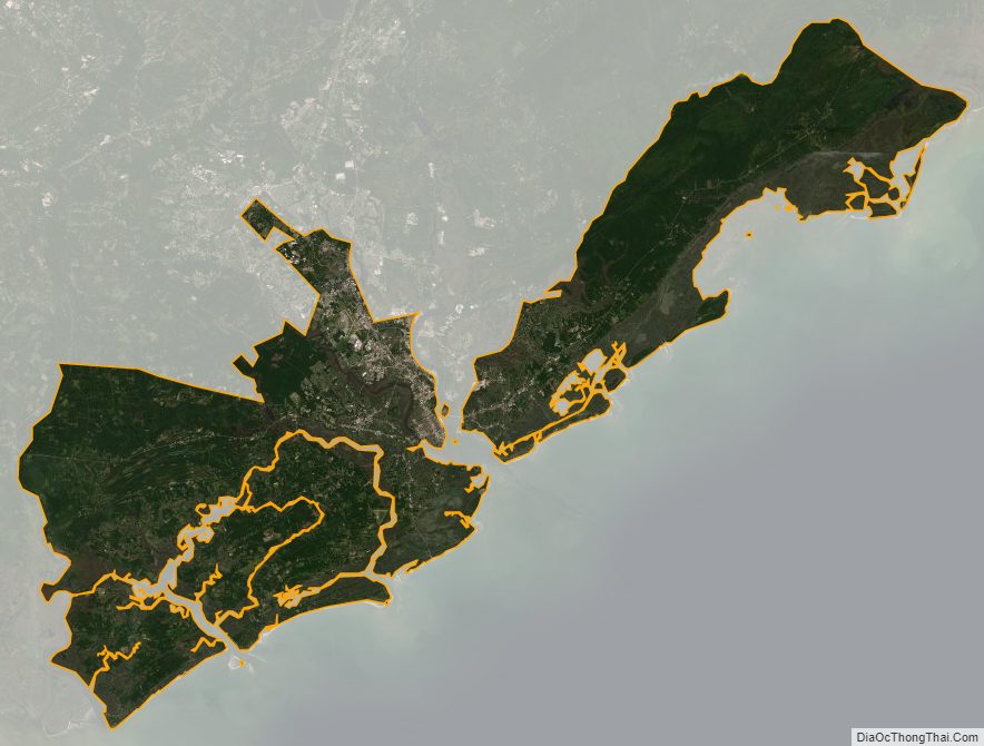
Charleston County Satellite Map
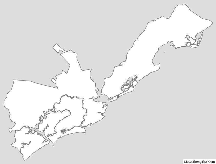
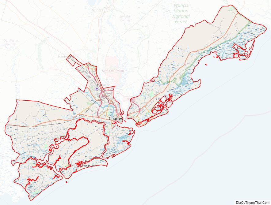
Charleston County Outline Map