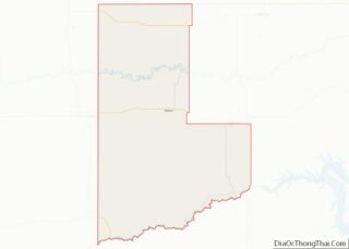
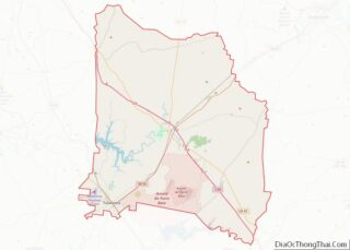
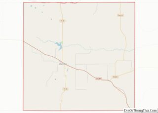
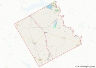
Map of Buffalo County, Nebraska
Buffalo County is a county located in the U.S. state of Nebraska in the Midwestern United States. As of the 2010 United States Census, the population was 46,102, making it Nebraska’s fifth-most populous of the 93 counties. Its county seat is Kearney. The county was created in 1855 and was organized in 1870. It was ... Read more
Map of Buffalo County, Nebraska
Map of Dixon County, Nebraska
Dixon County is a county in the U.S. state of Nebraska. As of the 2010 United States Census, the population was 6,000. Its county seat is Ponca. The county was created in 1856 and attached to Dakota County. It was organized in 1858. Dixon County is part of the Sioux City, IA–NE–SD Metropolitan Statistical Area. ... Read more
Map of Dixon County, Nebraska
Map of Harlan County, Nebraska
Harlan County is a county in the U.S. state of Nebraska. As of the 2020 United States Census, the population was 3,073. Its county seat is Alma. The county is home to the Harlan County Reservoir. In the Nebraska license plate system, Harlan County is represented by the prefix 51 (it had the 51st-largest number ... Read more
Map of Harlan County, Nebraska
Map of Loup County, Nebraska
Loup County is a county in the U.S. state of Nebraska. As of the 2010 United States Census, the population was 632, making it Nebraska’s fifth-least populous county and the tenth-least populous county in the United States. Its county seat is Taylor. The county was named after the Pawnee Loup Indians. In the Nebraska license ... Read more
Map of Loup County, Nebraska
Map of Richardson County, Nebraska
Richardson County is the easternmost county in the U.S. state of Nebraska. As of the 2010 census, the population was 8,363. Its county seat is Falls City. In the Nebraska license plate system, Richardson County is represented by the prefix 19 (it had the nineteenth-largest number of vehicles registered in the county when the license ... Read more
Map of Richardson County, Nebraska
Map of Wayne County, Nebraska
Wayne County is a county in the U.S. state of Nebraska. As of the 2010 census, the population was 9,595. Its county seat is Wayne. In the Nebraska license plate system, Wayne County is represented by the prefix 27 (it had the 27th-largest number of vehicles registered in the state when the license plate system ... Read more
Map of Wayne County, Nebraska
Map of Nye County, Nevada
Nye County overview: Name: Nye County FIPS code: 32-023 State: Nevada Founded: 1864 Named for: James W. Nye Seat: Tonopah Total Area: 18,199 sq mi (47,140 km²) Land Area: 18,182 sq mi (47,090 km²) Total Population: 51,591 Population Density: 2.8/sq mi (1.1/km²) Time zone: UTC−8 (Pacific) Summer Time Zone (DST): UTC−7 (PDT) Website: nyecounty.net Nye County location map. Where is Nye County? ... Read more
Map of Nye County, Nevada
Map of Bergen County, New Jersey
Bergen County overview: Name: Bergen County FIPS code: 34-003 State: New Jersey Founded: 1683 Named for: Bergen, Norway or Bergen, North Holland Seat: Hackensack Total Area: 246.67 sq mi (638.87 km²) Land Area: 233.00 sq mi (603.49 km²) Total Population: 955,732 Population Density: 4,105.6/sq mi (1,585.2/km²) Time zone: UTC−5 (Eastern) Summer Time Zone (DST): UTC−4 (EDT) Website: www.co.bergen.nj.us Bergen County location map. ... Read more
Map of Bergen County, New Jersey
Map of Somerset County, New Jersey
Somerset County overview: Name: Somerset County FIPS code: 34-035 State: New Jersey Founded: May 14, 1688 Named for: English county of Somerset Seat: Somerville Largest city: Franklin Township (population)Hillsborough Township (area) Total Area: 304.86 sq mi (789.6 km²) Land Area: 301.81 sq mi (781.7 km²) Total Population: 345,361 Population Density: 1,144.3/sq mi (441.8/km²) Website: www.co.somerset.nj.us Somerset County location map. Where is Somerset ... Read more
Map of Somerset County, New Jersey
Map of Hidalgo County, New Mexico
Hidalgo County (Spanish: Condado de Hidalgo) is the southernmost county of the U.S. state of New Mexico. As of the 2010 census, the population was 4,894. The county seat and largest city is Lordsburg. A bill creating Hidalgo from the southern part of Grant County was passed on February 25, 1919, taking effect at the ... Read more
Map of Hidalgo County, New Mexico
Map of Socorro County, New Mexico
Socorro County overview: Name: Socorro County FIPS code: 35-053 State: New Mexico Founded: January 9, 1852 Seat: Socorro Largest city: Socorro Total Area: 6,649 sq mi (17,220 km²) Land Area: 6,647 sq mi (17,220 km²) Total Population: 16,311 Population Density: 2.7/sq mi (1.0/km²) Time zone: UTC−7 (Mountain) Summer Time Zone (DST): UTC−6 (MDT) Website: www.socorrocounty.net Socorro County location map. Where is Socorro ... Read more
Map of Socorro County, New Mexico
Map of Cortland County, New York
Cortland County is a county located in the U.S. state of New York. As of the 2020 census, the population of Cortland County was 46,809. The county seat is Cortland. The county is named after Pierre Van Cortlandt, president of the convention at Kingston that wrote the first New York State Constitution in 1777, and ... Read more
Map of Cortland County, New York