Ziebach County is a county in the U.S. state of South Dakota. As of the 2020 census, the population was 2,413. Its county seat is Dupree. It is the last county (or county equivalent) in the United States alphabetically.
The county’s per-capita income makes it the fourth-poorest county in the United States.
| Name: | Ziebach County |
|---|---|
| FIPS code: | 46-137 |
| State: | South Dakota |
| Founded: | 1911 |
| Named for: | Frank M. Ziebach |
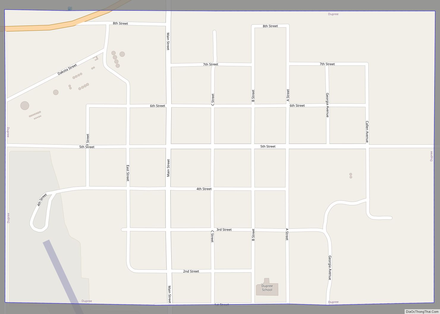
| Seat: | Dupree |
| Largest city: | Dupree |
| Total Area: | 1,971 sq mi (5,100 km²) |
| Land Area: | 1,961 sq mi (5,080 km²) |
| Total Population: | 2,413 |
| Population Density: | 1.2/sq mi (0.47/km²) |
| Time zone: | UTC−7 (Mountain) |
| Summer Time Zone (DST): | UTC−6 (MDT) |
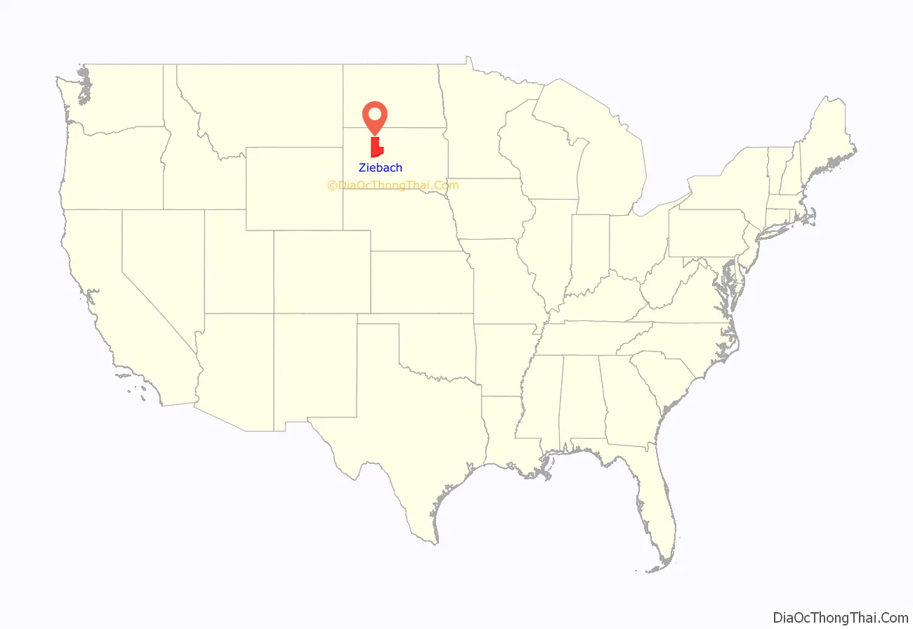
Ziebach County location map. Where is Ziebach County?
History
A county named Ziebach was created in Dakota Territory in 1877. However, after South Dakota became a state, this county was dissolved in 1898 and its areas absorbed by Pennington and Stanley counties. The present Ziebach County was created by the SD Legislature on February 1, 1911, and was fully organized by April 22. The 1911 Ziebach County encompassed parts of the former counties of Schnasse, Armstrong and Sterling, which were the last three extinct counties of South Dakota to cease to exist. It was named for Frank M. Ziebach, a political figure in the Dakota Territory during the territorial period from 1861 to 1889. Previously the area had been used by trappers and in 1907 part was briefly a reservation for Ute Indians displaced from Utah and Wyoming. Early in the 20th Century cattle were raised in substantial numbers, but when the railroad bypassed the area this industry declined. Limited homesteading also occurred on the more fertile lands.
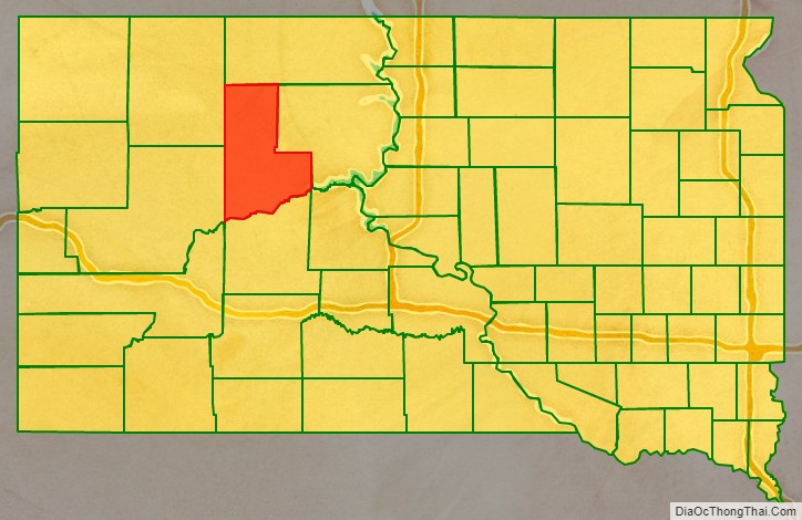
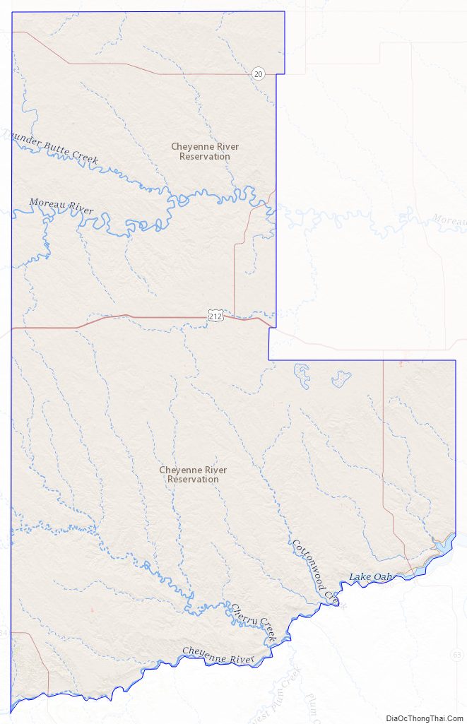
Ziebach County Road Map
Geography
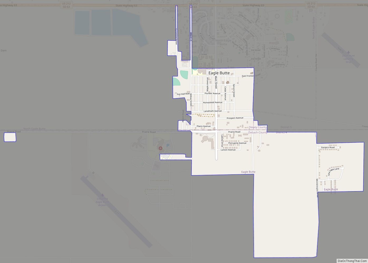
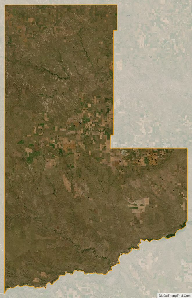
The Cheyenne River flows east-northeastward along the southern boundary of Ziebach County. The Moreau River flows eastward through the upper portion of the county, and Cherry Creek flows southeastward through the lower portion, draining the area into the Cheyenne River. The terrain is composed of semi-arid rolling hills interrupted by buttes and carved by drainages and gullies, partly devoted to agriculture and cattle. The terrain slopes to the south and the east; its highest point (except for the isolated Thunder Butte, at 2,733′) is near its NW corner at 2,582′ (787m) ASL. The county has a total area of 1,971 square miles (5,100 km), of which 1,961 square miles (5,080 km) is land and 9.3 square miles (24 km) (0.5%) is water. Almost the entire county lies within the Cheyenne River Indian Reservation. The balance of the county, along its extreme northern county line, lies within the Standing Rock Indian Reservation. It is one of five South Dakota counties that lie entirely on Indian reservations.
Buttes
Ziebach County is part of the Great Plains and is characterized by rolling grasslands and numerous buttes. The buttes form the highest points of elevation in Ziebach County:
- Bessie Butte 2,474 feet (754.08 m)
- Eagle Butte 2,484 feet (757.12 m)
- Gray Butte 2,316 feet (705.92 m)
- High Elk Hill 2,395 feet (730.00 m)
- Joshua Butte 2,165 feet (659.89 m)
- Marple Butte 2,484 feet (757.12 m)
- Mud Butte 2,500 feet (762.00 m)
- Mud Butte 2,365 feet (720.85 m)
- Rattlesnake Butte 2,411 feet (734.87 m)
- Saint Patrick Butte 2,356 feet (718.11 m)
- Squaw Teat Butte 2,365 feet (720.85 m)
- Thunder Butte 2,733 feet (833.02 m)
Major highways
- U.S. Highway 212
- South Dakota Highway 20
- South Dakota Highway 34
- South Dakota Highway 63
- South Dakota Highway 65
- South Dakota Highway 73
Adjacent counties
- Corson County – north
- Dewey County – east
- Stanley County – southeast
- Haakon County – south
- Pennington County – southwest
- Meade County – west
- Perkins County – northwest
Protected areas
- Bednor Lake State Game Production Area
- Cheyenne State Game Production Area (part)
- Grand River National Grassland (part)
Lakes and reservoirs
- Bedners Dam
- K C Dam
- Rattlesnake Lake
Ziebach County Topographic Map
Ziebach County Satellite Map
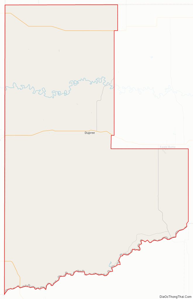
Ziebach County Outline Map