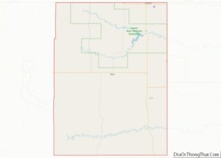
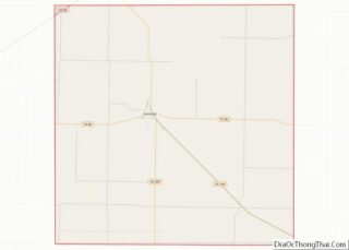
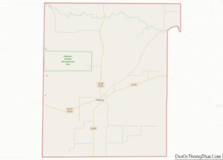
Map of Marshall County, South Dakota
Marshall County is a county in the U.S. state of South Dakota. As of the 2020 census, the population was 4,306. Its county seat is Britton. The county was created on May 2, 1885, and was named for Marshall Vincent, who homesteaded near Andover, South Dakota. Marshall County overview: Name: Marshall County FIPS code: 46-091 ... Read more
Map of Marshall County, South Dakota
Map of Sully County, South Dakota
Sully County is a county in the U.S. state of South Dakota. As of the 2020 census, the population was 1,446, making it the fifth-least populous county in South Dakota. Its county seat is Onida. The county was created in 1873 and organized in 1883. It is named after General Alfred Sully, who built Fort ... Read more
Map of Sully County, South Dakota
Map of Carroll County, Tennessee
Carroll County is a county located in the western division of the U.S. state of Tennessee. As of the 2020 census, the population was 28,440. Its county seat is Huntingdon. The county was established by the Tennessee General Assembly on November 7, 1821, and was named for Governor William Carroll. Carroll County overview: Name: Carroll ... Read more
Map of Carroll County, Tennessee
Map of Fentress County, Tennessee
Fentress County is a county located in the U.S. state of Tennessee. As of the 2020 census, the population was 18,489. Its county seat is Jamestown. Fentress County overview: Name: Fentress County FIPS code: 47-049 State: Tennessee Founded: November 28, 1823 Named for: James Fentress, state legislator Seat: Jamestown Largest city: Jamestown Total Area: 499 sq mi ... Read more
Map of Fentress County, Tennessee
Map of Hickman County, Tennessee
Hickman County is a county located in the U.S. state of Tennessee. As of the 2020 Census, the population was 24,925. Its county seat is Centerville. Hickman County was part of the Nashville–Davidson–Murfreesboro–Franklin, TN Metropolitan Statistical Area but was removed in September 2018. Hickman County overview: Name: Hickman County FIPS code: 47-081 State: Tennessee Founded: ... Read more
Map of Hickman County, Tennessee
Map of Marshall County, Tennessee
Marshall County is a county located in the U.S. state of Tennessee. As of the 2020 census, the population was 34,318. Its county seat is Lewisburg. Marshall County comprises the Lewisburg Micropolitan Statistical Area, which is also included in the Nashville-Davidson–Murfreesboro–Franklin, TN Metropolitan Statistical Area. It is in Middle Tennessee, one of the three Grand ... Read more
Map of Marshall County, Tennessee
Map of Roane County, Tennessee
Roane County is a county of the U.S. state of Tennessee. As of the 2020 census, the population was 53,404. Its county seat is Kingston. Roane County is included in the Knoxville, TN Metropolitan Statistical Area. Roane County overview: Name: Roane County FIPS code: 47-145 State: Tennessee Founded: 1801 Named for: Archibald Roane Seat: Kingston ... Read more
Map of Roane County, Tennessee
Map of Warren County, Tennessee
Warren County is a county located on the Cumberland Plateau in Middle Tennessee, one of the three Grand Divisions of the U.S. state of Tennessee. As of the 2020 census, the population was 40,953. Its county seat is McMinnville. Warren County comprises the McMinnville, TN Micropolitan Statistical Area. Warren County overview: Name: Warren County FIPS ... Read more
Map of Warren County, Tennessee
Map of Bandera County, Texas
Bandera County (Spanish: “flag”, /bænˈdɛrə/ ban-DERR-ə) is a county in the U.S. state of Texas. It is located in the Hill Country and its county seat is Bandera. As of the 2020 census, the population is 20,851. Bandera County is part of the San Antonio-New Braunfels metropolitan statistical area. The county is officially recognized as ... Read more
Map of Bandera County, Texas
Map of Burleson County, Texas
Burleson County overview: Name: Burleson County FIPS code: 48-051 State: Texas Founded: 1846 Named for: Edward Burleson Seat: Caldwell Largest city: Caldwell Total Area: 677 sq mi (1,750 km²) Land Area: 659 sq mi (1,710 km²) Total Population: 17,642 Population Density: 26/sq mi (10/km²) Time zone: UTC−6 (Central) Summer Time Zone (DST): UTC−5 (CDT) Website: www.co.burleson.tx.us Burleson County location map. Where is ... Read more
Map of Burleson County, Texas
Map of Coleman County, Texas
Coleman County is a county located in the U.S. state of Texas. As of the 2020 census, its population was 7,684. The county seat is Coleman. The county was founded in 1858 and organized in 1864. It is named for Robert M. Coleman, a signer of the Texas Declaration of Independence and soldier at the ... Read more
Map of Coleman County, Texas
Map of Dawson County, Texas
Dawson County is a county in the U.S. state of Texas. As of the 2020 census, its population was 12,456. The county seat is Lamesa. The county was created in 1876 and later organized in 1905. It is named for Nicholas Mosby Dawson, a soldier of the Texas Revolution. Dawson County comprises the Lamesa, TX ... Read more
Map of Dawson County, Texas