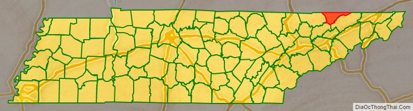
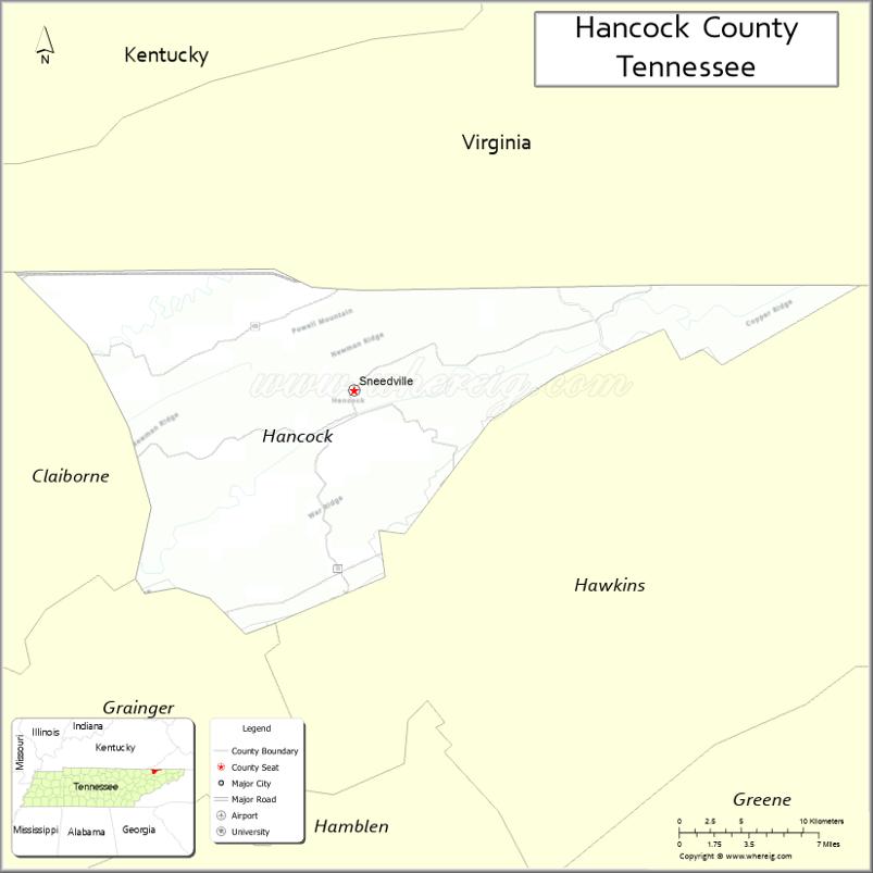
Hancock County is a county located in the northeastern part of the U.S. state of Tennessee. As of the 2020 census, the population was 6,662, making it the fourth-least populous county in Tennessee. Its county seat is Sneedville.
| Name: | Hancock County |
|---|---|
| FIPS code: | 47-067 |
| State: | Tennessee |
| Founded: | 1844 |
| Named for: | John Hancock |
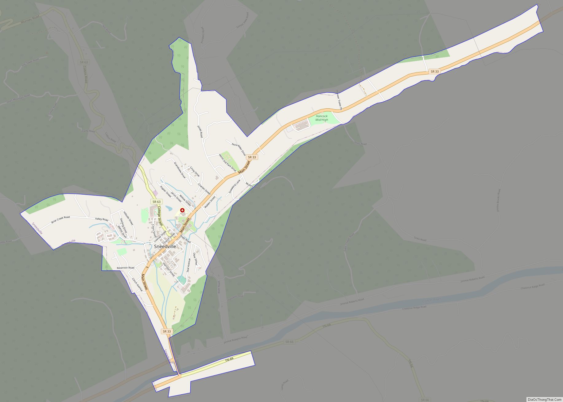
| Seat: | Sneedville |
| Largest town: | Sneedville |
| Total Area: | 223 sq mi (580 km²) |
| Land Area: | 222 sq mi (570 km²) |
| Total Population: | 6,662 |
| Population Density: | 31/sq mi (12/km²) |
| Time zone: | UTC−5 (Eastern) |
| Summer Time Zone (DST): | UTC−4 (EDT) |
| Website: | www.hancockcountytn.com |
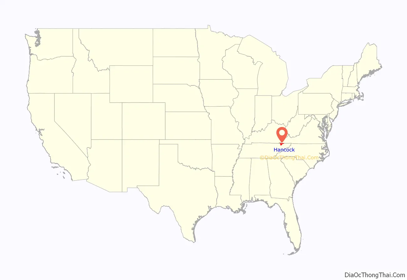
Hancock County location map. Where is Hancock County?
History
Hancock County was created from parts of Hawkins and Claiborne counties. The act establishing the county was passed by the state legislature in 1844, but several Hawkins residents sued to block its creation. In 1848, the Tennessee Supreme Court ruled in favor of the new county. The county seat, Sneedville, was named in honor of the attorney William H. Sneed, who represented the county in the court case. The county was named after the Revolutionary War patriot John Hancock.
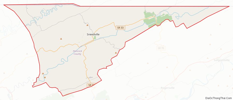
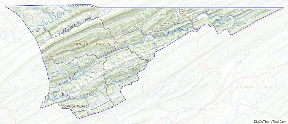
Hancock County Road Map
Geography
According to the U.S. Census Bureau, the county has a total area of 223 square miles (580 km), of which 222 square miles (570 km) is land and 1.2 square miles (3.1 km) (0.5%) is water.
Adjacent counties
- Lee County, Virginia (north)
- Scott County, Virginia (northeast)
- Hawkins County (east)
- Grainger County (southwest)
- Claiborne County (west)
State protected areas
- Kyles Ford Wildlife Management Area (part)
Major Highways
There are 3 primary state highways and 4 secondary state highways that run through Hancock County.
- SR 31 (to US 11W/ SR 1 and Hawkins County)
- SR 33 (Turns to SR 33 after the fork in Kyles Ford) then becomes SR 600 in VA. Southbound to Tazewell and Central Claiborne County)
- SR 63 (To Harrogate and Northern Claiborne County)
- SR 70 (Turns to SR 70 after the fork from SR 33 to the Virginia border. Then it becomes SR 70 in VA. Southbound goes to Rogersville)
- SR 131 (to US 25E/ SR 32 and NE Grainger County)
- Back Valley Rd (Connects downtown Sneedville with other communities with a terminus at SR 33 going towards Tazewell)
Hancock County Topographic Map
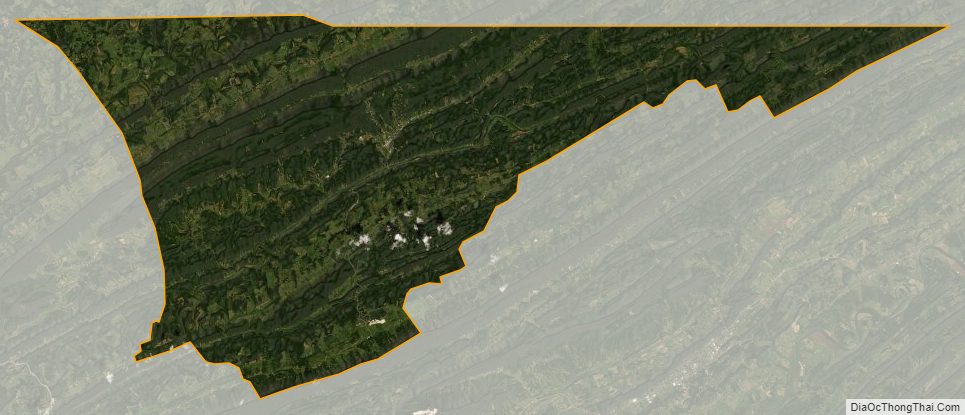
Hancock County Satellite Map
Hancock County Outline Map