Cumberland County is a county located in the U.S. state of Tennessee. As of the 2020 census, the population was 61,145. Its county seat is Crossville. Cumberland County comprises the Crossville, TN micropolitan statistical area.
| Name: | Cumberland County |
|---|---|
| FIPS code: | 47-035 |
| State: | Tennessee |
| Founded: | November 16, 1855 |
| Named for: | Cumberland Mountains |
| Seat: | Crossville |
| Largest city: | Crossville |
| Total Area: | 685 sq mi (1,770 km²) |
| Land Area: | 681 sq mi (1,760 km²) |
| Total Population: | 61,145 |
| Population Density: | 82/sq mi (32/km²) |
| Time zone: | UTC−6 (Central) |
| Summer Time Zone (DST): | UTC−5 (CDT) |
| Website: | cumberlandcountytn.gov |
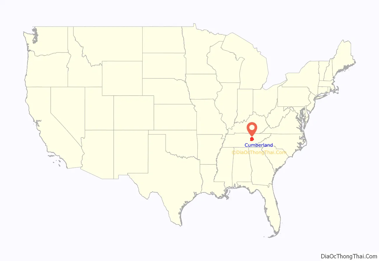
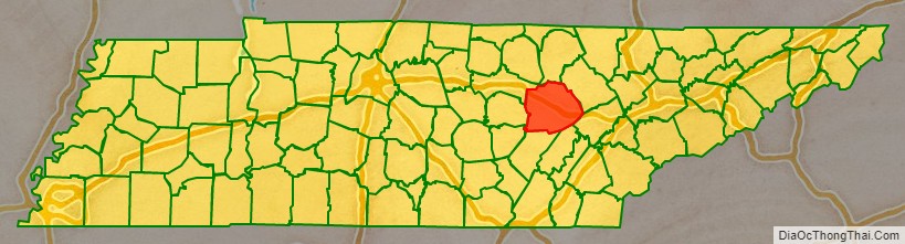
Cumberland County location map. Where is Cumberland County?
History
Cumberland County was formed in 1856 from parts of Bledsoe, Roane, Morgan, Fentress, Rhea, Putnam, Overton, and White. During the Civil War, the county was nearly evenly split between those supporting the Union and those supporting the Confederacy.
In 1787, the North Carolina legislature ordered widening and improvements to Avery’s Trace, the trail that ran from North Carolina through Knoxville and what is now Cumberland County to Nashville. They raised funds by a lottery and completed a project that built a wagon road. This slightly improved travel, but still required a bone jarring trip. The road was often muddy and crossed stone slabs so that it was only passable in some places on foot. Reportedly wagons could not get down the steep grade at Spencer’s Mountain without locking brakes on all wheels and dragging a tree behind to slow the descent. The mountain top was described as “quite denuded of trees.”
Cumberland County was the site of an important saltpeter mine. Saltpeter is the main ingredient of gunpowder and was obtained by leaching the earth from Grassy Cove Saltpeter Cave. Richard Green Waterhouse settled in this area in 1800. In his “Diary, Journal, and Memoirs” he states that he went with William Kelly into Grassy cove and explored his (Kelly’s) saltpeter cave on October 7, 1812.
According to Barr (1961), Dicky Mathews began the manufacture of gunpowder at the cave in 1859. His son was killed by an explosion at Powder House Spring below the cave. This is an exceptionally large cave and evidence of mining extends far from the entrance. The leaching vats were located in a large room near the entrance, but this room is damp and the wooden vats have deteriorated to the point that they are difficult to recognize.
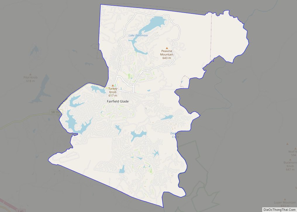
During the 1930s, as part of the New Deal, the federal government’s Subsistence Homesteads Division established the Cumberland Homesteads outside of Crossville. The program provided land and houses for 250 impoverished families. Cumberland Mountain State Park was built as part of this project.
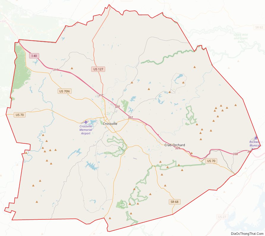
Cumberland County Road Map
Geography
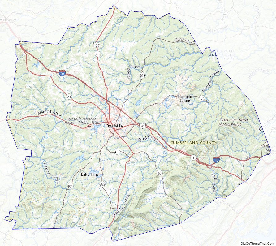
According to the U.S. Census Bureau, the county has a total area of 685 square miles (1,770 km), of which 681 square miles (1,760 km) is land and 3.8 square miles (9.8 km) (0.6%) is water. It is the fourth-largest county in Tennessee by area. The county is located atop the Cumberland Plateau. The southernmost of the Cumberland Mountains, known locally as the Crab Orchard Mountains, rise in the northeastern part of the county.
The county is home to a number of karst formations, most notably at Grassy Cove, a large, closed depression located southeast of Crossville. It is 3 miles wide, 5 miles long, and over 1,000 feet deep. All of the water draining into Grassy Cove flows underground through a large cave system and emerges 4 miles southwest at the head of the Sequatchie Valley to form the Sequatchie River.
The Tennessee Divide, where the watersheds of the Cumberland River and the Tennessee River meet, passes through the county. The source of the Caney Fork is located west of the divide, while the source of the Obed River is located east of the divide.
Adjacent counties
- Fentress County (north)
- Morgan County (northeast/EST Border)
- Roane County (east/EST Border)
- Rhea County (southeast/EST Border)
- Bledsoe County (south)
- Van Buren County (southwest)
- White County (west)
- Putnam County (northwest)
National protected area
- Obed Wild and Scenic River (part)
State protected areas
- Bledsoe State Forest (part)
- Catoosa Wildlife Management Area (part)
- Cumberland Mountain State Park
- Cumberland Trail (part)
- Keyes-Harrison Wildlife Management Area
- Luper Mountain Wildlife Management Area
- Mount Roosevelt Wildlife Management Area (part)
- Ozone Falls State Natural Area
Cumberland County Topographic Map
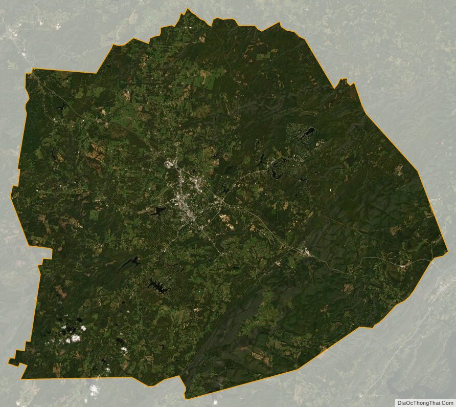
Cumberland County Satellite Map
Cumberland County Outline Map