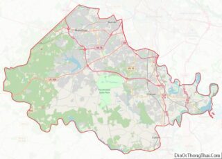
Map of Fresno County

Map of Fresno County, California

Fresno County (/ˈfrɛznoʊ/ (listen)), officially the County of Fresno, is a county located in the central portion of the U.S. state of California. As of the 2020 Census, the population was 1,008,654. The county seat is Fresno, the fifth-most populous city in California. Fresno County comprises the Fresno, CA Metropolitan Statistical Area, which is part … Read more

Map of Mono County

Map of Mono County, California

Mono County (/ˈmoʊnoʊ/ MOH-noh) is a county located in the east central portion of the U.S. state of California. As of the 2020 census, the population was 13,195, making it the fourth-least populous county in California. The county seat is Bridgeport. The county is located east of the Sierra Nevada between Yosemite National Park and … Read more

Map of Santa Barbara County

Map of Santa Barbara County, California

Santa Barbara County, officially the County of Santa Barbara (Spanish: Condado de Santa Bárbara), is located in Southern California. As of the 2020 census, the population was 448,229. The county seat is Santa Barbara, and the largest city is Santa Maria. Santa Barbara County comprises the Santa Maria-Santa Barbara, CA Metropolitan Statistical Area. Most of … Read more

Map of Yuba County

Map of Yuba County, California

Yuba County (/ˈjuːbə/ (listen); Maidu: Yubu) is a county in the U.S. state of California. As of the 2020 U.S. Census, its population was 81,575. The county seat is Marysville. Yuba County is included in the Yuba Citymetropolitan statistical area, which is also included in the Sacramento–Roseville combined statistical area. The county is in the … Read more

Map of Delta County

Map of Delta County, Colorado

Delta County overview: Name: Delta County FIPS code: 08-029 State: Colorado Founded: February 11, 1883 Named for: City of Delta, Colorado Seat: Delta Largest city: Delta Total Area: 1,149 sq mi (2,980 km²) Land Area: 1,142 sq mi (2,960 km²) Total Population: 31,661 Population Density: 27/sq mi (10/km²) Time zone: UTC−7 (Mountain) Summer Time Zone (DST): UTC−6 (MDT) Website: www.deltacounty.com Delta County … Read more

Map of Kiowa County

Map of Kiowa County, Colorado

Kiowa County is a county located in the U.S. state of Colorado. As of the 2020 census, the population was 1,446, making it the fifth-least populous county in Colorado. The county seat is Eads. The county was named for the Kiowa Nation of Native Americans. Kiowa County overview: Name: Kiowa County FIPS code: 08-061 State: … Read more

Map of Park County

Map of Park County, Colorado

Park County is a county located in the U.S. state of Colorado. As of the 2020 census, the population was 17,390. The county seat is Fairplay. The county was named after the large geographic region known as South Park, which was named by early fur traders and trappers in the area. Park County is included … Read more

Map of Yuma County

Map of Yuma County, Colorado

Yuma County overview: Name: Yuma County FIPS code: 08-125 State: Colorado Founded: March 15, 1889 Seat: Wray Largest city: Yuma Total Area: 2,369 sq mi (6,140 km²) Land Area: 2,364 sq mi (6,120 km²) Total Population: 9,988 Population Density: 4.2/sq mi (1.6/km²) Time zone: UTC−7 (Mountain) Summer Time Zone (DST): UTC−6 (MDT) Website: www.yumacounty.net Yuma County location map. Where is Yuma County? … Read more

Map of Bradford County

Map of Bradford County, Florida

Bradford County overview: Name: Bradford County FIPS code: 12-007 State: Florida Founded: December 31, 1858 Seat: Starke Largest city: Starke Total Area: 300 sq mi (800 km²) Land Area: 294 sq mi (760 km²) Total Population: 28,303 Population Density: 91/sq mi (35/km²) Time zone: UTC−5 (Eastern) Summer Time Zone (DST): UTC−4 (EDT) Website: www.bradfordcountyfl.gov Bradford County location map. Where is Bradford County? … Read more

Map of Gilchrist County

Map of Gilchrist County, Florida

Gilchrist County overview: Name: Gilchrist County FIPS code: 12-041 State: Florida Founded: December 4, 1925 Named for: Albert W. Gilchrist Seat: Trenton Largest city: Trenton Total Area: 355 sq mi (920 km²) Land Area: 350 sq mi (900 km²) Total Population: 18,360 Population Density: 48/sq mi (19/km²) Time zone: UTC−5 (Eastern) Summer Time Zone (DST): UTC−4 (EDT) Website: gilchrist.fl.us Gilchrist County location … Read more

Map of Leon County

Map of Leon County, Florida

Leon County (Spanish: Condado de León) is a county in the Panhandle of the U.S. state of Florida. It was named after the Spanish explorer Juan Ponce de León. As of the 2020 census, the population was 292,198. The county seat is Tallahassee, which is also the state capital and home to many politicians, lobbyists, … Read more

Map of Pinellas County

Map of Pinellas County, Florida

Pinellas County (US: /pɪˈnɛləs/, pih-NEL-əss) is a county located on the west central coast of the U.S. state of Florida. As of the 2020 census, the population was 959,107. It is the most densely populated county in Florida. The county is part of the Tampa–St. Petersburg–Clearwater, Florida Metropolitan Statistical Area. Clearwater is the county seat. … Read more