Map of La Plata County, Colorado
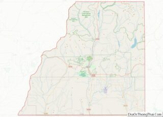
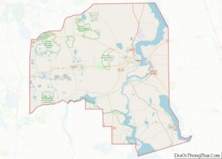
La Plata County is a county located in the U.S. state of Colorado. As of the 2020 census, the population was 55,638. The county seat is Durango. The county was named for the La Plata River and the La Plata Mountains. “La plata” means “the silver” in Spanish. La Plata County comprises the Durango, CO ... Read more
Map of La Plata County, Colorado
Map of Pitkin County, Colorado
Pitkin County is a county in the U.S. state of Colorado. As of the 2020 census, the population was 17,358. The county seat and largest city is Aspen. The county is named for Colorado Governor Frederick Walker Pitkin. Pitkin County has the seventh-highest per capita income of any U.S. county. Measured by mean income of ... Read more
Map of Pitkin County, Colorado
Map of Hartford County, Connecticut
Hartford County overview: Name: Hartford County FIPS code: 09-003 State: Connecticut Founded: May 10, 1666 Named for: Hertfordshire, England Seat: none (since 1960), Hartford (before 1960) Total Area: 750 sq mi (1,900 km²) Land Area: 735 sq mi (1,900 km²) Total Population: 899,498 Population Density: 1,199.3/sq mi (463.1/km²) Hartford County location map. Where is Hartford County? History Hartford County was one of ... Read more
Map of Hartford County, Connecticut
Map of Broward County, Florida
Broward County (/ˈbraʊ.ərd/ BROURD, BROW-(w)ərd) is a county in the southeastern part of Florida, located in the Miami metropolitan area. It is Florida’s second-most populous county after Miami-Dade County and the 17th-most populous in the United States, with over 1.94 million residents as of the 2020 census. Its county seat and largest city is Fort ... Read more
Map of Broward County, Florida
Map of Gulf County, Florida
Gulf County is a county located in the panhandle of the U.S. state of Florida. As of the 2020 census, the population was 14,192. Its county seat is Port St. Joe. Gulf County is included in the Panama City, FL Metropolitan Statistical Area. Gulf County overview: Name: Gulf County FIPS code: 12-045 State: Florida Founded: ... Read more
Map of Gulf County, Florida
Map of Liberty County, Florida
Liberty County is a county located in the state of Florida. As of the 2020 census, the population was 7,974, making it the least populous county in Florida. Its county seat is Bristol. Liberty County is one of only two dry counties in Florida (the other is Lafayette County). The Apalachicola National Forest occupies half ... Read more
Map of Liberty County, Florida
Map of Putnam County, Florida
Putnam County is a county located in the northern part of the state of Florida. As of the 2020 census, the population was 73,321. Its county seat is Palatka. Putnam County comprises the Palatka, FL Micropolitan Statistical Area, which is included in the Jacksonville–St. Marys-Palatka, FL-GA Combined Statistical Area. The county is centrally located between ... Read more
Map of Putnam County, Florida
Map of Baker County, Georgia
Baker County is a county in Georgia. As of the 2020 census, the population was 2,876. The county seat and only city is Newton. The county was created December 12, 1825 from the eastern portion of Early County by an act of the Georgia General Assembly and is named for Colonel John Baker, a hero ... Read more
Map of Baker County, Georgia
Map of Camden County, Georgia
Camden County overview: Name: Camden County FIPS code: 13-039 State: Georgia Founded: 1777 Named for: Charles Pratt, 1st Earl Camden Seat: Woodbine Largest city: St. Marys Total Area: 782 sq mi (2,030 km²) Land Area: 613 sq mi (1,590 km²) Total Population: 54,768 Population Density: 89.3/sq mi (34.5/km²) Time zone: UTC−5 (Eastern) Summer Time Zone (DST): UTC−4 (EDT) Website: www.co.camden.ga.us Camden County ... Read more
Map of Camden County, Georgia
Map of Columbia County, Georgia
Columbia County is a county located in the east central portion of the US state of Georgia. As of the 2020 census, the population was 124,035. The legal county seat is Appling, but the de facto seat of county government is Evans. Columbia County is included in the Augusta-Richmond County, GA-SC Metropolitan Statistical Area. It ... Read more
Map of Columbia County, Georgia
Map of Elbert County, Georgia
Elbert County is a county located in the northeastern part of the U.S. state of Georgia. As of the 2020 census, the population was 19,637. The county seat is Elberton. The county was established on December 10, 1790, and was named for Samuel Elbert. Elbert County overview: Name: Elbert County FIPS code: 13-105 State: Georgia ... Read more
Map of Elbert County, Georgia
Map of Habersham County, Georgia
Habersham County is a county located in the northeastern part of the U.S. state of Georgia. As of the 2020 census, the population was 46,031. The county seat is Clarkesville. The county was created on December 15, 1817, and named for Colonel Joseph Habersham of the Continental Army in the Revolutionary War. Habersham County comprises ... Read more
Map of Habersham County, Georgia