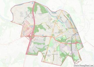
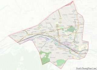
Map of Lincoln County, Arkansas
Lincoln County is located between the Arkansas Timberlands and Arkansas Delta in the U.S. state of Arkansas. It is also within the Pine Bluff metro area, and on the outer edge of the Central Arkansas region. The county is named for President Abraham Lincoln. Created as Arkansas’s 65th county on March 28, 1871, Lincoln County ... Read more
Map of Lincoln County, Arkansas
Map of Poinsett County, Arkansas
Poinsett County is a county located in the U.S. state of Arkansas. As of the 2020 census, the population was 22,965. The county seat is Harrisburg. Poinsett County is included in the Jonesboro–Paragould Combined Statistical Area. Poinsett County overview: Name: Poinsett County FIPS code: 05-111 State: Arkansas Founded: February 28, 1838 Named for: Joel Roberts ... Read more
Map of Poinsett County, Arkansas
Map of Washington County, Arkansas
Washington County is a regional economic, educational, and cultural hub in the Northwest Arkansas region. Created as Arkansas’s 17th county on November 30, 1848, Washington County has 13 incorporated municipalities, including Fayetteville, the county seat, and Springdale. The county is also the site of small towns, bedroom communities, and unincorporated places. The county is named ... Read more
Map of Washington County, Arkansas
Map of Imperial County, California
Imperial County (Spanish: Condado de Imperial) is a county located on the southeast border of the U.S. state of California. As of the 2020 census, the population was 179,702, making it the least populous county in Southern California. The county seat is El Centro. Imperial is the most recent California county to be established, as ... Read more
Map of Imperial County, California
Map of Nevada County, California
Nevada County (/nɪˈvædə/ (listen)) is a county located in the U.S. state of California, in the Sierra Nevada. As of the 2020 census, its population was 102,241. The county seat is Nevada City. Nevada County comprises the Truckee–Grass Valley micropolitan statistical area, which is also included in the Sacramento–Roseville combined statistical area, part of the ... Read more
Map of Nevada County, California
Map of Shasta County, California
Shasta County (/ˈʃæstə/ (listen)), officially the County of Shasta, is a county in the northern portion of the U.S. state of California. Its population is 182,155 as of the 2020 census, up from 177,223 from the 2010 census. The county seat is Redding. Shasta County comprises the Redding, California metropolitan statistical area. The county occupies ... Read more
Map of Shasta County, California
Map of Arapahoe County, Colorado
Arapahoe County (/əˈræpəhoʊ/ ə-RAP-ə-hoh) is a county located in the U.S. state of Colorado. As of the 2020 census, its population was 655,070, making it the third-most populous county in Colorado. The county seat is Littleton, and the most populous city is Aurora. The county was named for the Arapaho Native American tribe, who once ... Read more
Map of Arapahoe County, Colorado
Map of Douglas County, Colorado
Douglas County overview: Name: Douglas County FIPS code: 08-035 State: Colorado Founded: November 1, 1861 Named for: Stephen A. Douglas Seat: Castle Rock Total Area: 843 sq mi (2,180 km²) Land Area: 840 sq mi (2,200 km²) Total Population: 368,990 Population Density: 426/sq mi (164/km²) Time zone: UTC−7 (Mountain) Summer Time Zone (DST): UTC−6 (MDT) Website: www.douglas.co.us Douglas County location map. Where ... Read more
Map of Douglas County, Colorado
Map of Lake County, Colorado
Lake County overview: Name: Lake County FIPS code: 08-065 State: Colorado Founded: November 1, 1861 Named for: Twin Lakes in the area Seat: Leadville Largest city: Leadville Total Area: 384 sq mi (990 km²) Land Area: 377 sq mi (980 km²) Total Population: 7,436 Population Density: 20/sq mi (8/km²) Time zone: UTC−7 (Mountain) Summer Time Zone (DST): UTC−6 (MDT) Website: www.lakecountyco.com Lake ... Read more
Map of Lake County, Colorado
Map of Prowers County, Colorado
Prowers County is a county located in the U.S. state of Colorado. As of the 2020 census, the population was 11,999. The county seat is Lamar. The county is named in honor of John Wesley Prowers, a leading pioneer in the lower Arkansas River valley region. Prowers County overview: Name: Prowers County FIPS code: 08-099 ... Read more
Map of Prowers County, Colorado
Map of Litchfield County, Connecticut
Litchfield County overview: Name: Litchfield County FIPS code: 09-005 State: Connecticut Founded: 1751 Named for: Lichfield, England Seat: none (since 1960)Litchfield (before 1960) Largest city: Torrington Total Area: 945 sq mi (2,450 km²) Land Area: 921 sq mi (2,390 km²) Total Population: 185,186 Population Density: 196.0/sq mi (75.7/km²) Time zone: UTC−5 (Eastern) Summer Time Zone (DST): UTC−4 (EDT) Litchfield County location map. ... Read more
Map of Litchfield County, Connecticut
Map of Calhoun County, Florida
Calhoun County is a county located in the U.S. state of Florida. As of the 2020 census, the population was 13,648, making it the fifth-least populous county in Florida. Its county seat is Blountstown. Calhoun County overview: Name: Calhoun County FIPS code: 12-013 State: Florida Founded: January 26, 1838 Named for: John C. Calhoun Seat: ... Read more
Map of Calhoun County, Florida