Pendleton County is a county located in the U.S. state of West Virginia. As of the 2020 census, the population was 6,143, making it the second-least populous county in West Virginia. Its county seat is Franklin. The county was created by the Virginia General Assembly in 1788 from parts of Augusta, Hardy, and Rockingham Counties and was named for Edmund Pendleton (1721–1803), a distinguished Virginia statesman and jurist. Pendleton County was strongly pro-Confederate during the American Civil War; however, there were pockets of Unionists who supported the state government in Wheeling.
Spruce Knob, located in Pendleton County, is the highest point in the state and in the Alleghenies, its elevation being 4,863 feet. Parts of the Monongahela and George Washington National Forests are also located in Pendleton.
| Name: | Pendleton County |
|---|---|
| FIPS code: | 54-071 |
| State: | West Virginia |
| Founded: | May 1, 1788 |
| Named for: | Edmund Pendleton |
| Seat: | Franklin |
| Largest town: | Franklin |
| Total Area: | 698 sq mi (1,810 km²) |
| Land Area: | 696 sq mi (1,800 km²) |
| Total Population: | 6,143 |
| Population Density: | 8.8/sq mi (3.4/km²) |
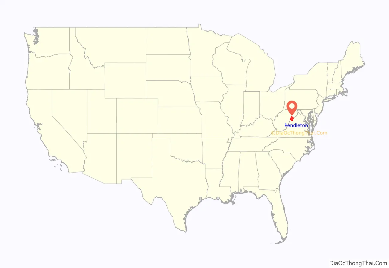
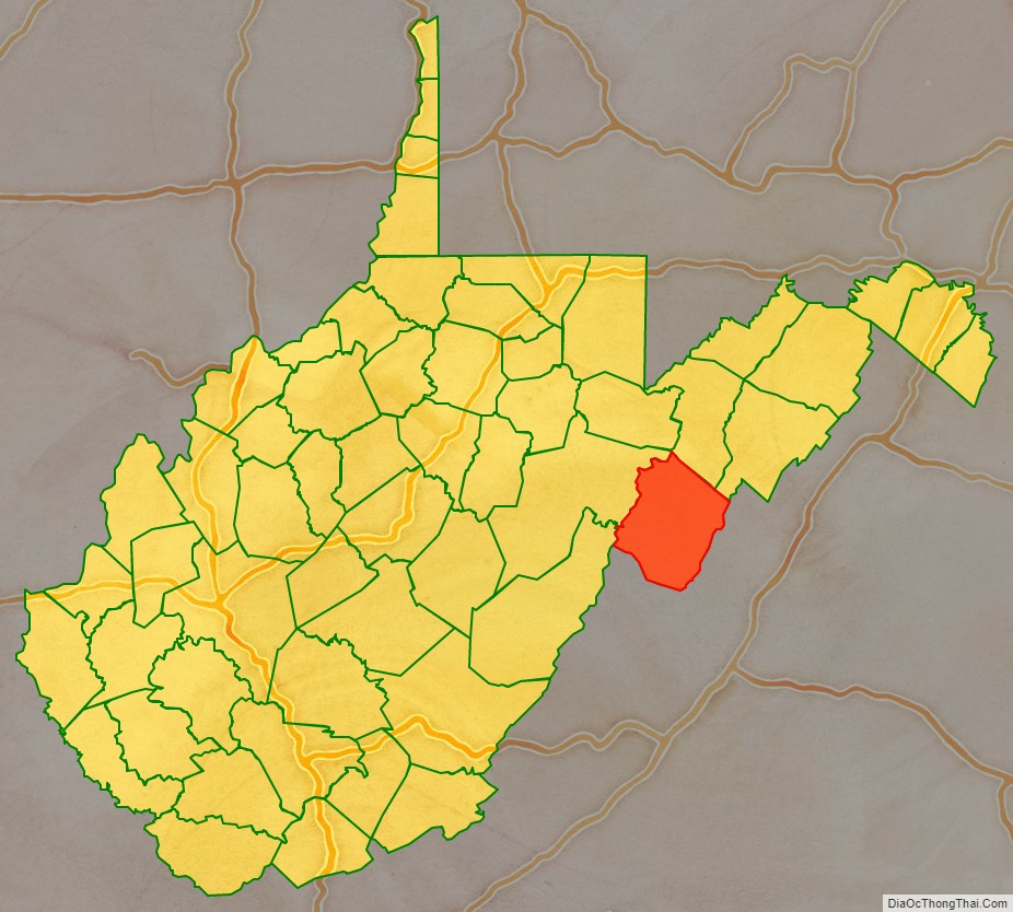
Pendleton County location map. Where is Pendleton County?
History
By the 1740s, the three main valleys of what became Pendleton County had been visited and named by white hunters and prospectors. One of the hunters, a single man named Abraham Burner, built himself a log cabin about a half mile downstream of the future site of Brandywine in 1745. He was the county’s first white settler. A local historian recorded that:
By 1747, immigrants were impinging on the (future) borders of Pendleton from two directions: the larger community was mostly Germans moving up the valley of the South Branch Potomac; the lesser consisted mainly of Scotch-Irish moving northwest from Staunton up into the headwaters of the James River. In an April 1758 surprise raid of Fort Seybert and nearby Fort Upper Tract occasioned by the French and Indian War (1754–63), most of the 60 white settlers sheltering there were massacred by Shawnee and Delaware warriors and the forts were burned.
Pendleton County was created by the Virginia General Assembly in 1788 from parts of Augusta, Hardy, and Rockingham Counties and was named for Edmund Pendleton, a distinguished Virginia statesman and jurist. Pendleton County was split between Northern and Southern sympathies during the American Civil War. The northern section of the county, including the enclave in the Smoke Hole community was staunchly Unionist. In June 1863, the county was included by the federal government in the new state of West Virginia against the wishes of many of the inhabitants. That fall, Union General W.W. Averell swept up the South Branch valley, and destroyed the Confederate saltpetre works above Franklin.
In the months following the state’s establishment, West Virginia’s counties were divided into civil townships, with the intention of encouraging local government. This proved impractical in the heavily rural state, and in 1872 the townships were converted into magisterial districts. Pendleton County was divided into six districts: Bethel, Circleville, Franklin, Mill Run, Sugar Grove, and Union. Except for minor adjustments, these magisterial districts remained largely unchanged until the 1990s, when they were consolidated into three new districts: Central, Eastern, and Western.
Pendleton County and the surrounding area were hit by severe flooding in November 1985. At Franklin, the county seat, the South Branch of the Potomac crested at 22.6 feet, more than fifteen feet above flood stage in the shallow riverbed. Sixty-two people were killed in West Virginia, Virginia, Maryland, and Pennsylvania, in what became known as the “1985 Election Day floods” in Virginia, or the “Killer Floods of 1985” in West Virginia. According to the National Weather Service, thirty-eight of the deaths occurred in Pendleton and Grant Counties, West Virginia. Twenty-two people were killed in Virginia, and there was one fatality each attributed to the flooding in Maryland and Pennsylvania.
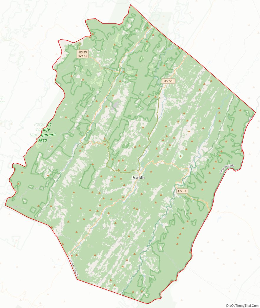
Pendleton County Road Map
Geography
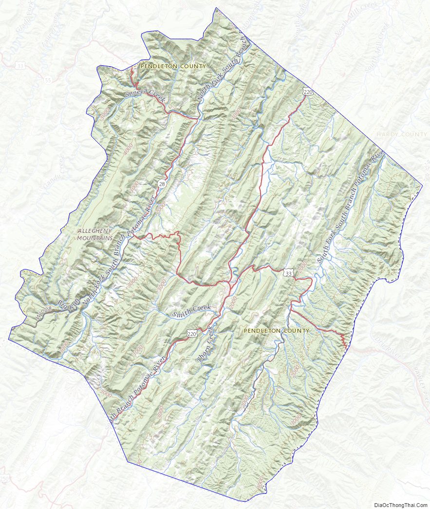
According to the United States Census Bureau, the county has a total area of 698 square miles (1,810 km), of which 696 square miles (1,800 km) is land and 2.1 square miles (5.4 km) (0.3%) is water. It is the fifth-largest county in West Virginia by area.
Major highways
- US 33
- US 220
- WV 28
- WV 55
Adjacent counties
- Grant County (north)
- Hardy County (northeast)
- Rockingham County, Virginia (east)
- Augusta County, Virginia (south)
- Highland County, Virginia (south)
- Pocahontas County (southwest)
- Randolph County (west)
National protected areas
- George Washington National Forest (part)
- Monongahela National Forest (part)
- Spruce Knob–Seneca Rocks National Recreation Area (part)
- United States National Radio Quiet Zone (part)
National Natural Landmarks
- Germany Valley Karst Area
- Sinnett-Thorn Mountain Cave System
Pendleton County Topographic Map
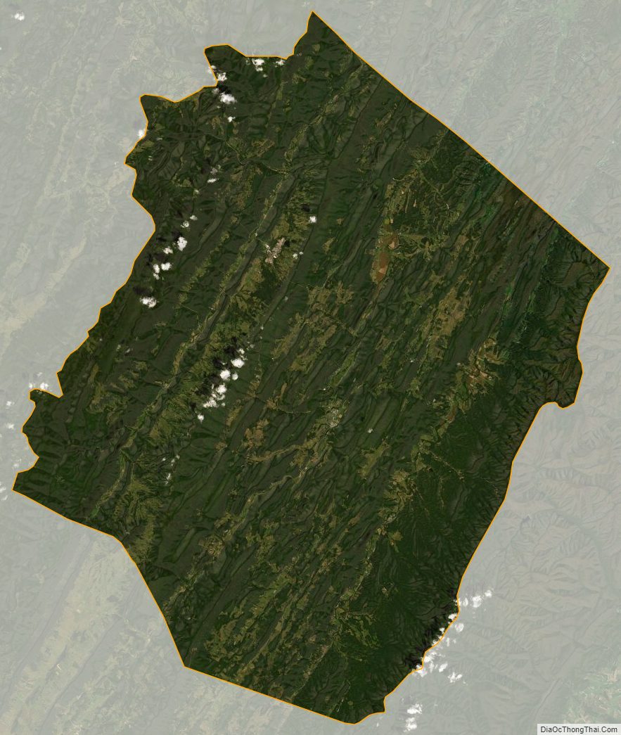
Pendleton County Satellite Map
Pendleton County Outline Map