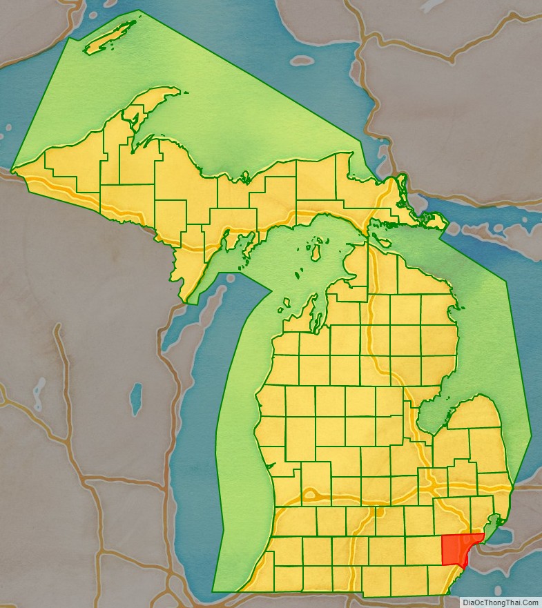
Wayne County is the most populous county in the U.S. state of Michigan. As of 2020, the United States Census placed its population at 1,793,561, making it the 19th-most populous county in the United States. The county seat is Detroit. The county was founded in 1796 and organized in 1815. Wayne County is included in the Detroit-Warren–Dearborn, MI Metropolitan Statistical Area. It is one of several U.S. counties named after Revolutionary War-era general Anthony Wayne.
| Name: | Wayne County |
|---|---|
| FIPS code: | 26-163 |
| State: | Michigan |
| Founded: | 1815 |
| Named for: | Anthony Wayne |
| Seat: | Detroit |
| Total Area: | 673 sq mi (1,740 km²) |
| Land Area: | 612 sq mi (1,590 km²) |
| Total Population: | 1,793,561 |
| Time zone: | UTC−5 (Eastern Time Zone) |
| Summer Time Zone (DST): | UTC−4 (Eastern Daylight Time) |
| Website: | www.waynecounty.com |
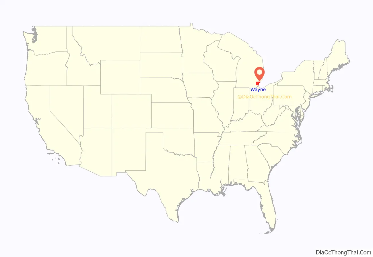
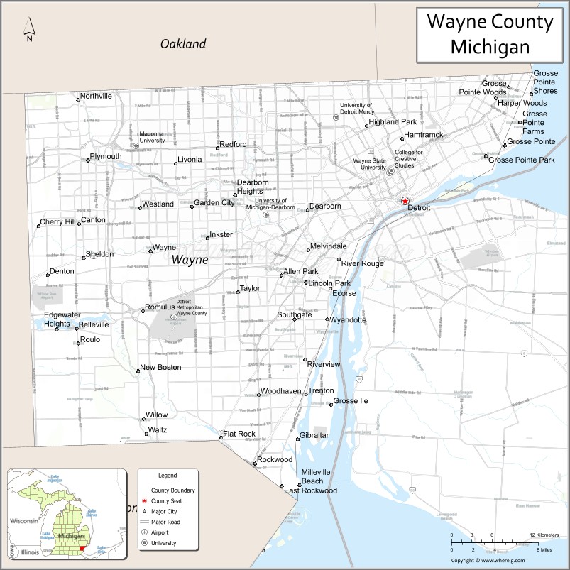
Wayne County location map. Where is Wayne County?
History
Wayne County was the sixth county in the Northwest Territory, formed August 15, 1796 from portions of territorial Hamilton County, territorial Knox County and unorganized territory. It was named for the U.S. general “Mad Anthony” Wayne. It originally encompassed the entire area of the Lower Peninsula of Michigan, most of the Upper Peninsula, as well as smaller sections that are now part of northern Ohio, Indiana, Illinois and Wisconsin. By proclamation of the Territorial Secretary and Acting Governor, Winthrop Sargent, on August 15, 1796, the boundaries of Wayne County were declared to begin at the mouth of the Cuyahoga River then west to Fort Wayne, then to the southernmost point of Lake Michigan and along the western shore north to the territorial boundary in Lake Superior and then along the territorial boundary through Lake Huron, Lake St. Clair, and Lake Erie back to the starting point. The first division of the county into townships occurred November 1, 1798, into the four townships of Detroit, Hamtramck, Mackinaw, and Sargent. The extent of Wayne county at that time included all the present state of Michigan in addition to parts of Indiana, Ohio, and Wisconsin, so that the townships erected at that time were vastly larger than the corresponding divisions of the present time.
On January 14, 1803, the Governor of Indiana Territory, William Henry Harrison, issued a similar proclamation defining the boundaries as beginning at a point where an east and west line passing through the southernmost extreme of Lake Michigan would intersect a north and south line, passing through the westernmost extreme of the lake, then north to the territorial boundary, then along said boundary line to a point where an east and west line passing through the southerly extreme of Lake Michigan would intersect the same, then along this last mentioned line to the place of beginning. This boundary would include Chicago, Illinois and a sizable strip of Wisconsin along Lake Michigan.
These boundaries would be adjusted as Indiana and Illinois became states and as other counties were formed within Michigan Territory.
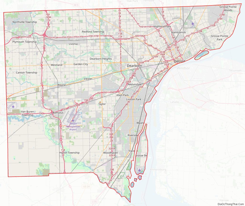
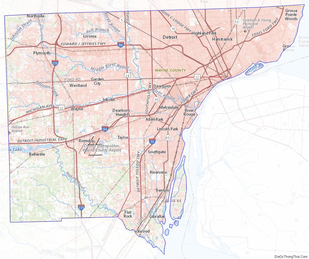
Wayne County Road Map
Geography
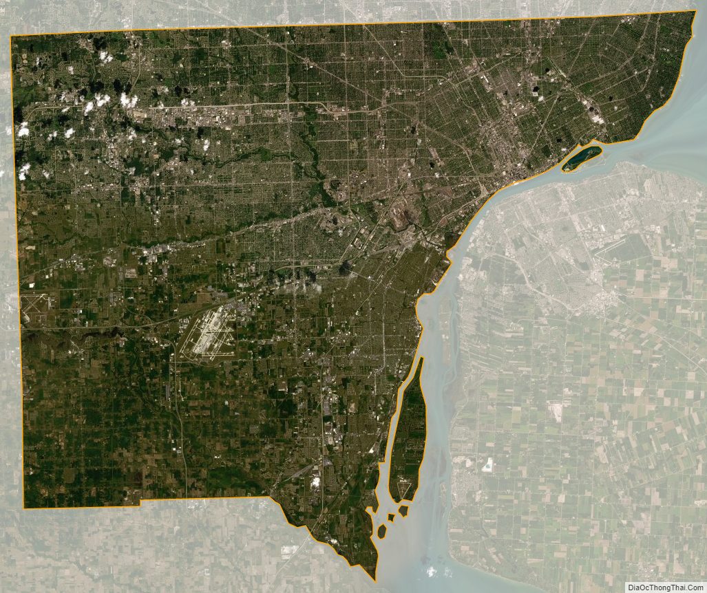
According to the U.S. Census Bureau, the county has a total area of 673 square miles (1,740 km), of which 612 square miles (1,590 km) is land and 61 square miles (160 km) (9.0%) is water. Its water area includes parts of the Detroit River and Lake St. Clair.
Wayne County borders on Oakland County and Macomb County to the north, Washtenaw County to the west, Essex County, Ontario, Canada to the east, and Monroe County to the south.
The eastern (and sometimes southern) boundary is a water boundary in the Detroit River and Lake St. Clair with Essex County, Ontario. Automotive traffic crosses this boundary at the Detroit-Windsor Tunnel and the Ambassador Bridge. Due to the southwestern course of the river, this small portion of Canada actually lies to the south of Wayne County. The southern communities of the county are usually referred to as “Downriver”, in reference to their location downstream of downtown Detroit.
Grosse Ile is the largest island in Wayne County and is connected to the mainland by the Wayne County Bridge and the Grosse Ile Toll Bridge.
Adjacent counties
- Washtenaw County (west)
- Monroe County (south/southwest)
- Macomb County (northeast)
- Oakland County (northwest)
- Essex County, Ontario, Canada (east/southeast)
National protected area
- Detroit River International Wildlife Refuge (part)
Wayne County Topographic Map
Wayne County Satellite Map
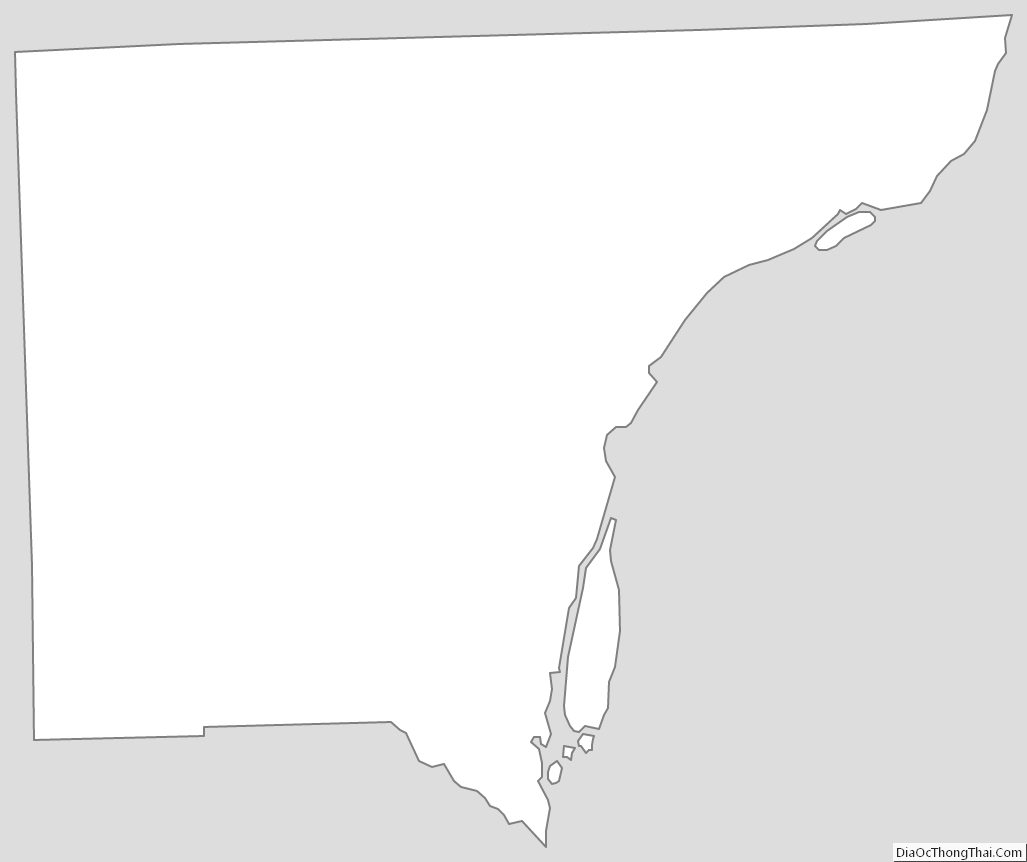
Wayne County Outline Map