Fort Wayne is a city in and the county seat of Allen County, Indiana, United States. Located in northeastern Indiana, the city is 18 miles (29 km) west of the Ohio border and 50 miles (80 km) south of the Michigan border. The city’s population was 263,886 as of the 2020 Census, making it the second-most populous city in Indiana after Indianapolis, and the 76th-most populous city in the United States. It is the principal city of the Fort Wayne metropolitan area, consisting of Allen and Whitley counties which had an estimated population of 423,038 as of 2021. Fort Wayne is the cultural and economic center of northeastern Indiana. In addition to the two core counties, the combined statistical area (CSA) includes Adams, DeKalb, Huntington, Noble, Steuben, and Wells counties, with an estimated population of 649,105 in 2021.
Fort Wayne was built in 1794 by the United States Army under the direction of American Revolutionary War general Anthony Wayne, the last in a series of forts built near the Miami village of Kekionga. Named in Wayne’s honor, the European-American settlement developed at the confluence of the St. Joseph, St. Marys, and Maumee rivers, known originally as Fort Miami, a trading post constructed by Jean Baptiste Bissot, Sieur de Vincennes around 1706. The modern city was platted in 1823 following its revitalization after the War of 1812 and its siege. It underwent tremendous growth after completion of the Wabash and Erie Canal and advent of the railroad. Once a booming manufacturing town located in what became known as the Rust Belt, Fort Wayne’s economy in the 21st century is based upon distribution, transportation and logistics; healthcare, professional and business services; leisure and hospitality, and financial services. The city is a center for the defense industry which employs 1-2% of the population.
Fort Wayne was an All-America City Award recipient in 1983, 1998, 2009, and 2021. The city also received an Outstanding Achievement City Livability Award by the U.S. Conference of Mayors in 1999.
| Name: | Fort Wayne city |
|---|---|
| LSAD Code: | 25 |
| LSAD Description: | city (suffix) |
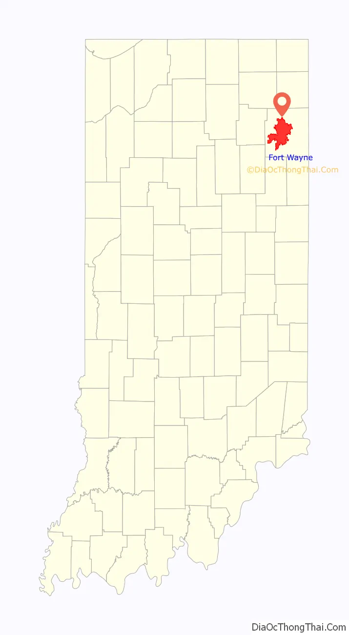
| State: | Indiana |
| County: | Allen County |
| Elevation: | 810 ft (247 m) |
| Land Area: | 110.57 sq mi (286.38 km²) |
| Water Area: | 0.22 sq mi (0.56 km²) |
| Population Density: | 2,400/sq mi (930/km²) |
| Area code: | 260 |
| FIPS code: | 1825000 |
| GNISfeature ID: | 0434689 |
| Website: | www.cityoffortwayne.org |
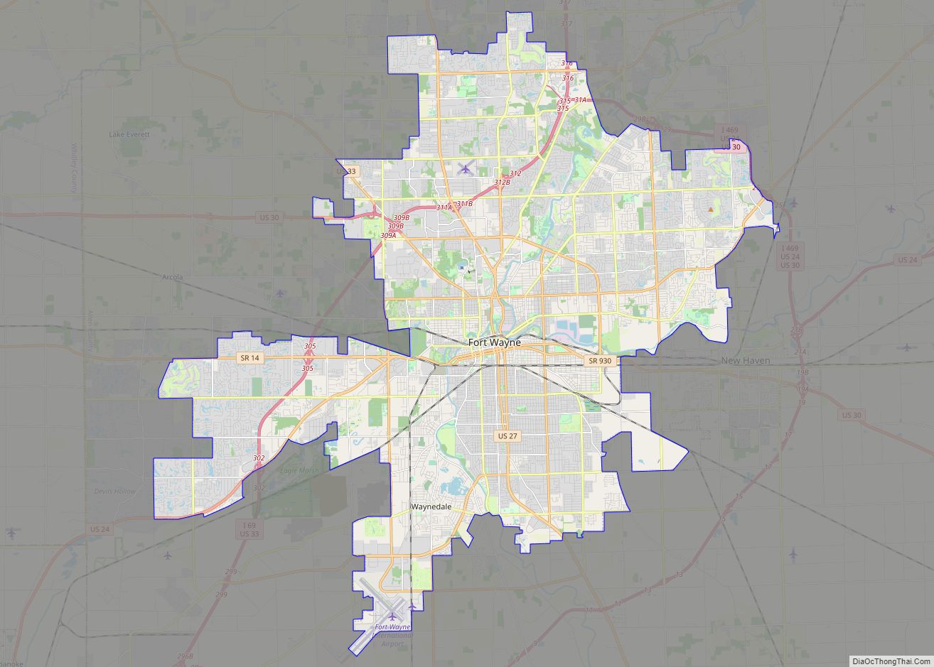
Online Interactive Map
Click on ![]() to view map in "full screen" mode.
to view map in "full screen" mode.
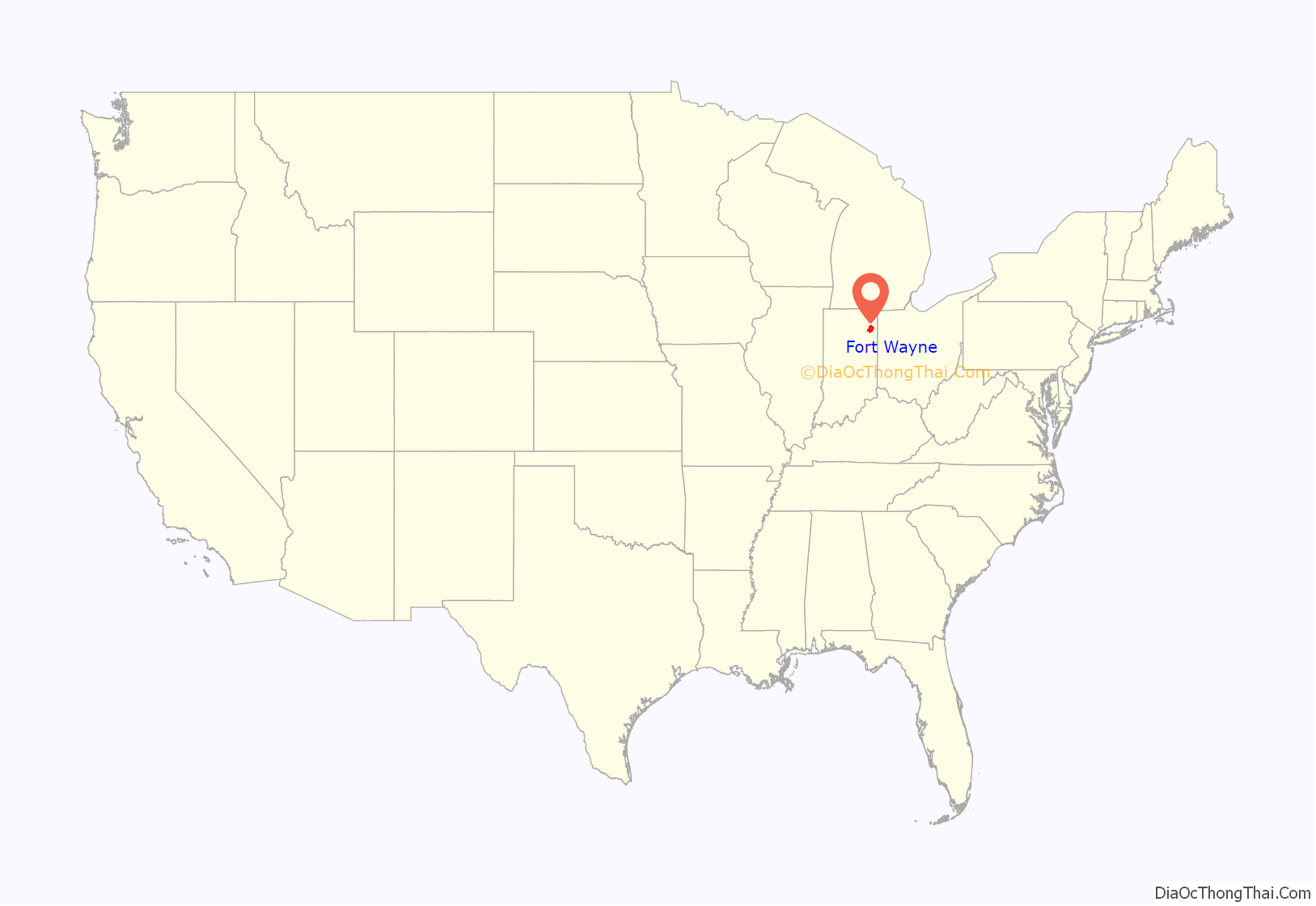
Fort Wayne location map. Where is Fort Wayne city?
History
Main articles: Kekionga, Fort Miami (Indiana), Fort Wayne (fort)
Early history
This area here on the river confluence was long occupied by successive cultures of indigenous peoples. The Miami tribe established its settlement of Kekionga at the confluence of the Maumee, St. Joseph, and St. Marys rivers. It was the capital of the Miami nation and related Algonquian tribes.
In 1696, Comte de Frontenac appointed Jean Baptiste Bissot, Sieur de Vincennes, who began visiting Kekionga in 1702, and would later build the original Fort Miami here in the wilderness of New France around 1706; Initially, a small trading outpost. It was part of a group of forts and trading posts built between Quebec and St. Louis. The first census in 1744 recorded a population of approximately 40 Frenchmen and 1,000 Miamians.
Increasing tension between France and Great Britain developed over control of the territory. In 1760, France ceded the area to Britain after its forces in North America surrendered during the Seven Years’ War, known on the North American front as the French and Indian War. Managing to hold down the fort for only a mere couple of years, the British lost control of it in 1763 when various Native American nations rebelled against British rule and retook the fort as part of Pontiac’s Rebellion. From this point forward in 1763, no active fort would exist at Kekionga for the next three decades until American General Anthony Wayne would go on to establish Fort Wayne in 1794, following the Battle of Fallen Timbers. The fort throughout this period was described as a, “Defiant mixture of Indian warriors and lawless renegades of the frontier, such as the Girties. It was also the home of a heterogeneous population of English and French traders and their families, French ‘engages”, and Miami, Delaware and Shawnee tribes.”
In 1772, the British would regain influence over the village after Sir William Johnson suggested to the government that the fort be reoccupied. The mixed population of the Kekionga area had moved past antipathy with the British by this point, and accepted their friendship. In 1776, Officer Jacques LaSalle moved into the village to conduct strict supervision on behalf of the British government, ensuring that the natives remained loyal to the British, and to check passports with travelers coming down from Fort Detroit.
The British continued to monitor Kekionga and Fort Miami throughout the American Revolutionary War. In 1780, French Canadian soldiers coming to assist the US with the revolution were slaughtered in several nearby locations in what is known as La Balme’s Defeat. At the close of the revolutionary war, through the passage of the Treaty of Paris (1783), Britain transferred this area to the new United States and its claim of sovereignty, over what would be established as the Northwest Territory by the United States in 1787 —the area north and west of the Ohio River, east of the Mississippi River, and south of British Canada. The Indigenous people already living there, though, were not part of that treaty and did not cede their ownership of those lands. American land speculators and pioneers began flooding down the Ohio River into the area, leading to conflict with an alliance of native tribes known as the Western Confederacy. It was headquartered at Kekionga, where the Miami had permitted two refugee tribes dislodged by white homesteaders, the Delaware and the Shawnee, to resettle. The confederacy—which included other Great Lakes and Algonquin tribes as well—began sending war parties to raid settlers, hoping to drive them back across the Appalachian Mountains, and refused to meet for negotiations over a possible treaty to instead cede land for white settlement. The growing violence led to the Northwest Indian War.
In 1790, President George Washington ordered the United States Army to conquer and pacify the tribes. The first expedition, led by General Josiah Harmar reached Kekionga and burned it, but was then driven off by confederacy warriors led by the Miami war chief Little Turtle. The confederacy attacked the second invading force, led in 1791 by General Arthur St. Clair, before it could get that far and wiped it out, in a massacre known as St. Clair’s Defeat at modern-day Fort Recovery, Ohio. General Anthony Wayne led a third expedition, defeating the confederacy’s warriors at the Battle of Fallen Timbers, near modern-day Toledo, Ohio on August 20, 1794. Wayne’s men then marched up the Maumee River, systematically burning evacuated native towns, crops and winter food stores, until they reached its headwaters, where Kekionga remained in ruins. Wayne ordered Fort Wayne built there to permanently occupy the area.
The following year, Wayne negotiated a peace accord, the Treaty of Greenville with tribal leaders, in which they agreed to stop fighting and ceded most of what is now Ohio along with certain tracts further west, including the area around Fort Wayne encompassing Kekionga and the land portage. Wayne promised the remainder would remain Indian lands, which is why the territory west of Ohio was named Indiana. In subsequent years, the government used Fort Wayne to hand out annual payments under the treaty. But in a recurring cycle, the tribes ran up debts to white traders who came there to sell them alcohol and manufactured goods, and the government pushed tribal leaders—including through bribes—to sell more reservation land to pay off those debts and, when the land was gone, then to agree to have the tribe removed to the Far West.
In 1802, a United States fur trade factory was established here. It was burned by the local Indians at the beginning of the War of 1812.
The first settlement started in 1815. In 1819, the military garrison abandoned the fort and moved to Detroit. In 1822, a federal land office opened to sell land ceded by local Native Americans by the Treaty of St. Mary’s in 1818. Platted in 1823 at the Ewing Tavern, the village became an important frontier outpost, and was incorporated as the Town of Fort Wayne in 1829, with a population of 300. The Wabash and Erie Canal’s opening improved travel conditions to the Great Lakes and Mississippi River, exposing Fort Wayne to expanded economic opportunities. The population topped 2,000 when the town was incorporated as the City of Fort Wayne on February 22, 1840. Pioneer newspaperman George W. Wood was elected the city’s first mayor. Fort Wayne’s “Summit City” nickname dates from this period, referring to the city’s position at the highest elevation along the canal’s route. As influential as the canal was to the city’s earliest development, it quickly became obsolete after briefly competing with the city’s first railroad, the Pittsburgh, Fort Wayne and Chicago Railway, completed in 1854.
Modern history
At the turn of the 20th century, the population of Fort Wayne nearly reached 50,000, attributed to a large influx of German and Irish immigrants. Fort Wayne’s “urban working class” thrived in industrial and railroad-related jobs. The city’s economy was substantially based on manufacturing, ushering in an era of innovation with several notable inventions and developments coming out of the city over the years, such as gasoline pumps (1885), the refrigerator (1913), and in 1972, the first home video game console. The Great Flood of 1913 caused seven deaths, left 15,000 homeless, and damaged over 5,500 buildings in the worst natural disaster in the city’s history.
As the automobile’s prevalence grew, Fort Wayne became a fixture on the Lincoln Highway. Aviation arrived in 1919 with the opening of the city’s first airport, Smith Field. The airport served as Fort Wayne’s primary commercial airfield until Baer Field (now Fort Wayne International Airport) was transferred to the city in 1947 after serving as a military base during World War II.
Fort Wayne was hit by the Great Depression beginning in 1929, with most factories cutting their workforce. The stock market crash did not discourage plans to build the city’s first skyscraper and Indiana’s tallest building at the time, the Lincoln Bank Tower. By 1935, the New Deal’s WPA put over 7,000 residents back to work through local infrastructure improvements, including the construction of new parks, bridges, viaducts, and a $5.2 million sewage treatment facility.
The post-World War II economic boom helped the city prosper once again. Between 1950 and 1955, more than 5,000 homes were built, many in large subdivisions in rural Allen County. In 1950, Fort Wayne’s first bypass, Coliseum Boulevard, opened on the north side of the city, followed by the city’s first arena, War Memorial Coliseum, bringing new opportunities for suburban expansion. The Coliseum was home to the NBA’s Fort Wayne Pistons from 1952 to 1957. The opening of enclosed shopping malls and the construction of Interstate 69 through rural areas north and west of the city proper further drove the exodus of retail from downtown through the 1960s. According to the Fort Wayne Home Builders Association estimates, more than 80 percent of new home construction occurred outside the city proper in the 1970s.
Like many cities in the Rust Belt, deindustrialization in the 1980s brought urban blight, increased crime, and a decrease in blue-collar manufacturing jobs. Downtown and surrounding neighborhoods continued declining as residents and businesses sprawled further into rural Allen County. A 1982 flood forced an evacuation of 9,000 residents, damaging 2,000 buildings, and costing $56.1 million (1982 USD, $137 million 2015 USD), prompting a visit from then president of the United States, Ronald Reagan.
The 1990s marked a turnaround for the city, as local leaders focused on crime reduction, economic diversification, and downtown redevelopment. By 1999, Fort Wayne’s crime rate decreased to levels not seen since 1974, and the city’s economy recovered, with the unemployment rate hovering at 2.4 percent in 1998. Clearing blighted buildings downtown resulted in new public greenspaces, including Headwaters Park, which has become the premier community gathering space and centerpiece in the city’s $50 million flood control project. Fort Wayne celebrated its bicentennial in 1994.
The city continued to concentrate on downtown redevelopment and investment in the 2000s. The decade saw the beginnings of its transformation, with renovations and expansions of the Allen County Public Library, Grand Wayne Convention Center, and Fort Wayne Museum of Art. In 2007, the $130 million Harrison Square development was launched, creating Parkview Field. Suburban growth continued, with the opening of Fort Wayne’s first lifestyle center, Jefferson Pointe, and the half-billion dollar Parkview Regional Medical Center in 2012.
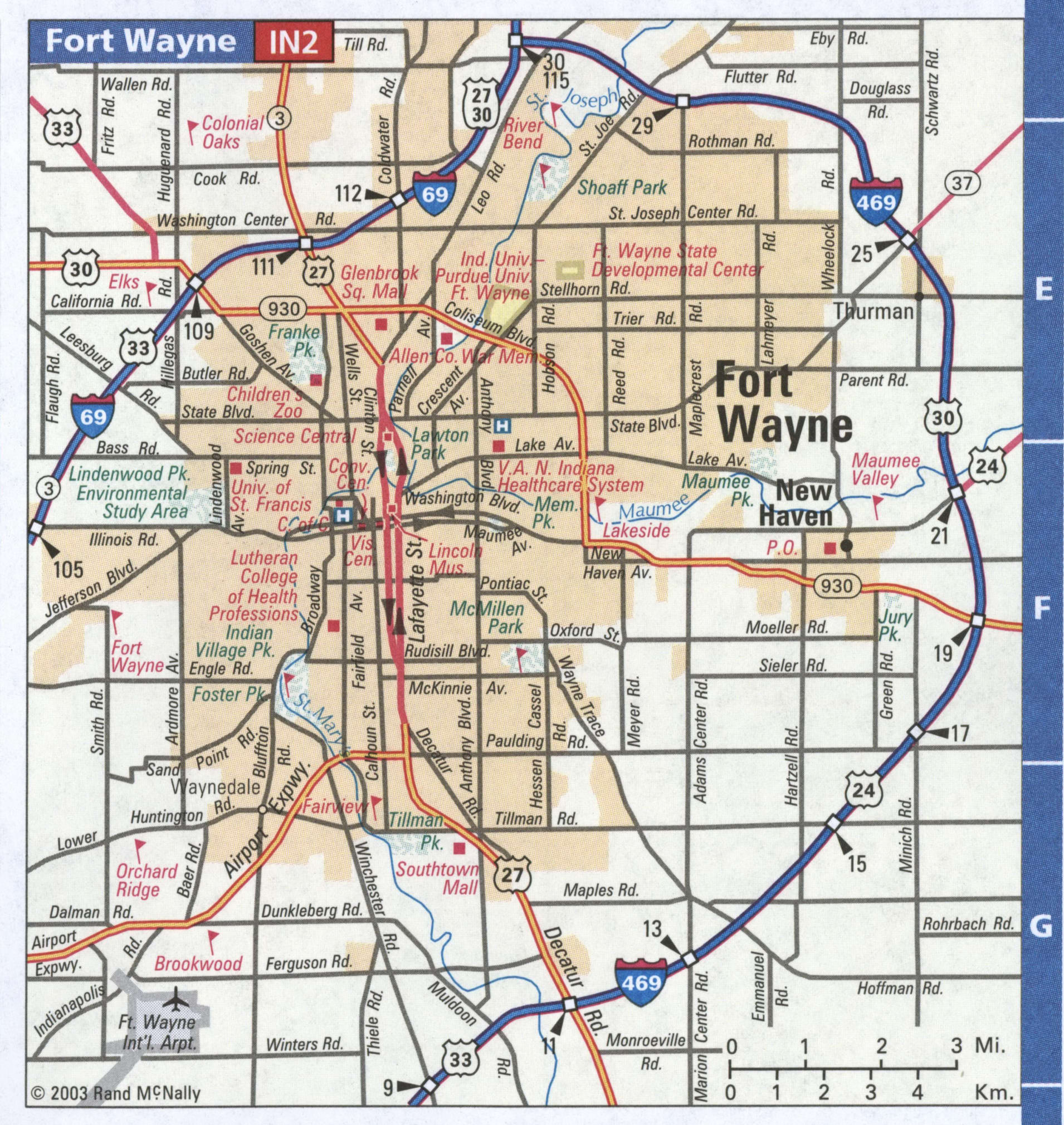
Fort Wayne Road Map
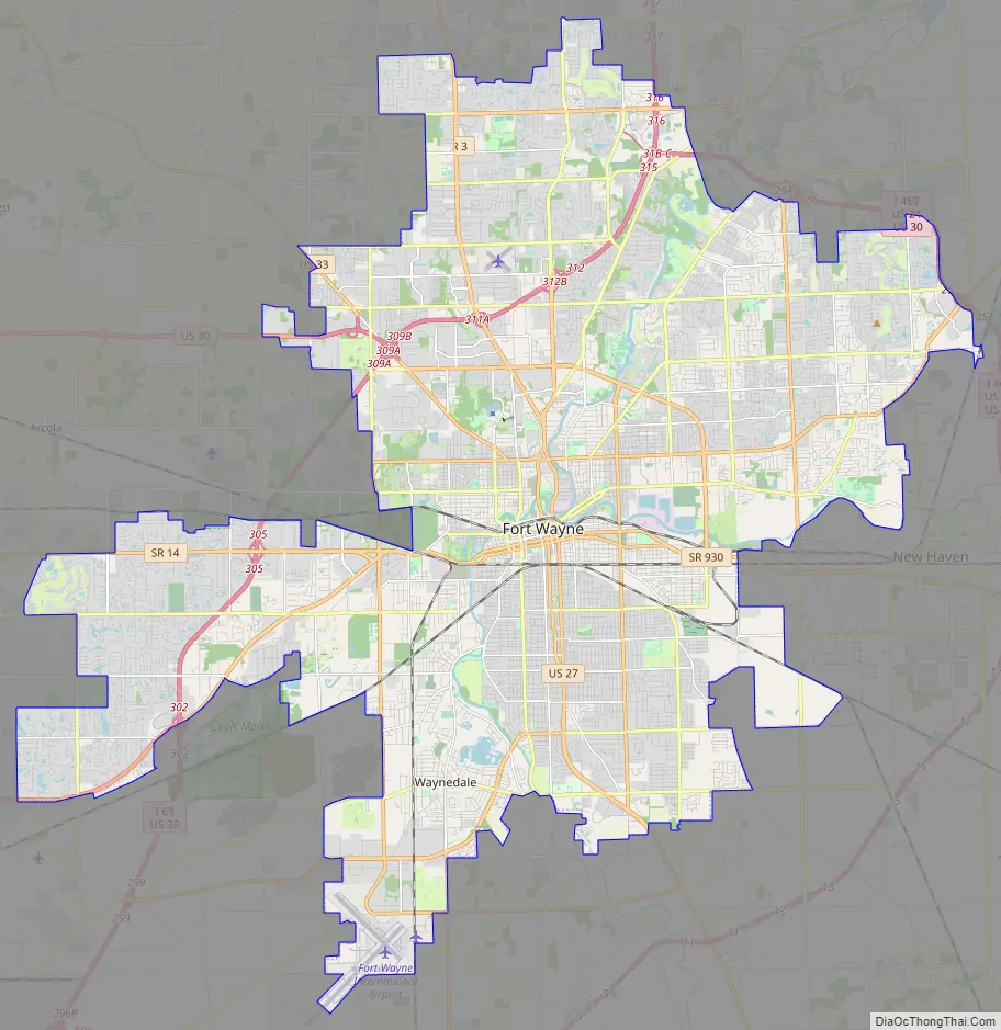
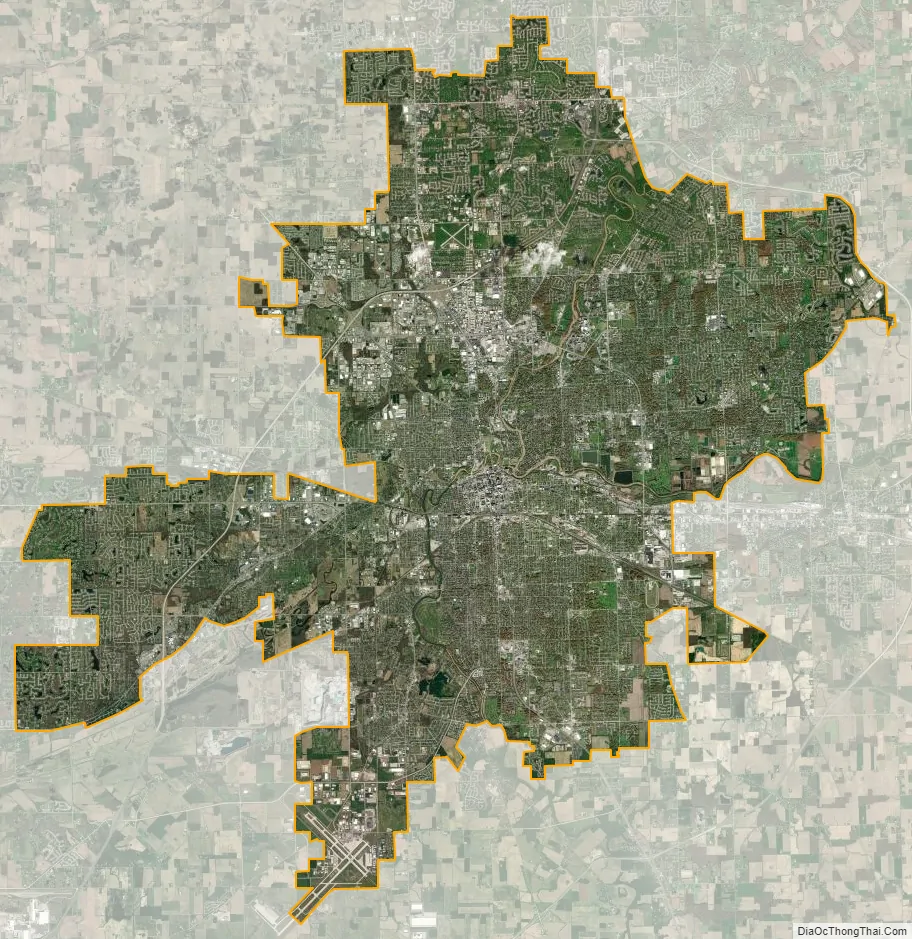
Fort Wayne city Satellite Map
Geography
Fort Wayne is in the East North Central region of the Midwestern United States, in northeastern Indiana, 18 miles (29 km) west of Ohio and 50 miles (80 km) south of Michigan. According to the 2010 census, Fort Wayne has a total area of 110.834 square miles (287.06 km), of which 110.62 square miles (286.50 km) (or 99.81%) is land and 0.214 square miles (0.55 km) (or 0.19%) is water.
Topography
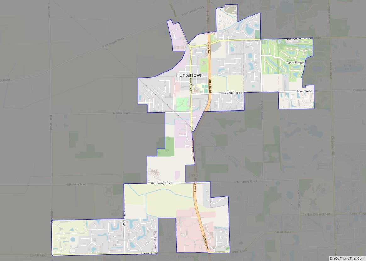
For a regional summit, the city is situated on flat land characterized by little topographical relief, a result of the Wisconsin glaciation episode. Receding glaciers eroded the land, depositing an evenly distributed layer of sediment during the last glacial period. The most distinguishable topographical feature is Cedar Creek Canyon, just north of the city proper near Huntertown. The Fort Wayne Moraine follows two of the city’s three rivers: the St. Marys and St. Joseph. The two rivers converge to form the Maumee, which eventually empties into Lake Erie. Land east of the moraine includes the former Great Black Swamp, a lacustrine plain formed by Glacial Lake Maumee. The Little River flows southwest of Fort Wayne, a tributary of the Wabash River, and remnant of the Maumee Torrent.
Fort Wayne is situated on the Saint Lawrence River Divide, a continental divide separating the Great Lakes Basin from the Gulf of Mexico watershed.
The most important geographical feature of the area is the short distance overland between the Three Rivers system, which eventually flows to the Atlantic, and the Wabash system, which eventually flows to the Gulf of Mexico. This came to be the “portage” or carrying place, over which travelers could transport their cargoes from one system to the next. This natural crossroads attracted the Native Americans for thousands of years. It later attracted the European explorers and traders and the American pioneer settlers who continued to develop the area as a transportation and communications center. Chief Little Turtle of the Miami Nation expressed its importance eloquently at the treaty of Greenville in 1795 when he called it “that glorious gate…through which all the words of our chiefs had to pass through from north to south and from east to west”.
Fort Wayne’s urban tree canopy is 29 percent, double the state average of 14.5 percent and above the national average of 27.1 percent. The canopy is decreasing, notably from development and the emerald ash borer infestation. Fort Wayne has been designated a Tree City USA since 1990.
Cityscape
Historically, Fort Wayne has been divided into four unofficial quadrants: northeast, northwest, southeast, and southwest. Calhoun Street divides the southwest and southeast, while the St. Joseph River divides the northwest and northeast quadrants. The Maumee River separates the northeast and southeast, while portions of the St. Marys River and Chicago, Fort Wayne and Eastern Railroad separate the northwest and southwest quadrants.
Fort Wayne’s early-20th century development was influenced by the City Beautiful movement and centered on a park and boulevard plan conceived by urban planner Charles Mulford Robinson in 1909 and finalized by landscape architect George Kessler in 1912. The master plan proposed a network of parkways and boulevards connecting the city’s three rivers and Spy Run Creek to dozens of neighborhoods and parks. Several parks were designed by noted landscape architect Arthur Asahel Shurcliff. Much of the original plan was implemented by 1955. In 2010, the Fort Wayne Park and Boulevard System was listed on the National Register of Historic Places, consisting of 11 public parks, four parkways, and ten boulevards, covering 1,883 acres (762 ha).
During the 19th century, Fort Wayne was dominated by Greek Revival, Gothic Revival, and Italianate architecture. Examples of Greek Revival architecture remain in the city, with one being the Richardville House (1827), a National Historic Landmark. Gothic and Gothic Revival architecture can be found in some of the city’s most prominent churches, including Trinity English Lutheran Church (1846), Cathedral of the Immaculate Conception (1860), Trinity Episcopal Church (1865), and Saint Paul’s Evangelical Lutheran Church (1889).
Popular early-20th century architectural styles found in the city include Queen Anne, Richardsonian Romanesque, Neoclassical, Colonial Revival, Dutch Colonial Revival, Tudor Revival, Prairie, American Craftsman, American Foursquare, and Art Deco. Richardsonian Romanesque buildings include Fort Wayne City Hall (1893) and John H. Bass Mansion (1902), each designed by Wing & Mahurin. Notable examples of Neoclassical architecture include the Masonic Temple (1926) and North Side High School (1927). Beaux-Arts, an architectural style closely related to Neoclassical, gained popularity during the City Beautiful movement of the 1890s and early 1900s, which is reflected in the Allen County Courthouse (1902). The Allen County Courthouse is one of two National Historic Landmarks in the city. The Pennsylvania Railroad Station, also known as Baker Street Station (1914), was designed in American Craftsman style. At 312 feet (95 m), the Art Deco-style Lincoln Bank Tower was Fort Wayne’s first high-rise and Indiana’s tallest building from 1930 to 1962. The E. Ross Adair Federal Building and United States Courthouse (1932) is another example of Art Deco architecture. Williams–Woodland Park Historic District includes examples of Queen Anne and Colonial Revival residential homes, while the Forest Park Boulevard Historic District includes Tudor Revival homes.
Modern and Postmodern architecture can be found in buildings constructed during the second half of the 20th century in Fort Wayne. The John D. Haynes House (1952) was designed by Frank Lloyd Wright, while the campus of Concordia Theological Seminary (1953) was designed by Eero Saarinen. Postmodern architect Michael Graves’ first commissions were built in the city, including Hanselmann House (1967) and Snyderman House (1972, now demolished). Louis Kahn’s design for the Arts United Center (1973) was inspired by a violin and its case. Other notable buildings include Indiana Michigan Power Center (1982), the tallest building in the city and tallest building in Indiana outside of Indianapolis, at 442 feet (135 m).
The 1970s characterized an era in Fort Wayne that saw substantial changes to the downtown area in accommodation of increasing suburbanization and urban sprawl that began in the city during the early 50s, of which resulted in the demolition of a number of both prominent and historical buildings and homes around the downtown area. This included several hotels, such as the historic thirteen-floor Hotel Anthony. Most of which, were demolished for surface-level parking lots. One example was the Ewing Homestead, built by William Ewing in 1838, it once stood at the northwest corner of Berry street:
Climate
Fort Wayne lies in the humid continental climate zone (Köppen: Dfa), experiencing four distinct seasons. The city is located in USDA hardiness zones 5b and 6a. Typically, summers are hot, humid, and wet. Winters are generally cold with moderate snowfall. The average annual precipitation is 38.34 in (974 mm), recorded at Fort Wayne International Airport. During the winter season, snowfall accumulation averages 33.5 in (85 cm) per year. Lake-effect snow is not uncommon to the region, but usually appears in the form of light snow flurries.
The National Weather Service reports the highest recorded temperature in the city at 106 °F (41 °C), most recently on June 28, 2012, and the lowest recorded temperature at −24 °F (−31 °C) on January 12, 1918. The wettest month on record was June 2015, with 11.98 in (304 mm) of precipitation. The greatest 24-hour rainfall was 4.93 in (125 mm) on August 1, 1926. The snowiest month on record was January 2014, with 30.3 in (77 cm) of snowfall. The greatest calendar-day snowfall was 18.0 in (46 cm) on February 28, 1900.
Severe weather is not uncommon, particularly in the spring and summer months; the city experiences an average of 39 thunderstorm days and about 10 severe weather days annually. An F2 tornado struck northern Fort Wayne on May 26, 2001, injuring three and causing damage along the Coliseum Boulevard corridor and a subdivision. Fort Wayne experienced 91 mph (146 km/h) wind gusts in the June 2012 North American derecho, knocking out power to 78,000, uprooting approximately 500 trees, and costing $2.5 million.
See also
Map of Indiana State and its subdivision:- Adams
- Allen
- Bartholomew
- Benton
- Blackford
- Boone
- Brown
- Carroll
- Cass
- Clark
- Clay
- Clinton
- Crawford
- Daviess
- De Kalb
- Dearborn
- Decatur
- Delaware
- Dubois
- Elkhart
- Fayette
- Floyd
- Fountain
- Franklin
- Fulton
- Gibson
- Grant
- Greene
- Hamilton
- Hancock
- Harrison
- Hendricks
- Henry
- Howard
- Huntington
- Jackson
- Jasper
- Jay
- Jefferson
- Jennings
- Johnson
- Knox
- Kosciusko
- LaGrange
- Lake
- Lake Michigan
- LaPorte
- Lawrence
- Madison
- Marion
- Marshall
- Martin
- Miami
- Monroe
- Montgomery
- Morgan
- Newton
- Noble
- Ohio
- Orange
- Owen
- Parke
- Perry
- Pike
- Porter
- Posey
- Pulaski
- Putnam
- Randolph
- Ripley
- Rush
- Saint Joseph
- Scott
- Shelby
- Spencer
- Starke
- Steuben
- Sullivan
- Switzerland
- Tippecanoe
- Tipton
- Union
- Vanderburgh
- Vermillion
- Vigo
- Wabash
- Warren
- Warrick
- Washington
- Wayne
- Wells
- White
- Whitley
- Alabama
- Alaska
- Arizona
- Arkansas
- California
- Colorado
- Connecticut
- Delaware
- District of Columbia
- Florida
- Georgia
- Hawaii
- Idaho
- Illinois
- Indiana
- Iowa
- Kansas
- Kentucky
- Louisiana
- Maine
- Maryland
- Massachusetts
- Michigan
- Minnesota
- Mississippi
- Missouri
- Montana
- Nebraska
- Nevada
- New Hampshire
- New Jersey
- New Mexico
- New York
- North Carolina
- North Dakota
- Ohio
- Oklahoma
- Oregon
- Pennsylvania
- Rhode Island
- South Carolina
- South Dakota
- Tennessee
- Texas
- Utah
- Vermont
- Virginia
- Washington
- West Virginia
- Wisconsin
- Wyoming