Warren is a city in Macomb County in the U.S. state of Michigan. The 2020 Census places the city’s population at 139,387, making Warren the largest city in Macomb County, the third largest city in Michigan, and one of Metro Detroit’s core cities. The city is home to a wide variety of businesses, including General Motors Technical Center, the United States Army Detroit Arsenal, home of the United States Army TACOM Life Cycle Management Command and the Tank Automotive Research, Development and Engineering Center (TARDEC), and the headquarters of Asset Acceptance. The current mayor is James R. Fouts, who was elected to his first mayoral term in November 2007.
| Name: | Warren city |
|---|---|
| LSAD Code: | 25 |
| LSAD Description: | city (suffix) |
| State: | Michigan |
| County: | Macomb County |
| Incorporated: | 1893 (village) 1957 (city) |
| Elevation: | 627 ft (191 m) |
| Total Area: | 34.43 sq mi (89.18 km²) |
| Land Area: | 34.38 sq mi (89.04 km²) |
| Water Area: | 0.06 sq mi (0.15 km²) |
| Total Population: | 139,387 |
| Population Density: | 4,054.66/sq mi (1,565.52/km²) |
| Area code: | 586 |
| FIPS code: | 2684000 |
| GNISfeature ID: | 1615781 |
Online Interactive Map
Click on ![]() to view map in "full screen" mode.
to view map in "full screen" mode.
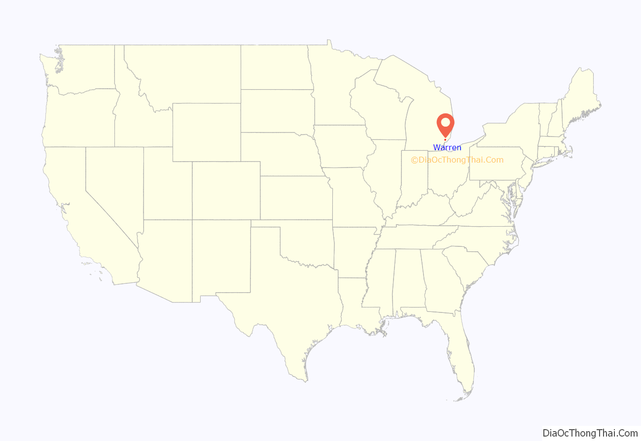
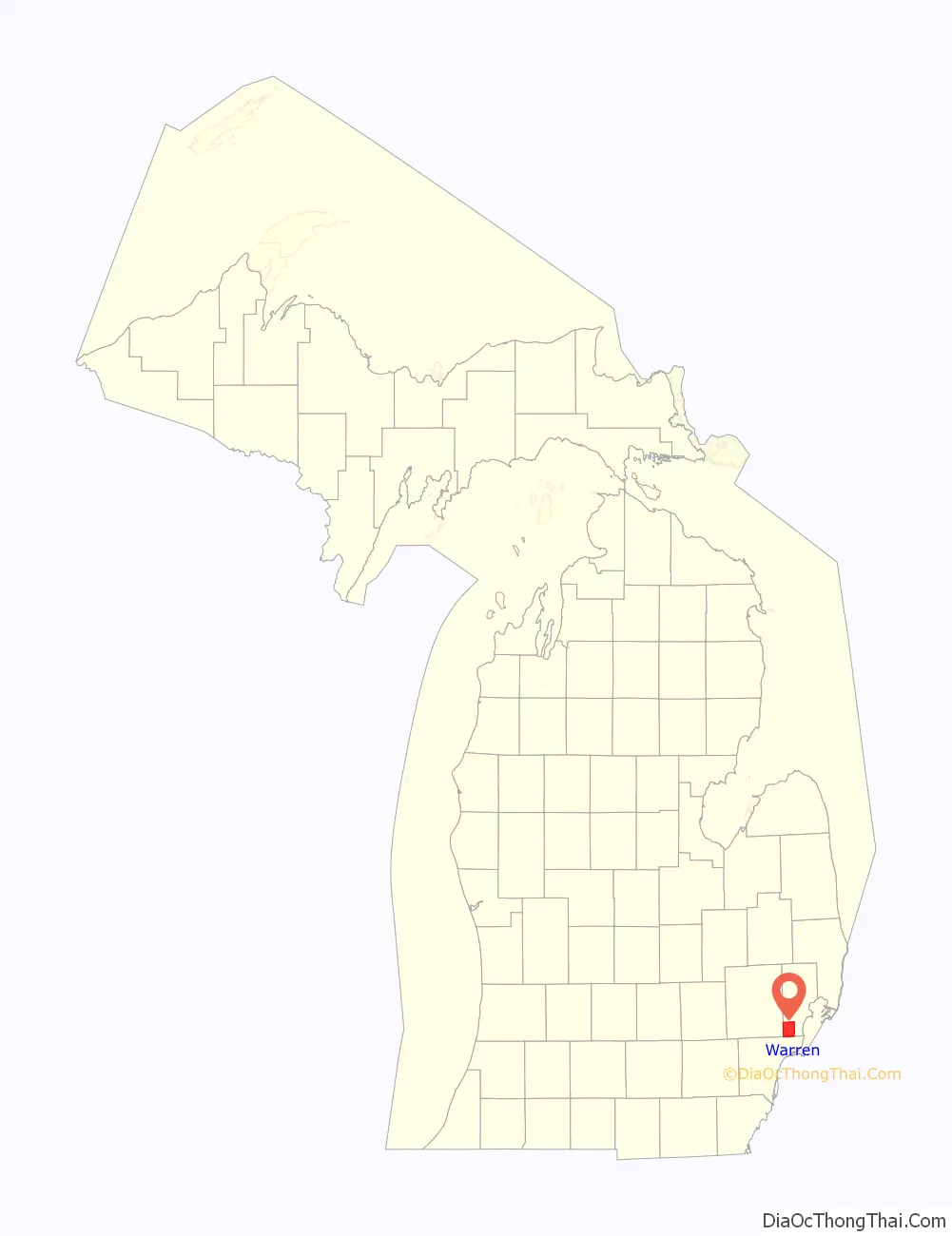
Warren location map. Where is Warren city?
History
Beebe’s Corners, the original settlement in what would become the city of Warren, was founded in 1830 at the corner of Mound Road and Chicago Road; its first resident was Charles Groesbeck. Beebe’s Corners was a carriage stop between Detroit and Utica, and included a distillery, mill, tavern, and trading post. It was not until 1837 that the now-defunct Warren Township was organized around the settlement, first under the name Hickory, then renamed Aba in April 1838, and finally renamed Warren shortly thereafter. It was named for War of 1812 veteran, and frontier cleric, Rev. Abel Warren. However, when it was originally organized the township was named for Rev. Warren who was a Methodist Episcopal preacher who left his native New York in 1824 for Shelby Township. He went throughout the present-day Macomb, Lapeer, Oakland, and St. Clair Counties, baptizing, marrying, and burying pioneers of the area, as well as establishing congregations and preaching extensively. He was the first licensed preacher in the State of Michigan.
Another version of the source of the city’s name claims it was “named for General Joseph Warren, who fell at the Battle of Bunker Hill.
The settlement was formally incorporated as the Village of Warren from Warren Township on April 28, 1893, out of one square mile bound by 14 Mile Road and 13 Mile Road to the north and south, and in half-a-mile east and west of Mound Road. The small village grew slowly, and had a population of 582 in 1940 and 727 in 1950, while the larger surrounding township grew at a much quicker pace. Much of this growth was due to the construction of the Chrysler’s Truck Assembly plant in 1938, the Detroit Arsenal Tank Plant in 1940 to support the WW II effort, and the General Motors Technical Center between 1949 and 1956.
The Red Run and Bear Creek, just small creeks back in the 1800s, has blossomed into an open major inter-county stormdrain flowing through Warren, into the Clinton River, and onwards to Lake St. Clair.
The Village of Warren and most of the surrounding Township of Warren, together with Van Dyke, incorporated as a city in 1957, less the city of Center Line, which had incorporated as a village from Warren Township in 1925 and as a city in 1936. Between 1950 and 1960, Warren’s population soared from 42,653 to 89,426. This population explosion was largely fueled by the post-WWII Baby Boom and later, by white flight from its southern neighbor of Detroit in that decade. This change in population continued into the next decade when the city’s population doubled again, ultimately reaching a high of 179,000 in 1970.
The subsequent decades have seen Warren’s population decline, while violent crime has increased. Combined with collapsing housing prices, down -53% between 2011 and 2016, this has led Warren to a number 7 ranking in Forbes’ Most Miserable Cities to Live in the US; joining two other Michigan cities, Detroit and Flint, in the Top 10.
Mayors
The following is a list of the previous mayors of the city. The current mayor is James Fouts. Mayoral elections are currently non-partisan.
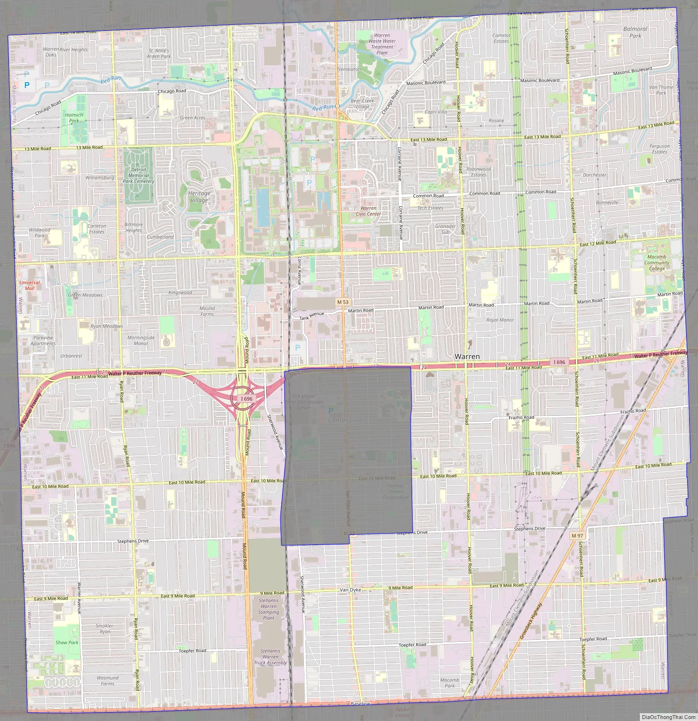
Warren Road Map
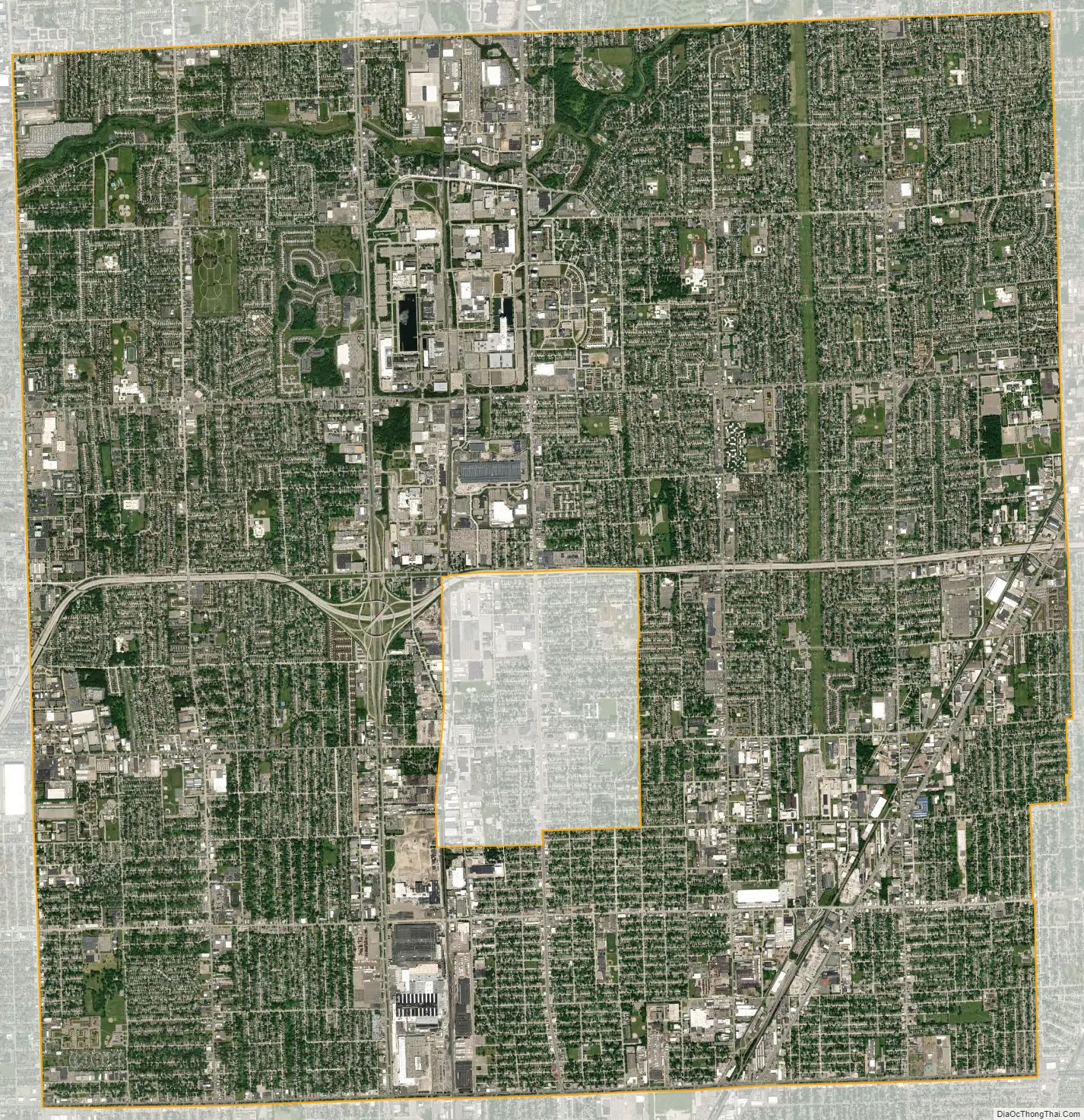
Warren city Satellite Map
Geography
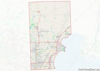
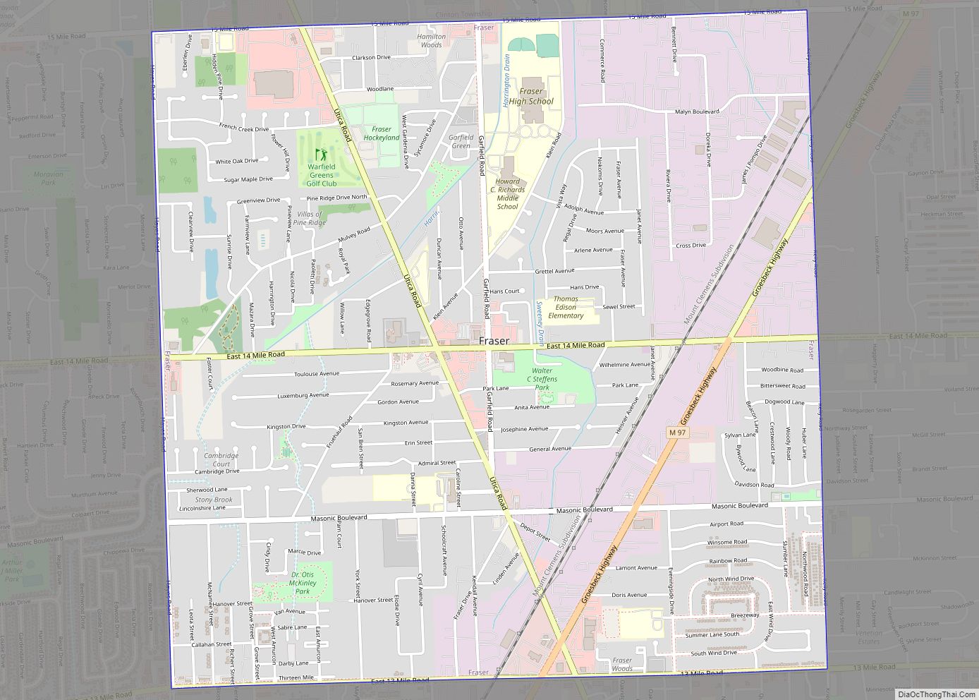
Warren is a core city of Metro Detroit. According to the United States Census Bureau, the city has a total area of 34.46 square miles (89.25 km), of which 34.38 square miles (89.04 km) is land and 0.08 square miles (0.21 km) is water. The city covers a six-mile-by-six mile, 8mile through 14 mile (10 km x 10 km) square in the southwest corner of Macomb County in Metro Detroit (minus Center Line, which is a small city totally enclosed within Warren). Warren shares its entire southern border with the northern border of the Detroit city limits. Other cities bordering on Warren are Hazel Park, Madison Heights, Sterling Heights, Fraser, Roseville, and Eastpointe.
Climate
Warren features a humid continental climate (Köppen: Dfa). Summers are somewhat hot with temperatures exceeding 90 °F (32 °C) on average 8.6 days. Winters are cold, with temperatures not rising above freezing on 39.1 days annually, while dropping to or below 0 °F (−18 °C) on average 1.2 days a year.
Main highways
- I-696 cuts east and west through the middle of Warren.
- M-53, which is Van Dyke Avenue (also known as the Earle Memorial Highway), leads into Van Dyke Freeway runs north and south and (roughly) bisects the city.
- M-97 also known as Groesbeck Highway named for former Governor Alex Groesbeck is near the eastern edge of Warren. It comes north from Detroit, and is a fast and wide diagonal connector to northern Macomb County.
- M-102 more commonly known as 8 Mile Road or more esoterically as Base Line Road is the city’s south border.
Unnumbered roads
Mound Road is an important north–south artery in the city. East-west travel is mainly on the mile roads. Most notable are 8 Mile Road, which is on the southern border of Warren with Detroit; 11 Mile Road, which serves as a service drive for I-696, and 14 Mile Road, which is on the northern border of Warren with Sterling Heights.
See also
Map of Michigan State and its subdivision:- Alcona
- Alger
- Allegan
- Alpena
- Antrim
- Arenac
- Baraga
- Barry
- Bay
- Benzie
- Berrien
- Branch
- Calhoun
- Cass
- Charlevoix
- Cheboygan
- Chippewa
- Clare
- Clinton
- Crawford
- Delta
- Dickinson
- Eaton
- Emmet
- Genesee
- Gladwin
- Gogebic
- Grand Traverse
- Gratiot
- Hillsdale
- Houghton
- Huron
- Ingham
- Ionia
- Iosco
- Iron
- Isabella
- Jackson
- Kalamazoo
- Kalkaska
- Kent
- Keweenaw
- Lake
- Lake Hurron
- Lake Michigan
- Lake St. Clair
- Lake Superior
- Lapeer
- Leelanau
- Lenawee
- Livingston
- Luce
- Mackinac
- Macomb
- Manistee
- Marquette
- Mason
- Mecosta
- Menominee
- Midland
- Missaukee
- Monroe
- Montcalm
- Montmorency
- Muskegon
- Newaygo
- Oakland
- Oceana
- Ogemaw
- Ontonagon
- Osceola
- Oscoda
- Otsego
- Ottawa
- Presque Isle
- Roscommon
- Saginaw
- Saint Clair
- Saint Joseph
- Sanilac
- Schoolcraft
- Shiawassee
- Tuscola
- Van Buren
- Washtenaw
- Wayne
- Wexford
- Alabama
- Alaska
- Arizona
- Arkansas
- California
- Colorado
- Connecticut
- Delaware
- District of Columbia
- Florida
- Georgia
- Hawaii
- Idaho
- Illinois
- Indiana
- Iowa
- Kansas
- Kentucky
- Louisiana
- Maine
- Maryland
- Massachusetts
- Michigan
- Minnesota
- Mississippi
- Missouri
- Montana
- Nebraska
- Nevada
- New Hampshire
- New Jersey
- New Mexico
- New York
- North Carolina
- North Dakota
- Ohio
- Oklahoma
- Oregon
- Pennsylvania
- Rhode Island
- South Carolina
- South Dakota
- Tennessee
- Texas
- Utah
- Vermont
- Virginia
- Washington
- West Virginia
- Wisconsin
- Wyoming