| Name: | Anne Arundel County |
|---|---|
| FIPS code: | 24-003 |
| State: | Maryland |
| Founded: | April 9, 1650 |
| Named for: | Anne Arundell |
| Seat: | Annapolis |
| Total Area: | 588 sq mi (1,520 km²) |
| Land Area: | 415 sq mi (1,070 km²) |
| Total Population: | 588,261 |
| Population Density: | 1,000/sq mi (390/km²) |
| Time zone: | UTC−5 (Eastern) |
| Summer Time Zone (DST): | UTC−4 (EDT) |
| Website: | www.aacounty.org |
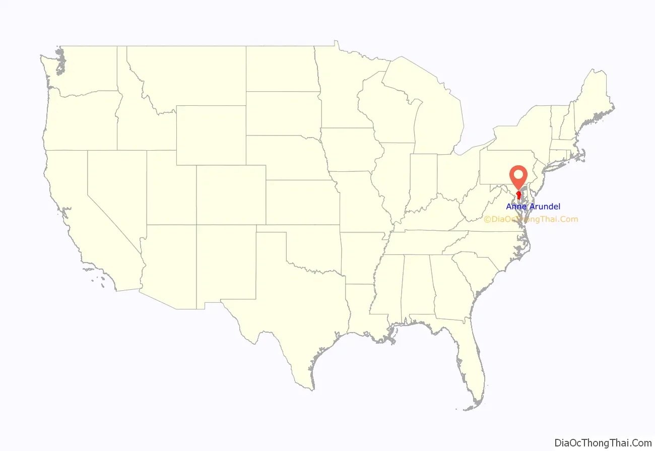
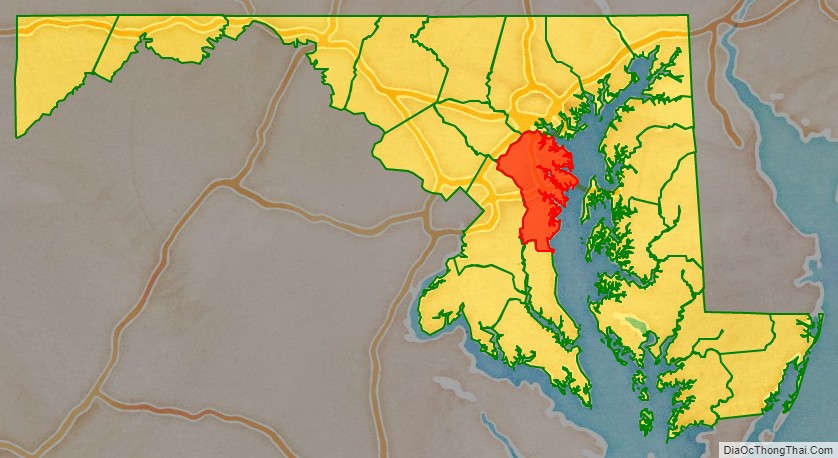
Anne Arundel County location map. Where is Anne Arundel County?
History
The county was named for Lady Anne Arundell, (1615/1616–1649), the daughter of Thomas Arundell, 1st Baron Arundell of Wardour, members of the ancient family of Arundells in Cornwall, England. She married Cecilius Calvert, second Lord Baltimore, (1605–1675), and the first lord proprietor of the colony, Province of Maryland, in an arranged marriage contract in 1627 or 1628.
Anne Arundel County (modern spelling adds an ‘e’ to her first name of “Ann” and removes the second ‘L’ from the family name of “Arundell” – but the old traditional spelling of her name is still used in the title of the local historical society, the Ann Arundell County Historical Society) was originally part of St. Mary’s County, the province’s first erected county in the southern portion of the Province of Maryland, which had first been established by arriving settlers in 1634. In 1650, the year after Lady Ann Arundell’s death, the county separated from St. Mary’s and “erected” into its own jurisdiction and became the third of the 23 Maryland counties. It was composed of the hundreds of Town Neck, Middle Neck, Broad Neck, South River, West River, and Herring Creek. Between 1654 and 1658, the county was known as “Providence” by many of its early settlers.
On March 25, 1655, after the English Civil War, (1642-1651), in Europe, the Battle of the Severn, the first naval colonial battle ever fought in America, was fought in Anne Arundel County on the Severn River between Puritan forces supporting the Commonwealth of England and forces loyal to Lord Proprietor Cecilius Calvert. The Commonwealth forces under William Fuller were victorious.
In 1692, the Church of England, also known as the Anglican Church, became the established church of the Province of Maryland through an Act of the General Assembly. Ten counties had been established in the colony, and those counties were divided into 30 parishes, with vestrymen appointed within each. Ann Arrundell County was divided into four parishes: Herring Creek, South River, Middle Neck, and Broad Neck.
Between 1694 and 1695, the provincial capital of Maryland was moved from St. Mary’s City along the northern shore of the Potomac River across from the southern colonial border with the Province of Virginia in St. Mary’s County farther north along the western shore of the Chesapeake Bay, midway in the colony to Annapolis in Anne Arundel County. Prior to the move, Annapolis was known as “Providence”.
During the American Revolutionary War, citizens of Anne Arundel County supported the Continental Army by providing troops for three regiments. The 3rd Maryland Regiment, the 4th Maryland Regiment, and the 6th Maryland Regiment were recruited in the county.
During the War of 1812, the one of the original six heavy frigates of the recently re-established United States Navy, U.S.S. Constitution, sailed from Annapolis prior to its victorious engagement with the H.M.S. Guerriere of the British Royal Navy.
On May 22, 1830, the inaugural horse-drawn train of the Baltimore and Ohio Railroad travelled the 13 miles (21 km) of the newly completed track from Mount Clare Station in southwestern Baltimore City to Ellicott Mills, (now Ellicott City), then in the Western or Howard District (now Howard County) of Anne Arundel County. This was the first regular railroad passenger service in the United States. In 1831, land west of the railroad was considered the Howard District of Anne Arundel County. In 1851, The Howard District was broken off to form Howard County, now the 21st county in Maryland (of 23).
The county has a number of properties on the National Register of Historic Places.
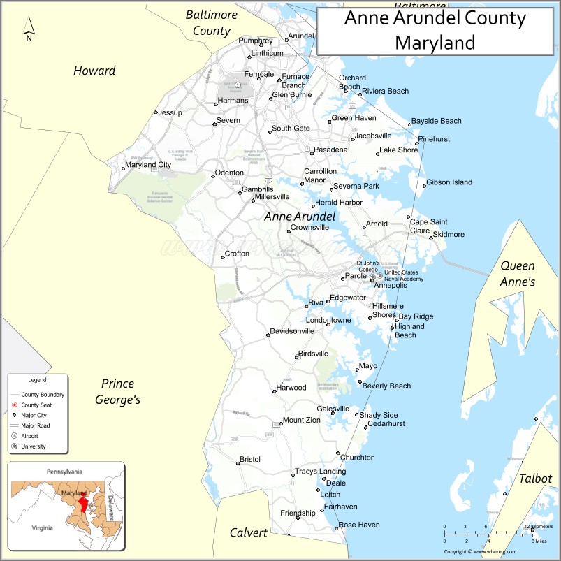
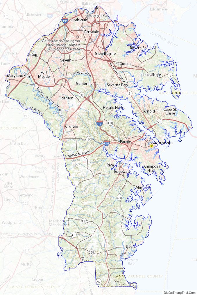
Anne Arundel County Road Map

Geography
According to the U.S. Census Bureau, the county has a total area of 588 sq mi (1,520 km), of which 173 sq mi (450 km) (29%) is covered by water. Anne Arundel County is located to the south of the city of Baltimore.
Most of the county’s borders are defined by water. To the east lies the western shore of the Chesapeake Bay, and numerous tidal tributaries of the bay indent the shoreline, the various rivers, creeks, streams, inlets forming prominent peninsulas, also known as “necks” (as further south in Virginia). The largest of these tributaries include (from north to south), the Magothy River, Severn River, South River, and the West River. Further south, the upper Patuxent River forms the border of Anne Arundel with Prince George’s County to the west. Deep Run forms part of the northwestern border with Howard County, and Lyons Creek forms part of the southern border with Calvert County. The Patapsco River to the north is the border with Baltimore County, but the communities and areas of Brooklyn and Curtis Bay neighborhoods (and adjacent Fairfield, Wagner’s Point [also known as East Brooklyn], Arundel Cove [off of Curtis Creek], and Hawkins Point), lying south of the Patapsco River were annexed from Anne Arundel County to Baltimore City in the third major annexation of January 1919.
Anne Arundel County originally included all of the land between the Patuxent River and the Patapsco River (mainstem and South Branch) upstream to their headwaters on Parr’s Ridge. The northwestern section of this long tract later became Howard County, with the border between the two running very close to the Atlantic Seaboard fall line. As a result, Anne Arundel County lies almost entirely within the Atlantic Coastal Plain, while Howard County is almost entirely within the Piedmont province.
Elevations in Anne Arundel County range from sea level at the Chesapeake and tidal tributaries to about 300 feet (91 m) in western areas near the fall line. The terrain is mostly flat or gently rolling, but more dramatic banks and bluffs can be found where waterways cut through areas of higher elevation.
With the exception of the very limited extent of Piedmont underlain by Precambrian to early Paleozoic metamorphic rock, all of the county is underlain by thick deposits of gravel, sand, silt, and clay dating from the early Cretaceous to Holocene times. Most of these sediments are unconsolidated but include local formations of sandstone, especially in the Pasadena area.
Adjacent counties and independent city
- Baltimore City (north)
- Baltimore County (north)
- Calvert County (south)
- Kent County (northeast)
- Howard County (northwest)
- Prince George’s County (southwest)
- Queen Anne’s County (east)
- Talbot County (southeast)
National protected area
- Patuxent Wildlife Research Center (part)
Climate
Anne Arundel County has a humid subtropical climate, with hot summers and cool winters. Annual precipitation averages around 40 in (100 cm) per year throughout the county, with a fairly even distribution throughout the year. Annual snowfall totals around 20.1 in (51 cm) on average at BWI Airport, which has an elevation of 156 ft (47.5 m) above sea level. Slightly colder winter temperatures and higher snowfall are experienced at the higher elevations, with slightly lower snowfall closer to sea level. According to the most recent USDA Hardiness zone maps, the lowland areas of the county fall into Zone 7b, with an expected annual minimum temperatures of 5 to 10 °F (−15 to −12 °C), while higher areas fall into Zone 7a, with expected annual minima of 0 to 5 °F (−18 to −15 °C).
Anne Arundel County Topographic Map
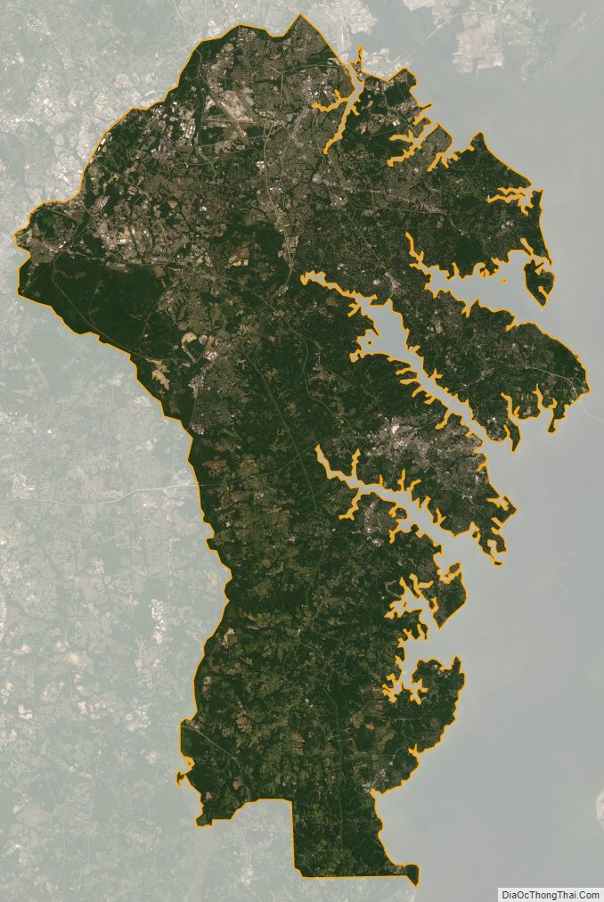
Anne Arundel County Satellite Map
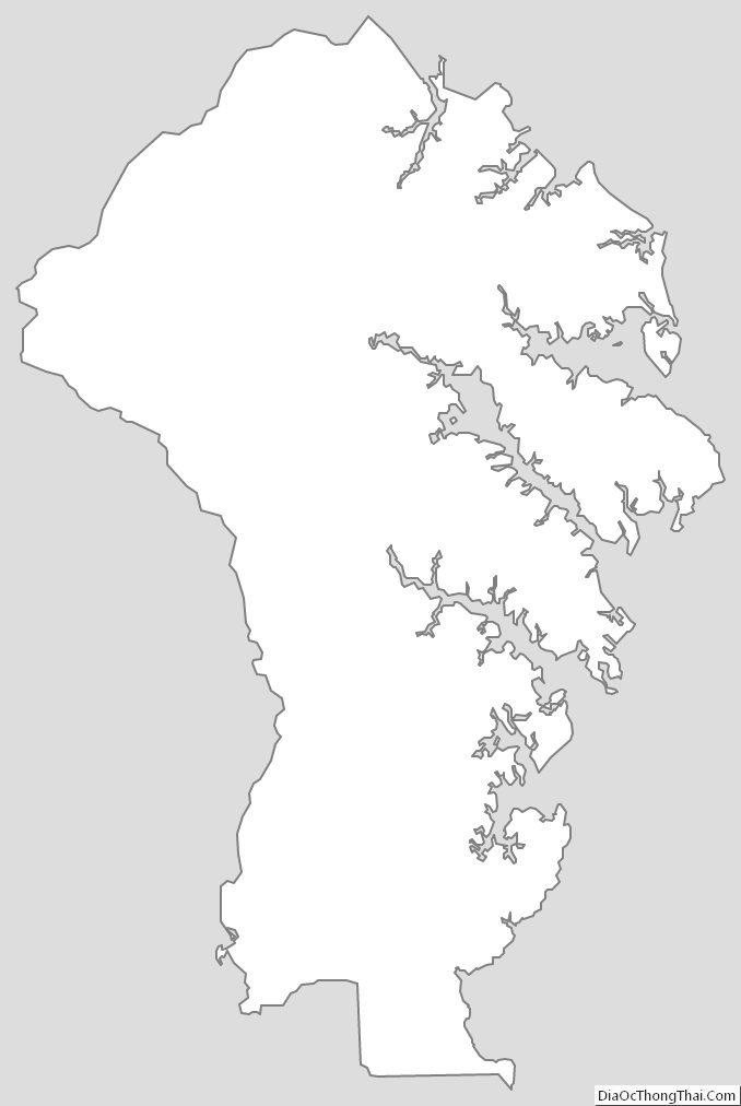
Anne Arundel County Outline Map