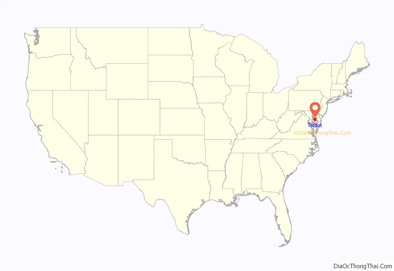
Talbot County is located in the heart of the Eastern Shore of Maryland in the U.S. state of Maryland. As of the 2020 census, the population was 37,526. Its county seat is Easton. The county was named for Lady Grace Talbot, the wife of Sir Robert Talbot, an Anglo-Irish statesman, and the sister of Lord Baltimore.
Talbot County comprises the Easton, MD Micropolitan Statistical Area, which is also included in the Washington–Baltimore–Arlington, DC–MD–VA–WV–PA Combined Statistical Area.
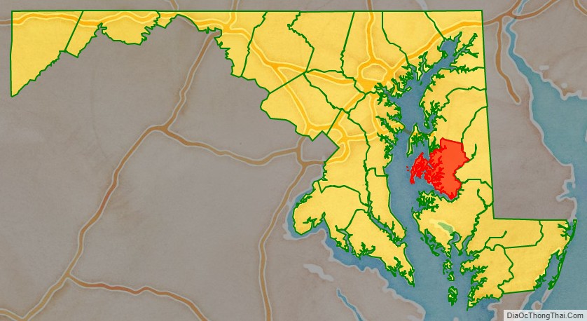
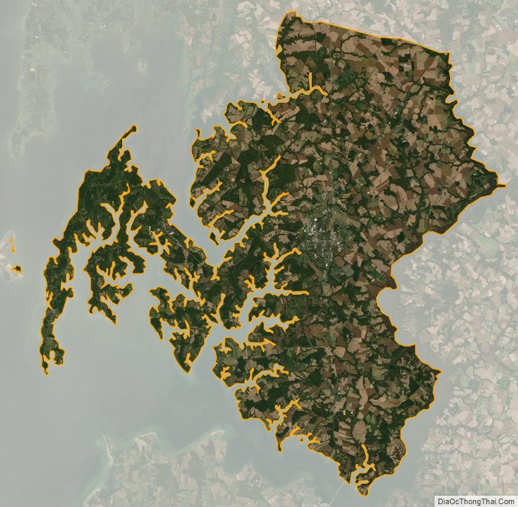
Talbot County is bordered by Queen Anne’s County to the north, Caroline County to the east, Dorchester County to the south, and the Chesapeake Bay to the west.
| Name: | Talbot County |
|---|---|
| FIPS code: | 24-041 |
| State: | Maryland |
| Founded: | c. 1661 |
| Named for: | Grace Talbot |
| Seat: | Easton |
| Largest town: | Easton |
| Total Area: | 477 sq mi (1,240 km²) |
| Land Area: | 269 sq mi (700 km²) |
| Total Population: | 37,526 |
| Population Density: | 79/sq mi (30/km²) |
| Time zone: | UTC−5 (Eastern) |
| Summer Time Zone (DST): | UTC−4 (EDT) |
| Website: | www.talbotcountymd.gov |
Talbot County location map. Where is Talbot County?
History
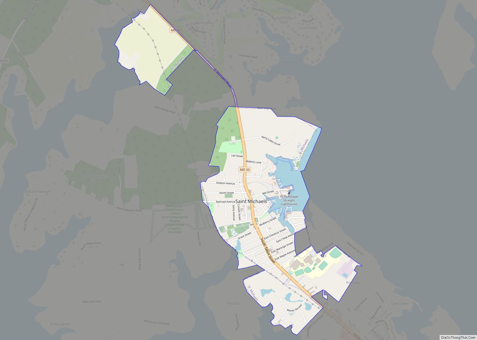
The founding date of Talbot County is not known. It existed by February 12, 1661, when a writ was issued to its sheriff. It was initially divided into nine Hundreds and three parishes: St. Paul’s, St. Peter’s and St. Michael’s.
In 1667, the first meeting of Commissions was held in the home known as Widow Winkles on the Skipton Creek near the town of York. The town of York was vacated once the courthouse was to be built on Armstrongs Old Field in 1709 near Pitts’ Bridge. The new courthouse designated because York was too far north in the county once Queen Anne’s County received their charter and was lopped off of Talbot County. Pitts’ Bridge was just north of the Quaker Meeting House, but most importantly, it faced the Indian trail (Washington Street – Easton).
After the American Revolutionary War in 1786, Act to Assemble in Annapolis appointed John Needles to survey and “to erect a town in Talbot County to be called Talbottown”—laying out a town around then existing court house with 118 number parcels of land and designated streets, alleys and lanes. Talbottown was to be known as the county seat of Easton. Another act was passed in 1789 to build a larger courthouse on the site of the old one. This court house was completed in 1794 and today parts of it still stand today inside of the present court house.
Lt. Col. Tench Tilghman, Gen. George Washington’s Aide-De-Camp, was born on Fausley in Talbot County on December 25, 1744. He died on April 18, 1786, and is buried in Oxford, Maryland. On the monument at the grave site, an inscription reads: “Tench Tilghman Lt. Col. in the Continental Army And Aid de-camp of Washington Who spoke Him thus: He was in Every Action in which the Main Army was concerned a great part of the Time. He refused to receive Pay. While living no man could be more Esteemed and since dead none more Lamented than Col. Tilghman. No one had imbibed Sentiments of greater Friendship for Him than I had done. He left as Fair a Reputation as Ever belonged to a Human Character. Died April 18, 1786 Aged 42″
On his actual grave an inscription reads “In memory of Col. Tench Tilghman who died April 18, 1786 in the 42nd year of his age. Very much lamented. He took an early and active part in the great contest that secured the Independence of the United States of America. He was an Aide-de-Camp to His Excellency General George Washington Commander in Chief of the American Armies and was Honoured with his Friendship, Confidence and he was one of those whose merit were Disinguished and Honourable Reward By the Congress But Still more to his Praise He was a Good Man“.
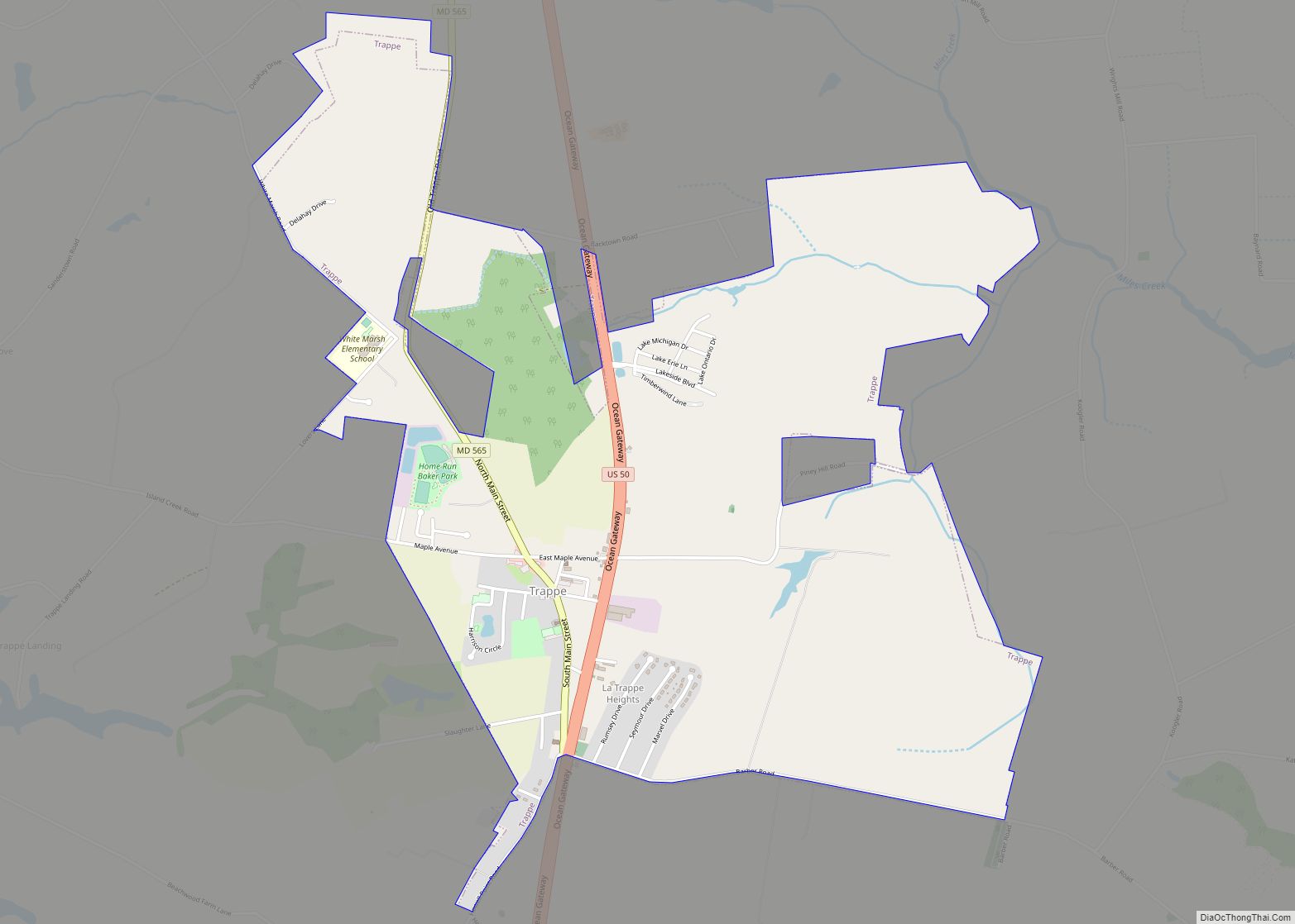
Founding Father John Dickinson was born in Trappe in 1732. The abolitionist Frederick Douglass was born into slavery near Tuckahoe Creek around 1817 or 1818.
The first established hospital on the Eastern Shore was near McDaniel at Dr. Absolom Thompson farm, the old Mary’s Delight Farm.
The county has a number of properties on the National Register of Historic Places.
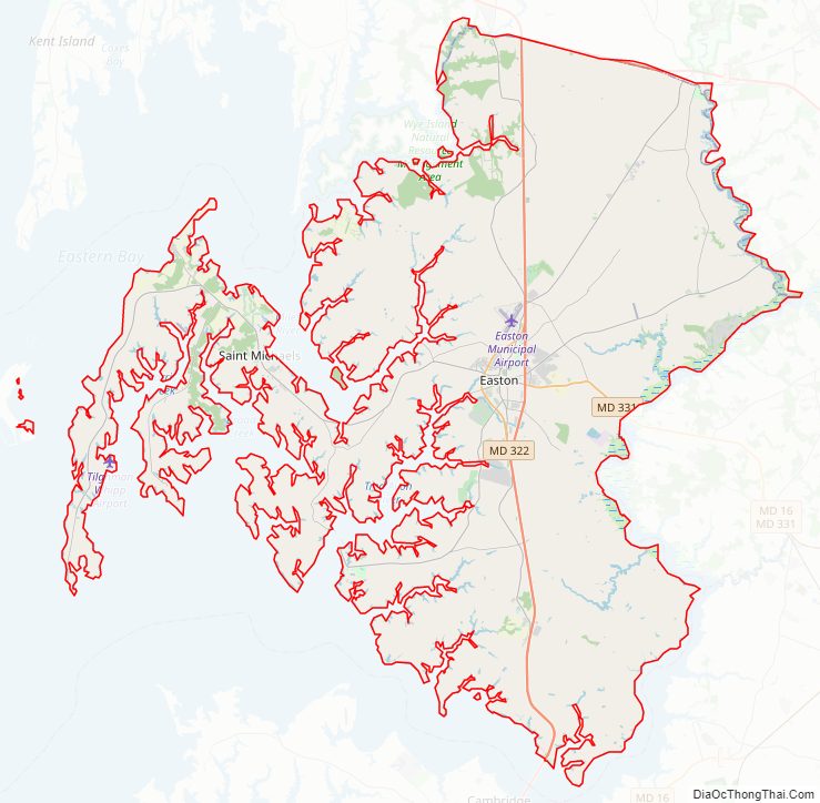
Talbot County Road Map
Geography
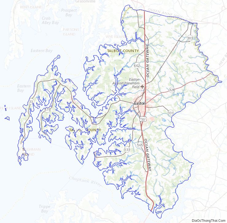
According to the U.S. Census Bureau, the county has a total area of 477 square miles (1,240 km), of which 269 square miles (700 km) is land and 208 square miles (540 km) (44%) is water. It is the third-smallest county in Maryland by land area.
Adjacent counties
- Queen Anne’s County (north)
- Dorchester County (south)
- Calvert County (southwest)
- Caroline County (east)
- Anne Arundel County (west)
Major highways
U.S. Route 50 is the major highway serving Talbot County.
Rivers and creeks
Choptank River takes its name from a tribe of Algonquian-speaking Indians who inhabited both shores of this stream before its settlement by the English. They were people of large stature. The Academy of Natural Sciences in Baltimore City holds several skeletons of these Indians (taken from an Indian earthwork mound at Sandy Hill on the Choptank) Cambridge that measure nearly 7 feet (210 cm) in height with skulls of unusually large size.}
Miles River is a corruption of Saint Michael’s River, its original name. In colonial times all grants of land from the Lords Baltimore were in the shape of leases subject to small and nominal ground rents, reserved by the Proprietary, and payable annually at Michaelmas, the Feast of St. Michael and All Angels. In the calendar of the Roman Catholic and Anglican churches this is observed on September 29. Because of this association, St. Michael was considered to be the patron saint of colonial Maryland, and as such was honored by the river being named for him. A large colony of Quakers were among the earliest settlers in Talbot County; as they had no reverence for saints, they persisted in dropping the word saint and calling the river Michaels River. It gradually became known as Miles.
As early as 1667, six years after the laying out of Talbot County, references to these names are found in the Proceedings of the Provincial Council of Maryland. A commission was issued by Charles Calvert, Esq., Captain General of all the forces within the Province of Maryland, to George Richard as captain of 10 troops of horse to march out of “Choptanck and St. Miles rivers in Talbot County, aforesaid upon any expedition against any Indian enemy whatsoever,” etc. At the same time, a similar commission was issued to Hopkin Davis, as Captain of foot in Choptanck and St. Miles rivers.
Wye River, which forms the northern boundary of Talbot County, was named by Edward Lloyd, a Welsh immigrant who took up large tracts of land along its southern shores before the laying out of Talbot County. He named it for the River Wye, noted for its sinuosity, whose source is near that of the River Severn, near a mountain in Wales. He named his homestead Wye House, which was owned by nine generations of Lloyds.
Tred Avon River is a corruption of “Third Haven”, as the Third Haven Meeting House was built at the river’s headwaters in 1682. “Third Haven” may be a corruption of “Thread Haven”, an early name for the first port established at what is now Oxford, Maryland
Of the thirteen Eastons in England, the most important town of that name is situated about one mile (1.6 km) from the head of the Lower Avon. The seat of Talbot County, located one mile (1.6 km) from the headwaters of Tred Avon River, changed its name from Talbot Court House to Easton in 1788 following the American Revolutionary War, as a reference to the English town. In colonial days, many merchant vessels traded between Oxford and Bristol, England, near which Easton is located. Many of the early settlers of Talbot County emigrated from this area.
Talbot County Topographic Map
Talbot County Satellite Map
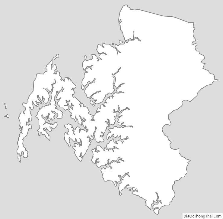
Talbot County Outline Map