Barrow County is a county located in the north central portion of the U.S. state of Georgia. As of the 2020 Census, the population was 83,505. The county seat is Winder.
Barrow County is included in the Atlanta-Sandy Springs-Roswell, GA Metropolitan Statistical Area.
| Name: | Barrow County |
|---|---|
| FIPS code: | 13-013 |
| State: | Georgia |
| Founded: | 1914 |
| Named for: | David Crenshaw Barrow Jr. |
| Seat: | Winder |
| Largest city: | Winder |
| Total Area: | 163 sq mi (420 km²) |
| Land Area: | 160 sq mi (400 km²) |
| Total Population: | 85,588 |
| Population Density: | 534.93/sq mi (110/km²) |
| Time zone: | UTC−5 (Eastern) |
| Summer Time Zone (DST): | UTC−4 (EDT) |
| Website: | www.barrowga.org |
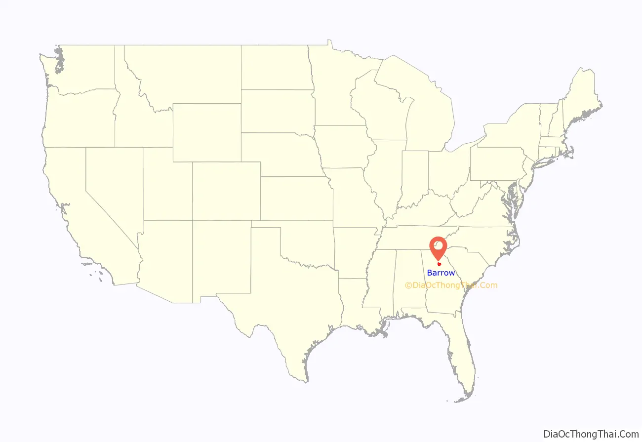
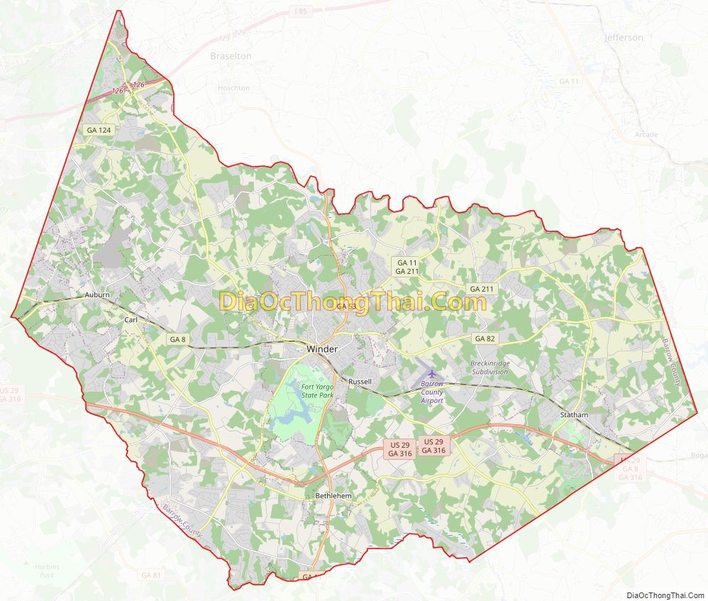
Barrow County location map. Where is Barrow County?
History
Barrow County was created from portions of Gwinnett, Jackson, and Walton counties when Georgia voters approved a constitutional amendment on November 3, 1914, making Barrow County the 149th Georgia county out of 159. Barrow County was named after David Crenshaw Barrow, Jr., a University of Georgia mathematics and engineering professor who was later Chancellor serving in that position from 1906 to 1925. Barrow died on January 11, 1929, in Athens and is buried in Oconee Hill Cemetery in Athens.
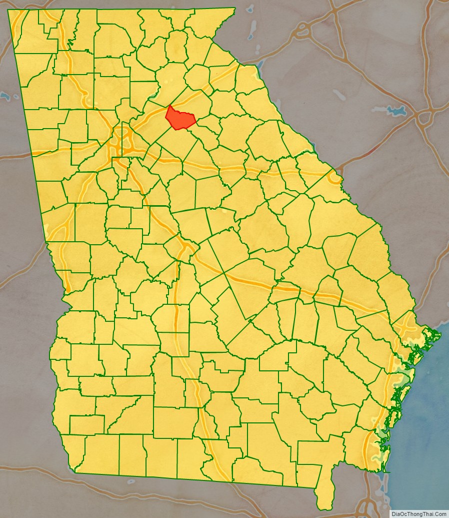
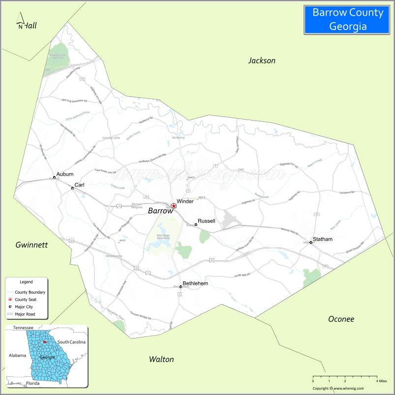
Barrow County Road Map
Geography
According to the U.S. Census Bureau, the county has a total area of 163 square miles (420 km), of which 160 square miles (410 km) is land and 2.6 square miles (6.7 km) (1.6%) is water. The entirety of Barrow County is located in the Upper Oconee River sub-basin of the Altamaha River basin.
Adjacent counties
- Hall County – north
- Clarke County – east
- Jackson County – east
- Oconee County – southeast
- Walton County – south
- Gwinnett County – west
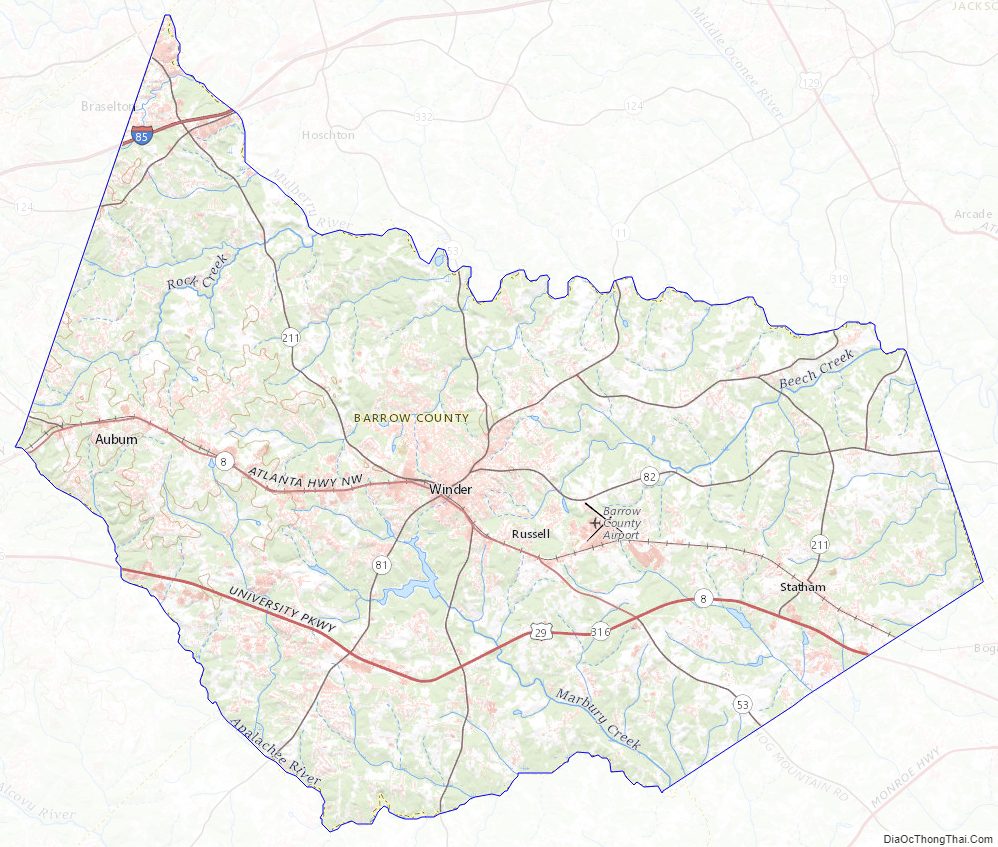
Barrow County Topographic Map
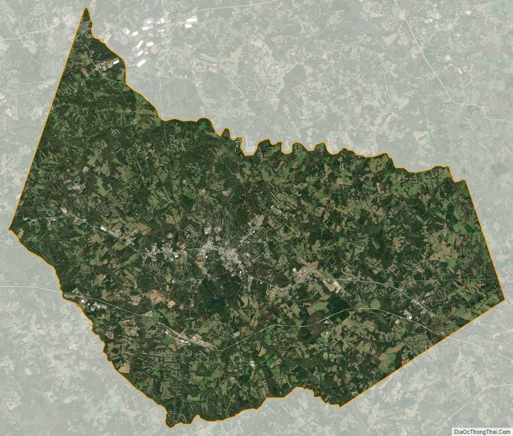
Barrow County Satellite Map
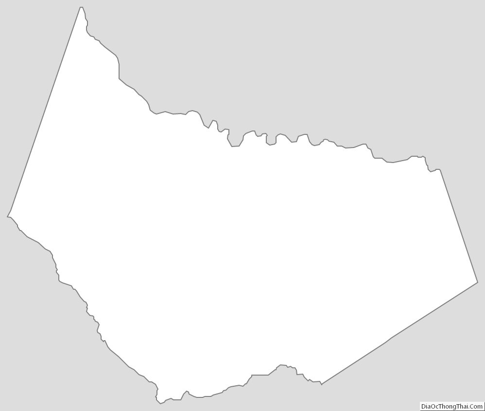
Barrow County Outline Map